Additional posts on Streets for People Active Transportation Plan are at category: Active Transportation Plan.
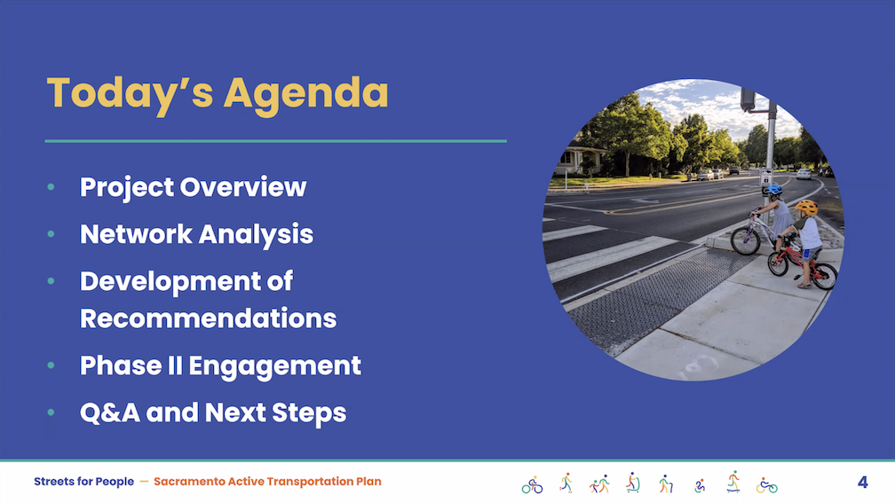
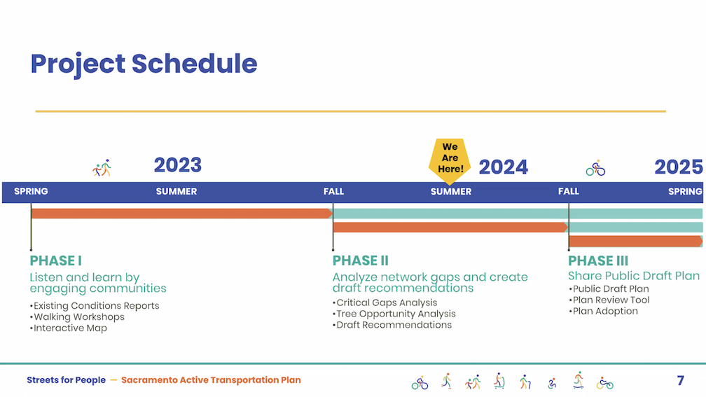
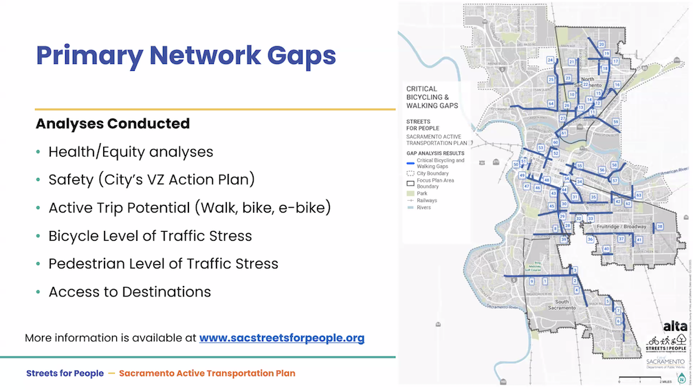
The City of Sacramento held the Streets for People Citywide Virtual Workshop #1 yesterday. Though the city may eventually post the slideshow, it is not on the program page Streets for People Active Transportation Plan yet, so I’m posting them here. These are low-ish resolution screen captures, so you won’t be able to see detail in them, but I hope they are still useful to you. I did not capture every single slide, but I hope the ones of interest are here. Of course the slides do not capture the presenter comments that went with each slide, which are important.
The next workshop, Streets for People Citywide Virtual Workshop #2, will be tomorrow, July 11. Please see the program web page for registration link. I assume the presentation will be the same.
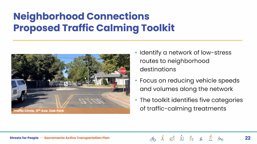
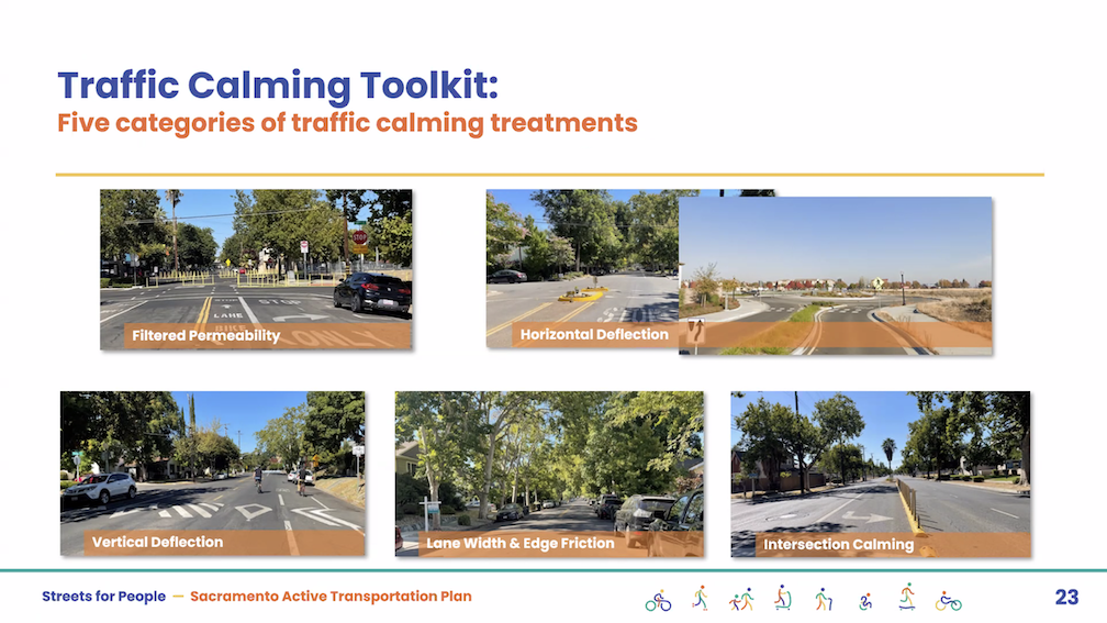
The first workshop was poorly attended. I don’t know how many people, but the presenters mentioned several times how few people were on the webinar. My question/comment is that the Traffic Calming tab of the Neighborhood Connections storymap has the best examples of traffic calming measures, with many of the photos local, whereas the visual glossary pedestrian and visual gallery bikeways examples provided as part of the interactive map are of poorer quality, not local, and in a few cases should not be recommended at all. These two sources should use the same examples, where they overlap.
The second workshop will be followed by a series of focus groups for particular neighborhoods or areas of the city, and walk audits in those same areas. I hope that people will participate in one or more of them.
You won’t be surprised, but City of Sacramento achieved a score of 34 out of 100 on the People for Bikes annual City Ratings. The scores are simplistic, using road width and bike lane mileage, but are still indicative of the relative ranking of cities and of the progress being made. Progress in the case of Sacramento is very slow.
I believe Sacramento’s poor ranking is due largely to the city’s policy of building bicycling infrastructure almost entirely with grant funding, and not with city budget. When you are competing nationally, statewide, or regionally for grants, funds will be limited and progress very slow. The city must spend more of its general fund on shifting our transportation system away from unsafe car dominated streets to streets that work for all users.
Strong SacTown Street Design Team will be posting a series to improve and promote the City of Sacramento update of their street design standards. This is the first. You can follow their website at https://www.strongsactown.org/, and the series at https://www.strongsactown.org/tag/street-design-standards/. Getting Around Sacramento / Dan Allison is participating in the team planning and writing, but these posts are the work of the team.
“We are Strong SacTown — Streets for People, a group of Sacramentans advocating for updated street designs that will rank safety, livability, and economic vitality above vehicle throughput or speed; where congestion relief will not be the goal in street design.
The City of Sacramento is updating the street design standards for the first time since 2009. The city is embarking on this effort as it is becoming increasingly apparent that the existing standards do not meet the needs of all users in the modern era.”
When a fatality or severe injury occurs for walkers and bicyclists, people often ask, what can we do right now to prevent or reduce the severity of the next crash? This topic has come up a number of times at the Sacramento Active Transportation Commission (SacATC), and communication from Slow Down Sacramento and the Safety Forum, Civic Thread, SABA, Strong SacTown and other organizations.
Based on the successful program from Oakland, I am proposing that the City of Sacramento develop a similar rapid response program.
The City of Sacramento would establish a pilot Rapid Response Program with an initial budget of $100K. The pilot program would address only fatal crashes. The budget will likely be insufficient, as Sacramento has a state-leading level of fatal crashes, but the pilot would allow the city to develop expertise and program structure, and formulate a future budget. The city might respond only to fatal crashes on the high injury network, in order to extend the budget.
A Rapid Response Team will include a city planner and city traffic engineer, and may include responding law enforcement officer and walking or bicycling advocate (Civic Thread for walking and SABA for bicycling, paid for their time). I intentionally say the law enforcement officer who responded to the crash. Other law enforcement officers would likely offer only uninformed opinions and victim blaming, though the experience could be useful for educating officers about street design.
The team will review existing documents and data, and then visit the fatal crash site within two work days of the crash, or the death of a person resulting from an earlier crash.
The team will make a report within five working days which identifies and proposes quick-build features (countermeasures) to reduce or eliminate infrastructure hazards, with prioritization based on effectiveness.
The quick-build features (countermeasures) may include:
Refreshed crosswalk
Refreshed pavement markings
Temporary curb extension with flex posts
Temporary modal filter (traffic diverter) with flex posts
Temporary traffic circle with flex posts
New marked crosswalk
Changed or added signing
Temporary new stop sign; permanent stop sign would require additional analysis
Changed signal timing
At least one quick-build feature (countermeasure) will be installed within 10 work days of the site visit. Additional temporary features will be designed and scheduled.
I had previously mentioned mapping of crashes and related data by the city, because the state SWITRS system is always too far behind. I had previously mentioned a dashboard on crashes. However, these would probably best be implemented after the pilot year.
The City of Sacramento does not make available to the public an inventory of sidewalks. The city does make available on the Transportation & Infrastructure page: Bike Master Plan, EV Chargers, Off-Street Parking, Signs, Street Lights, Traffic Counts, and Traffic Signals, and other datasets. Sacramento County makes available on the Transportation page: Posted Speed Limits. SACOG makes available on the Transportation page several other transportation datasets. None have sidewalk inventories.
I have heard, unofficially, that the city has a partial dataset of sidewalks, but it is not spatially complete. It may be that it has only more recent installations, or that it focuses on some parts of the city. I have done a PRA for sidewalk inventory, but the city couldn’t figure out what I was asking for, so I will have to determine how to describe the dataset in a way they will understand.
What would a good sidewalk inventory contain?
total width
unobstructed width
sidewalk buffer (planting strip) width
available right-of-way
condition
year of installation, or reconstruction
gaps
intersection corner design
ramps (compliant or not)
The soon to be adopted 2040 General Plan 8-Mobility Element mentions sidewalks a number of times, suggesting widening or improving. Probably the most important are:
M-1.9 Equitable Processes and Outcomes. The City shall ensure that the transportation system is planned and implemented with an equitable process to achieve equitable outcomes and investments so that all neighborhoods one day will have similar levels of transportation infrastructure such as sidewalks, marked low stress crossings, and bikeways.
M-1.14 Walking Facilities. The City shall work to complete the network of tree-shaded sidewalks throughout the city, to the greatest extent feasible, through development project improvements and grant funding to build new sidewalks and crossings, especially within the high-injury network, in disadvantaged communities, near highridership transit stops, and near important destinations, such as schools, parks, and commercial areas. Walking facilities should incorporate shade trees.
However, there is no mention of how locations needing improvement will be identified. Is this guesswork on the part of city staff, or is there a dataset being used but not shared with the public?
My request is that the city make available to the public whatever sidewalk inventory it has, even if it is not spatially complete nor has all the elements a sidewalk inventory should have.
A sidewalk inventory is the first step in meeting the city’s goal of a continuous, high quality sidewalk network. More about that soon.
deteriorated sidewalk on 24th St, near Capitol Ave
And while we are at it, a crosswalk inventory:
marked or unmarked
width
length
design
median island
material: paint or thermoplastic
condition
date of placement or refresh
traffic control (yield, stop, signal, actuated crossing)
crossing prohibition
It should be said that sidewalks and crosswalks in the City of Sacramento are in better condition than many similar sized cities in California, but that does not mean that there isn’t a need for great improvement. Every city and county neglects its sidewalks.
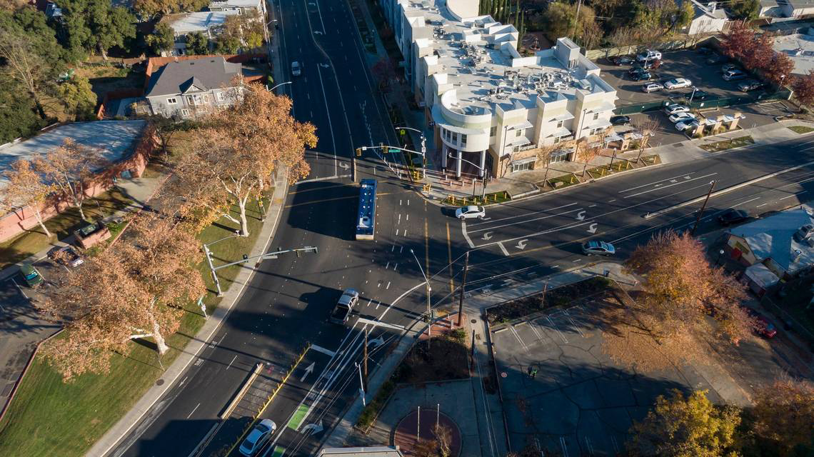
The SacBee published an article yesterday: After a deadly crash, Sacramento fixed a dangerous road. Why isn’t this the norm? Apologies for linking to a firewalled article; if you have a subscription or access to a printed newspaper, it is well worth reading.The article is quite in-depth, more like the investigative reporting that the SacBee used to do, but rarely does any more. The author is Ariane Lange.
The article highlights changes made to the intersection of Broadway and Martin Luther King, Jr. Blvd (MLK) after a fatal crash single-vehicle crash in 2021. Though the article did not make clear, the driver was likely eastbound on Broadway and continued straight into the building. Google maps, below, does not show the changes, but a photo from the article does (second).
Broadway & MLK intersection, Google Maps (not up to date)Broadway & MLK, SacBee photo (more recent)Read More »
The white line stripes that were added to the two blocks of P Street protected bikeway, 19th Street to 17th Street, are an attempt to keep leaf piles and trash cans out of the bikeway. I noted the added white stripes in Central City Mobility update #27, but wasn’t sure why they were added. The wording was added later. I have not yet observed this location on either a trash pickup day, or now that there are a lot more leaf piles. I have not seen the striping and marking on other blocks of the new bikeways, so this may be a pilot to see if it works. The practice of putting leaf piles in the regular Class 2 bike lanes in common, and the city has made no effort to reduce this practice.
The parking-protected, separated bikeway on 9th Street between K Street and L Street is finally open again, 2-1/2 years after it was closed for construction conversion of the Capitol Park Hotel by Mercy Housing. Though the area was occasionally used for active construction, mostly it was used for long-term storage of construction materials.
This phrase summarizes the street network we have in the City of Sacramento. With a very, very few exceptions, every single street is too wide and too fast, across the entire range from residential streets to traffic sewer arterials. These streets kill and injure incredible numbers of people every year. Walkers, bicyclists, drivers, passengers, no one is immune to the danger that these poorly designed streets present. Though rankings change year to year, and depend on details, Sacramento is at or near the top of crash rates for the state. We probably don’t have worse drivers than other cities, we have worse streets.
The city has promised that it will update the Street Design Standards that have created this hazard. Maybe soon, maybe not for years. In fact, the existing standards don’t even have all that much detail, so a lot of the streets were apparently designed on the whim of traffic engineers, not even on standards. MUTCD (Manual for Uniform Traffic Control Devices) and CA-MUTCD will not be considered acceptable roadway designs since they emphasize motor vehicles over all other roadway users. NACTO (National Association of City Transportation Officials) or European standards such as the Netherlands CROW will be referred to as needed.
The new standards must ensure that we never build an unsafe roadway again. The goal must be no fatalities or severe injuries, no matter how drivers behave. Sacramento must be a true Vision Zero, safe systems city, not the lip service, we will fix things someday, when we have the money, that it is now.
What should the new standards be like?
There should be separate documents, or at least clearly separate sections, for new construction and for healing existing designs.
The state and federal roadway functional classification system (FCS) should not be used. Instead, a system that addresses the intended purpose of streets including ALL users should be used. The FCS is in large part responsible for the mess we have now. It represents that traditional traffic engineer focus on maximizing motor vehicle volume and speed. See SacCity street classification for more information.
New construction standards:
will emphasize limited roadways, one lane in each direction, and would include designs for two lanes in each direction in exceptional circumstances
design speeds and posted speed limits must match
base design speed is 20 mph
roadways over 20 mph must have bike lanes; over 30 mph must have separated bikeways
no roadway will have a design speed over 40 mph. Anywhere. Ever.
intersections will be designed so that it is clear that crosswalks, at sidewalk level, continue through the intersection, and motor vehicles are the guests
all new developments will be designed with a street grid of 1/4 mile
rolled curbs will not meet standards, however, streets without curbs may be used if the design speed is 10 mph
Healing existing roadways:
no street will be repaved without consideration being given to reallocating right-of-way width to walking, bicycling, transit, and sidewalks buffers for trees
the intent of reallocation will be to achieve the same design as new construction
on-street parking will be retained for its traffic calming effect, however, removal of parking will never prevent reallocation to higher uses
for overly wide streets, parallel parking will be converted to back-in diagonal parking in order to narrow roadways for safety
streets without a tree canopy will have trees added, in parking lanes if no other space is available
the city will adopt responsibility for maintenance of sidewalks, in the same way that they are responsible for pavement
designs will be available for closing sections of street temporarily or permanently for dining or community events
designs for diagonal ADA ramps will not be part of the updated standards; only perpendicular ramps will meet standards
My intent here is to provide something simple, summarizing beyond the details of previous posts on Street Design Standards.
At the meeting of the ECOS Climate Committee on Tuesday, June 27, there was a presentation on the City of Sacramento General Plan 2040 Update by city staff Remi Mendoza. The presentation gave an overview of the plan, which is pretty much available on the city website, but the questions and comments were interesting.
Heather Fargo raised issue of language to address disability transportation concerns; does plan address sidewalk maintenance? Staff did not really answer about disabled mobility, rather, the answer was about walking and bicycling for other people. Heather said she is dissatisfied with bicyclist improvements which make things harder for disability. I will ask Heather for clarification on her concerns. Heather also expressed a number of concerns about the lack of a commitment to protecting agricultural and wildlife lands in the Natomas Basin and Natomas area, both in the main general plan and in the specific North Natomas Community Plan.
I asked two questions:
Why is the council commitment to removing parking mandates now a weak ‘could include’? Staff answered that a consultant is working on this, and if council wants stronger language, it can reinstitute it. This is a very dissatisfying answer. If the council wanted weaker language, they could asked for it, but they have not. I suspect that some politically powerful people (more powerful than you or I) asked for the language to be weakened, and staff complied. Was this City Manager Howard Chan, or was it one of the powerful who is not on the council?
Map M-3 emphasizes light rail and arterials for transit oriented development. These are both NOT the best locations due to surrounding land use (often industrial and toxic), poor accessibility to transit (long distances to safe crosswalks over high speed, high volume, very wide arterials), lack of existing neighborhoods to build on in several cases, and the pollution created along these freight routes and motor vehicle traffic sewers. This question was brushed off.
A number of others asked questions about the plan, which were only partially answered. It appears that the transportation and climate community are very concerned about the general plan. And they should be.
The members of city Community Development Department, which initially seemed to be on board with very innovative and future-looking goals and policies, seems to have backed way off, and are now proposing something not remarkable different from the current 2035 plan, which was outdated before it was even adopted.
I appreciate ECOS (Environmental Council of Sacramento) for their willingness to stand up to the powers that be. I’m a member of a number of other groups that are not willing to stand up. The city and the county, and the other cities in the county, get away with the status quo and gaslighting because no one is calling them out on their poor decisions and lack of attention to the needs of the people who live here.