Land Park & Broadway construction zone issues

A new development is under construction on the southeast corner of Land Park Drive and Broadway, the historical site of Tower Records and Tower Books. I am glad to see development, particularly housing, happening here after the lot sitting empty for a bit more than a year. The project name is either Land Park & Broadway, or Tower Broadway. The project description from the City of Sacramento Agency Counter site is:

“MULTI-FAMILY HOUSING/MIX USE – New Five (5) story mixed use development consisting of ground floor retail within a concrete podium and (4) floors of for-rent apartments above. Studios: 39; 1 Bedrooms: 19; 2 Bedrooms: 10”

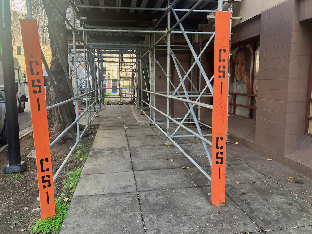
However, the construction site has several violations of ADA and PROWAG.

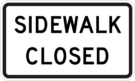
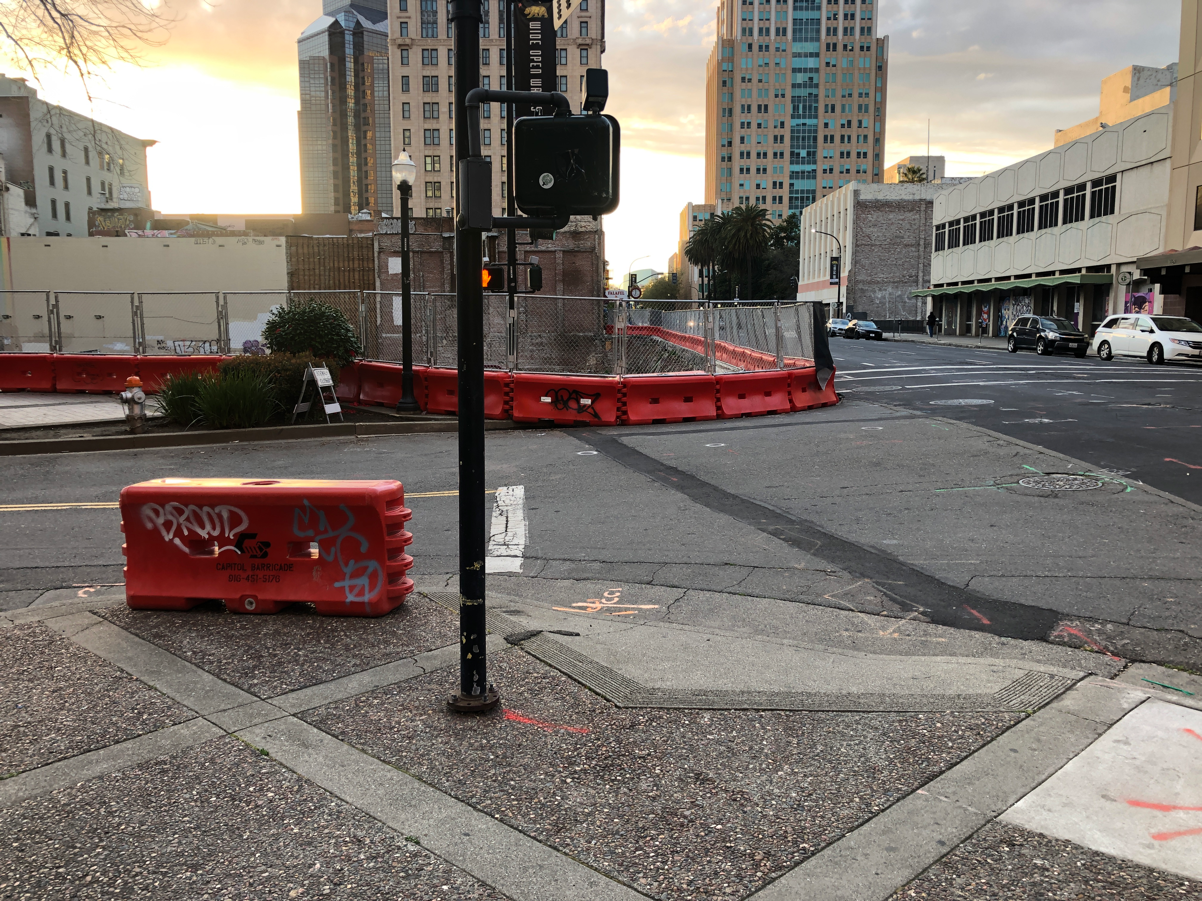
The crosswalk over Broadway at 16th Street is closed by a construction fence on the south side. However, there is no detectable warning barrier on the north side, only a sidewalk closed sign with, being on a folding barricade, is a trip hazard, and the pedestrians signal is not covered so that someone with limited vision would know the crosswalk is closed.

photo of Broadway at 16th St closed crosswalk not ADA compliant
Broadway at 16th St closed crosswalk not. ADA compliant

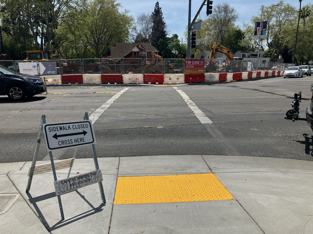
The same problem exists for the crosswalk over Land Park Drive, inappropriate signing posing a tripping hazard, lack of detectable barrier, and pedestrian signal face not covered.

photo of Land Park Dr at Broadway closed crosswalk, not ADA compliant
Land Park Dr at Broadway closed crosswalk, not ADA compliant

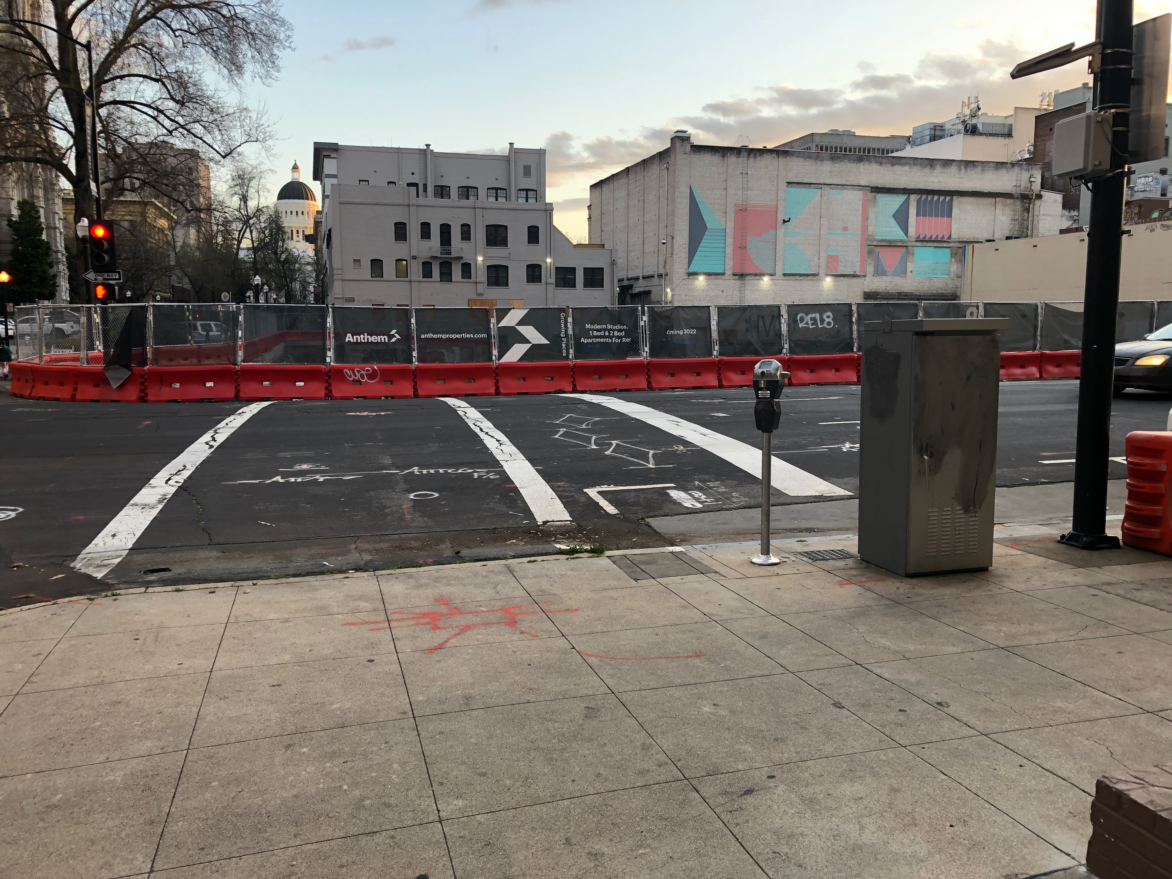
On the east side of Land Park Drive approaching the construction site, there is no detectable barrier, signing is placed so that it blocks access to the bus stop, and the construction fence intrudes into the sidewalk. Note that the pedestrian detour sign is not required and probably does nothing to help people walking.

photo of Land Park Dr closed sidewalk, not ADA compliant
Land Park Dr closed sidewalk, not ADA compliant

Getting a little closer, you can see that there is a bus stop for which access has been blocked by the construction signing. The bus stop is no longer accessible to anyone with mobility issues. I just talked to a SacRT employee, who said they had received no communication from either the city or the construction company about this blockage. SacRT will consider temporarily moving the bus stop. The construction company could have placed fencing and signing to maintain access to the stop, with a detectable barrier beyond the stop, but they did not. I suspect the city didn’t even notice this in their Traffic Control Plan. The city generally accepts whatever the construction company writes, without field checking it. It is well known that the city and most construction companies consider walkers and transit users as unimportant.

photo of Land Park Dr no bus stop access
Land Park Dr no bus stop access
Land Park Dr bus stop 1058

I did not check ADA compliance on the Broadway sidewalk approaching this construction site from the east, but would expect to see similar problems there.

While walking Broadway today, I noticed that two construction projects which were reported to the city (311) months ago have not been corrected. So far as I can tell, the city stopped inspecting or enforcing construction sites and Traffic Control Plans months ago.

construction violation on 6th St

You may be getting tired of these posts on construction zone failures to accommodate walkers and bicyclists, to to comply with ADA regulations. Well, I’m getting tired of the City of Sacramento Public Works Department completely failing at its responsibility to protect people walking and bicycling. I wonder why it falls to the public to report these issues, rather than to city employees whose job it is to take care of these things. Maybe they should not have their jobs.

This most recently noticed problem is on the east side of 6th Street between I Street and Improv Alley. The building is Riverview Plaza Apartments, a Sacramento Housing and Redevelopment Agency (SHRA) housing, and the project is apparently Riverview Plaza Rehabilitation Project. This construction is not on the city’s AgencyCounter website, perhaps because SHRA is a city/county partnership and assumes it does not need to inform the public.

The sidewalk on the east side of 6th Street is completely blocked by construction. At I Street, there is no advance warning of the sidewalk being closed ahead. At the closure, southbound, there is a chainlink fence, which is not a detectable barrier, and no sidewalk closed sign. The construction extends to the curb, including the sidewalk buffer. From the south, there is no advance warning of the sidewalk being closed ahead, either at Improv Alley or at J Street. At the closure, there is a scaffolding, which is not a detectable barrier, and a small paper sidewalk closed sign, not compliant with CA-MUTCD or PROWAG. At the time I walked past, there were two delivery vehicles double-parked on the street, so even if a person wanted to walk around the closure, they would be forced out into traffic on 6th Street. This situation is a complete failure on the part of the construction company, and the city.

photo of SHRA construction on 6th St, no advance warning, no sign on chainlink fence
SHRA construction on 6th St, no advance warning, no sign on chainlink fence
photo of SHRA construction on 6th St, scaffolding as barrier, non-compliant paper sidewalk closed sign
SHRA construction on 6th St, scaffolding as barrier
photo of SHRA construction on 6th St, scaffolding as barrier, non-compliant paper sidewalk closed sign

SHRA construction on 6th St, scaffolding as barrier, non-compliant paper sidewalk closed sign

J Street needs construction bypass

The future development, possibly to be called Anthem Cathedral Square, at J Street & 11th Street is currently a hole in the ground. The old buildings have been razed, and debris hauled away, but new construction has not started, so it will be some while before J Street on the north side of the site (south side of the street) returns to normal.

A channelized bypass should be created to carry the sidewalk for walkers and the bike lane for bicyclists past this construction site, between 10th St and 11th St, by removing a general purpose travel lane from J Street. The aerial below (before removal of the buildings) shows a sidewalk, a parking lane, a bicycle lane, three general purpose travel lanes, and a parking lane. The channelized bypass would include a shared pathway for walkers and bicyclists, in place of the right hand general purpose lane. The bypass can be created with use of orange construction barrier, as was done on 9th Street. This bypass would remain in place until construction is complete.

While the razing and cleanup was going on, there was decent signing, but it has disappeared or been moved to the side. The first set is the former signage at J St & 1oth St, and then today without an signage. There should be a sign here, the MUTCD R9-11; a barrier is not appropriate at this location since the closure is ahead and there are businesses open.

J St at 10th St se, signage
J St at 10th St se, no signage

At the sidewalk closure point, there is an acceptable barrier but no signage. At this point, it looks like there could be a bypass, but it is fenced off. The appropriate sign here is MUTCD R9-9.

J St past 10th St, sidewalk barrier

At J St & 11th St southeast corner, there was a barrier and signage, but the barrier has been moved to the side and the signage is gone. There should be a barrier and sign here to indicate that the crosswalk is closed. The third photo is an example of a correct barrier and signage.

11th St at J St se, signage
11th St at J St se, no signage
crosswalk closure barrier
correct barrier and signage

At J St & 11th St northwest corner, there should be a barrier and signing to indicate the crosswalk is closed, but neither is present.

J St & 11th St nw, no barrier or signage

This construction zone failure is one among many in Sacramento. The city is not creating traffic control plans that accommodate walkers and bicyclists, and the construction companies are not appropriately placing signs and barriers. This is a violation of the ADA (Americans with Disabilities Act). Responsibility for encroachment permits (when the construction project goes into the public right of way, which includes sidewalks), and traffic control plans to mitigate the situation, rests with the City of Sacramento Department of Public Works.

I have created a new category, construction zone, which will make is easier to find other posts on the construction zone topic. Photos of many construction zone locations are on Flicker in Sac construction-zone album.

9th St update

Things have changed again. The construction zone on the east side of 9th Street between K Street and L Street has changed again. The east parking lane and east travel lane are now dedicated to the construction project, the general purpose lane has been shifted right into the west parking lane, and the combined pedestrian/bicyclist bypass is now in what was the right hand general purpose lane.

One the plus side, detectable strips have been added to the left side of the bypass, which are required to provide protection from trip and crash hazards presented by the fence bases. Photo below.

detectable strips along bypass on 9th St

The entrance to the bypass is still awkward, too narrow and poorly signed. There are still corrections to be made.

entrance to pedestrian/bicyclist bypass on 9th St

Previous posts: 9th Street update, 9th St fixed, sort of, and 9th St blocked by construction.

curb ramps

While walking in the central city today, I saw this brand new curb ramp on the southwest corner of X Street and 24th Street.

new curb ramp, southwest corner of X Street & 24th Street

Why, why, why, did the city put in a diagonal curb ramp when they should have put in a two perpendicular ramps? Though I’ve searched in vain through city documents looking to see what the criteria is for a single ramp per corner versus two ramps per corner, I have heard it said by city staff that the single ramps are for residential neighborhoods and the two ramps are for urban neighborhoods. This is definitely an urban neighborhood setting, with both 24th Street and X Street being arterials. Yet the city put in a single ramp. They call this a ‘single flare curb ramp’. What should have been installed here is a ‘standard curb ramp’. The city diagrams do not show exactly this situation, where there is a sidewalk buffer (planter strip) on X Street, with an attached sidewalk on 24th Street, but the diagram below is the closest to the situation.

If the city development code does not specify that single, diagonal ramps should be used only in purely residential situations (if even there), it should be modified to be so.

2021-03-12: Adding a photo that better shows the context for this diagonal ramp. This is the southwest corner, X Street to the right and 24th Street to the left. There is space for perpendicular ramps. Of course this would have been a great location for a curb extension (bulb out) on both 24th Street and X Street, but yes, that would be significantly more expensive and might involve drainage issues.

curb ramp at southwest corner of 24th St & X St

2021-03-17: Adding a photo of a new curb ramp in the same area of town, at 22nd Street and W Street, showing the correct perpendicular curb ramps. It isn’t that the city doesn’t know how to do it right, it is that they chose not to at the intersection of X Street and 24th Street.

perpendicular curb ramps at 22nd Street & W Street

9th Street update

The section of 9th Street in Sacramento, between K Street and L Street, finally has an acceptable walking and bicycling pathway around the construction on both sides of the street. It looks as though the construction on the west side of 9th is getting closers to completion, so the sidewalk blockage on that side may disappear, but the east side construction is just beginning.

9th Street walking and bicycling bypass

The pathway is about 12 feet wide, as originally promised, so that is taken care of. There are cones down the middle, the purpose of which I’m not clear about since there is no indication of directional or mode separation, but they do no harm. The signing and barricades on both the north side and south side are still lacking, the barricades not meeting ADA detectability requirements, and the signing less than ideal.

Two days ago the fencing had been pushed out into the pathway area. I’m not sure if this was a one-time occurrence, or will keep happening. The next day it was back in the right place.

After my moving the cone out of the bikeway on the approach at K Street several times, it seems to be staying out of the way.

This safe pathway for walkers and bicyclists is the direct result of citizen complaints, mine and several others. If not for these complaints, the city and the construction contractor would not have done anything. So, please report violations of ADA accommodation through the city’s 311 system, and if that doesn’t result in change, complain to your city council member. Though the city is working on new policy intended to address these failures, I suspect that indifference is so embedded in city staff that it will take a long while to see proactive solutions, and we will need to continue to report and complain for some while.

Prior posts: 9th St fixed, sort of; 9th St blocked by construction

Level boarding with low floor light rail cars

SacRT light rail steep steps for bicyclist

Today in Sacramento will be the last of SACOG’s Unmet Transit Needs meetings. It will start at 9:30AM in the SACOG board room at 1415 L St, Ste 300, in downtown Sacramento, near the northeast corner of Capitol Park. In preparation for that meeting, I’m thinking about the things I’d like to talk about, particularly issues that I’m not sure that others will bring up. Those two are bicycles on light rail, and level boarding for light rail. I’ve said a bit about level boarding in my Portland post, but there is plenty more to say.

The SacRT light rail system has high floor cars. Both the older 100 series cars by Siemens Transportation Systems and the newer 200 series cars by Construcciones y Auxiliar de Ferrocarriles (CAF) have high floors. People must navigate steep stairs from the ground to the car. Disabled people are accommodated by a high boarding platform, but with only one platform at each station (and none for southbound blue line at 12th & I station), those needing level boarding are restricted to one end of the lead car, and all other doors and cars exclude them. Many people who use the train don’t consider themselves disabled enough to use the high boarding platforms, yet struggle with getting up and down the steps. Many bicyclists also struggle with these steps. The handrails which are provided in the middle of the stairs to assist people with the steep steps are themselves part of the problem, as they block people who are carrying items such as strollers, groceries, luggage and bicycles.Read More »