Note: General information on the Top 20 intersections is available on ArcGIS Hub Getting Around Sac GIS ‘SacCity Vision Zero‘ page. Other posts on Top 20 intersections are available at Tag: Top 20 Intersections.
I am looking more closely at the Top 20 intersections identified in the City of Sacramento Vision Zero Action Plan Update. Intersection 8 is Florin Rd & 24th St. Note that I have skipped intersection 7, San Juan Rd and Northgate Blvd, because it is unclear why this was included on the Top 20.
Design
Lanes: Florin Road eastbound is five lanes (two through, one left turn, two opposite), and westbound six lanes (two through, one left turn, one right turn, and two opposite). 24th Street southbound is six lanes (two through, one left turn, one right turn, two opposite), and northbound is five lanes (two through, one left turn, two opposite). 24th Street northbound has an area that might be intended to be a bike lane, but is not signed as such, and otherwise constitutes an extremely wide travel lane of about 36 feet. Lane total is 22.
Medians: All four legs of the intersection have concrete medians. Florin Road eastbound approaching the intersection has a barrier fence on the median to prevent pedestrian crossing.
Crosswalks: All legs of the intersection have recently upgraded marked crosswalks in the Sacramento pattern.
Bicycle Facilities: Florin Road to the east of the intersection has a new buffered bike lane with vertical delineators on the north side (westbound), and a Class 2 bike lane on the south side (eastbound). None of the other roadways have bicycle facilities.
Speed: Florin Road to the east has a posted speed limit of 40 mph. To the west is unknown because it is not signed. 24th Street has a posted speed limit of 35 mph.
The city no longer has a database or map of speed limits, so it is often necessary to look in Google Maps Street View for speed limit signs. The county (and SACOG) have a database, but it does not include the City of Sacramento roadways.
Crashes
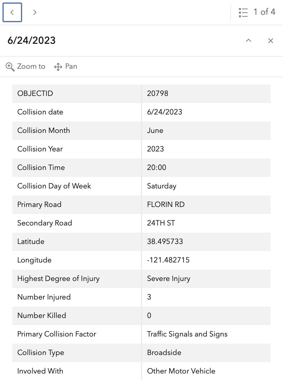
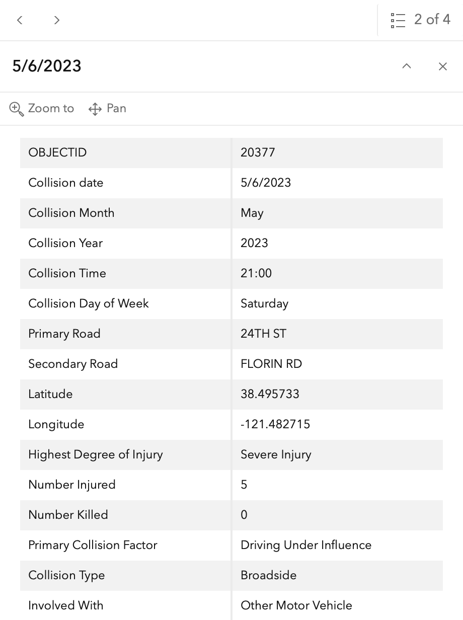
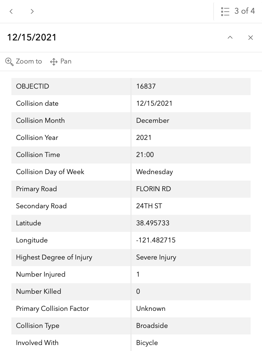
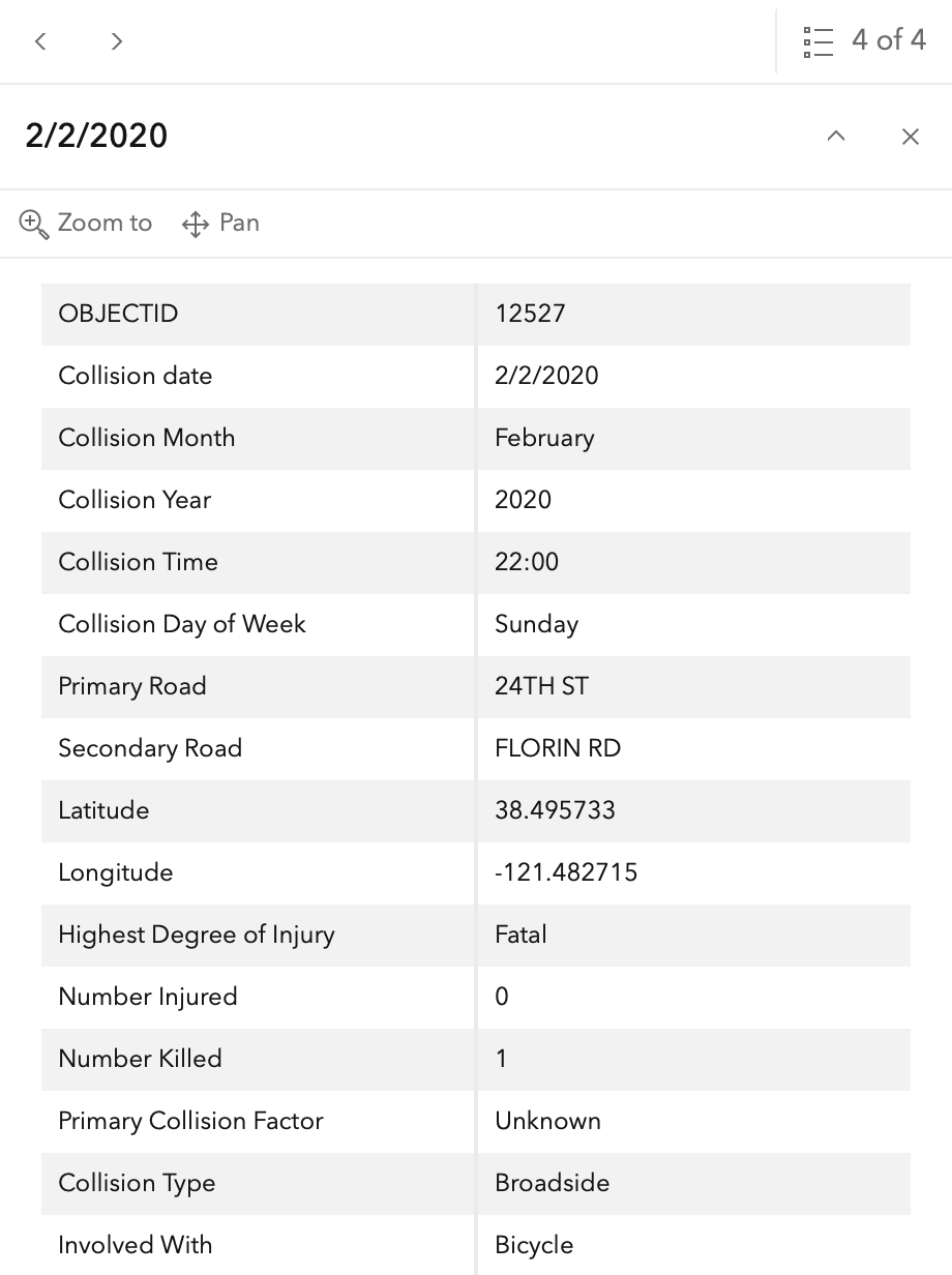
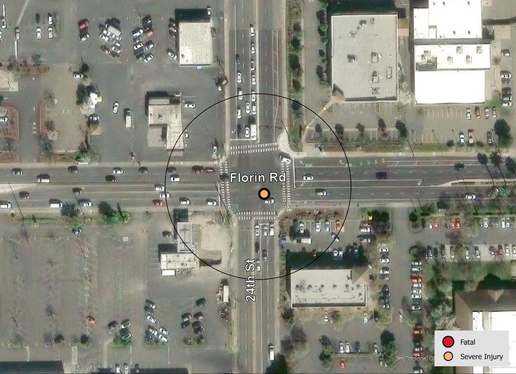
In the 2015 to 2024 period (which is used in the Vision Zero Action Plan Update), there were three severe injuries at this intersection and one fatality, two with motor vehicles and two with with bicyclists, including the fatality. These are mapped below (pdf). One dot contains all four crashes. The fatality is 2/2/2020 (12527).
The orange dots are severe injuries (one contains three crashes); the red dots are fatal (none). Together, these are know as KSI = killed or severe injury. ‘Other visible injury’ and ‘complaint of pain’ crashes are not shown on my map, since these are not the focus of Vision Zero, however, there are quite a number of these at this intersection, particularly on 24th Street, which you may view in the Crash Dashboard Interactive Map.
Please note that the exact crash locations may not be accurate, as police reports often do not correctly locate crashes. Also note that ‘pedestrian violation’ entry may be false, as police often blame crashes on the person walking when actual responsibility is not clear, or the pedestrian is dead and can’t counter the driver story.
The crash details, available in the Vision Zero Crash Dashboard Interactive Map, are below.