SacCity: VZ intersection 12: 16th St and J St

Note: General information on the Top 20 intersections, with criteria, list, and map, is available in post 1. Other posts on Top 20 intersections are available at Tag: Top 20 Intersections.

I am looking more closely at the Top 20 intersections identified in the City of Sacramento Vision Zero Action Plan Update. Intersection 12 is 16th St and J St.

Design

Lanes: 16th Street is one-way northbound and three lanes wide. J Street is one-way eastbound and four lanes wide (two through, one through/left turn and one left turn).

Medians: No concrete medians are present.

Crosswalks: Crosswalks are present on all intersection legs, however, they are low-visibility parallel lines.

Bicycle Facilities: Neither roadway has bicycle facilities at this intersection.

Speed: 16th Street has a posted speed limit of 30 mph. J Street has a posted speed limit of 30 mph.

The city no longer has a database or map of speed limits, so it is often necessary to look in Google Maps Street View for speed limit signs. The county (and SACOG) have a database, but it does not include the City of Sacramento roadways.

Transit: The intersection area is served by SacRT route 30 J St.

Crashes

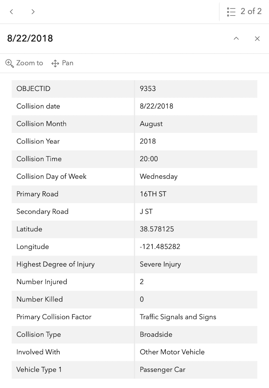
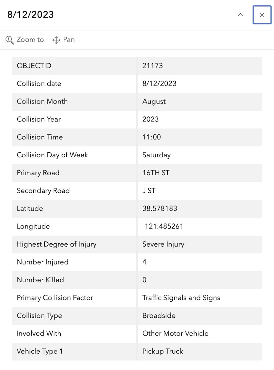
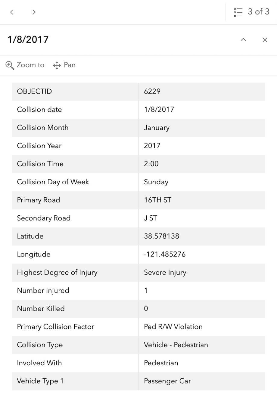
In the 2015 to 2024 period (which is used in the Vision Zero Action Plan Update), there were four severe injuries at this intersection, one involving a pedestrian and three involving motor vehicles. These are mapped below (pdf).

The orange dots are severe injuries (one contains three crashes); the red dots are fatal (none). Together, these are know as KSI = killed or severe injury. ‘Other visible injury’ and ‘complaint of pain’ crashes are not shown on my map, since these are not the focus of Vision Zero, however, there are several of these along J Street, which you may view in the Crash Dashboard Interactive Map.

Please note that the exact crash locations may not be accurate, as police reports often do not correctly locate crashes. Also note that ‘pedestrian violation’ entry may be false, as police often blame crashes on the person walking when actual responsibility is not clear, or the pedestrian is dead and can’t counter the driver story.
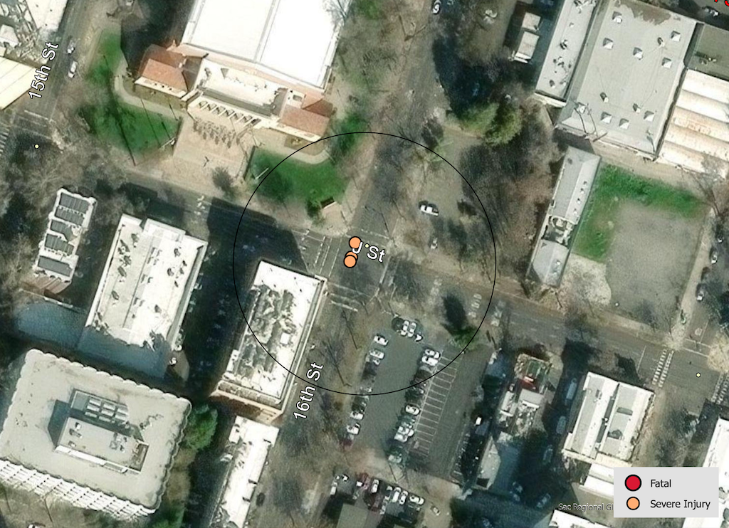
map of 16th St & J St
16th St & J St, VZAP update Top 20

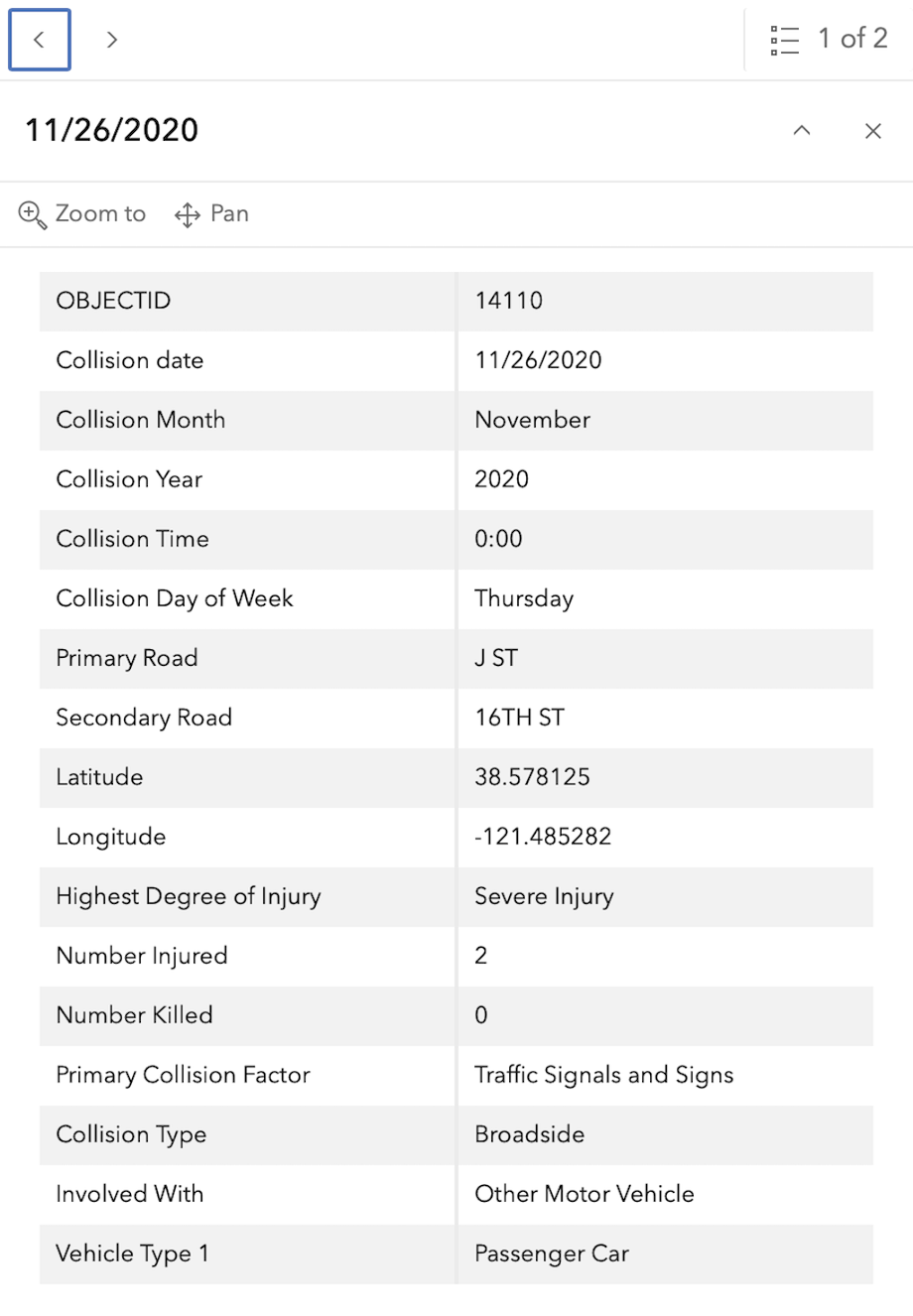
The crash details, available in the Vision Zero Crash Dashboard Interactive Map, are below.
Strong SacTown: Things that work: traffic posts

Things That Work: Traffic Posts is the eighth post by Strong SacTown to improve and promote the City of Sacramento update to its Street Design Standards. Other posts at tag: street design standards.

“You don’t often hear news about the crashes that didn’t happen. Today we’d like to highlight something already making real-world safety impacts in Sacramento: traffic posts (aka. delineators) on 15th & 16th Streets in Downtown. These traffic posts reduce the speed of cars (and severity of injuries) as well as channelize traffic – stopping cars from changing lanes at the crosswalk and potentially striking pedestrians who have started crossing.

Hmm. 16th St traffic calming

A new traffic calming feature has showed up on 16th Street approaching R Street in midtown Sacramento. Paint and flex posts have been placed between the travel lanes. Advance yield lines (‘sharks teeth’) were also painted, showing where drivers should stop when yielding to pedestrians.

16th St lane channelization

I’m not sure what to think of this. Certainly this is a problematic intersection. Cars stopped for the light rail gates between R Street and Q Street often stop throughout the intersection, blocking both the north and south crosswalks over 16th Street, as well as the intersection itself, preventing vehicles along R Street from proceeding while the traffic is stopped. As with all multilane streets, but particularly high speed, one-way arterials, drivers in one lane may stop for a walker while the others will not. I see this every day, and this intersection is worse than most. For reasons I don’t understand, traffic speeds on 16th Street northbound are noticeably higher than 15th Street southbound, even though the design of both streets in the same.

So, how’s it working. Well, I’ve so far only had the chance to observe it for 15 minutes. I’m not sure it is making much difference. About 10% of drivers stopped at or close to the advance yield lines. About 70% of drivers stopped at the forward edge of the flex posts, about 10% stopped over the crosswalk, and about 10% did not stop for people using the crosswalk. I saw three people nearly hit by drivers. This is not unusual, and it not worse than before, but it is not good.

Below is an example. The driver to the left stopped over the top of the crosswalk, even though it was clear that traffic ahead was stopped for the light rail gate, and there was no space to proceed into. The driver to the right stopped before the crosswalk, but not at the advance yield line. Not visible it the driver in the closest lane who did not stop at all because there was a space in that lane across the intersection.

walker using the crosswalk over 16th St at R St

While I appreciate the effort, I’m not sure if the results will be what is desired, which is the ability of walkers to safely cross the street.

In the long run, the reallocation of roadway on 16th Street to reduce the general purpose lanes from three to two will help this location a great deal, but I don’t know when that will happen. It could be years away.

With the new businesses on R Street to the east, and the street dining area on R Street to the west of 15th Street, this intersection has become quite busy with walkers, bicyclists, scooters, and motor vehicles. It does deserve attention.

Curb extensions 16th & N

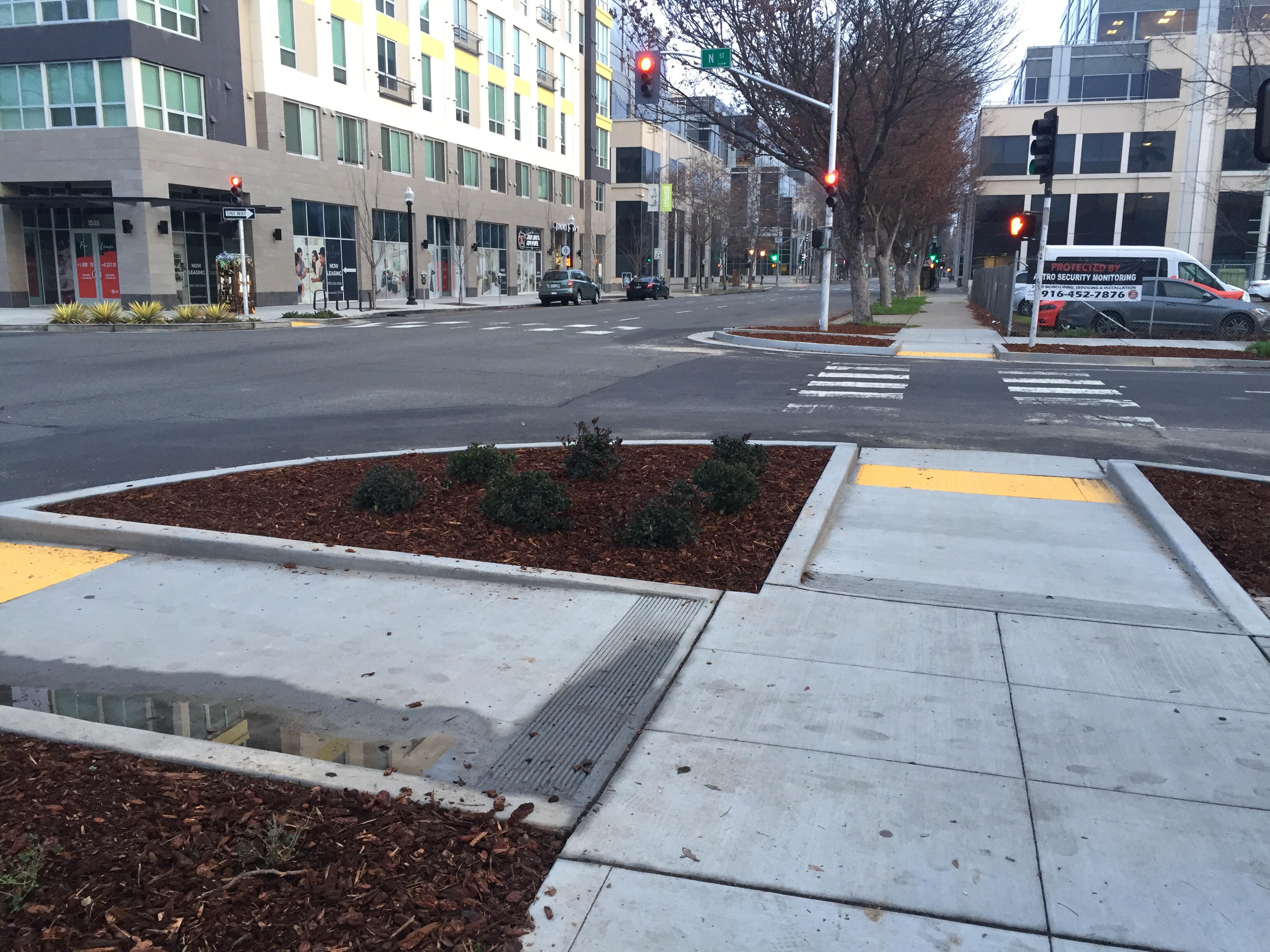
Curb extensions, also called bulb-outs, have been installed on all four corners at the intersection of 16th Street and N Street in midtown Sacramento. The extensions are the width of the parking lanes along both these streets. N Street has bikes lanes, which are not restricted by the extensions, while 16th Street does not have bike lanes, and won’t until the street is reconstructed into a more complete street at some unknown point in the future.

The primary beneficiaries of curb extensions are pedestrians, who have a shorter distance to cross, with every crossing being about six feet less distance for every parking lane, so in this case, 12 feet less. There is also much better visibility of cars by walkers, and of walkers by car drivers. Sometimes they also provide an opportunity for beautification, with rainwater swales and/or planting, as can be seen in the photo.

Every street with parking lanes should have curb extensions, so almost every intersection, but implementation will be slow because they are moderately expensive to construct (curbs sidewalks, detectable warning strips, better located ped buttons), and sometimes require drainage changes and occasionally even utility relocation. These particular extensions are certainly not the first in Sacramento, in fact there are extensions on the west corners of the intersection of 16th and O, just to the south, but are notable for being installed in a high pedestrian use area along two heavily trafficked streets.

freeway teardown

Synchronously today, Terry Preston (WALKSacramento) and SABA (Jim Brown) posted to Facebook with a link to an article “Is it time to start dismantling downtown freeways?” I encourage you to follow and join in those discussions: Sacramento Area Bicycle Advocates and Terry Preston. I am glad to see this being discussed. I posted on this blog about the same topic, “and the freeways” back in March.

SF-FerryBuilding_Embarcadero
San Francisco Ferry Building, with and without the Embarcadero Freeway

Read More »