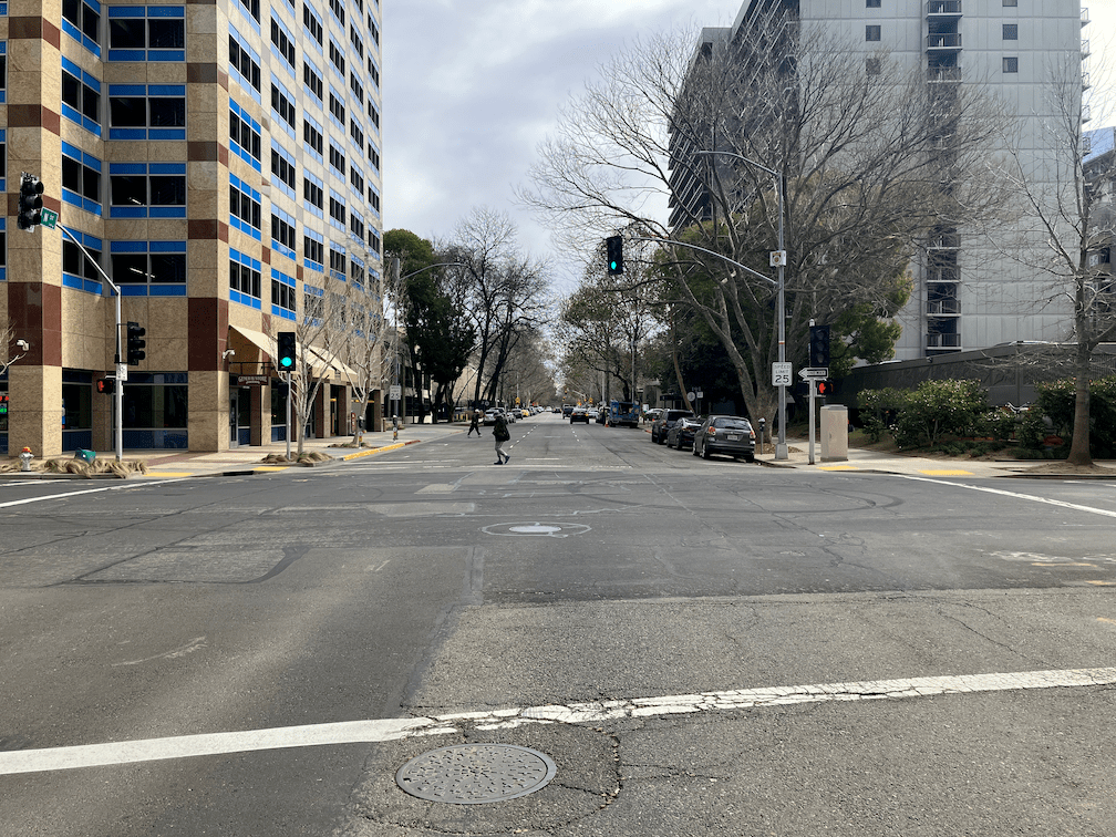
why are bike lane gaps so important?

My last three posts have been about locations where sharrows replace bike lanes for one-block sections in the Sacramento central city: Sacramento’s worst possible place for sharrows; Sac kill those sharrows on I St; Sac kill those sharrows on H St. There may well be other such locations that did not come to mind. If so, please let me know so I can document and post on them. I’m not asking about locations that should have bike lanes, or where bike lanes should be upgraded to separated (protected) bikeways. There are simply too many of those locations for me to deal with.

So, why are bike lane gaps so important? Bike lanes are basically a promise to bicyclists that the city is providing a safe place to ride your bike. Yes, I know traditional bike lanes have serious safety issues (they are called door zone bike lanes, or DZBLs), but for the average rider, they are safer than no bike lane. But this promise is broken when there is a gap. For these gap sections, bicyclists who felt comfortable riding in a bike lane are suddenly left to deal with motor vehicle traffic in a location where neither the bicyclist nor drivers are sure how to behave. What does the average bicyclist then do? Decide never to ride on that street again. And if they have a scary experience, they may even decide not to ride again at all.

I’m a bicyclist with strong vehicular bicycling skills. I know where the safest place to ride is on every street, and I ride there no matter what motor vehicle drivers or law enforcement happens to think about it. But I am far, far from a typical Sacramento bicyclist. I am ‘strong and fearless’, though as I get older, I’m tending towards ‘enthused and confident’. The four types of bicyclists, or levels of comfort, developed in Portland but applicable to Sacramento, are shown in the graphic:

four types of bicyclists and levels of comfort diagram

The city should be designing bicycle facilities that work for all three categories of people who will bicycle. When there is a gap in a bike lane, the city has designed bicycle facilities that serve the ‘strong and fearless’, only 7% of potential bike riders. This is discriminatory. It is wrong. I suspect that with the resurgence of bicycling and the availability of e-bikes, the ‘no way, no how’ category has shrunk a bit.

The city must close bike lane gaps. Not off in the future when the street is repaved, or when a grant is obtained, but NOW. To do otherwise is to intentionally discourage bicycling and to risk people’s lives.

Sacramento’s worst possible place for sharrows

The third place where sharrows need to be eliminated in the central city Sacramento is I Street at the county jail. In the phot below, the right hand lane is a parking lane most of the time, except for commute rush hour, 4:00-6:00PM on weekdays (note the time sign in the ‘bikes may use full lane’ photo following), when it is a general purpose lane. When it is a parking lane, there are sharrows nearly covered up by parking, as you can see in the second photo. This is not a bike lane in any sense of the word, but drivers assume that it is and close pass anyone using that area to ride in. When it is a general purpose lane, there is high speed traffic approaching the Interstate 5 onramps, absolutely not an appropriate location for sharrows. The current trend in use of sharrows is 1) don’t use them at all; 2) if they are used, they should absolutely never be used over 35 mph, and rarely used over 25 mph. Though the posted speed limit of I Street is 25 mph (though it isn’t really posted anywhere), regular traffic speeds are over 35 mph, and during commute hours is over 45 mph except when congestion prevents that. So this is not any appropriate location for sharrows.

Of all the places where bicyclists are at risk of getting doored, this is the place. Everyone parking here has a family member or friend who is in jail. They are upset, they are depressed, they are often angry, they are not thinking about bicyclists and looking before they open their door. There is also a lot of turn-over here, so a lot of door opening. When I ride this area, I ride in the exact middle of the next lane over, taking the lane. But that is something that the average bicyclist will not do. So the sharrows leave them vulnerable to both close passing and dooring.

The city has placed a ‘bikes may use full lane’ sign (MUTCD R4-11), but is is up high against the background of a tree, where it would not likely be noticed by drivers or bicyclists. Of course bicyclists may use the full lane, with or without the sign, but again, most bicyclists will not do that. If signing is to have any meaning at all, the sign must be much bigger than it is, closer to 7th Street, and the message should also be marked on the pavement.

I Street west of 7th Street, part-time lane with sharrows
I St west of 7th St, part-time parking and general purpose lane with sharrows, Sacramento
I St west of 7th St, sharrows and parking in a part-time general purpose lane, Sacramento
I St west of 7th St, bikes may use full lane sign

I am not sure what the best solution is here. It is not to get rid of the parking; this is one location where on-street parking is justified. The right hand lane should be a parking only lane, however. There is no justification of traffic volume requiring another general purpose lane during commute times. That just encourages more driving and higher speeds, as drivers race each other for the on-ramps.

This is also a location where bicyclists separate into two destinations. Riders heading towards Sacramento Valley Station stay on the right so they can turn on 5th Street toward the station. Riders heading to Old Sacramento must move to the left hand side to avoid the high speed on-ramps. The left side bike lane, however, doesn’t even start until just before 5th Street, leaving no refuge for bicyclists trying to merge across traffic to the left side between 7th Street and 5th Street. I think there needs to be an intentional location for bicyclist to shift, at 7th Street or 6th Street or 5th Street. There would be a green bicycle box for waiting, and a signal with exclusive bicycle phase for bicyclists to safety transition from the right side to the left side. A bike lane would be present from that crossing point on I Street, without gaps.

Of course I Street needs to be reallocated so that it serves all users, and is not just a traffic sewer for drivers going to the freeway. It should be no more than two lanes at any location. Fewer lanes would slow traffic, as the prudent driver sets the speed rather than the egregious speeder. There should be a separated (protected) bikeway on either the left or right side, with a safe transition from one side to the other at some point.

Caveat: I post about issues in the central city because I live here, and see the problems every time I am out walking or bicycling. However, I strongly believe that the city should be focused on solving issues in lower income, disinvested neighborhoods, of which there are ample throughout the city. The central city has received more than its share of bike facilities.

Sac kill those sharrows on I St

Next sharrows location to address is I Street between 10th Street and 9th Street. The bike lane present to the east disappears in this block, with Cesar Chavez Plaza on the south and Old City Hall on the north, before picking up again west of 9th Street. Not having my tape measure out (and I’d have to measure late night when there is no traffic), it isn’t clear why this one block does not have a bike lane. It may be that the curb extension is too wide, or it may be that the general purpose (car) lanes are not configured correctly. If lanes, then it is an easy problem to fix, just re-stripe the lanes and add a bike lane. If the curb extension, then that would require a bit of infrastructure work. I fully support curb extensions, nearly all intersections should have them, but in some places the city has installed them incorrectly and caused issues for bicycle facilities. This is not, as many places are, a case for removing parking, but for designing the street correctly. Of course ultimately there should be no three-lane one-way traffic sewers in the city, and right of way should be reallocated to a separated (protected) bikeway and wider sidewalks.

I St westbound at 10th St, sharrows, Sacramento
I St westbound at 10th St, Sacramento

Caveat: I post about issues in the central city because I live here, and see the problems every time I am out walking or bicycling. However, I strongly believe that the city should be focused on solving issues in lower income, disinvested neighborhoods, of which there are ample throughout the city. The central city has received more than its share of bike facilities.

Sac kill those sharrows on H St

The block of H Street between 7th Street and 8th Street in downtown Sacramento has shadows instead of a bike lane. There is a bike lane in the preceding block, and in the block past, but not this block. Why? Because on-street parking has been preserved on this block in preference to bicycle facilities. The right lane lane is marked with a sharrow. Not a properly placed sharrow, but one in the door zone of the parking lane. When shadows are used, they should be placed in the center of the travel lane. But rare is the situation in which they should be used at all. Research indicates that sharrows are less safe than no markings are all, less safe than marked bike lanes.

So why is this parking here at all? No reason whatsoever. On the north side of this block is a County of Sacramento parking garage. There is even a pedestrian bridge between the parking garage and the Sacramento County administrative building on the south side of H Street, as seen in the photo.

I am certain that all of these cars belong to county employees or contractors. They should be parking in the garage, and this parking should be removed so that at least a marked bike lane can be placed in this block. Of course H Street should have a separated bikeway from 6th Street, Sacramento Valley Station, to 16th Street, where it becomes two-way. But a Continous painted bike lane is at least a first step.

There are a number of locations in the central city where bike lanes are dropped for a block in favor of parking and travel lanes. Every single one of these should be fixed either by the removal of parking or a general purpose lane.

Caveat: I post about issues in the central city because I live here, and see the problems every time I am out walking or bicycling. However, I strongly believe that the city should be focused on solving issues in lower income, disinvested neighborhoods, of which there are ample throughout the city. The central city has received more than its share of bike facilities.

freight and passenger rail

The strike by railroad workers seems to have been averted by the private railroads giving in just slightly. I don’t know enough about labor in the railroads to say much of intelligence on the issues, though I am pretty sure that as huge and very profitable corporations, the interests of the freight railroads are not those of the workers.

The possible strike has reminded me that I have ideas about railroads. I quite often use the Capitol Corridor regional service, Sacramento to the Bay Area, and also use the Amtrak long-distance routes, Coast Starlight and California Zephyr. My experience is that service on these routes has been continuously deteriorating over the years. Amtrak is not really very good at running trains, and they are even worse on maintaining trains. Equipment problems are a daily occurrence, and are often the start of trains falling behind schedule.

Passenger trains are guaranteed, by federal law, right of way over freight trains. But only if the passenger train is on schedule. So if a passenger train falls off schedule, due to equipment problems or slow loading at a station or slow crew changes (Amtrak personnel are often late to the job at crew change locations), the train will fall further and further behind. The long distance trains are either on time, because they never fell behind, or four to six hours late, because they did, and lost priority to freight trains. It is frustrating to sit on a siding, often for quite a while, while a slow and long freight train gets the right of way.

The Martinez rail bridge is a major problem for Capitol Corridor schedules. The only solution is a new high level bridge that would not be delayed by maritime traffic.

But the real issue to me is that maintenance of the rails is unacceptably bad. About two years ago, Union Pacific did a major maintenance project on part of the route between Sacramento and Martinez. The result? The rails were much worse after than before. It used to be I could write, not easily, but acceptably, on the Capitol Corridor. Those times are long gone. It is now difficult, and dangerous, to even get up and walk around. Sharp jolts from poorly maintained rails are a regular occurrence. I’ve seen people thrown to the ground by these jolts. A few years ago, a Capitol Corridor train almost derailed between Sacramento and Davis, with many passengers injured. Amtrak stonewalled the investigation, and Capitol Corridor JPA shrugged and accepted that no one was going to take responsibility.

Transportation advocates have long pushed for electrification of the Capitol Corridor trains, and similar regional rail systems throughout the US. But Union Pacific does not want catenary wires (the overhead wires that power electrified trains) along its tracks. So Capitol Corridor will continue to use diesel locomotives forever. The current model is much cleaner than older ones, but still dirty. If you really want to see dirty, look at the ancient diesel locomotives that Amtrak uses for its long distance trains.

Capitol Corridor JPA has a project to add a third track between Sacramento and Roseville so that more passenger trains can be run on that section. Today, there is one train westbound and one train eastbound, up to Auburn, with a stop in Roseville. The project has been much delayed, and now has been trimmed back so that only part of the route with have a third track. As I see it, Capitol Corridor was extorted by Union Pacific.

So, solutions:

  1. Regional rail services, which are almost entirely funded by the states and not Amtrak, should start separating from Amtrak. The result will be better managed trains and better maintained trains. The only advantage regional rail gets from Amtrak is unified ticketing, so the solution there is to have a separate unified ticketing service that is not controlled by Amtrak.
  2. The states and/or federal government should take ownership of all rail lines that serve more than one passenger train per day. Freight railroads would still own their rolling stock, and could buy passage on the routes, but the routes would be managed (dispatched) to prioritize passenger rail at all times. If the freights are willing sellers, then fair market value, but condemnation would be used where they are not.
  3. All regional passenger service should be considered for electrification. The passenger service would be cleaner and quieter and faster (better acceleration than diesel). Not all would be electrified. Freight railroads would have to accept running under catenary, or better yet, just start running electric locomotives as well.
  4. California should commit to and fully fund a high level bridge at or near Martinez.
  5. Capitol Corridor should terminate the third track project as currently designed, and demand that Union Pacific provide the right of way for a third track without any freight use at any time. I’m sure UP would refuse, which takes us back to item 2 above, public ownership of the right of way and rails.

Measure A fix-it-first for only five years

From the Measure A 2022 transportation sales tax measure, Implementation Guidelines, paragraph F: ““Fix It First” Investment Priority for Years 1-5. With the exception of Caltrans and the Capital Southeast Connector Joint Powers Authority, Authority allocations for the first five years following implementation of this Measure shall prioritize “Fix It First” road, transit, safety, bicycle, and pedestrian investments.”

For the first five years of the measure, if it passes, the county and cities will be obligated to prioritize (that word is not defined) fix-it-first, which most people think of as fix-my-potholed street. What about the other 35 years of the measure? The agencies can then go back to what they have been doing all along, which is de-prioritizing maintenance in favor of building new stuff. Potholes in your street? Broken sidewalks? Sorry, we are going to spend the bulk of your tax dollars on building new stuff.

A measure that really cared about the quality of our transportation network would prioritize a state of good repair, not just for five years, but always. Of course traffic engineers know that is not possible. We have already built more than we can possibly maintain. But rather than being honest about that, the county and cities have adopted a policy of full-speed-ahead with new stuff – more freeways, more interchanges, more pavement.

Note also that Caltrans projects and the Capital Southeast Connector are exempted from even that meek requirement.

SACOG pathways

SACOG is in the process of developing the 2024 MTP/SCS, now referred to as the Blueprint in acknowledgement of the innovative and leading 2004 Blueprint. As part of the process, they have defined three pathways or scenarios, shown below. Pathway one is the vision of more greenfield development, more roadways and expanded roadways, ineffective transit, and neglect of already developed areas. Pathway three is close to the vision of advocates for an effective and equitable transportation system. Pathway two is basically continuing what we are doing, some good things along with many bad things.

Where does the 2022 Measure A transportation sales tax measure, which will lock in a vision of transportation for 40 years while costing taxpayers $8.5 billion, is as close to pathway one as possible. It is a mistake for land use planning, for transportation, for equity, and for climate. Please vote against Measure A in November.

PATHWAY 1: OUTWARD EXPANSION
This pathway builds on the land use trends over the last two decades and expands the footprint of the region outwards through significant lower density growth in developing communities and rural residential areas. It will provide the most large lot single-family and rural residential housing and the least amount of infill growth. The Outward Expansion pathway will provide more emphasis on adding roadway capacity to meet mobility needs. Due to this pathway’s more dispersed land use pattern, transit services will focus on geographic coverage rather than frequency of service, and bicycle and pedestrian facilities will focus more on connecting developing communities to existing networks.

PATHWAY 2: COMPACT GROWTH AND PHASED EXPANSION
This pathway will use the key land use metrics from the 2020 MTP/SCS to create a land use forecast and will be updated with current conditions. In the 2020 MTP/SCS, roughly 65 percent of new housing and 85 percent of new jobs were in infill areas and roughly 73 percent of new homes were either small lot single-family or attached products. This pathway will maintain the transportation project list from the 2020 MTP/SCS but will include updates based on completed or modified projects in capital improvement programs or planning efforts. New roadways or transportation investments will be included where the growth pattern has shifted. Transit service in this pathway will focus on increasing vehicle service hours for bus and rail projects.

PATHWAY 3: INWARD EXPANSION
This pathway will explore a future in which most of the future growth occurs in infill areas such as centers and corridors and established communities. This pathway is intended to explore the performance implications of a future that significantly departs from today’s land use trends. This pathway provides the most new small lot and attached housing and growth in infill areas would consist of already approved projects, vacant lots, and significant redevelopment of underutilized commercial corridors oriented around the transportation investments. In this pathway investments in capacity projects will only be used to address extreme bottle necks and congestion. To meet the region’s mobility needs, this pathway will focus on transit service in corridors with sufficient density and mix of uses needed to generate sufficient ridership to justify higher frequency transit, and fully connect existing communities through an integrated bike and trail network to reach essential destinations within communities.

housing plus transportation affordable

I have mentioned the concept of H+T, housing plus transportation, in previous posts, but not focused on it. H+T is a concept developed by Congress for a New Urbanism’s Center for Neighborhood Technology. The Affordability Index concept is explained as:

“The H+T® Index provides a more complete measure of affordability.

By taking into account the cost of housing as well as the cost of transportation, H+T provides a more comprehensive understanding of the affordability of place.

Dividing these costs by the representative income illustrates the cost burden of housing and transportation expenses placed on a typical household.

While housing alone is traditionally deemed affordable when consuming no more than 30% of income, the H+T Index incorporates transportation costs—usually a household’s second-largest expense—to show that location-efficient places can be more livable and affordable.”

The traditional way of finding ‘affordable’ housing, for those able to, is to ‘drive until you qualify’. The further away from the core city, the less expensive housing becomes, because the cost of land is lower, and the level of subsidy for development is higher. Of course there are exceptions – think Granite Bay, the most expensive and highest income area in the region. But with lower housing costs come higher transportation costs. In fact, it is almost an inverse relationship. The longer travel distances and the lack of choice of modes – driving becomes the only choice – eat up savings from less expensive housing.

For Sacramento County, the map of H+T is below. The fact sheet for Sacramento County is here. In general, the affordable areas (light color) are downtown, Stockton Blvd (with SacRT bus route 51), Interstate 80 east (with SacRT light rail Blue Line and bus route 1). Overall for the county, 52% of income is spent on housing plus transportation, with 29% being housing and 23% being transportation. That is a remarkably high transportation component. Why? Because Sacramento County is so spread our, vast areas of low density housing, and undeveloped land (that used to be agricultural land) that has been leapfrogged over by developers seeking even less expensive land to develop. If time allows, I will use the H+T data to overlay with the transit system and pin down better the relationship between transit and transportation costs. But for now, you can clearly see there is a relationship.

Why is H+T so important, at this point in time? Because the proposed transportation sales tax for Sacramento County, Measure A, focuses mostly on the old model of transportation, where freeways and arterials provide fast travel to far flung developments. The banner project in the measure is the Capital Southeast Connector, which comes nowhere close to the capital, in fact avoids the city of Sacramento and will provide no benefit to the city. See all the high transportation cost areas, the darker blue? The measure envisions more and more of those, places where the housing might be relatively affordable, but transportation costs are back-breaking. The measure wants to build more freeways and interchanges, expand freeways, widen roadways, and ease travel along major arterials. It is not interested in sidewalks and bicycle facilities that would support more housing in the already transportation affordable areas. The complete streets are all along major arterials, the dangerous, busy, noisy, pollution generating roadways that are not where affordable housing should be.

The measure provides some funding for transit, but significantly less than the existing Measure A, less than the 2016 Measure B which failed at the ballot box, less than the draft 2020 Measure which was withdrawn in part due to the pandemic. It also sees the function of transit as mitigating motor vehicle capacity expansion projects, not as a valid mode of travel.

Infill housing can be affordable, if priced correctly. Yes, under current housing cost inflation, almost nothing anywhere is affordable, but in concept infill can be affordable. Greenfield development can never be affordable because the transportation component of H+T will always be too high in greenfield areas.

Sacramento County and the cities in the county are obligated by state law, under the RHNA (regional housing needs assessment) process, to zone sufficient areas for housing at many income levels (very low, low, moderate, above moderate). The proposed measure, because it sucks up nearly all transportation funding into areas of moderate and above moderate housing, pretty much ensures that the governments will not be able to meet their very low and low obligations.

infill housing for GHG reduction

The Carbon Footprint Planning Tools and Scenarios webpage of the Cool Climate Network of UC Berkeley has a tool for calculating how much of a contribution various local policies and actions could make to reducing greenhouse gas emissions (GHG). For Sacramento County, the graph produced is:

What is the leading category? Urban infill, which is primarily but not entirely housing. Electric vehicles, the solution most touted by agencies and politicians, comes in fifth.

This finding tracks with other analyses:

Many cities in the region, including Elk Grove, Rancho Cordova, Folsom, and Roseville, and the county of Sacramento, envision of future of continuously expanding greenfield development, which is the exactly opposite of infill. Why? Because greenfield developers make bigger contributions to candidates than infill developers, and greenfield development is the perfect way of gaining property tax income now, while deferring maintenance to the future, when current office holders will be long gone. Greenfield development is climate arson, simple as that. Yes, the developments may have nice walking and bicycling paths within them, but travel to jobs, grocery stores, coffee shops, medical services, and really anything people want, requires driving a motor vehicle. As you well know, we already are not able to maintain our transportation system because most of the money goes to building more roadway capacity (particularly very expensive freeways and interchanges), not to maintenance. If what has already been built were maintained to high standards, your tax rate would be about half your income.

The answer is residential infill. That does take some investment. Some utilities may need to be upgraded. We may need to spend more on transit. But the costs are far far lower over the life of the development than is greenfield development.

Some recent articles and research on the different costs of infill and greenfield, but if you search online, you will find almost unlimited references, with a few that come to other conclusions.

celebration, and caution

Today is a day of celebration for housing and transportation in California, with the possibility of more to come in the next two days. Yay!

But I want to caution about the alignment of housing with transit. It seems like a no-brainer, right? As I’ve long said, you can’t have affordable housing without effective transit, and you can’t have effective transit without widely available affordable and other housing. The problem I’m concerned about is that most of our transit system is oriented to arterial roadways (the semi-high speed, many-lane roads that are also called stroads because they don’t function well as streets or roads, and also called traffic sewers). Or in the case of rail transit, often uses old railroad corridors or freeway medians that make housing development difficult and probably unwise.

Research indicates that people, particularly kids, who live near freeways and arterials have much higher rates of asthma, and many other health problems, and shorter lifespans. Is that where we want low income families and kids living?

Apart from freeways, most traffic crashes happen on arterial roadways, and particularly at intersections of arterial roadways, and freeway on-ramps an off-ramps. Is this the hazard we want for low income families and kids?

I don’t have an answer for this challenge, but I often think it would be better to upzone everywhere (the next increment of development), so that additional housing can be built in places with better air quality and lower traffic violence. Maybe we should be fixing the arterials first, before we build housing along them. Yes, that delays the benefit of easy transit access to housing, but good transit in a poor living environment is just not what I want to see.