Streets for People virtual slides

Additional posts on Streets for People Active Transportation Plan are at category: Active Transportation Plan.

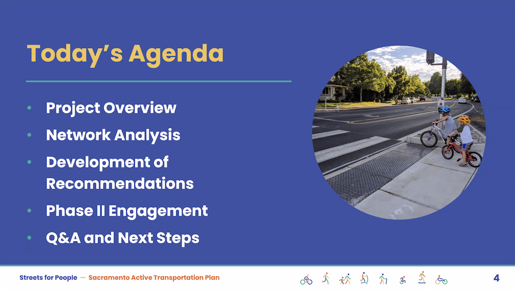
The City of Sacramento held the Streets for People Citywide Virtual Workshop #1 yesterday. Though the city may eventually post the slideshow, it is not on the program page Streets for People Active Transportation Plan yet, so I’m posting them here. These are low-ish resolution screen captures, so you won’t be able to see detail in them, but I hope they are still useful to you. I did not capture every single slide, but I hope the ones of interest are here. Of course the slides do not capture the presenter comments that went with each slide, which are important.

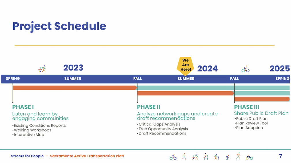
The next workshop, Streets for People Citywide Virtual Workshop #2, will be tomorrow, July 11. Please see the program web page for registration link. I assume the presentation will be the same.

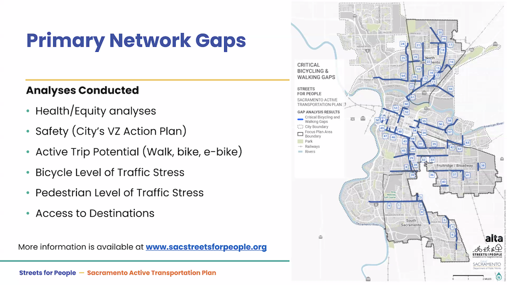
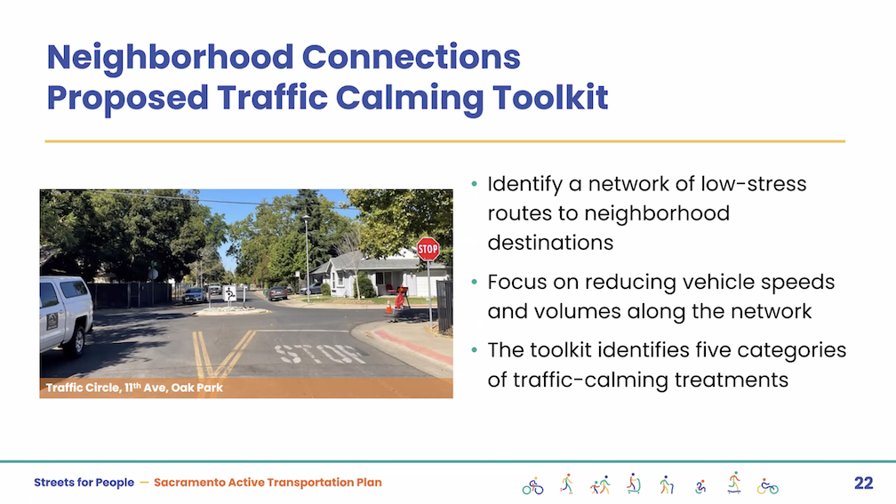
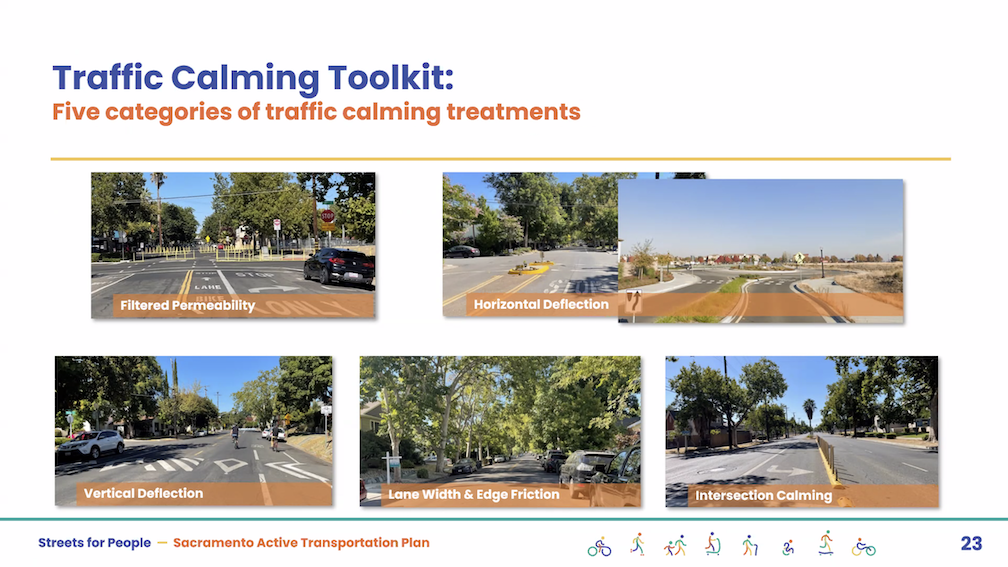
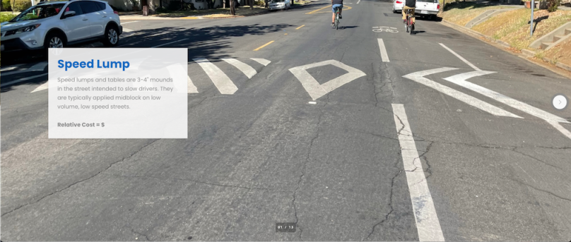
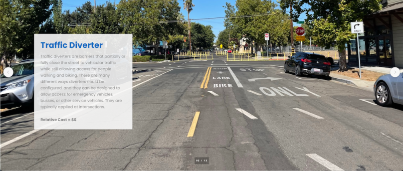
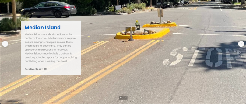
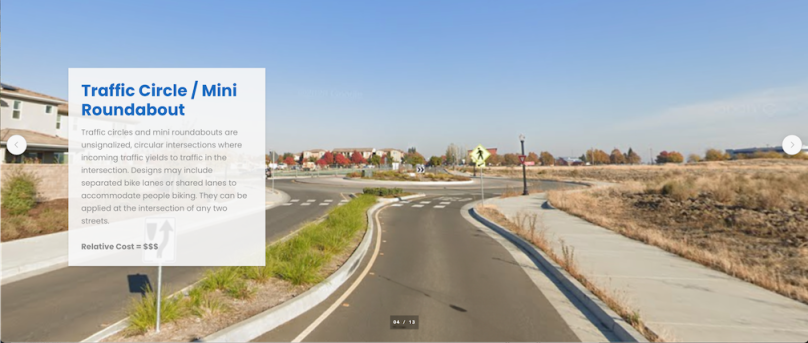
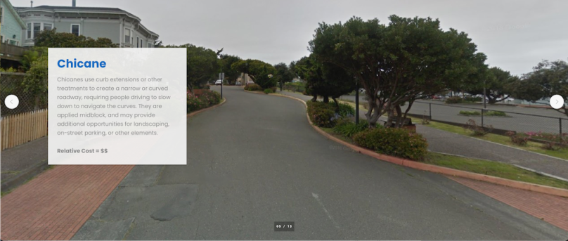
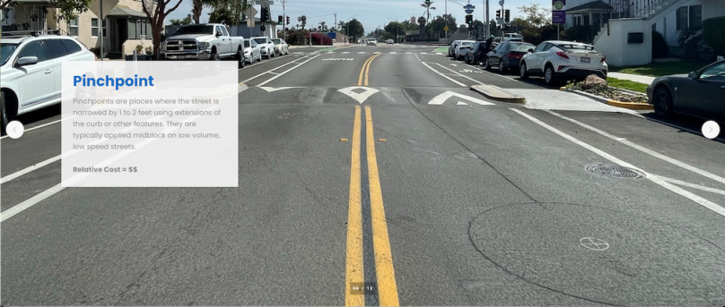
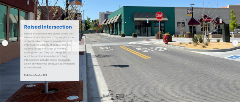
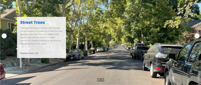
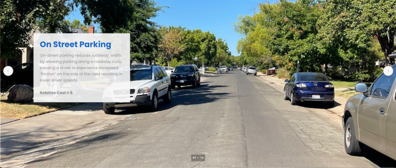
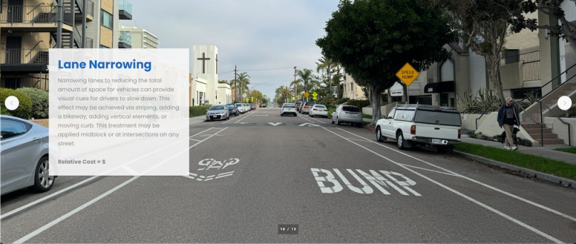
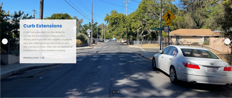
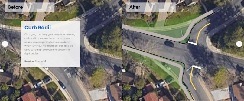
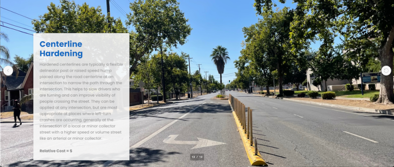
The first workshop was poorly attended. I don’t know how many people, but the presenters mentioned several times how few people were on the webinar. My question/comment is that the Traffic Calming tab of the Neighborhood Connections storymap has the best examples of traffic calming measures, with many of the photos local, whereas the visual glossary pedestrian and visual gallery bikeways examples provided as part of the interactive map are of poorer quality, not local, and in a few cases should not be recommended at all. These two sources should use the same examples, where they overlap.

The second workshop will be followed by a series of focus groups for particular neighborhoods or areas of the city, and walk audits in those same areas. I hope that people will participate in one or more of them.

Streets for People Interactive Map visual gallery – pedestrian

Streets for People Active Transportation Plan has posted an interactive map on which people may make comments on proposed projects, or add their own points or lines. There are visual galleries for pedestrian infrastructure and bicycle classes, but they overlay the map so can’t be viewed while viewing the map. The visual galleries have been captured and made available here. This post is the pedestrian infrastructure gallery, next will be the bicycle classes gallery.

These elements are not exhaustive. There are several elements in the Streets for People Neighborhood Connections storymap traffic calming tab which can be used on the interactive map as well. And you may add your own.

Note: Photos are not from Sacramento. These galleries and the elements they contain are re-used from projects in other cities.

Visual Glossary of Pedestrian Infrastructure

Note: Also available as a pdf.

Sidewalks

Provide an area for people walking to travel separated from vehicle traffic. Typically constructed out of concrete and separated from the roadway by a curb or gutter and sometimes a landscaped buffer. 

Read More »

Streets for People Interactive Map visual gallery – bikeway classes

Streets for People Active Transportation Plan has posted an interactive map on which people may make comments on proposed projects, or add their own points or lines. There are visual galleries for pedestrian infrastructure and bicycle classes, but they overlay the map so can’t be viewed while viewing the map. The visual galleries have been captured and made available here. This post is the classes of bikeways gallery.

These elements are not exhaustive. There are several elements in the Streets for People Neighborhood Connections storymap traffic calming tab which can be used on the interactive map as well. And you may add your own.

Note: Photos are not from Sacramento. These galleries and the elements they contain are re-used from projects in other cities.

Visual Glossary of Classes of Bikeways

Also available as a pdf.

Shared-Use Paths 

Paths shared by people walking and biking completely separated from motor vehicle traffic. These facilities tend to be comfortable for people of all ages and abilities. 

Read More »

Streets for People traffic calming

The city yesterday added the Neighborhood Connections Story Board to the Streets for People Active Transportation Plan webpage. I encourage you to look at the entire storymap, but the traffic calming slides are worth sharing independently. The slideshow below has the 13 traffic calming features, with photos, brief descriptions, and relative costs. These traffic calming features are meant for local and minor collector streets, not for major collector and arterials streets. Note that the city is still using the outmoded classification system (local, collector, arterial) that focuses on motor vehicle throughput. This typology approach must change.

SacATC 2024-06-20 on Streets for People

The City of Sacramento Active Transportation Commission (SacATC) will meet today, June 20, 2024, 5:30PM in city council chambers, 915 I Street. 

The main agenda item is: 

  1. Streets for People Active Transportation Plan

This is a discussion and feedback item, not for decision.

The attachments to the staff report are available separately on the Streets for People webpage. Hopefully this will solve issues with the very large and likely corrupted combined document.

You can comment via eComment at the city’s meeting page, http://sacramento.granicus.com/ViewPublisher.php?view_id=21, before the meeting starts, or in person. Of course in-person is more powerful, but eComments are valuable and the only method many people can use. eComments submitted well ahead of time can be viewed by commissioners, while last-minute ones will go into the record but not be viewed before the meeting.

If you are frustrated by my posting the meeting on the day of the meeting, please view or subscribe to the calendar hosted by STAR, at https://star-transit.org/events/, which has this event and many others of interest to transportation advocates.

SacCity Active Transportation Plan

The City of Sacramento is in a planning process that will lead to an active transportation plan, called Streets for People. It will replace the somewhat out of date Bicycle Master Plan and the prehistoric Pedestrian Master Plan. Phase 1 involved gathering input and specifics from the community, and resulted in an existing conditions report.

I have, to be honest, not participated in this process nor posted anything about it. Well, here you go! I’ll look more closely, and no doubt have things to say. Soon, I hope.