Pedestrian and Bicyclist Fatalities Up? More data flaws!

California Walks tweeted an LA Times articles entitled Highway deaths at lowest level since 1949; bike, truck fatalities rise. The misinformation and misunderstanding in the article includes:

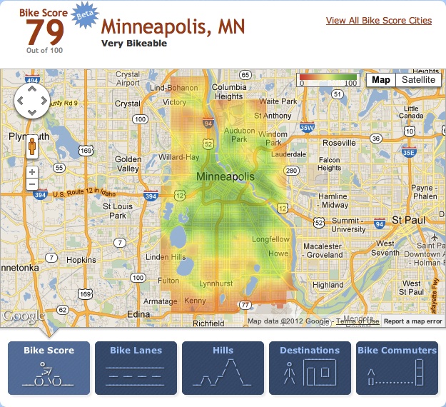
The article misses that the Traffic Safety Fact: 2011 Motor Vehicle Crashes: Overview (TSF), linked from the National Highway Traffic Safety Administration (NHTSA) press release, also shows that the injury rate per vehicle mile traveled (VMT) has been flat for three years. What does this mean? It probably means that the number of crashes has not declined, just the likelihood of fatality in a crash. The rate per VMT is the only useful measure of traffic safety. Fatality counts and injury counts are a mis-measure because they are affected by the rate of driving and a number of other factors, rather than the safety of driving.

The TSF provides counts of pedestrian fatalities, up 3%, and bicyclists (the NHTSA uses the obscure term pedalcyclists), up 8.7%. To go with the counting game, this is an increase of 130 dead pedestrians and 54 dead bicyclists in just one year. No statistics are presented on the fatality rate per bicycle mile traveled. Why? I believe that it is because NHTSA is too lazy or too disinterested to compile information on bicycle miles traveled. Though pedestrian miles traveled would be difficult to compile, at least a rate could be developed per pedestrian trip, which would be a more accurate measure of the rate of fatalities. Again, the NHTSA can’t be bothered. I am certainly not the first to point out that pedestrian and bicyclist fatality counts are a mis-measure of safety, yet the federal, state, and local governments continue to ignore the issue.

Read More »

Sacramento River Parkway next step November 13

existing pathway on Sacramento River levee

At the November 13 Sacramento City Council meeting, the next step for the Sacramento River Parkway will be on the agenda. This is just a small step. primarily to allocate funds to start property research, but it is an important next step. It may be controversial, with a small number of property owners in the Pocket and Little Pocket area opposed to public access to the publicly owned levees. The City Council meeting starts at 6:00PM, in the City Council Chambers of the City Hall at 915 I St. It is difficult to guess how much time will be taken with preceding agenda items, but item 19 might come up about 7:30PM.

19. American and Sacramento River Parkway Plans 2012 Implementation Program  Report # 2012-00851 Estimated Time:  45 Minutes
Location: Districts, 3, 4, and 7
Recommendation: Pass a Resolution: 1) approving the American and Sacramento River Parkway Plans 2012 Implementation Program; 2) establishing a new Capital Improvement Program (CIP) for the River Parkway Plans Implementation (L19016500) project; 3) transferring $100,000 from the Regional Park/Parkway Acquisition/ Development (L19003500) project to L19016500; 4) authorizing the City Manager, or City Manager’s designee to negotiate with public agencies and private parties for public access trail easements; and 5) authorizing the City Manager, or City Manager’s designee, to coordinate with local, state, and federal agencies regarding associated flood protection permit and easement compliance and removal of unpermitted encroachments. Contact: J.P. Tindell, Park Planning & Development Manager, (916) 808-1955, Parks and Recreation Department Item 19-American and Sacramento River Parkway Plans 2012 Implementation Program  (PDF-1689 KB)


Freeport Blvd bike lane project

Freeport Blvd bike lanes project

Tomorrow night (Nov. 8) at 6 PM the Sacramento City Council meets to vote to adopt a plan for the Freeport Blvd. Bike Lane project.

City staff propose replacing 4 substandard-width traffic lanes on Freeport Blvd. between 4th Ave and Sutterville Rd with 5 lanes: 2 standard-width traffic lanes and a center turn lane for motor vehicles and bike lanes in both directions (Segment Design Concept 2 on the website below). Staff also proposes bike-friendly modifications to the intersection at Freeport and 4th Ave, in front of Taylor’s Market (Intersection Design Concept 2).

The segment improvements are exactly what bicyclists need for safety, and while the intersection improvement isn’t the best one (see #4), it’s affordable and workable.This is a good plan and it looks likely a council majority is prepared to approve it.We need **100** bicyclists to attend this meeting to show the council that our community supports these kinds of essential safety improvements. If you ride on Freeport or care about the safety of someone who does, please join us and please share this invitation with others!

Questions? Contact SABA at jim@sacbike.org or 916-444-6600.

New bike lanes, diets and sharrows downtown

10th Street northbound at Roosevelt Park, three lanes reduced to two

As part of a recent repaving project, now mostly complete, bike lanes were added to several streets in the downtown area, sometimes by converting three travel lanes to two, and sometimes just by narrowing the travel lanes. As an example, 9th Street (one-way southbound) and 10th Street (one-way northbound) were converted from three lanes to two, which freed up space for bike lanes. 10th Street is shown at right. A reduction in the number of travel lanes is sometimes referred to as a road diet. However, the amount of right of way is the same, it has just been shifted to serve all modes of travel more effectively. The reduction in motor vehicle lanes reduces the motor vehicle road capacity slightly, but far less than many people think it will. In fact, with more space for bicycles, more people will bicycle and the motor vehicle traffic drops somewhat, lessening congestion for everyone.

I Street westbound just past 7th St; sharrow in time restricted lane

Sharrows (shared lane markings) were also used liberally throughout, particularly on east-west streets. Along I Street westbound, bike lanes are present in some blocks and sharrows in others. The photo at right shows the sharrows placed within a time restricted travel lane in front of the courthouse on I Street. When parking is allowed, the sharrows form a defacto bike lane adjacent to parked cars. This lane is a bit wider than it was before. During no-parking times, the sharrows define their usual meaning, that “Bikes Can Use Full Lane”. The MUTCD R4-11 sign is used at times to provide the same indication. Sharrows are placed in lanes which are too narrow for a motor vehicle and a bicycle to share side by side, which is less than 14 feet. In any lane narrower than 14 feet, the bicycle not only can be should occupy the middle of the lane to prevent motor vehicles from passing too closely.

Some criticisms of the project:

  1. Sharrows are placed inconsistently within the travel lanes. They should always be centered in the travel lane, but it looks like in some cases they were placed a certain distance out from the curb. Placement too far to the right encourages motor vehicle drivers to try to squeeze by, which is what creates the hazard.
  2. The alternating of bike lanes when there is space with sharrows when there is not space is an understandable effort to create the best solution to a challenging situation, but in my mind, it fails. Regular bicyclists often take the travel lane anyway, in order to create the necessary distance from parking cars and their dooring hazard, to bypass slow traffic, and to prepare for left turns. It is the less confident bicyclists who would benefit most from the new bike lanes, but I think they will be quite confused with the change back and forth between bike lanes and sharrows.
  3. I think that all three lane streets in downtown should be converted to two lanes. Three lane streets encourage high vehicle speeds. It is not unusual during non-congested times to see vehicles going 40 mph on these streets, where the posted speed limit is 25. An opportunity was missed to make these conversions.
  4. I also think that one-way streets should be converted to two-way streets. Again, one-way streets encourage high vehicle speeds, and in fact they are designed to do this, to flush cars in and out of downtown twice a day. They are called traffic sewers for a reason. Two-way streets create an environment where drivers are much less likely to speed. Of course once a street has been road dieted to two travel lanes, a conversion to two-way is much easier.

Despite these criticisms, though, I am pleased to see the new bike lanes freshly painted. I suspect this project has doubled the number of sharrows in Sacramento, and as people see them used more and more, they will become more effective. It was a pleasure riding on Sunday from my residence in midtown south to the farmers marked on 9th Street, and then back north on 10th Street.

The claw and bike lanes

Leaf pile on 17th St, a mild one

The City of Sacramento will include on the November ballot a repeal of Measure A, from 1977, which prohibits the city from requiring green waste bins. If passed, the city has already established a policy that “the claw” would only be used during three months, November through January, and during other months, green waste bins would be required for everyone.

Why is this a transportation issue? The yard waste ends up most commonly in the bike lanes. Piles of leaves can be challenging, but branches end up in the piles as well, an almost certain guarantee of a bicycle crash. At night the dark piles don’t stand out, and I’ve hit a number of them. Once the pile is there on the street, it accumulates all sorts of other trash as well. Some jerks seem to take it as an open invitation to add household trash, and couches, and … The piles could be placed in the parking lane, but almost never are. On streets without bike lanes, the piles constitute a mine field for the bicyclist who rides close to the right. Of course one can avoid the piles by taking the travel lane, as I and many others do, but at least as many bicyclists won’t place themselves there and end up swerving back and forth to avoid the piles.

If the measure passes, we will still have three months of piles, but there should be fewer of them as many people use the green waste bins year round. In my experience, the fall is the most challenging time of year, as the abundant leaves are hit by the fall rains and decay into a slimy slippery mess. I love that Sacramento has so many trees, and therefore so many leaves, but it is still a challenge.

We’ve all experienced waste bins in the bike lanes as well, trash, recycling, and green waste. But this seems a more manageable issue to me, as the owners can be cited and the bins moved by cyclists. In my opinion, bins belong in the parking lane where one is present, and where not, in the owner’s driveway or yard. Unfortunately, law does not seem clear on this point.

Bins do not ever belong on the sidewalk. As much as I am inconvenienced by bins in the bike lane, I never want to see them on the sidewalk, where they completely block access by disabled people and make walking less pleasant for everyone. When I’m walking, I always move bins off the sidewalk and back into people’s yards or driveways. Fortunately this is not a major problem in the city of Sacramento, but is common practice in the suburbs and other cities of the region.

Yet another criminal

I was assaulted by a vehicle driver today on J Street. Assault includes intent to harm with a deadly weapon, which is a motor vehicle, and does not require actual battery. Having learned my lesson from the last incident, I got the license number and vehicle description right. I did not get enough of a driver ID to press charges, but it will at least go on their record.

The details:
3VFM067 CA
White Toyota 4-runner, not new
White male young
J St eastbound at 10th St
Occurred about 6:25pm, 2012-05-29

A white Toyota 4-runner driven by a young white male attempted to intimidate me off the roadway by using his vehicle as a weapon. The driver gunned their engine at me for a block, and then passed within 3 inches, I felt the mirror touch my arm. I was traveling in the rightmost lane at about 20 mph. There is no bike lane in this area, and the lane is not wide enough to share. The other two eastbound travel lanes were open, at a time of light traffic, so the driver could have easily passed but chose to intimidate me. I caught up to the person and asked why he would use his vehicle to kill another person, and he flipped me off. Another vehicle immediately following did the same thing, passing too closely, so I suspect the two drivers were traveling together.

Incident 12-146316
Responding officer R. Cabrera, Sacramento Police Department

Bike Score

Bike Score for Minneapolis, with “heat map”

Walk Score/Bike Score offers an assessment of the bikeability of any location. It is available in any browser at https://www.redfin.com/how-walk-score-works. The Redfin app shows walk score, bike score and transit score for each listing (scroll way down). Walk Score is based on the distance to the places people want to go, such as grocery stores, restaurants, coffee shops, bars, movie theaters, schools, parks, libraries, bookstores, fitness locations, drug stores, hardware stores, and clothing & music.

The next stage from the folks at Walk Score, Bike Score, is now available, for a select 10 cities. There aren’t any big surprises, Minneapolis, San Francisco, and Madison are at the top.

Sacramento is not on the list of 10. If you’d like to see it there, you can go to the Bike Score page and tweet a vote for it. Please do!

Walk Score also recently released Transit Score, where Sacramento is listed, as 22 out of the 25 largest cities with accessible transit data, at a score of 32. Both the Bike Score and Transit Score are created at a city-wide level, unlike the address-specific Walk Score. So these rankings are just first steps, but nevertheless interesting and useful.

You may have seen articles in the media recently about the high correlation between walkability and housing prices, with walkable communities in high demand and unworkable suburbs in the doldrums. This is good news for all of us. Walk Score was in fact designed as a tool for helping people find real estate and apartments in places that fit their desired lifestyle. As the correlation between walkable, bikeable, transit-dense communities and livability becomes more clear, resources (societal and personal) will be shifted away from the suburbs to urban areas.

Bike to School Day

Mariemont Elementary, full bike racks on Bike to School Day

Today, May 9, is the first official Bike to School Day (BTSD).

Mariemont ES in San Juan USD had 78 bicyclists, all wearing helmets.

I’ll be posting more local information as it becomes available, but here are some national posts to get started.

League of American Bicyclists blog: Happy Bike to School Day

Fastlane blog (US Department of Transportation Secretary Ray LaHood): First-ever National Bike to School Day gets kids on two wheels–safely

Utility pole in the bike lane

Note: I have moved this post here from my personal blog, since it fits better here, and it is the post that got me started on this blog.

The photos are of a bike lane with a utility pole in the middle of it. This is Fair Oaks Blvd westbound, just west of New York Ave, in the Carmichael area of Sacramento County. The first photo is from a distance, showing the clear bike lane markings. The second photo is closer, showing the pole dead (yes, DEAD) center in the bike lane.

I can think of a million irate things I’d like to say about this situation, but perhaps I’ll restrain myself and let the photos speak for themselves. I will say that, though this is the most egregious bike facility hazard I’ve seen in Sacramento County, it is far from the only.