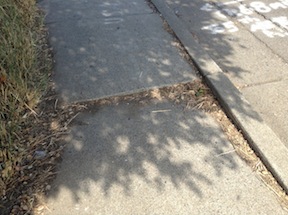
Rolled curbs slope up from the gutter pan to the sidewalk, whereas standard curbs have a more vertical face. Standard curbs are both old and modern, but there was a period of time in the 1950s through 1970s when rolled curbs were very popular, seen as a sign of the new suburbs. In the grid area of Sacramento, including the first ring suburbs, standard curbs are quite common. In the second ring suburbs and the sprawl suburbs, rolled curbs are quite common, not only being found in residential neighborhoods but even on arterial roads.
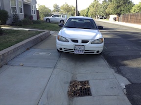
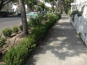
So, what’s the problem with rolled curbs? Drivers use rolled curbs to drive up on the edge of the sidewalk, constraining the sidewalk width, reducing walkability, and not infrequently causing blockage of the sidewalk for people in wheelchairs. ADA regulations require at least 36 inches of clear width. Combine the narrow 4-foot sidewalks that were popular in the suburbs with this driver behavior, and the car-influence zone is expanded to the complete width of the right of way, leaving no place for pedestrians. [Note: This photo is for illustration purposes only, not to give this driver a hard time. This is common practice, and I’ve seen many instances where much more of the sidewalk was blocked.]
A side affect of parking up on sidewalks is that it leaves more of the street width for moving motor vehicles, which then increases the speed at which people drive. By trying to get their vehicles out of the way of the “speeding drivers,” they are actually making it easier for drivers to speed.
What are the solutions?