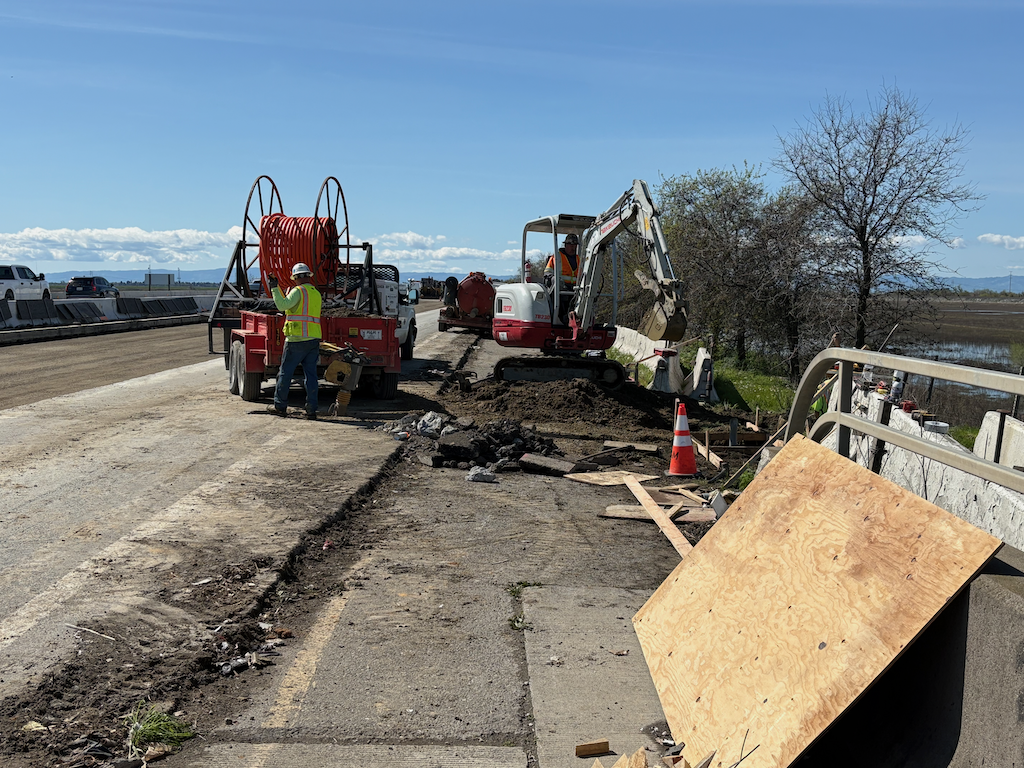
Caltrans D3 says ‘fuck you’ to Yolo bicyclists

The bike path along I-80 along the Yolo causeway is closed this afternoon (Tuesday, 2:00 PM). The sign at the east entry to the bike paths says:

Bike Path Closed sign on east entry to Yolo causeway bike path

Note that this sign indicates that the path will not be closed until 8 PM on Tuesday, March 18.

This is what the Caltrans website says (UPDATE: Extended 79-hour Closure for Eastbound U.S. Highway 50 in Yolo County Postponed due to Weather Forecast, 2025-03-13, retrieved 2025-03-18 3:00 PM):

screen capture from Caltrans D3 website

Note that this press release says that the path will be open again by 6:00 AM on Tuesday, March 18.

And this is the reality is:

construction on Yolo causeway bike path

Construction is completely blocking the path, at this location and several others. The work to remove the concrete barrier from the freeway is ongoing along the western section of the causeway. Some parts of the freeway are also torn up, awaiting reconstruction.

I talked to the supervisor at this construction location, and he said they are just a subcontractor, not responsible for Caltrans signing, or lack thereof. He called the general contractor, who apparently said it is my problem, not theirs. After exiting at the I-80 off-ramp (the normal entry to the path north to Yolo County 32A is not accessible), I saw a CHP officer, and reported the issue to him. He said he would pass it along. He probably will, but I doubt that either CHP nor Caltrans will do anything about it.

This is an active construction project which was not properly signed for construction. This is a violation of Caltrans procedure, and state law, and federal law.

It is absolutely typical of Caltrans District 3 (which includes Yolo and Sacramento counties) to not care about the travel or safety of bicyclists. What would it take to correct the signing, and to correct the website? Not much, but it is beyond the care and interest of Caltrans D3.

Caltrans has said that as a result of the Yolo 80 project, there would be an improved bike path. I’ve previously written about why that is very likely to be a lie: Yolo causeway bike path. Note that though Caltrans claims the current construction is just bridge rehabilitation and has nothing to do with the Yolo 80 project, that is a lie. It is safe to assume that everything Caltrans D3 says is a lie. Caltrans is a highway department, not a transportation department. They care about motor vehicles. They do not care about walkers or bicyclists or air quality or the state budget. In fact, given the high fatality rate on both under-construction and completed highway projects, they don’t really care about motor vehicle drivers either.

I will also note that the California Transportation Commission (CTC) is complicit in Caltrans D3 malfeasance, as they continue to fund projects no matter what the behavior or violation of the law. And above CTC, California State Transportation Agency, which is intended to oversee both CTC and Caltrans, but does not.

CalBike’s Agenda for 2025

A number of organizations have come out with agenda’s for next year, and I’ll cover a few of those in several posts. First, CalBike. I participated in CalBike’s agenda reveal on December 3, and it was disappointing. Mostly videos of talking heads about the past, not much about the future. The breakout I participated in was dominated by a single person who wanted to talk about specific locations and wouldn’t let anyone get a word in edgewise about policy. But CalBike now has a page dedicated to CalBike’s Agenda for 2025, which is clearly presented. CalBike has organized support statewide for progressive legislation which encourages bicycling and makes it safer, and has supported legislation for walkers as well. There isn’t an active statewide organization for walking, unfortunately.

The agenda lists:

  • bicycle highways
  • shared streets
  • quick-build pilot
  • bike omnibus #2
  • bicycle safety stop
  • new bike boulevard classification
  • e-bike policy

Though e-bikes modified to be (illegal) motorcycles is not a big problem in Sacramento area, yet, it is in other places. San Francisco, where I am right now, is full of deliveristas on bikes that have pedals and chains, but top out about 40 mph. In the Lake Tahoe region, it is rich high school students. I’d like to see legislation to clearly define what is and is not an e-bike, and make sure high speed devices are banned from bike lanes and bike facilities. It is already illegal (AB 1774 Dixon, 2024) to modify an e-bike for higher speeds, or to sell devices which bypass design speed, but of course enforcement is uncertain.

The bicycle safety stop should be a no-brainer, except of course that Newsom and CHP probably don’t have brains. Treating stop signs as yield signs, slowing and yielding when necessary, is what almost all bicyclists already do, and there is nothing unsafe about it. Research has indicated that the rate of full and complete stops at stop signs is nearly the same for bicyclists and drivers, but when bicyclists stop, then are in danger of getting hit from behind by drivers not stopping, and the energy to get started again is significant, not just a press of the gas pedal.

Shared street standards are a good idea. Many locations have implemented shared streets, with different designs. As a new idea to be experimented with, wide variation was OK, but enough is known about designs now to create a standard. Some cities have continually lessened the protection and messaging on shared streets (or removed them completely, in the case of Sacramento), and standards would help prevent this erosion. I think shared streets should be more common that ‘regular’ streets. Shared streets are where people live, regular streets are where people drive.

I’m not sure whether state-recognized quick-build designs would help much. Cities are already doing these projects, and the best thing Caltrans could do is get out of the way.

photo of Sacramento 26th St slow & active street, since terminated
Sacramento 26th St slow & active street, since terminated

Elvas Ave and Hornet Tunnel update

Re-upping the Elvas Ave and Hornet Tunnel post from earlier this year. It has been reported to me by a number of bicyclists, and I have experienced it myself, that this section of Elvas between the Hornet Tunnel and the signal at 62nd Street has become significantly more hazardous due to the motor vehicle traffic generated by The Line (a collection of various food vendors, opened 2022) and Garden at the Line (an outdoor eating and drinking area adjacent to The Line, opened this December). There is a lot more come and go parking on Elvas, and a lot more motor vehicle traffic in and out of the parking lots. Most bicyclists ride on the sidewalk to avoid the fast-moving traffic, otherwise the crash rate would be higher. The M Street to Elvas Avenue to Hornet Tunnel route is probably the busiest in the city.

In addition to the previous post (reblog below) about the hazards for bicyclists, this area is now hazardous for walkers along and crossing Elvas.

I was there last night for the SABA social gathering, and the place was packed. People were parking along the west side of Elvas as well as on 63rd Avenue and 64th Avenue, and then trying to cross Elvas to Garden at the Line. It was nearly impossible to cross, as there are no marked crosswalks over Elvas at either street, drivers are going fast, and Elvas is not well lit. The speed limit in this section is 40 mph, which almost guarantees that walkers hit by cars will die. Sidewalks on both sides of Elvas are in poor condition, and rolled curbs are common, which are less safe for people walking than vertical curbs. There are no sidewalk buffers. While this section of Elvas is not one of the top 5 or top 10 Vision Zero corridors, it will quickly become so. In the last five years, there have been two injury crashes on this stretch, one bicyclist and one walker, both in the vicinity of Hornet Tunnel.

The city has no plans to improve safety for bicyclists or walkers on this stretch of Elvas.

SacCity is not sweeping separated bikeways

The City of Sacramento is not sweeping its separated bikeways, as it promised to do when it installed them. The separated bikeways, on I St, P St, Q St, 9th St, 10th St, 19th St, and 21st St have not been swept by the city. The city has a sweeper designed specifically for these bikeways. It may be broken down, or the city may be choosing not to sweep. Some of the bikeways are being swept by landscape maintenance services associated with adjacent properties, a few spots are being swept by individual owners or residents, and even the parks department is cleaning up, but not consistently.

photo of Q St at 14th St, separated bikeway, not swept by city
Q St at 14th St, separated bikeway, not swept by city

In a few places that have heavier bicycle and scooter traffic, such as P St between 15th and 14th, the leaves have turned into leaf slime, which is extremely hazardous for anyone on two wheels. I’ve seen people almost spin out here, and I have as well.

Most people seem to have realized that the place for piled leaves is NOT in the bikeway, but in the adjacent buffer, and in some locations that buffer is labeled as such. But some people are still piling in the bikeway.

Regular bike lanes are an issue as well. Most are not swept. Dry leaves are sometimes swept away be motor vehicle traffic, but once they are wet, they don’t move. If there is motor vehicle traffic across or along the bike lane, such as approaching an intersection, the leaves are quickly turned into slime. Very slippery! Be cautious anywhere there are leaves.

Palm trees – ack!

And just in case you need to be reminded, palm trees and the fronds they drop are an ongoing hazard to people walking and bicycling. A single frond can block a sidewalk from use by anyone with a mobility device. A single frond can block a bikeway or bike lane, and can throw a bike rider off their bike. With every wind storm or heavy rain storm, palm trees drop huge numbers of fronds. Why do we continue to allow this hazard for walkers and bicyclists? In a few locations where they have historic value, such as Capitol Park, they might be justifiable. But nowhere else. They need to be removed!

photo of palm fronds on Q St
palm fronds on Q St

Denver’s approach to sidewalk maintenance

Denver is implementing a unique approach to sidewalk maintenance (Denver’s Sidewalk Program). Rather than making the individual property owner responsible for sidewalk maintenance, the city will charge all property owners a fee which will be pooled city-wide to maintain or install sidewalks. It is a flat fee for most parcels, but with a progressive fee based on sidewalk footage for parcels with a lot of sidewalk.

The City of Sacramento, and most governments in California, make sidewalk maintenance the responsibility of individual property owners. State law allows this, though does not require it. You can see the results for yourself: broken sidewalks due to root heaves, discontinuous sidewalks, lack of ADA ramps. And the city and cities within the county and the county are not the worst in California. If you want to see truly horrible sidewalks, visit the City of Los Angeles, where root heaves from too narrow sidewalk buffers have broken or destroyed most sidewalks in the city.

Denver, recognizing that the model of individual property owners paying was not working, and under the threat of lawsuits, decided to take a different approach, making maintenance and installation the responsibility of all property owners. This is an immense improvement over the Sacramento and California model, though still falls short.

Sidewalks are a part of our transportation network, in fact are the most important part of that network. As such, they should be maintained, and gaps filled, as part of the regular transportation budget of cities, counties and the state. Making them a special case with special funding, or ignoring them completely, leads to a deteriorated and missing sidewalk network that actively discriminates against people who use the sidewalks to walk, roll, and, in some cases, bicycle. Every broken sidewalk and every missing sidewalk is a abject failure of the government to fulfill its responsibility to citizens to create a transportation system that serves everyone. Transportation engineers will always, if given the choice, prioritize motor vehicles over everyone and everything else, so we must compel them to meet their true responsibilities.

photo of broken sidewalk and missing sidewalk, Capitol Mall & 3rd St, Sacramento
broken sidewalk and missing sidewalk, Capitol Mall & 3rd St, Sacramento

River District Open Streets October 19

This Saturday, October 19, 2024, the River District Open Streets Festival will occur 12:00 PM to 4:00 PM at Mirasol Village, 400 Pipestem St, in the River District. Civic Thread is the primary host, working with a number of other partners and supporters. Registration is not required to participate, but is available on Eventbrite.

From the festival info page:

“Get ready to experience the heartbeat of our community at the Open Streets Festival in the vibrant River District this fall!

Join us for a day filled with family fun, local flair, and exciting activities for all ages. Discover live music, delicious food from local vendors, arts and crafts. Participate in interactive games, enjoy street performances, and explore the many pop-up shops that line the streets. It’s a perfect opportunity to connect with neighbors, celebrate our diverse culture, and support local businesses. Don’t miss out on this unforgettable event that brings everyone together in the heart of our beloved community.

This event is intended to showcase the power of community connection, healthy and active lifestyles, and the multitude of what the River District has to offer whether it be arts, food, or fun. There will be tables from community organizations, food vendors, and performances, along with interactive community activities such as a bike rodeo.”

Rancho Cordova and SABA also hosted an open street event last Saturday, which I hope to post about soon. Several other open streets events have happened recently, and more are in the planning stages, which is good to see after the long pause since the Sunday Street on Broadway event in 2017.

what’s going on? (other)

There are so many actions and possibilities for improving the efficient, equity, and safety of our transportation system that I can’t keep up with it all, and even nonprofits that have staff are unable to keep up. So, what’s going on? The list below is not in any priority order, but may give you ideas about what you would like to get involved in. It takes a village!

Items specific to City of Sacramento were in a previous post, while these items are about other locations, and/or applicable to all the cities and counties in the region.

Transportation funding in Sacramento County: Transportation sales tax measures in 2016 and 2022 failed, and a 2020 measure was withdrawn. Each measure was weak on active transportation and transit (and the sprawl developer sponsored ‘citizens initiative’ in 2022 was horrible), and also suffered from anti-tax sentiment in the county. There are three efforts to place a funding measure on the 2026 ballot, Sacramento Transit Authority (SacTA) new Measure A, SMART/Steinberg citizen measure for housing, active transportation, and roadway maintenance, and SacRT transit measure for City of Sacramento and Elk Grove. All of these are in early stages, not yet formalized. Sales taxes are regressive, making low-income people pay a much higher percentage of their income on these taxes, so efforts to identify other mechanisms are critically important.

City of Rancho Cordova Active Transportation Plan: The city is starting the process of community engagement towards developing a plan for walking, rolling and bicycling.

Other active transportation plans: Sacramento County updated its plan in 2022. Folsom updated its plan in 2022. It isn’t clear what the status of Elk Grove’s Bicycle, Pedestrian, And Trails Master Plan is. West Sacramento’s Bicycle, Pedestrian, and Trails Master Plan, from 2018, received minor updates in 2024. Roseville is undertaking a Transportation 360 effort to include walking, bicycling and transit. Davis does not seem to have an active transportation plan.

Sacramento County Climate Action Plan: The county has delayed a climate action plan by years, going through a series of revisions that aren’t much better than the previous. Sacramento Climate Coalition and 350Sacramento have been the most active on this issue. It will take citizen pressure on staff and on the Board of Supervisors to ensure an effective plan.

Other climate action plans: Every city and county is required to come up with a climate action plan. I don’t know the status of plans other than City of Sacramento and Sacramento County.

SACOG 2025 Blueprint: SACOG is developing a new version of the MTP/SCS called Blueprint ‘Linking land use and transportation in the Sacramento region’. There is a constant tension between the desires of cities, in particular Sacramento, West Sacramento, and Davis, and the smaller cities and rural counties of the six county SACOG region, over what kinds of transportation investment to make. SACOG is required to come up with a plan that would reduce greenhouse gas emissions (GHG) by 19%, and the transportation policies and projects selected will make all the difference in whether the region has a chance for achieving that goal. Citizen pressure for infill and livable communities is required to counteract the small city and rural voices that just want money to continue doing what they’ve always done, which is encourage low density sprawl development with a motor-vehicle focused transportation network.

Caltrans District 3: While other entities are beginning to meet the public demand and legal requirements to reduce greenhouse gas emissions (GHG) by reducing vehicle miles traveled (VMT), and improve roadway safety, Caltrans District 3 is continuing to expand highway capacity, inducing travel demand and increasing GHG/VMT, and making it very hard for cities and counties to make their roadways that are state highways or that cross state highways (underpasses and overpasses) to improve safety. Caltrans headquarters has been unable to rein in District 3.

This list no doubt misses some important topics. Please suggest them in the comments.

Rancho Cordova Active Transportation Plan graphic

what’s going on? (SacCity version)

In compiling this list, I realized that it was becoming very long, so I’m splitting it into two lists, the second on non-City of Sacramento to be posted shortly.

There are so many actions and possibilities for improving the efficient, equity, and safety of our transportation system that I can’t keep up with it all, and even nonprofits that have staff are unable to keep up. So, what’s going on? The list below is not in any priority order, but may give you ideas about what you would like to get involved in. It takes a village!

City of Sacramento

  • Street Design Standards Amendment: This is ongoing. The organization most involved is Strong SacTown, and of course, Getting Around Sacramento
  • Streets for All Active Transportation Plan: This is ongoing. The neighborhood connections part of the plan, perhaps the most important element, will open a public input process in November, with two online workshops.
  • Work Zone and Event Detour Policy: This is ongoing, however, opposition in Public Works has delayed this policy by many months, and it will take public pressure to free it up.
  • Active Transportation Commission (SacATC): Though it has been pretty ineffective since founding in 2018, the addition of strong leaders to the commission and the notice of supportive city council members has opened the opportunity for real progress.
  • Vision Zero: Though the city committed to Vision Zero in 2017, the rate of traffic fatalities and severe injuries has increased every year since, because of the city’s unwillingness to take dramatic action, and the very very slow process of depending on grant funding to improve streets. The focus on corridors and inattention to intersections is also a flaw. The Vision Zero plan is being updated, but so far there has been no public involvement.
  • Speed limits: The city reduced speed limits in many school zones several years ago, on a few streets recently, and is working towards additional reductions under AB 43.
  • Emergency Declaration on Roadway Safety: Vice Mayor Caity Maple, Mayor Darrell Steinberg, and council member Karina Talamantes are sponsoring an emergency declaration on roadway safety, to address the epidemic (pandemic?) of traffic violence in the city. The initial proposal focused on ineffective traditional responses, but they seem open to more innovative and effective approaches.
  • Climate Action and Adaptation Plan: This plan, now part of the 2040 General Plan, set targets for walking, bicycling, and transit mode share, that were less ambitious than proposed in the Mayors Climate Action Plan, but nevertheless significant. Reaching these targets will require proactive changes to transportation funding allocation, street redesign, and implementation of quick-build projects.
  • Transportation Priorities Plan (TPP): This plan was adopted in 2022, to guide city investment and grant seeking based on objective criteria, rather than the whims of traffic engineers. Though the priorities could have been better weighted towards equity, active transportation, and climate action, it is nevertheless an immense improvement. Citizens will have to monitor the city’s decisions to ensure that the plan is followed, and improved over time.
  • Shared Mobility/Shared Rideables: The city has a shared rideables program which has resulted in a plethora of electric scooters in some parts of the city, and almost none in others, and almost no bike share at all, though we once had the second most successful bike share in the US. The city has chosen to let the market decide, the commercial companies, and has refused to consider city subsidy or a city program to ensure more widespread and equitable availability.
  • Quick-build: The active transportation community has requested that the city implement a quick-build program, with funding, that can respond quickly to crashes and traffic safety issues. Leadership has primarily been by Slow Down Sacramento. Though the city has discussed a program, they have so far refused to implement or fund a program.
  • Red light camera enforcement (no link because the city removed its page): The city participated in the county’s red light camera program, but when the county dropped the program, the city did as well, and so far as is known, has no plans to develop their own program. Red light running is epidemic (pandemic?) in Sacramento, and elsewhere, and there must be an automated enforcement program, with equity guardrails, to address this traffic violence issue.
  • Daylighting: State law (AB 413) prohibits parking with 20 feet of intersections, in order to increase visibility between drivers and people walking. The city has not said whether it will enforce this law, nor whether it will add signing or red curbs to communicate it to drivers. So of the benefits of daylighting can also be achieved through temporary (quick-build) or permanent curb extensions.
  • Speed camera enforcement: The city is not part of the speed camera enforcement pilot program (though to its credit, it asked to be). The city should continue to ask to be part of the pilot program, and to fully participate when the program becomes permanent.
  • The 2040 General Plan: The plan sets a new vision for mode priority in the city (graphic below). This is a seismic shift in priorities, and will be resisted by many city staff, so it will take citizen pressure to ensure that it is followed.
graphic of User Prioritization from City of Sacramento 2040 General Plan
User Prioritization from City of Sacramento 2040 General Plan

This list no doubt misses some important topics. Please suggest them in the comments. The next post will include some actions that are applicable to City of Sacramento, but also to other cities, the county, and the region.

Yolo causeway bike path

Caltrans and Yolo County Transportation District are proposing to widen a section of Interstate 80 from Sacramento to the Yolo/Solano county line, a project called Yolo 80. This is not just a future project, subject to funding shortfalls and lawsuits, but is actually underway, as Caltrans illegally spends funds for highway maintenance on highway widening. I have written a number of posts on Yolo 80 and managed lanes, but today is just about the bike path that parallels Interstate 80 from the west edge of West Sacramento to Davis.

I am not a commuter or regular rider on the causeway path, but I do average riding it about once a week (I like concerts and beer and Mishka’s tea), and have been doing so for about 13 years.

Read More »

more on Broadway-Land Park bike signal

I have written before about the problematic bike signal for Broadway eastbound at Land Park Drive (dangerous bike signal on Broadway, Broadway bicyclist press the button). Now some more detail, from a full hour of observation on the signal and driver behavior.

I had hoped to observe bicyclists reacting to the signal, but unfortunately there were no bicyclists. Despite the city devoting much of the street right-of-way to bike lanes (not protected, on only sometimes buffered), it appears that no one is riding their bicycle on Broadway. I’m not surprised. Broadway continue to be an unpleasant place for bicyclists and walkers, and regular bike lanes are unlikely to change that.

The last post I had noted that there was a required beg button for bicyclists to trigger the bike signal, but had failed to look up and notice that there was a complete set of regular signal, bike signal, and blank-out no-right-turn sign on the same post. It looks like:

photo of Broadway eastbound at Land Park Dr, signal, bike signal, blank-out no right turn
Broadway eastbound at Land Park Dr, signal, bike signal, blank-out no right turn

For those unfamiliar with the blank-out signs, which are relatively uncommon in the city, it illuminates when turns are prohibited, and is blank when not prohibited. See photo below for the blank-out phase.

This signal array is definitely mis-communicating to drivers. When the bicycle signal is on, the no-right-turn sign should be on, and the regular signal red. This is mounted close to the right hand turn lane, and drivers see it as applying to that lane.

Most of the time, it is necessary to press the pedestrian beg button to trigger the bike signal. But then sometimes it is triggered without any press, and not due to the presence of bicyclists, as there were no bicyclists. Most signal cycles the bike signal remains red.

When the bike signal is on, there is a period of time when the no-right-turn sign is not on (blanked out), as below.

photo of Broadway eastbound at Land Park Dr, signal, bike signal, blanked-out no-right-turn
Broadway eastbound at Land Park Dr, signal, bike signal, blanked-out no-right-turn

Do drivers follow the no-right-turn sign? In an hour of observation, I did not see one driver follow the sign. Every driver turned across the no-right-turn sign and across the green bike signal. Every. Though I did not observe it at this time, I have experienced drivers yelling at me, and other bicyclists have reported being yelled at, by drivers who think they have the right of way and wonder why bicyclists are proceeding and interfering with cars. The photo below shows just one of about 70 drivers who turned against the no-right-turn sign.

photo of Broadway eastbound at Land Park Dr, driver turning against no-right-turn sign
Broadway eastbound at Land Park Dr, driver turning against no-right-turn sign

Solutions

  1. The regular signal should remain red while the bike signal is green. The placement of this signal is interpreted by drivers as applying to the right hand turn lane, so it must be red.
  2. The bike signal must have an exclusive phase where all other vehicle movements are prohibited. A properly designed intersection with a properly designed signal system probably would not need an exclusive phase, but this is NOT a properly designed intersection and NOT a properly designed signal system.
  3. The pedestrian beg button should be removed from the bike lane, and automatic detection of bicyclists installed. The city knows how to do this, and has done it at a few other intersections, but chose not to here.

Bicyclists will be fatally or severely injured here, and the cause of the crash will be mis-designed roadways, for which city engineers are directly responsible. Drivers are just responding to a mis-designed roadway, the guilty party is the traffic engineers.

The design document for Broadway Complete Streets, and as built, has a through lane, a dedicated left hand turn lane, and a dedicated right hand turn lane. This right hand turn lane is the source of the conflict, the source of the danger. The roadway as built prioritizes motor vehicle throughput over safety.