SacCity is not sweeping separated bikeways

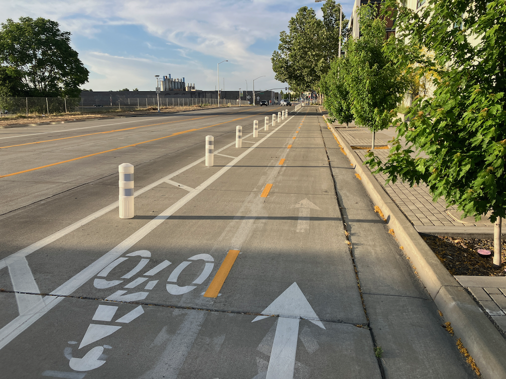
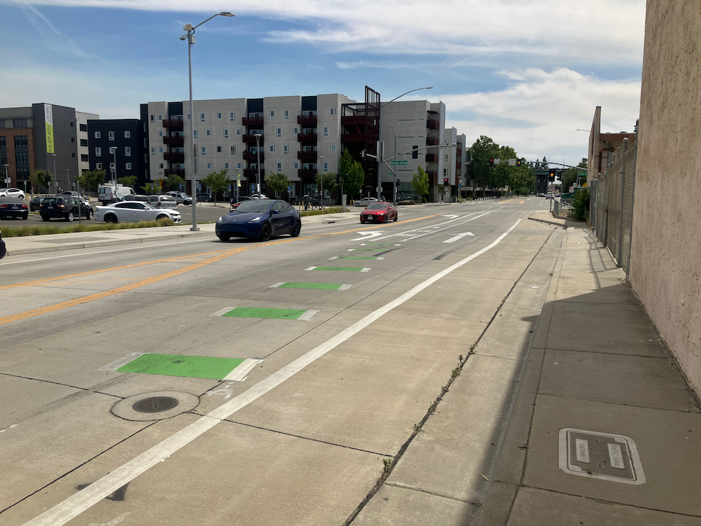
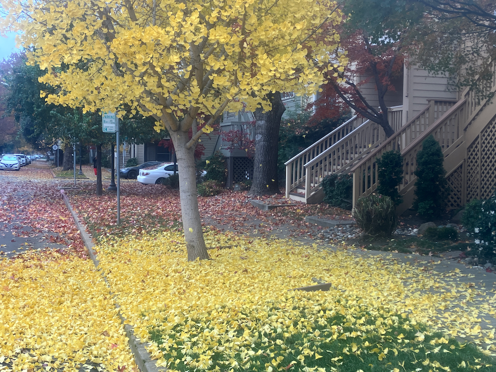
The City of Sacramento is not sweeping its separated bikeways, as it promised to do when it installed them. The separated bikeways, on I St, P St, Q St, 9th St, 10th St, 19th St, and 21st St have not been swept by the city. The city has a sweeper designed specifically for these bikeways. It may be broken down, or the city may be choosing not to sweep. Some of the bikeways are being swept by landscape maintenance services associated with adjacent properties, a few spots are being swept by individual owners or residents, and even the parks department is cleaning up, but not consistently.
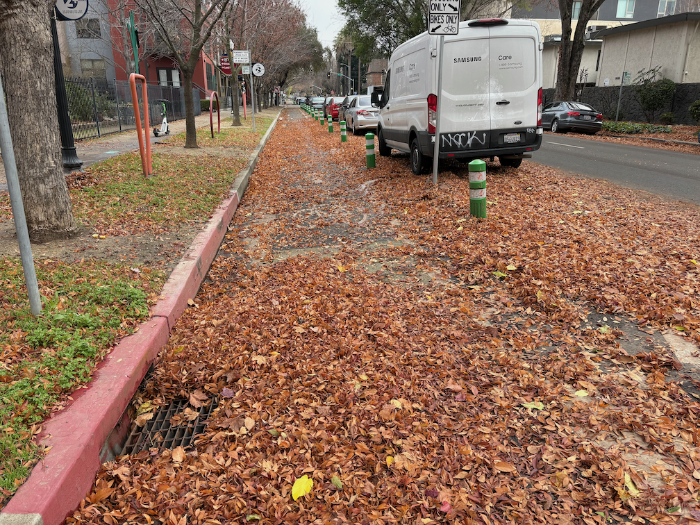
photo of Q St at 14th St, separated bikeway, not swept by city
Q St at 14th St, separated bikeway, not swept by city

In a few places that have heavier bicycle and scooter traffic, such as P St between 15th and 14th, the leaves have turned into leaf slime, which is extremely hazardous for anyone on two wheels. I’ve seen people almost spin out here, and I have as well.

Most people seem to have realized that the place for piled leaves is NOT in the bikeway, but in the adjacent buffer, and in some locations that buffer is labeled as such. But some people are still piling in the bikeway.

Regular bike lanes are an issue as well. Most are not swept. Dry leaves are sometimes swept away be motor vehicle traffic, but once they are wet, they don’t move. If there is motor vehicle traffic across or along the bike lane, such as approaching an intersection, the leaves are quickly turned into slime. Very slippery! Be cautious anywhere there are leaves.

Palm trees – ack!

And just in case you need to be reminded, palm trees and the fronds they drop are an ongoing hazard to people walking and bicycling. A single frond can block a sidewalk from use by anyone with a mobility device. A single frond can block a bikeway or bike lane, and can throw a bike rider off their bike. With every wind storm or heavy rain storm, palm trees drop huge numbers of fronds. Why do we continue to allow this hazard for walkers and bicyclists? In a few locations where they have historic value, such as Capitol Park, they might be justifiable. But nowhere else. They need to be removed!

photo of palm fronds on Q St
palm fronds on Q St

Yolo causeway bike path

Caltrans and Yolo County Transportation District are proposing to widen a section of Interstate 80 from Sacramento to the Yolo/Solano county line, a project called Yolo 80. This is not just a future project, subject to funding shortfalls and lawsuits, but is actually underway, as Caltrans illegally spends funds for highway maintenance on highway widening. I have written a number of posts on Yolo 80 and managed lanes, but today is just about the bike path that parallels Interstate 80 from the west edge of West Sacramento to Davis.

I am not a commuter or regular rider on the causeway path, but I do average riding it about once a week (I like concerts and beer and Mishka’s tea), and have been doing so for about 13 years.

Read More »

more on Broadway-Land Park bike signal

I have written before about the problematic bike signal for Broadway eastbound at Land Park Drive (dangerous bike signal on Broadway, Broadway bicyclist press the button). Now some more detail, from a full hour of observation on the signal and driver behavior.

I had hoped to observe bicyclists reacting to the signal, but unfortunately there were no bicyclists. Despite the city devoting much of the street right-of-way to bike lanes (not protected, on only sometimes buffered), it appears that no one is riding their bicycle on Broadway. I’m not surprised. Broadway continue to be an unpleasant place for bicyclists and walkers, and regular bike lanes are unlikely to change that.

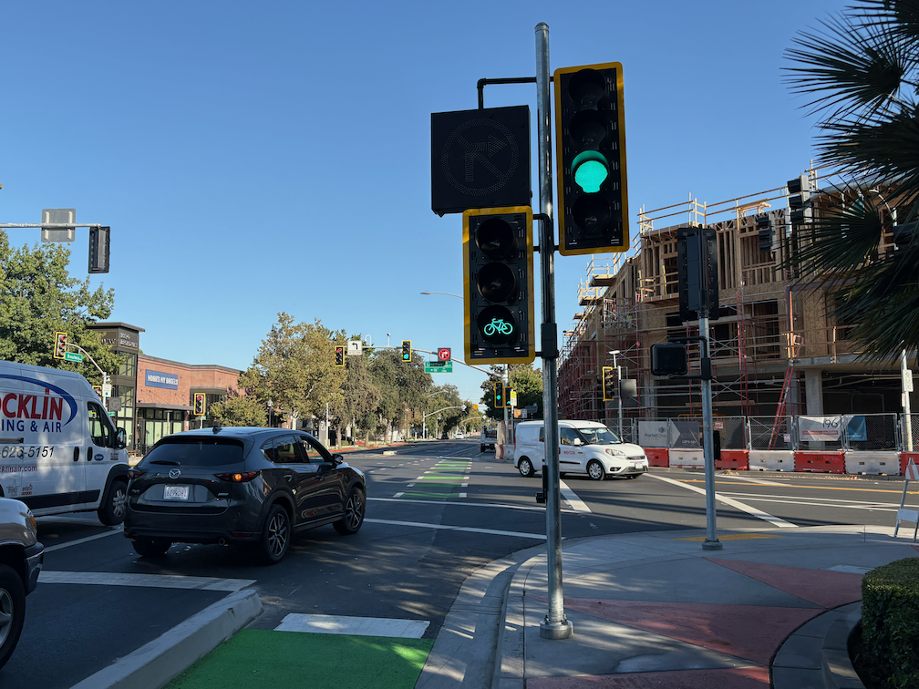
The last post I had noted that there was a required beg button for bicyclists to trigger the bike signal, but had failed to look up and notice that there was a complete set of regular signal, bike signal, and blank-out no-right-turn sign on the same post. It looks like:

photo of Broadway eastbound at Land Park Dr, signal, bike signal, blank-out no right turn
Broadway eastbound at Land Park Dr, signal, bike signal, blank-out no right turn

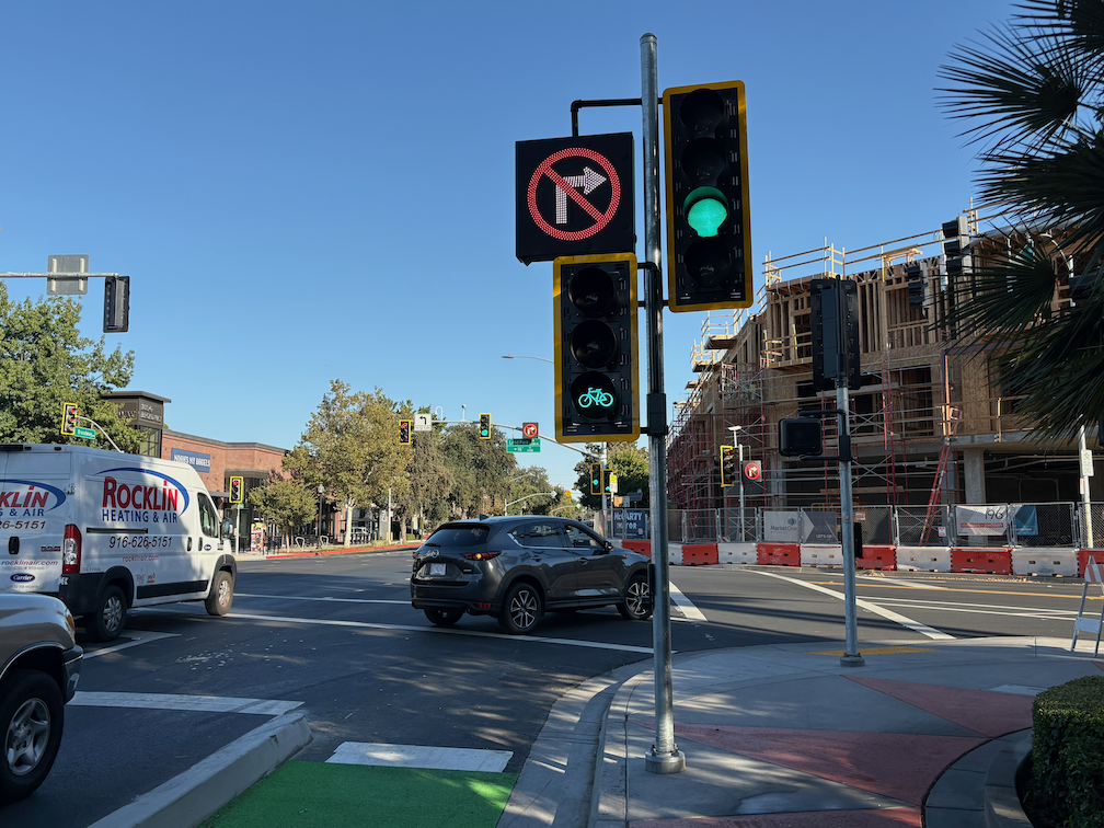
For those unfamiliar with the blank-out signs, which are relatively uncommon in the city, it illuminates when turns are prohibited, and is blank when not prohibited. See photo below for the blank-out phase.

This signal array is definitely mis-communicating to drivers. When the bicycle signal is on, the no-right-turn sign should be on, and the regular signal red. This is mounted close to the right hand turn lane, and drivers see it as applying to that lane.

Most of the time, it is necessary to press the pedestrian beg button to trigger the bike signal. But then sometimes it is triggered without any press, and not due to the presence of bicyclists, as there were no bicyclists. Most signal cycles the bike signal remains red.

When the bike signal is on, there is a period of time when the no-right-turn sign is not on (blanked out), as below.

photo of Broadway eastbound at Land Park Dr, signal, bike signal, blanked-out no-right-turn
Broadway eastbound at Land Park Dr, signal, bike signal, blanked-out no-right-turn

Do drivers follow the no-right-turn sign? In an hour of observation, I did not see one driver follow the sign. Every driver turned across the no-right-turn sign and across the green bike signal. Every. Though I did not observe it at this time, I have experienced drivers yelling at me, and other bicyclists have reported being yelled at, by drivers who think they have the right of way and wonder why bicyclists are proceeding and interfering with cars. The photo below shows just one of about 70 drivers who turned against the no-right-turn sign.

photo of Broadway eastbound at Land Park Dr, driver turning against no-right-turn sign
Broadway eastbound at Land Park Dr, driver turning against no-right-turn sign

Solutions

  1. The regular signal should remain red while the bike signal is green. The placement of this signal is interpreted by drivers as applying to the right hand turn lane, so it must be red.
  2. The bike signal must have an exclusive phase where all other vehicle movements are prohibited. A properly designed intersection with a properly designed signal system probably would not need an exclusive phase, but this is NOT a properly designed intersection and NOT a properly designed signal system.
  3. The pedestrian beg button should be removed from the bike lane, and automatic detection of bicyclists installed. The city knows how to do this, and has done it at a few other intersections, but chose not to here.

Bicyclists will be fatally or severely injured here, and the cause of the crash will be mis-designed roadways, for which city engineers are directly responsible. Drivers are just responding to a mis-designed roadway, the guilty party is the traffic engineers.

The design document for Broadway Complete Streets, and as built, has a through lane, a dedicated left hand turn lane, and a dedicated right hand turn lane. This right hand turn lane is the source of the conflict, the source of the danger. The roadway as built prioritizes motor vehicle throughput over safety.

a trip to San Rafael

Dan Allison, author of this blog, took a trip to San Rafael, California, in north bay Marin County, on Monday of Week Without Driving. To be transparent, I have been car-free for over 13 years, and car-light for about 7 years before that, so a trip on bicycle and public transportation is just the way I live life, not an exploration of the challenge that people who can’t drive face. My income is lower middle income, so I have enough money to travel, at least locally. I went to San Rafael to retrieve my phone charger and battery pack that I’d left on a Marin Transit bus last Wednesday. It took three days for Marin Transit to find the item and get it to lost and found. It was entertaining, and sad, to watch the included AirTag travel around on multiple bus routes. AirTags are bluetooth, so only report when they are close to a modern iPhone, but they do keep showing up in new locations.

So, the Monday trip:

  • bicycle from home to Sacramento Valley Station
  • Capitol Corridor train from Sacramento Valley Station to Richmond Station, $22.95
  • BART from Richmond to El Cerrito del Norte, $0.85
  • Golden Gate Transit bus 580 from El Cerrito del Norte to San Rafael Transit Center, $3.50
  • bicycle to a local coffee shop, where I worked on Week Without Driving communication
  • bicycle to Sprouts Farmers Market for lunch supplies
  • bicycle to Larkspur Ferry
  • Golden Gate Larkspur Ferry to San Francisco, $7
  • bicycle to San Francisco Bay Ferry gate G1
  • San Francisco Bay Ferry to Oakland Ferry, $2.30
  • bicycle to Oakland Jack London Station
  • Capitol Corridor from Oakland to Sacramento, $24.65
  • bicycle from Sacramento Valley Station to home

All of the public transportation was using my senior Clipper Card, on my watch. Capitol Corridor train travel was pre-purchased tickets through the app. The total was $61.25, which is rather expensive for a none day trip, but is quite a bit less than I would have spent driving. At about 83 miles there, and about 105 miles back, using the IRS rate of $0.67 per mile, driving would have cost $126. Plus $17.25 for Golden Gate Bridge and Carquinez Bridge tolls. Most people think only about gas costs, or charging costs, and forget about depreciation, insurance, maintenance, parking, and tolls.

Travel time is hard to compare, since I made so many stops along the way, and did not travel by the most direct route. Looking at the simpler Sacramento to San Rafael trip, driving would be 1 hour 20 minutes, whereas I spent about 2 hours 20 minutes on public transportation.

This is a trip that I’ve taken many times, so there was very little planning involved, and in fact I changed my plans for the leg back home several times on the fly, without problems. Less familiar trips would take more planning.

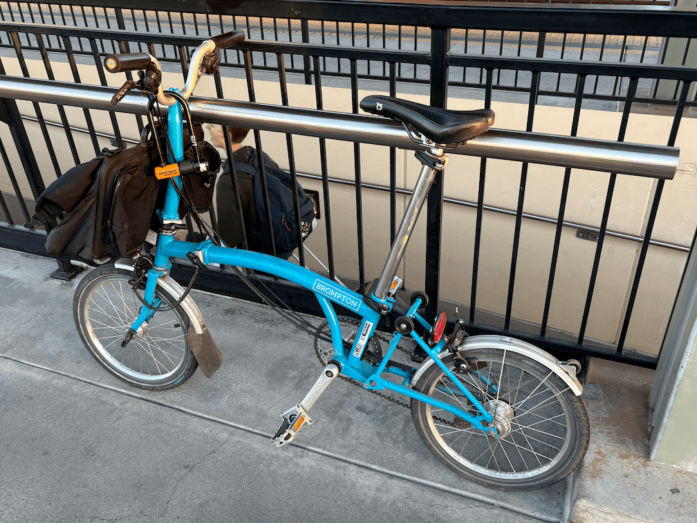
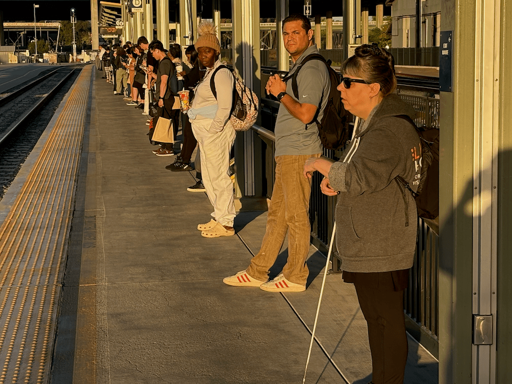
A few photos from my trip are below, but many parts are missing. I’m not used to documenting my public transportation travels, and even less for selfies.

dangerous bike signal on Broadway

Additional posts on Broadway Complete Streets are available at category ‘Broadway Complete Streets‘.

On Broadway eastbound at Land Park Drive, there is a bicycle signal face, shown below. The signal is permanently red, it never changes to green. The presence or absence of bicyclists makes no difference; it does not change from red. This is confusing both motor vehicle drivers and bicyclists. Bicyclists wait for it to change, and it never does. Drivers wonder why bicyclists are proceeded along Broadway with the green ‘car’ light when the signal clearly says that they should not be proceeding. I have seen drivers yelling at bicyclists for going when it is not their turn, and this has been reported to me by a number of people.

This issue has been reported to the city, twice by myself, and multiple times by other people. It has been this way for at least two weeks, perhaps longer. The city has decided to ignore these reports and to not fix the issue. The city is endangering bicyclists, and is in fact legally liable for knowing that a safety hazard exists and doing nothing to respond. This is criminal behavior on the part of the city. Sorry to be so blunt, but when city employees, or contractors acting on behalf of the city, ignore a known and easily solvable safety problem, that is criminal behavior. Period.

This would be so easy for the city to temporarily solve, by covering the bicycle signal face so that it is not visible. The pedestrian crossing sign over Broadway at the east side of the intersection is covered, due to the construction on the corner closing the crosswalk. Beyond a temporary fix, the city needs to determine why the bicycle signal face is not working, and make it work.

cycletrack in West Sacramento Bridge District

Note: I’ve added text and a photo of the approach from the north.

The City of West Sacramento has installed a section of cycletrack (a two-way Class 4 separated bikeway) on South River Road and 5th Street in the Bridge District. Apparently completed late 2023 (shows how long since I’ve ridden that way), it is part of the Riverfront Street Extension and 5th Street Widening Project.

From 15th Street (the connection to Jefferson Blvd) north to almost Mill Street, the bikeway is separated from motor vehicles by a hard curb divider. The on-street bike lane southbound still exists, but this bikeway provides a much safer alternative. The onramp to Hwy 50 east (or Business 80 as it is designated), was an extreme hazard for bicyclists due to drivers turning at high speeds. See two photos below.

South River Rd cycletrack / separated bikeway at 15th St
South River Rd cycletrack / separated bikeway

From Mill Street north to Bridge Street, the cycletrack is separated by a buffer and vertical delineators (K-71). At Bridge Street and north, the roadways returns to traditional Class 2 unprotected bike lanes. Though it would have been great to extend the curb-protected cycletrack all the way north to West Capitol Avenue, at least the truly dangerous section at the freeway onramp was fixed.

To the south of 15th Street, South River Road has more traditional bike lanes, with buffers in a few locations, as it crosses the ship channel and goes through two roundabouts.

The transitions to and from the bikeway seem a little awkward as they swoop through the intersection, but are probably not unsafe. I observed several bicyclists heading westbound to 15th Street who were not following the skip green bicycle markings, but the maneuver was not unsafe. I did not observe any bicyclists at the Bridge Street intersection.

Approaching the cycletrack from the north, the southbound traditional bike lane on the west side of 5th Street transitions to the cycletrack on the east side of 5th Street at Bridge St. Though the transition does not feel safe, I think it actually is, with signals preventing inappropriate motor vehicle movements.

5th St bike lane transitioning to cycletrack approaching Bridge St
signs and signals for bicyclist on 5th St at Bridge St

Folsom Blvd alternative

The city has proposed a Folsom Blvd Safety Project.  See previous post on that project. I would like to present an alternative to the bicycle facilities aspect of this project, improvement of the M Street corridor. M Street, and related streets including Elvas Ave, provide an alternative route. This route is already used by hundreds of bicyclists per day, students at Sacramento State, other commuters, and recreational bicyclists accessing the American River Parkway. Folsom, on the other hand, sees very little bicycle use. This is because it feels dangerous for most bicyclists, and because it is not the most direct route for many destinations.

The lack of bicyclists does not indicate that the street does not deserve bicycle facilities. Folsom has no bicycle facilities in the section to be revised, does not feel safe for bicyclists, and is not safe for bicyclists. The classic saying is that you can’t judge the need for a bridge by the number of people swimming the river. Bicyclists deserve safety on every street.

However, since bicycle facilities are a primary feature of the project, so it is worth asking: ‘Is this the best investment of limited funds?’ I’d suggest that upgrades to the M Street corridor might be a better investment.

Neither route actually offers safe access to and through Sacramento State. M Street is a low volume, mostly low speed street, from Alhambra Blvd to Elvas Blvd, However, the section along Elvas to the Hornet Tunnel that goes under the railroad tracks, is hazardous and intimidating for bicyclists. Folsom Blvd, with this project, would provide basic bicyclist facilities from Alhambra to 65th Street. However, access to and through Sacramento State beyond 65th Street is poor. The ‘safer’ crossing of Folsom at 69th Street and Elvas Avenue is awkward, was designed for walkers and not bicyclists, and not really safe. I have observed a number of drivers blowing the red light at this crossing. After crossing Folsom, a bicyclist can jog west to Elvas Avenue, and ride that to Hornet Tunnel, though the street is very deteriorated, of widely variable width, and the entrance to the tunnel is awkward.

The map below shows both routes, M Street from Alhambra Blvd to Elvas Avenue, in orange, and Folsom Blvd from Alhambra Blvd to 65th Street. Both are of equal length. Folsom Blvd has bike lanes from Alhambra to 47th Street, and discontinuously from 49th Street to 57th Street, with nothing to the east. M Street does not have bike lanes, but is is a low volume, low speed roadway along which most bicyclists feel comfortable riding. It is a ‘low stress bikeway’. Some of the route is marked with bike sharrows. Though improvements could certainly be made to M Street, it is functional as is, as a bicycle route.

Folsom Blvd has a posted speed limit of 35 mph, and much higher speeds are routinely observed. The fatal crash was in fact due in part to egregious speed violation by a driver. The proposed project would reduce speeds somewhat due to prudent drivers, but will probably encourage passing in the center turn lane. The project would leave the posted speed limit unchanged. M Street has a posted speed limit of 25 mph throughout, and speeds above 30 mph are rare. Would bicyclists rather ride on a non-bicyclist facilities roadway with 30 mph traffic, or on a buffered and un-buffered bike lane with 50 mph traffic?

Both of these routes are unacceptable because they don’t create a safe corridor all the way to Sacramento State. However, I feel that an investment in improving the M Street corridor section along Elvas would be a better investment than bicycle facilities along Folsom Blvd which end at 65th Street.

I wrote about improving the section of the M Street corridor between 62nd Street and Hornet Tunnel earlier this year: Elvas Ave and Hornet Tunnel. I don’t have a cost estimate for this project.

I am not saying the the Folsom Blvd Safety Project is a bad idea, just raising the question of where funds can be best invested to improve safety and comfort for bicyclists.

Elvas Ave and Hornet Tunnel

The section of Elvas Avenue between 62nd Street and Hornet Tunnel which leads to Sac State is very dangerous for bicyclists. Bicyclists have to transition across four lanes of traffic (three travel lanes and a center turn lane), without any protection whatsoever. The pavement quality is low, particularly on the east side where the ‘bike lane’ (not a real bike lane) is. Despite this, it is a high-use bicycle route from Sacramento to Sac State and the American River Parkway trail. M Street, this section of Elvas, and the Hornet Tunnel serve as a bicycle boulevard (though not designated) between the central city, Sac State, and beyond.

Since the day I arrived in Sacramento and rode my bike to work in the eastern suburbs, I have known that this section needs to be fixed. It took me 12 years to get around to writing about it. I hope that it will take the city less to fix it. The solution presented here is not the only solution, so I encourage others to comment, point out flaws, and suggest optimal solutions.

Elvas Avenue is a high-speed, moderately high-volume roadway that acts in many ways as an expressway due primarily to the turns from Elvas Avenue to 65th Street, and from 65th Street to Elvas that encourage high speeds. The roadway is dangerous for motor vehicle drivers and passengers as well as bicyclists. North of 62nd Street, St. Francis High School (about 1100 students) suffers from traffic risk created by Elvas Avenue, so traffic calming to the south will benefit the high school as well as bicyclists. It might be appropriate to extend the separated bikeway north to the signalized crosswalk over Elvas to the school.

Read More »

the long awaited death of ‘share the road’

The ‘share the road’ sign, which has been very popular with traffic engineers, is NOT in the 2023 MUTCD. So this sign is dead, and a well deserved death. The ‘share the road’ sign was often interpreted by drivers to mean, bicyclists must share the road with motor vehicles, or in less polite terms, “get out of my way, the sign says so”. The share the road diamond shaped sign was never a legal MUTCD sign, though they were and are quite common.

W16-1P sign, which used to say ‘share the road’ now says ‘in road’, as in, bicycles in roadway. The left sign is common, the middle sign can be used, and the right sign is for temporary traffic control (TTC). Since this new sign content replaces the old with the same sign designation, I take it to mean that the old sign may no longer be used at all, and must be replaced by the new sign.

The plaque is not used by itself, but with the W11-1 bicycle sign, below. Though the yellow version of the W11-1/W16-1P assembly is permitted, this sign would more likely be used at TTC in a construction zone.

MUTCD W11-1/W16-1P assembly sign 'bicycles in road'
MUTCD W11-1/W16-1P assembly sign ‘bicycles in road’

Outside of construction zones, the preferable sign would be MUTCD R9-20 ‘bikes allowed use of full lane’, below, and this sign can also be used in construction zones. This sign is similar to the old MUTCD R4-11 sign, which is no longer in the MUTCD.

MUTCD R9-20 'bicycles allowed use of full lane'
MUTCD R9-20 ‘bicycles allowed use of full lane’

Only in a few cases does the MUTCD require replacement of existing signs, but does require that the current sign be used in any new installation.

The new MUTCD recognizes the green painted bicycle lanes and green dotted bicycle lanes (often called skip marking) through conflict areas such as merges and intersections. Unfortunately, it did not drop recognition of the ‘sharrow’ shared lane marking. Though the sharrow can be legitimately used to show a bicyclist path in confusing locations, it has generally been used to bias roadways against bicyclists and to encourage motorists to fail to yield to bicyclists in the roadway. Maybe next time!

The MUTCD now has an entire chapter devoted to bicycles, Part 9: Traffic Control for Bicycle Facilities. This is progress, even if less than desired.

beware the leaves of December

It is fall in Sacramento, trees are turning, leaves are falling. It is my favorite time of year, in part due to the knowledge that it will be over soon, only memories and photos. While out walking the last two days, I have been watching little breezes create leaf-fall, more fascinating to watch than snowfall. The four ginkgo trees back of my apartment are at their peak of brilliant yellow color, and the ground is carpeted in yellow. Blocks with a variety of trees are a kaleidoscope of colors.

This morning landscape workers were out blowing leaves into piles, but they were falling faster than they were moved. As I write, it is raining lightly, which will accelerate the leaf fall.

photo of ginkgo tree and leaves next to bikeway on P St
ginkgo tree and leaves next to bikeway on P St

What is not to like? Well, what happens over the next few days. The wet leaves will start to rot, which is a natural process. But any leaf area where cars are allowed to drive will grind the leaves into fine particles, and those particles with turn into what I call leaf slime. Leaf slime is incredibly slippery, and it is a clear and present danger to bicyclists (and walkers). The Class 4 separated bikeways probably won’t be too bad, since bicycles don’t grind up the leaves, and the city may even get around to sweeping the bikeways. But the regular Class 2 bike lanes will be horrible. Cars will drive over the leaves, and start the process. The city very rarely sweeps bike lanes. They may be partially cleared if residents have illegally piled leaves in the bike lane, and the claw picks up the leaf piles, but the very act of scraping up the piles leaves a thin leaf slime layer.

So, it is time of year to avoid bike lanes, until there is either maintenance or enough rain to wash away the leaf slime. Ride in the general purpose lane. Yes, you will get yelled at by asshole drivers whose car isolates them from the realities of roadways, but at least you won’t be slipping and falling on the leaf slime. Beware the leaves of December.