Northgate Boulevard Emerging Design Concepts

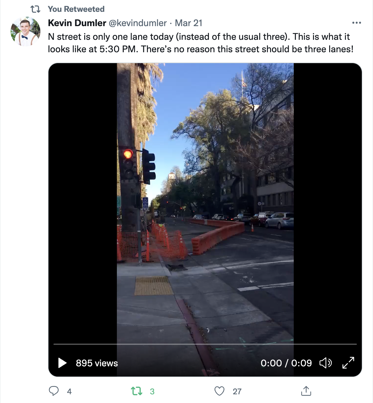
Update: Added a crash/collision map at the bottom. Though prevention of pedestrian and bicyclist killed and severe injury is always a top priority, this is not a high risk corridor as compared to many arterials in the city.

City of Sacramento staff (Leslie Mancebo) presented to the Sacramento Active Transportation Commission last Thursday on the Northgate Boulevard Emerging Design Concepts. The presentation slides are here. The city’s Northgate webpage has a lot of background material. A link to the virtual open house on May 11 is available.

I rode Northgate Blvd yesterday to refresh my memory about the street, as I’d not gone that way in a while. So, some comments:

The section of Northgate from Rio Tierra to I-80 is a standard suburban arterial, with low quality development and a completely uninteresting place to be. Changes to the roadway may make it safer, but won’t make it any more interesting or economically successful. The city should not focus on this area. It is unpleasant, and not particularly safe, but leave it be.

The section of Northgate from Rio Tierra to Garden Hwy has serious issues, but I see it as a place that could be transformed into an interesting, welcoming, and vibrant place. The number of small businesses, each with a driveway, is a challenge, but also an opportunity. At least half of the businesses are locally owned. This is not the home of big box and chain stores like much of the suburbs. It IS a place where people could walk if provided a safe and encouraging environment, and there are multiple destinations used by local residents.

I think that this entire segment should have buffered and wide sidewalks. The bike facilities could provide some buffer, but the sidewalk buffer is critical because it allows street trees. This section desperately needs street trees! Of course to be successful, the buffer/planting strip needs to be at least six feet, and the sidewalk at least six feet, but eight-ten foot buffer and eight foot sidewalk would be better. I think that the walking mode should take precedence over all other modes, even bicycling and transit, so whatever right-of-way the buffer and sidewalk needs, it should get. Don’t compromise this away.

I realize this project is at the gathering community input stage. However, diagrams will be used, and I’d like to see the diagrams include significant improvement to the pedestrian environment, wide sidewalks buffered from other modes, with trees in the buffer.

The presentation resulted in a number of questions from commission members about bicycle facilities. One of the ideas that got support is a two-way separated bikeway (or cycletrack) to provide a connection between the Ninos multiple use trail and the American River Parkway multiple use trail (the ‘special section’ in the presentation). There was less agreement about bicycle facilities north of there. One of the ideas is separated bikeways (protected bike lanes). Though of course separated bikeways are the best solution overall, I’m not sure they make sense for the east side of the street. Separated bikeways work best when there are few or no driveways, but there is a huge numbers of driveways here. The west side of the street has far fewer driveways.

There are some opportunities on the corridor for reducing driveways, and certainly some of the driveways can be narrowed to reduce entry and exit speeds. But short of a wholesale revision of the area, most driveways will remain, so the street design must accommodate this fact.

Transit on the part of the corridor between Arden Way and San Juan Road is provided by SacRT Route 13 Natomas/Arden, with a 45 minute frequency on weekdays. The route has a fairly low ridership, but it is a long route of which the Northgate section is a small part.


Crash/collision map of the Northgate Blvd corridor for pedestrians (walkers) and bicyclists. Data is from SWITRS for the years 2015-2019. (pdf)

Take the information about fault below with a huge grain of salt. It is well known that law enforcement officers assume walkers and bicyclists to be at fault, without any serious investigation, and often on the sole word of the driver involved.

Pedestrian (walker):

  • Northgate near Rosin Ct: killed, 60 yo male, unknown detail, no fault, no alcohol
  • Northgate near Ozark Cir: severe injury, 74 yo female, crossing, at fault, alcohol
  • Northgate at Wisconsin: severe injury, 36 yo female with two children, crossing, driver fault
  • Northgate at Peralta: severe injury, 48 yo, crossing Peralta, at fault (very unlikely)

Bicyclist:

  • Northgate near Winter Garden: severe injury, 49 yo male, left turn, at fault
  • Northgate at Bridgeford: killed, 47 yo male, crossing, at fault, alcohol or drug
  • Northgate at Harding: killed, 31 yo female, left turn, at fault
  • Northgate at Garden Hwy: severe injury, 40-44 yo male, broadside, at fault CVC 21453

The intersections of Northgate and San Juan Rd, West El Camino, and Garden Hwy/Jefferson Ave are particularly problematic because they are flared out to accommodate turning lanes, thereby lengthening crossing distances for walkers and creating a walker-hostile environment. Fixing these intersections would probably do more to improve the safety and feeling of this corridor than changes along the corridor.

leaf blowers

In the City of Sacramento, there are two sections of city code that address leaf blowers, both in Title 8: Health & Safety.

8.68.180 Portable gasoline-powered blowers.

        A.     It is unlawful for any person to operate any portable gasoline-powered blower on residential property or within two hundred (200) feet of residential property, except between the hours of nine a.m. and six p.m. Monday through Saturday and between the hours of ten a.m. and four p.m. on Sunday.

        B.     It is unlawful for any person to operate any portable gasoline-powered blower on residential property or within two hundred (200) feet of residential property during the hours permitted by subsection A of this section if the blower creates noise exceeding the following specified levels measured at a distance of fifty (50) feet from the blower:

  1. Blowers purchased or otherwise acquired between May 15, 1992, and November 15, 1995, shall not exceed seventy (70) dba.
  2. Blowers purchased or otherwise acquired after November 15, 1995, shall not exceed sixty-five (65) dba.
  3. Blowers in use on or before the effective date of the ordinance codified in this chapter or purchased or otherwise acquired before May 15, 1992, shall not exceed seventy (70) dba after November 15, 1993. (Prior code § 66.02.213)

8.70.020 Use of portable blowers.

No person shall operate a portable blower when the air quality index is 101 and above. (Ord. 2020-0042 § 1)

a safe and effective transportation system

Many organizations and individuals are deciding to oppose the transportation sales tax measure being proposed for the November 2022 ballot in Sacramento County. The reasons for opposition are many, but previous posts here (Measure 2022) cover significant ones. If the measure does not qualify for the ballot, or does qualify and fails, what then are we to do for transportation? Below are some ideas for a safe and effective transportation system. They are not yet well organized or prioritized.

I acknowledge the contribution of Walkable City Rules by Jeff Speck to this list. If you haven’t read it, please do. I don’t agree with everything he says, but it is the best prescription for correcting our transportation system and healing our cities that I know of. See also Measure 2022: the path not taken.

The realities of climate change and social justice demand a radical redesign of our existing transportation system and radical shift in transportation policies and investments. More of the same, with slight improvements, as the sales tax measure suggests, will not serve our needs now or in the future. See also our racist and classist transportation system.

General

  • all projects must contribute to or be neutral in reaching regional (SACOG) and state goals for reducing VMT and GHG (vehicle miles traveled, greenhouse gas emissions)
  • travel modes will be prioritized as: 1) active transportation (walking and bicycling), 2) transit, and 3) motor vehicles

Equity

  • sales taxes are regressive, and will not be the default mechanism for funding transportation projects
  • travel needs of people who don’t or can’t drive (children, elderly, disabled, choice) will receive at least the same concern and investment as those who do drive
  • at least 60% of transportation investments must serve formerly underinvested communities
  • transportation projects will be selected and designed to meet community needs previously expressed through community engagement; projects will not be selected by transportation agencies or employees
  • anti-displacement measures will be included in all transportation projects
  • no investments will be made in transitioning motor vehicles from fossil fuels to electric or hydrogen, except where formerly underinvested communities need supporting infrastructure; transitioning vehicles away from fossil fuels merely maintains motor vehicle dominance of our transportation system
  • all projects over $10M will require a health impact analysis
  • agencies will educate the public about H+T (housing and transportation) costs as a measure of housing affordability

Policies

  • roadways will be maintained in a state of good repair to serve all travel modes
  • transportation planning will be integrated with land use planning
  • only agencies that acknowledge and plan around induced travel demand will receive transportation funding
  • all transportation agencies must implement a robust complete streets policy which includes frequent, safe crossings of roadways and speed reductions
  • congestion pricing will be considered as a solution in all dense urban areas, to reduce motor vehicle travel and to fund transportation projects; pricing will be based at least in part on vehicle weight, value or emissions
  • cities and counties will not accept responsibility for maintaining local roadways in new developments; therefore, new development must establish reserve accounts to cover ongoing maintenance

Vision Zero

  • all transportation agencies must establish and implement Vision Zero policies in which redesign of roadways is a preferred action
  • at least 25% of transportation funds must be spent on Vision Zero projects
  • all roadway fatalities will be analyzed using a safe systems approach, with required change to the roadway design or use to prevent future fatalities

Roadway Design

  • implement 10-foot or less travel lanes whenever a roadway is repaved; remove striping from local streets
  • all new developments will require a grid street system of one-eighth mile so that the need for arterials and collectors is reduced
  • consider all right-turn-only and left-turn-only lanes for elimination
  • eliminate slip lanes everywhere
  • require signal cycles to be 90 seconds or less
  • eliminate level-of-service (LOS) in transportation planning
  • conversions of one-way streets to two-way streets will be funded; one-way one-lane streets will be considered an acceptable design for local streets and central cities
  • overly wide roadways will be reduced, with unneeded right-of-way returned to adjacent property owners or sold for infill housing
  • rougher pavements such as brick will be considered whenever slower traffic speeds are desired (but crosswalks will be smoother than the pavement)

Traffic Enforcement

  • wherever possible, automated enforcement will be used to enforce vehicle code that protects vulnerable users, rather than direct enforcement by law enforcement officers
  • violations which to do not threaten the safety of other roadway users will be de-prioritized or removed, with reduced fees if maintained
  • temporary or permanent vehicle confiscation will be used for egregious violators of vehicle codes
  • cities and county shall have the authority to do city-wide and county-wide reductions of posted speed limits, with or without corresponding changes to roadway design; redesign is of course preferred

Parking

  • all on-street motor vehicle parking in urban areas will be charged, either through curb metering or though flat fees
  • parking fees will be used to:
    • cover the cost of providing on-street parking construction and maintenance, and parking enforcement
    • improve transportation and economic vitality within the neighborhood that generates them, and therefore will not go into the general fund
  • parking minimums will be eliminated
  • de-couple parking from rent so that car-free renters are not subsidizing renters with cars
  • parking will be managed to maintain a level of availability on every block (similar to the Shoup 85% rule)
  • removal of on-street parking for higher uses such as active transportation, dining, and community spaces will be supported; however, removal of a travel lane rather than removal of parking is preferred
  • remove parking upstream of intersection corners to ensure visibility (daylighting); not needed when curb extensions provide the visibility
  • parking lanes/areas will be maintained to a reduced and less expensive level than roadways

Freeways

  • freeway removal, reduction, or decking will be considered for all freeways
  • new interchanges must be 100% paid for by private development
  • in urban areas, reconnect street networks over or under freeways at no less than one-half mile intervals, and provide pedestrian and bicyclist connections at no less than one-quarter mile intervals
  • managed lanes must be converted from general purpose lanes, not created through capacity expansion

Transit

  • transit performance measures will be developed, with a tentative goal that 80% of the population is served by 15 minute or better frequency bus or rail service, within one-half mile, for at least 15 hours per day on weekdays and 12 hours per day on weekends
  • transit will not be used as a mitigation for roadway expansion or induced motor vehicle travel; transit is a desirable mode in and of itself
  • transit will be funded to at least the equivalent of one-half cent of sales tax
  • dedicated bus lanes or bus rapid transit (BRT) design will be implemented on all high ridership bus routes
  • transit agencies will have flexibility to allocate funds between capital, maintenance, and operations, based on established criteria
  • metered freeway on-ramps serving four or more regular (non-commute) buses per hour will have bus bypass lanes

Sidewalks and Crosswalks

  • sidewalks will be considered an integral part of the transportation network, and therefore maintained by transportation agencies rather than property owners, except where trees or work on private property impacts the sidewalk; buffer strips in which trees are planted will be considered public responsibility
  • sidewalk infill will be considered a primary use of transportation funds, with at least 60% going to formerly underinvested neighborhoods
  • sidewalks with driveway ramps that slope the sidewalk crosswise will be replaced with continuous flat sidewalks, or the driveway eliminated
  • all traffic signals that have a pedestrian signal head will be programmed with a leading pedestrian interval (LPI) of at least 3 seconds
  • required pedestrian-activation will be eliminated (buttons to trigger audible information are acceptable); pedestrian auto-detection will be considered
  • raised crosswalks or raised intersections will be the default design for all reconstructed intersections
  • all crosswalks will be marked, with the possible exception of purely residential areas
  • pedestrian crossing prohibitions will be analyzed and eliminated where not strictly necessary for safety
  • curb extensions, the width of parking lanes and designed to not interfere with bicycling, will be installed whenever intersections are modified or reconstructed

Bicycle Facilities

  • bike facilities on any roadway with a posted speed limit over 30mph must be separated (protected) bikeways
  • bike facilities on any roadway with a posted speed limit over 40 mph must be separated from the roadway
  • roadway design will be used to make bicycle facilities unnecessary on low speed streets
  • design and implement low-stress bicycle networks
  • prioritize filling gaps in the bicycle network
  • re-stripe or re-design roadways so that bike lanes or separated bikeways are not dropped at intersections
  • bike share, and possibly scooter share, will be supported with transportation funds
  • secure, on-demand bicycle parking will be provided at common destinations; bicycle racks will be provided at common destinations and on every block in urbanized areas

Schools

  • school districts will have the authority to close roadways fronting the main entrance to a school, during arrival and dismissal times, in order to increase student safety and protection from air pollutants
  • Safe Routes to School programs or similar will be supported by transportation funds at the local level
  • school districts will be prohibited from building new schools at locations which are not easily accessible via active transportation or transit
  • school districts will prioritize neighborhood schools over magnet schools, in order to reduce travel
  • school districts will develop policies that allow neighborhood schools to remain open under declining enrollment
  • school districts will be responsible for the same transportation demand management requirements placed on any other entity

Thank you if you read all the way through. I realize some of these are radical ideas, but radical ideas make space for more reasonable ideas provided by others. That is part of the purpose of this blog.

and bike lane blockages

Here is one example (of many) of a bike lane blocked by construction, on J Street between 10th Street and 11th Street in Sacramento. There is a major construction project on the south side in the eastern half of the block for a new apartment building. I’ve written about this issue before: J Street needs construction bypass. As construction progresses, the barriers around the site have moved closer to and further from J Street. The last time I was there, only the parking lane (and of course sidewalk) was blocked, but today, the bike lane is blocked again.

J Street bike lane pinches out at construction barrier

There are no signs along J Street warning of the closure ahead, and there is no ‘share the road’ sign. The commonly used, but not official MUTCD or CA-MUTCD, ‘bicycle share the road’ sign is below. This is, at minimum, the sign that should be installed here.

The solution is to either get the construction company to pull the barrier back from the street, returning the bike lane to function, or for a bike lane to replace the right hand travel lane. Since the sidewalk is also blocked, the accommodation can also serve walkers. As you can see from the photo, the left hand general purpose lane is already blocked for a utility work project. That would result in one lane for an unknown period of time, though the utility project seems to be going fairly quickly and might be done within a couple of weeks or less. The city should do a better job of scheduling construction projects so that they aren’t going on both sides of a busy street at the same time!

excess car capacity!

Kevin Dumler posted this to Twitter, and it caused me to pay more attention to all the utility and construction projects going on in the central city that have reduced general purpose travel lanes (car lanes). What follows are some photos of other locations.

10th St past P St, lane reduction two to one
I St past 10th St, lane reduction three to two
J St past 10th St, lane reduction three to two, also parking and bike lane closure
N St past 10th St, lane reduction from three to one (same location as Kevin tweeted)
L St past 12th St, lane reduction from three to one

It is only in this last example, on J Street between 12th and 10th, where there was some congestion. However, no vehicles were being stuck at signals, nor failing to make it through the signal at 11th Street, so this is very minor congestion.

The point, well made by Kevin, is that we have excess capacity for motor vehicles on many of our roadways, particularly three lane roadways, that could better be used for other things, like bike facilities, wider sidewalks, planter strips or wider planter strips. Or even narrowing the street for housing!

bikeway blockages

There are active utility projects on 9th Street and 10th Street that have closed parts of the separated bikeways on those streets. Upon noticing this, I thought, no big deal, a few days of work and things will be back. But the closures have been continuing for three weeks now, with no end in sight. It is interesting that the utility work on J Street is moving fairly quickly, but on 9th and 10th, not so much. I am not sure what utilities are being worked on, and whether these are city-led projects with contractors working on city-owned utilities, or whether they are private utilities such as PG&E or communications.

When there is an extended closure of a separated bikeway, more than two days, an accommodation for bicyclists should be provided. I am aware that some bicyclists are willing to ride in the traffic lanes, but the entire point of a separated bikeway is that it needs to work for all bicyclists, including people who are not comfortable riding in traffic. To allow construction to close a bikeway, without any alternative, is a failure on the part of the city. The city is again expressing its favoritism for motor vehicle drivers over bicyclists.

10th Street

10th St at K St bikeway closure
10th St bikeway construction plate

For 10th Street, general purpose lanes should be reduced from two to one, making the other lane a temporary bikeway. Or, remove parking from the left (west) side of the street so as to allow two general purpose lanes and one temporary bikeway.

9th Street, H Street to J Street

9th St at H St bikeway/bike lane closure
9th St at I St bikeway/bike lane

The bike facility on 9th St is not technically a bikeway until it crosses J St, but since it is intended to provide a similar safe route of travel, I’m including it here. Utility work has closed off the bike lane between H St and J St. No alternative has been provided. The solution is to remove one general purpose travel lane and create a bikeway, or remove parking on the right (west) side of the street in order to maintain two general purpose lanes and one bikeway.

9th Street, K Street to L Street

9th St at K St, no signing for bikeway closure
9th St construction materials stored in the bikeway (just south of previous photo)

9th St at Kayak Alley, walkway/bikeway gone

The reconstruction of Capitol Park Hotel, on the east side of 9th Street between Kayak Alley and L Street, has been going on for months. Every time I go by, something has changed about how the roadway is being handled. Today, the safe bikeway and walkway that was there is now gone. Construction has pushed the fence up against what were formerly the barriers that separated the bikeway/walkway from traffic. Today there was a crane filling the space, which may be necessary, but that doesn’t change the clear message that the entire area is now construction zone with stored construction materials.

The section between K St and Kayak Alley is now being used to store construction materials and worker vehicles. The closure of the separated bikeway is not signed in any way; there have been signs here in the past, but they are gone. If you rode the bikeway without realizing it was closed, you would crash into construction materials.

I am not sure whether there is enough space left in the roadway to provide both a separated bikeway and a travel lane. If so, it should be modified for that. If not, the travel lane should be closed until the construction footprint shrinks again to allow the original walkway/bikeway.

It should be noted that the city did not initially provide the walkway/bikeway on 9th Street, and it was only installed after considerably public outcry.

These locations are a fraction of the ones throughout the city where the city has decided that motor vehicle traffic must be accommodated, but walkers and bicyclists do not. The construction guidelines code that the public requested the city develop and implement have been back-burnered because the city has decided to use staff to apply for grants rather than solving current problems on the roadways. I get more frustrated by the city by the day. I don’t really think they care at all. The car-dominated city, which was created by city planners and engineers, is just fine with them.