HOV lanes are a failure. They save time for the drivers using them, but always less time than was asserted when the project was designed, funded, and built. And they do not save average drivers any time at all. But when added to existing freeways, they certainly cost a lot of money. And they certainly induce a lot more travel, exacerbating climate change, motor vehicle pollution, and damage to the communities through which they pass.
Hwy 50 in Sacramento
Despite this fact, the Hwy 50 project in Sacramento is adding HOV lanes in order to widen the freeway, which will induce more travel, and return traffic to previous or greater levels within a few years, or less. That means accelerated climate change, motor vehicle pollution and noise in the areas through which they travel, and for this particular project, strong discouragement to walkers and bicyclist passing under the freeway, since the undercrossings are very dark and very scary.
Hwy 50 HOV lanes (Fix50) project includes: “Adding Carpool [High-Occupancy Vehicle (HOV)] lanes in each direction on U.S. Highway 50 from east of Watt Avenue to Interstate 5”. HOV lanes would also be added on two on-ramps at 65th Street. I haven’t been able to locate any operational information. Will HOV be weekdays daytime, as in the Bay Area, or full time, as in Southern California?
The proposal by Yolo County Transportation Authority (YoloTD) and Caltrans to add a managed lane to the I-80 corridor between the Solano County line and just inside Sacramento County, is the hot transportation topic in the region. It would induce motor vehicle traffic (VMT) along this corridor, and by extension, would induce traffic on I-5, I-80, and US 50 within Sacramento County. I’m sure I’ll have a number of posts. Two so far are: Tolling for I-80 managed lanes and missing alternatives for Yolo 80 Managed Lanes Project.
Cool Davis sponsored a recent event in Davis, entitled A Freeway Teach-In: Davis Futures Forum on the Future of the I-80 Corridor. You can watch a video of the event on YouTube at https://www.youtube.com/watch?v=pW7a07pyhLs. The first 4:45 is dead space that you can skip, and the actual presentations start at 19:00. I encourage you to watch the video. I noticed that different people had different take-aways, so you may have your own. But of course I’ll comment.
There are three items that I found most interesting.
Susan Handy (starting 32:27) of UC Davis ITS summarized and referred to her recently published book, Shifting Gears. Here primary point is that his particular project must be viewed in the context of our entire transportation system, including how we go here, where we are, and where we might go. She explained induced travel in a succinct and clear manner. She reminded that transportation and land use cannot be considered separately.
Don Mooney (starting 1:13:00), an attorney who has previously sued Caltrans, pointed out that public comments on the Draft EIR of the ‘I like it’ or ‘I hate it’ are meaningless to the process. Only substantiative comments from experts or which quote from expert sources have any effect on the decision, or provide standing for suing over the final decision.
The City of Sacramento has released the Draft Criteria and Guidance to Accommodate Active Transportation in Work Zones and at Events. The related page is Work Zone and Event Detour Policy Update. The city’s Active Transportation Commission (SacATC), many advocates in the region, as well as myself, have long requested this document, as current city practice is simply unacceptable. Starting with this post, posts related to this document and the process will be under the category ‘Work Zones‘ within City of Sacramento. Previous posts, of which there are a considerable number, are linked via the tag ‘construction zone‘ within Active Transportation.
I will read through the document and no doubt have comments to offer to you, and the city. At a glance, it looks pretty good.
One issue that I note right of the top is that the document does not mention PROWAG (Public Right-of-Way Accessibility Guidelines). Though PROWAG includes text from the federal MUTCD, and therefore the CA-MUTCD, PROWAG supercedes both MUTCDs. PROWAG no longer accepts some outmoded and unsafe designs that are in the MUTCD.
I hope that readers will review the document and comment, here and to the city. There is a comment form linked from the city’s page, though it is not structured in such as way as to comment on specific sections. You can also email Casandra Cortez, Transportation Planner, cncortez@cityofsacramento.org.
PROWAG (Public Right-of-Way Accessibility Guidelines) from the US Access Board have now been officially adopted. I’ve only begun to review them, but a few things grabbed my attention right off the bat. From PROWAG:
“At an intersection corner, one curb ramp or blended transition shall be provided for each crosswalk, or a single blended transition that spans all crosswalks at the intersection corner may be provided. Where pedestrian crossing is prohibited, curb ramps or blended transitions shall not be provided, and the pedestrian circulation path shall be either (a) separated from the roadway with landscaping or other non-prepared surface or (b) separated from the roadway by a detectable vertical edge treatment with a bottom edge 15 inches maximum above the pedestrian circulation path.”
This means that the diagonal access ramps at corners, which are common in suburban areas and even a few urban areas, are no longer legal for installation. For any alterations of curbs, sidewalk, or corner, new ramps must be two to a corner, perpendicular, or the ramp must cover the area of both sidewalks. See photo below.
diagonal curb ramp, now illegal under PROWAG, installed May 2023 by Sac City
Secondly, the pedestrian prohibition signing in common use in the City of Sacramento and many other places is now illegal, because it does not meet the criteria of the bottom edge no more than 15 inches above the sidewalk. See photo below, showing a newly installed curb ramp where the ramp does not extend the full width of both crosswalks. Again, any alteration of the curb, sidewalk, or corner requires compliant design. Of course the majority of these pedestrian crossing prohibitions are unnecessary, and were installed to ease motor vehicle traffic and not to protect walkers, so most should simply be removed, and legal curb ramps installed. The one exception would be freeway on and off ramps that have not been modified to be safe under any conditions.
pedestrian crossing prohibition, now illegal under PROWAG
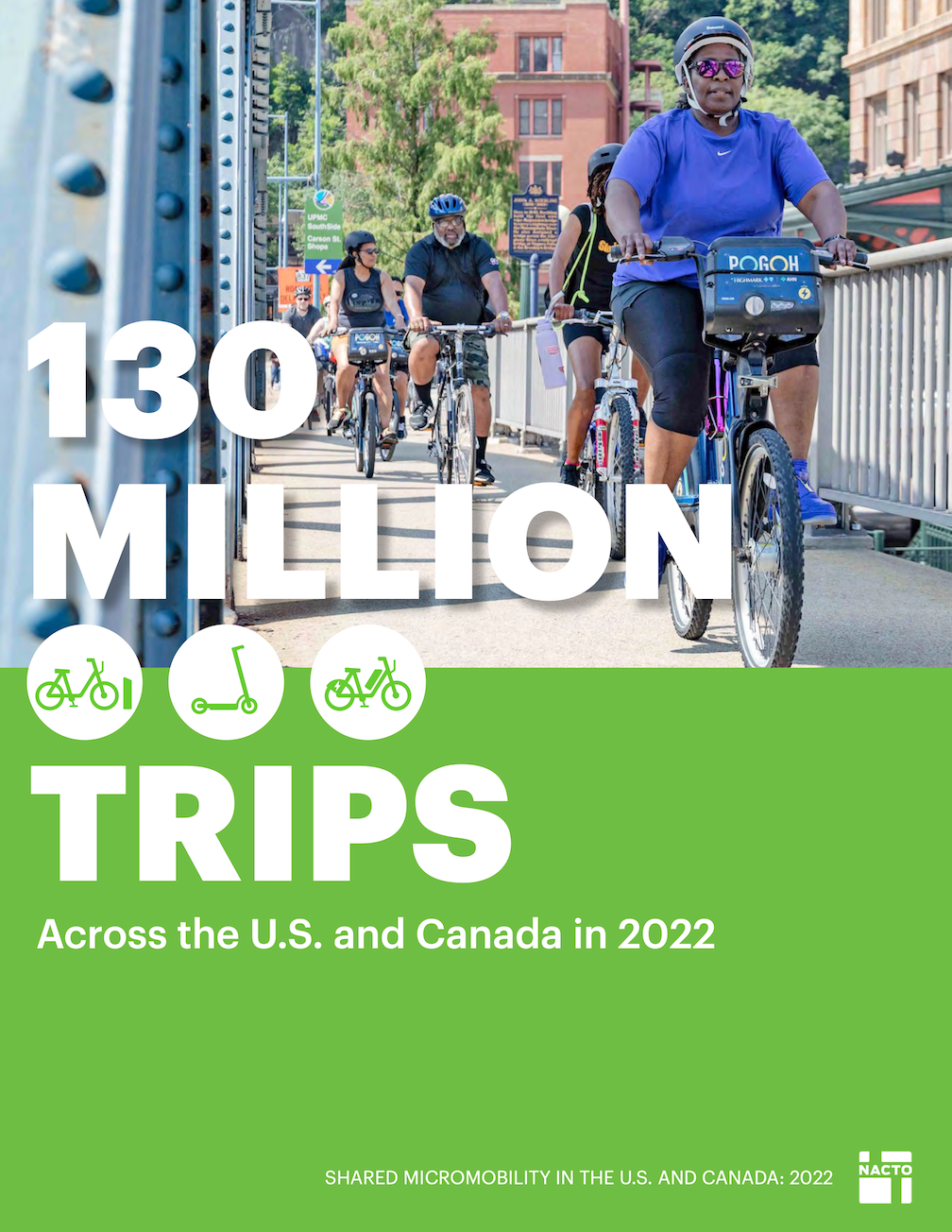
NACTO released it’s Shared Micromobility in the U.S. and Canada 2022 ‘130 Million Trips’ report in September 2023, and the report has a summary webpage at https://nacto.org/publication/shared-micromobility-in-2022/. The report is interesting throughout, but one paragraph in particular is important for the Sacramento situation in which Lime has removed its bikes from the region, and Bird is offering few bikes. Bike share in Sacramento is more or less dead. It is clear that the model of privately owned and managed bike share does not work here. If we are to have bike share, we need a new model. I’ll have one or more posts on that shortly.
From the report (page 10):
“Shared micromobility systems that see consistent growth and equitable outcomes are typically municipally-owned or closely managed through long-term partnerships with private operators. Long-term contracts have resulted in more sustainable results for ridership and the durability of systems. The enduring viability of private sector operators remains uncertain, especially as companies with short-term permits respond to financial troubles by pulling out of cities–often abruptly–altogether. Shared bikes and e-scooters can and should be integral parts of a city’s transportation network, but that is only possible if they are consistently available and resistant to the volatility of market conditions. Partnership models where local governments have greater involvement in their shared micromobility programs generally lead to better outcomes, like more equitable pricing structures, greater investment in historically underserved communities, and ultimately, a greater likelihood of long-term viability.”
Another issue for the Sacramento area was that rental prices for bikes saw several increases during the JUMP and Uber times, and a huge jump when Lime took over. The system had become unaffordable for many former users. Lime originally offered a free for a low monthly fee rental program for people in CalFresh or similar programs, but this year changed to a half-off discount, helpful but hardly affordable. Bird has a similar half-off program. Again, from the NACTO report (page 14):
“The cost to ride a shared bike or scooter continues to rise in numerous cities, posing a threat to affordability. In a year of widespread consumer price increases–including public and private transportation modes–shared micromobility was no exception. Annual membership hikes, alongside rising e-bike surcharges, led to a 70% increase in average per-trip costs for members of station-based bike share systems from the previous year. Pay-as-you-go trips on e-bikes or e-scooters were the most expensive, with average per-trip costs more than double the typical fare of a one-way trip on public transit in the U.S. and Canada.”
I have not yet used the Spin bike share in Davis yet. I’m always in Davis with my own bike, so haven’t been motivated, but I should test it out.
Note that automated pedestrian detection is among the eleven. Pedestrian pushbuttons are not listed because they are not a pedestrian safety countermeasure.
Now knowing about the Vision Zero update (thanks, Matt), I will see how the city’s list of actions compares to this list of countermeasures.
About a month ago, Lime pulled their e-bikes from the cities of Sacramento and West Sacramento. They are renewing their permits in both cities with the intent of only continuing to provide e-scooters. Bird has about 30 e-bikes available to rent in the City of Sacramento.
Since the launch of bike share in the SACOG region, Sacramento and West Sacramento have had open market permitting for shared micromobility, which allows any private operator to apply for a permit. If the operator meets all local requirements, they are then able to deploy shared bikes and scooters. For more information on these cities’ permitting processes, please see the links below:
The City of Davis and UC Davis recently launched a shared micromobility system with Spin. More information on this program and their plans is available here: https://taps.ucdavis.edu/spin.
Though not obvious from this response, I have been told by several sources that SACOG is no longer involved in bike share in any way. They have washed their hands of the program that they originated. The last time bike share was on the agenda for SACOG board or committees was May 2023. Since then, nothing. No discussion, no announcements, no communication with the public.
City of Sacramento staff said that the permit that Lime has with the city specifies a number of ‘devices’ but does not require that any of them be bikes.
This loss of a transportation service again points out that bike share systems must be at least publicly owned, though they might be operated by a private company with expertise. This is the second time that a private bike share has pulled out of the city, and region, without any notice to customers or the agencies. This is unacceptable.
I was out walking last evening, and was horrified to discover this:
new beg button at Alhambra Blvd & L St
This is a brand new beg button (technically called pedestrian pushbutton) on Alhambra Blvd in Sacramento. These have not been turned on yet, hence the cardboard over the button itself, but they are newly installed. There are a number of these along Alhambra Blvd, though I don’t yet know how many. For at least the ones I observed, these are all at locations where the pedestrian signal was previously on auto-recall, meaning the pedestrian signal changes as part of the regular signal cycle, not requiring any action on the part of the walker. Now, with these beg buttons, a person walking must ‘beg’ to cross the street by pressing the button. These buttons do not, at least in Sacramento, speed up the signal cycle. The person waiting must wait the same amount of time before a walk indicator comes on.
This is an affront to myself and anyone who walks. I’m sure the city considers this a pedestrian safety improvement, and I’d not be surprised if the city used pedestrian safety funds to install it. But it is a motor vehicle facility and improvement, it does absolutely nothing for someone walking. What is does do is allow the traffic engineer to favor motor vehicle traffic in signal timing.
The trend all over the US is to either remove such beg buttons completely, or to change them to accessible audible buttons. In a few places, they are being replaced by automated pedestrian detection, so that no action is required on the part of any walker. San Francisco has converted all of its beg buttons to accessible buttons. Other bay area cities have started to do so. I know of no place in the US where new beg buttons are being installed.
City of Sacramento Public Works is populated by fossil engineers and fossilized thinking. It has a cars-first attitude, and will continue to have that attitude until the fossils are cleared out. Put them in a museum of the 1970s, and get them out of our transportation system.
Caltrans and Yolo County Transportation District (YoloTD) want to widen Interstate 80 in Yolo County and into Sacramento County. I previously wrote about this project in missing alternatives for Yolo 80 Managed Lanes Project. The list of alternatives seems to continually change. I saw a presentation at the SACOG Transportation Committee meeting this week that had a different list of alternatives. But the one on the Caltrans ‘Yolo 80 Corridor Improvements Project’ website is:
Build Alternative 2a: Add a high-occupancy vehicle lane in each direction for use by vehicles with two or more riders (HOV 2+).
Build Alternative 2b: Add a high-occupancy vehicle lane in each direction for use by vehicles with two or more riders (HOV 2+) and build an I-80 managed lane direct connector.
Build Alternative 3a: Add a high-occupancy toll lane in each direction for free use by vehicles with two or more riders (HOT 2+). Single-occupied vehicles would pay a fee for lane usage.
Build Alternative 3b: Add a high-occupancy toll lane in each direction for free use by vehicles with two or more riders (HOT 2+) and build an I-80 managed lane direct connector. Single-occupied vehicles would pay a fee for lane usage.
Build Alternative 4a: Add a high-occupancy toll lane in each direction for free use by vehicles with three or more riders (HOT 3+). Vehicles with less than three riders would pay a fee for lane usage.
Build Alternative 4b: Add a high-occupancy toll lane in each direction for free use by vehicles with three or more riders (HOT 3+) and build an I-80 managed lane direct connector. Vehicles with less than three riders would pay a fee for lane usage.
Build Alternative 5a: Add an express lane in each direction (i.e., everyone would pay a fee to use the lane, regardless of the number of riders).
Build Alternative 5b: Add an express lane in each direction (i.e., everyone would pay a fee to use the lane, regardless of number of riders), and build an I-80 managed lane direct connector.
Build Alternative 6a: Add a transit-only lane in each direction.
Build Alternative 6b: Add a transit-only lane in each direction and build an I-80 managed lane direct connector.
Build Alternative 7a: Repurpose the current number one general-purpose lane for use by vehicles with two or more riders (HOV 2+); no new lanes would be constructed.
Build Alternative 7b: Repurpose the current number one general-purpose lane for use by vehicles with two or more riders (HOV 2+); no new lanes would be constructed. Build an I-80 managed lane direct connector.
Note that of these 12 alternatives, 10 of them add a lane to the existing six lanes, which is capacity expansion, while 6 of them would be tolled in some manner. High occupancy toll (HOT) lanes charge vehicles that do not meet the minimum passenger count (often 2, but could be 3). Express lanes charge every vehicle using the lane, though there might be discounts for higher occupancy or certain types of vehicles, or certain times of day when there is no congestion.
The white line stripes that were added to the two blocks of P Street protected bikeway, 19th Street to 17th Street, are an attempt to keep leaf piles and trash cans out of the bikeway. I noted the added white stripes in Central City Mobility update #27, but wasn’t sure why they were added. The wording was added later. I have not yet observed this location on either a trash pickup day, or now that there are a lot more leaf piles. I have not seen the striping and marking on other blocks of the new bikeways, so this may be a pilot to see if it works. The practice of putting leaf piles in the regular Class 2 bike lanes in common, and the city has made no effort to reduce this practice.