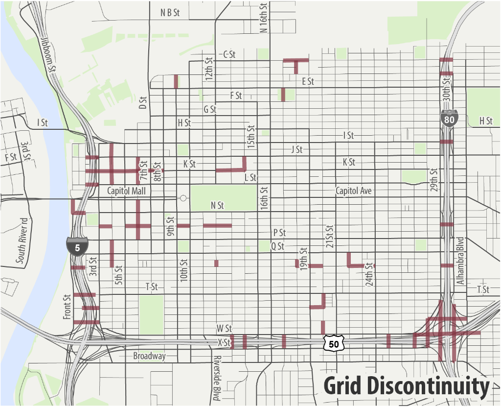
As mentioned in no grid: the original sin of city planning, freeways are one of the features that constrain the grid system of the central city Sacramento. Unlike the rivers, which are a natural feature, the freeways were designed to break the grid. This was a design choice by Caltrans to priority freeway travel over local travel. It doesn’t mean freeways are a bad idea, they are good and bad, but the decision to break grid streets was an intentional one, and a mistake that has harmed the city.
I was thinking of mapping all the broken grid streets, but realized there is a useful map in the Grid 2.0 presentation. Note that Grid 2.0 was superseded by Grid 3.0, and then the Downtown Mobility Plan, and then Central City Mobility Project. The focus on broken grid locations, and the goal of correcting some of them, was lost. In the map below, you can see seven locations where Business 80 broke the grid, eight locations where Hwy 50 broke the grid, and eight locations where Interstate 5 broke the grid. There was a proposal to reconnect N Street over Interstate 5, but I’ve not heard anything about that in years.
Some of the grid streets are broken in favor of freeway onramps and off-ramps. A reconfiguration of the ramps from long, long ramps to shorter (and safer) ramps could allow reconnection of some grid streets, but not most of them. The freeways, as designed and built, are a permanent blight on city livability.
13th Street is one that could be reconnected, and would have great utility because 13th, with its route through Capitol Park, is a critical north-south bikeway through the central city. Though K Street has a freeway underpass for walkers and bicyclists, a street connection at J Street or L Street would serve to reconnect Old Sacramento Waterfront (as it is called now) to the rest of the city. Currently, it is isolated by freeway, parking lots, and broken grid streets.
Worse, from a city amenity viewpoint, was that Hwy 50 broke Southside Park, splitting it into two sections, and with the W Street and X Street traffic sewers, making it unsafe and unpleasant to get from one part of the park to the other.