Update: With some help from others, I located the Governors Mansion and Handle District signs, and have added that information.
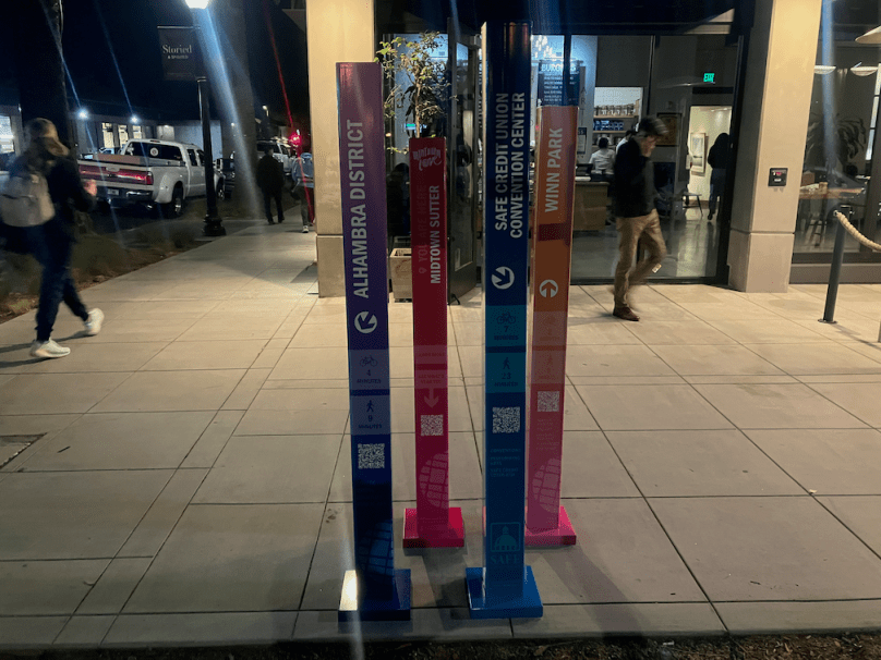
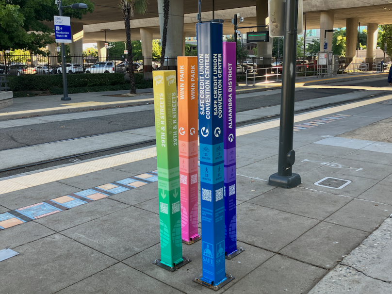
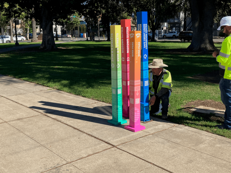
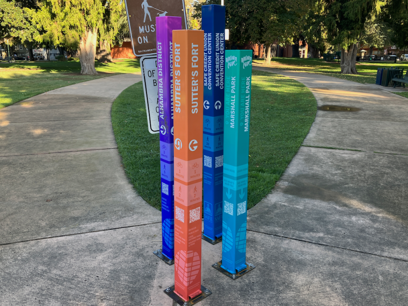
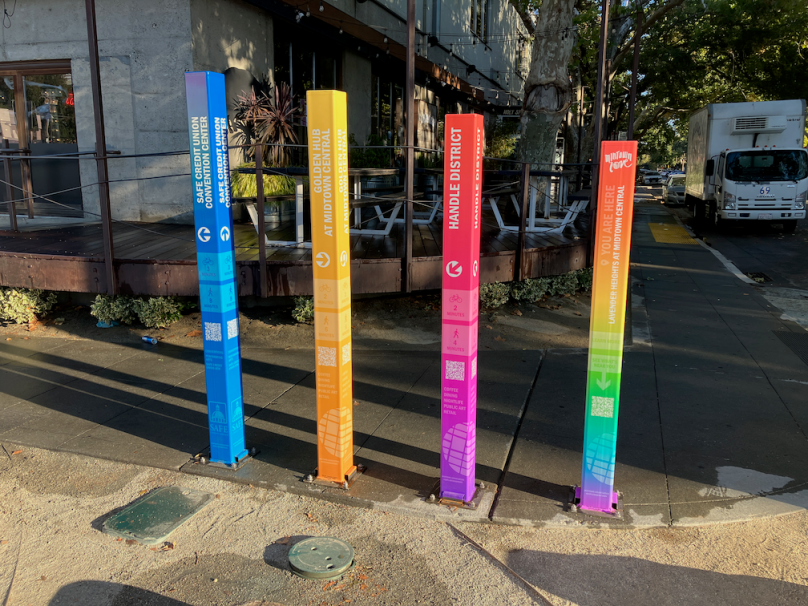
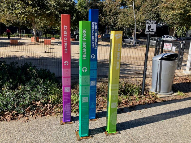
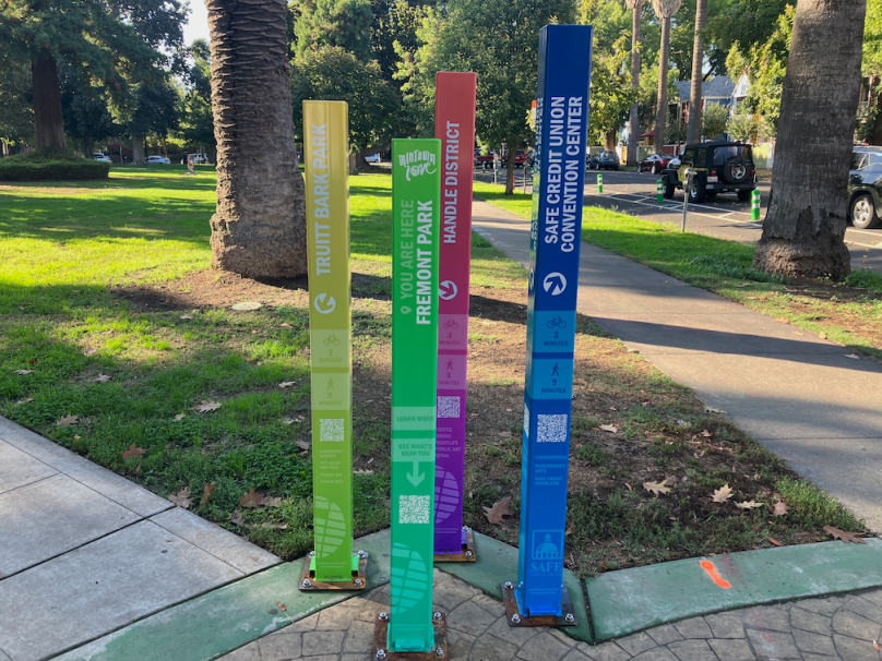
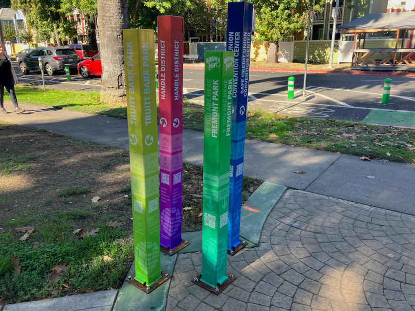
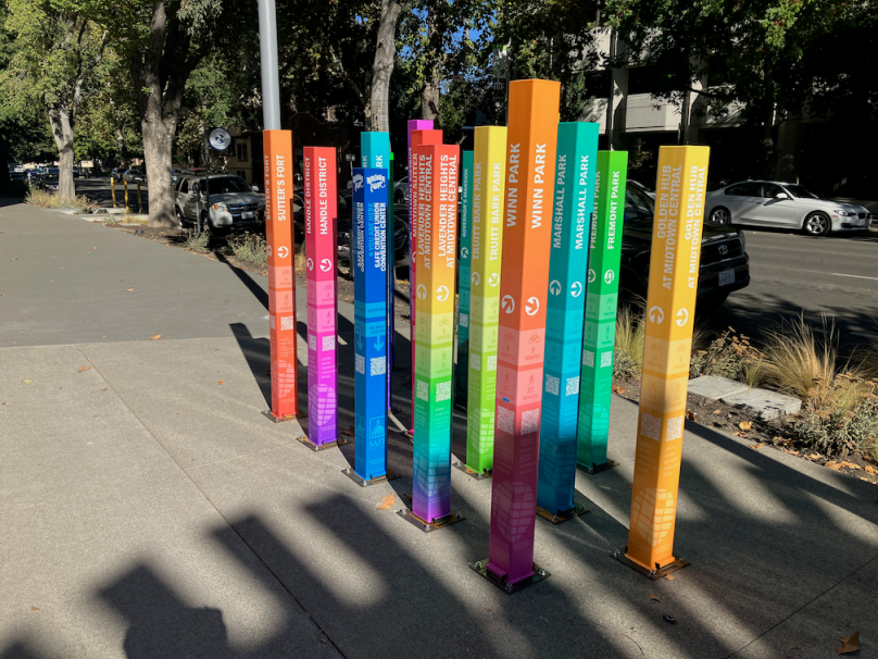
The Midtown Association (Sacramento) has installed a series of wayfinding signs in the midtown area. More information is available at Explore Midtown – Your Way!. It appears that SAFE Credit Union is also a sponsor, as the central origin of the signing is the northwest corner of 15th Street and K Street, on the grounds of the SAFE Credit Union Convention Center and Performing Arts District. This location references 15 other wayfinding locations with its 16 posts. The other locations have four posts, one for the location itself and three destinations. The posts have QR codes which link to an Explore Midtown page for that location, listing nearby attractions and businesses. Businesses not a member of the association are not shown.

| Number | Location | Intersection | URL |
| 01 | SAFE Credit Union Convention Center | 1401 K St; 15th & K NW | http://bit.ly/MA-SAFE |
| 02 | Memorial Auditorium | 1515 J St; 16th & J NW | https://bit.ly/MA-Memorial |
| 03 | Governors Mansion | 1526 H St; 16th & H SE | https://bit.ly/MA-Governors |
| 04 | Muir Park | 1515 C St; 16th & C NW | https://bit.ly/MA-Muir |
| 05 | Fremont Park | 1515 Q St; 16th & P SW | https://bit.ly/MA-Fremont |
| 06 | Truitt Bark Park | 1818 Q St; 19th & Q SW | https://bit.ly/MA-Truitt |
| 07 | Handle District | 18/19/L/Capitol; 19th & L NW | https://bit.ly/MA-Handle |
| 08 | Lavender Heights | 20th & K NW | https://bit.ly/MA-Lavender |
| 09 | Golden Hub | 24th & K NW | https://bit.ly/MA-Golden |
| 10 | Marshall Park | 915 27th St; 28th & J NW | https://bit.ly/MA-Marshall |
| 11 | Sutter’s Fort | 2701 L St; 28th & L NW | https://bit.ly/MA-Fort |
| 12 | Midtown Sutter | 27/28/J to N; 28th & Capitol SW | https://bit.ly/MA-Sutter |
| 13 | 29th & R Streets | 29th & R SE | https://bit.ly/MA-29th |
| 14 | Winn Park | 1616 28th St; in park | https://bit.ly/MA-Winn |
| 15 | Alhambra District | Alhambra Blvd, J to S; Alhambra & J SW | https://bit.ly/MA-Alhambra |
Note that I am not completely sure about the location numbers. Just as I was visiting each site, a contractor was placing base plates on each sign post, which covered the location numbers that were on each post.
Some of these names are well known and long used, but several seem to be made up for this project. I’m not against this idea – giving people a neighborhood name can increase identification and therefore support for your local neighborhood. On the other hand, efforts by developers to create their own neighborhood or district names are often laughed at, and San Francisco has a number of those.
The wayfinding sign locations are in the slideshow below. I’ve also included bike racks and utility box designs that highlight the Alhambra District.


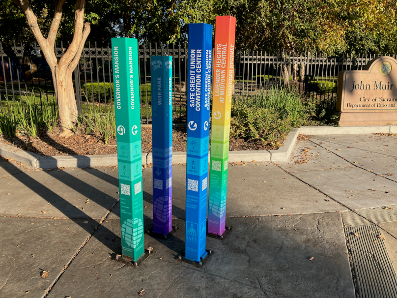


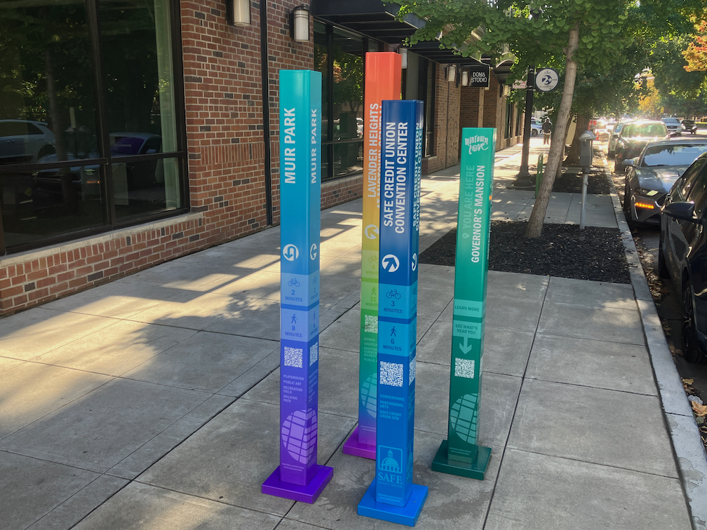

The “Governor’s Mansion” posts are on the SE corner of 16th & H Sts. My least fave aspects of this project are the locations of the QR codes at the very bottom of the posts. To scan them requires crouching/kneeling closeby… to hover a smartphone mere inches above the sidewalk pavement?!? And, apparently MBA didn’t bother to spellcheck the posts before installation…
LikeLike
Thanks for the pointer. I’ll look for it again. I hadn’t thought about the QR location, as I’m able-bodied, but that is a very valid criticism.
LikeLike
To use the lingo of tech: the UX needs work: mebbe these are just a beta rollout?!?
LikeLike
I’m pretty sure they are permanent. They are also internally reference, nothing outside midtown. Except the convention center, which, being on the west side of 15th, is technically in downtown.
LikeLike
Indeed! I was being (poorly?) sarcastic re the beta. If MBA’s ever-lengthening tentacles get any further flung, everything west of “downtown/DSP-ville” will soon be under their umbrella of marketing meme mediocrity… and I’d bet the SCUCC/PAC will be the eventual locale for dominance between the two PBIDs sooner than we might we assume…
LikeLike