SacRT: Watt/I-80 update

I wrote about the SacRT project to upgrade Watt/I-80 light rail station and bus transit: SacRT: Watt/I-80 station upgrade, and more recently about the freeway and traffic noise issue at Watt/I-80. But I went there not just for the noise issue, but to look at some other issues.


The project included changes to the freeway on-ramps/off-ramps to the north and south of the Watt/I-80 station and bus areas. They were reconstructed to make on-ramps closer to right angles, in order to slow traffic which presents an ongoing danger to people walking to and from the buses and light rail, or anywhere, for that matter.

I-80 on-ramp/off-ramps at Watt Avenue, north side, westbound traffic

The former configuration is shown in the Google map capture, below.
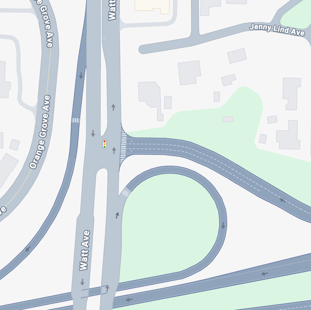
Google map of Watt Ave & I-80 on-ramp/off-ramp, north side, westbound
Watt Ave & I-80 on-ramp/off-ramp, north side, westbound

The sweeping cloverleaf on-ramp that encourages high-speed traffic and no attention to people walking and bicycling has been changed to a more right-angle turn, shown below.

The first shows a bicycle lane that was not present before, and the second a crosswalk over the on-ramp that is more prominent and somewhat safer than before. However, the bike lane lacks marking for the merge zone. There should be skipped green marking that highlights the conflict area in the merge. The current marking implies that motor vehicles have the right of way over bicyclists, when in fact this is a merge area where neither has precedence. Note that Watt Avenue north of this on-ramp/off-ramp has been reconstructed and now has bike lanes, but this is a different project.

The crosswalk over the on-ramp is better marked and better signed than what was there before. However, the implication again is that motor vehicles have the right of way over pedestrians. Though drivers are moving slower than before, there is no indication that they must yield to walkers. Drivers entering a freeway don’t think of these crosswalks as having the same rules as surface streets, if they even are aware that walkers have the right-of-way in crosswalks (many drivers do not know this, and many more know it but don’t follow it). Better, but still not safe.
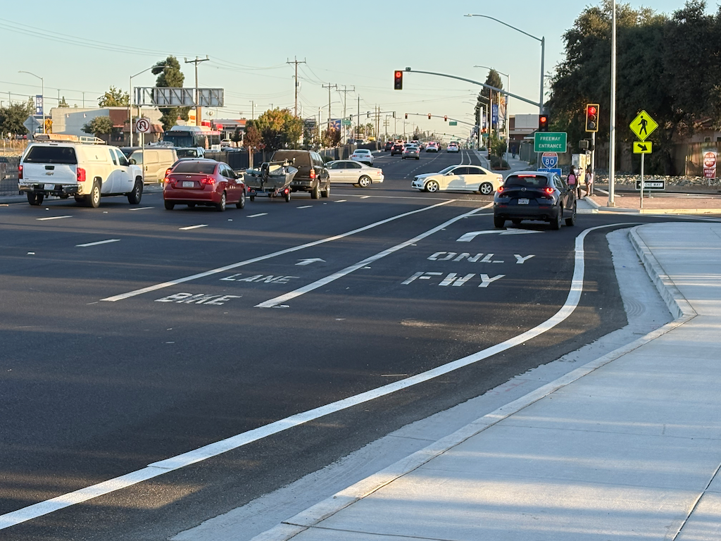
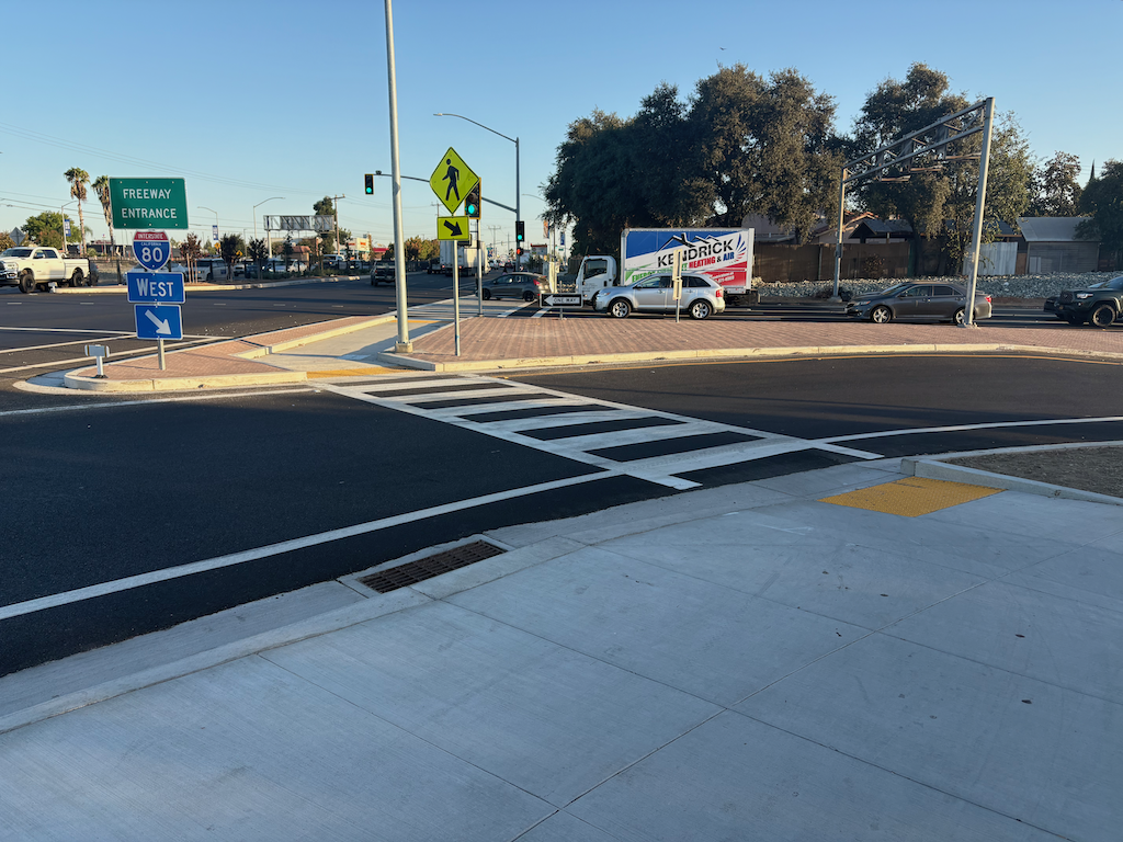
photo of I-80 westbound on-ramp from Watt Ave, bike lane
I-80 westbound on-ramp from Watt Ave, bike lane
photo of I-80 westbound on-ramp from Watt Ave, crosswalk
Watt Ave & I-80 on-ramp/off-ramp, north side, westbound

The off-ramp has not been improved. There are three lanes. I am sure that Caltrans would not have allowed a change that reduced stacking capacity on the off-ramp.

I-80 on-ramp/off-ramp at Watt Ave, south side, eastbound traffic

The former configuration is shown in the Google map capture, below.
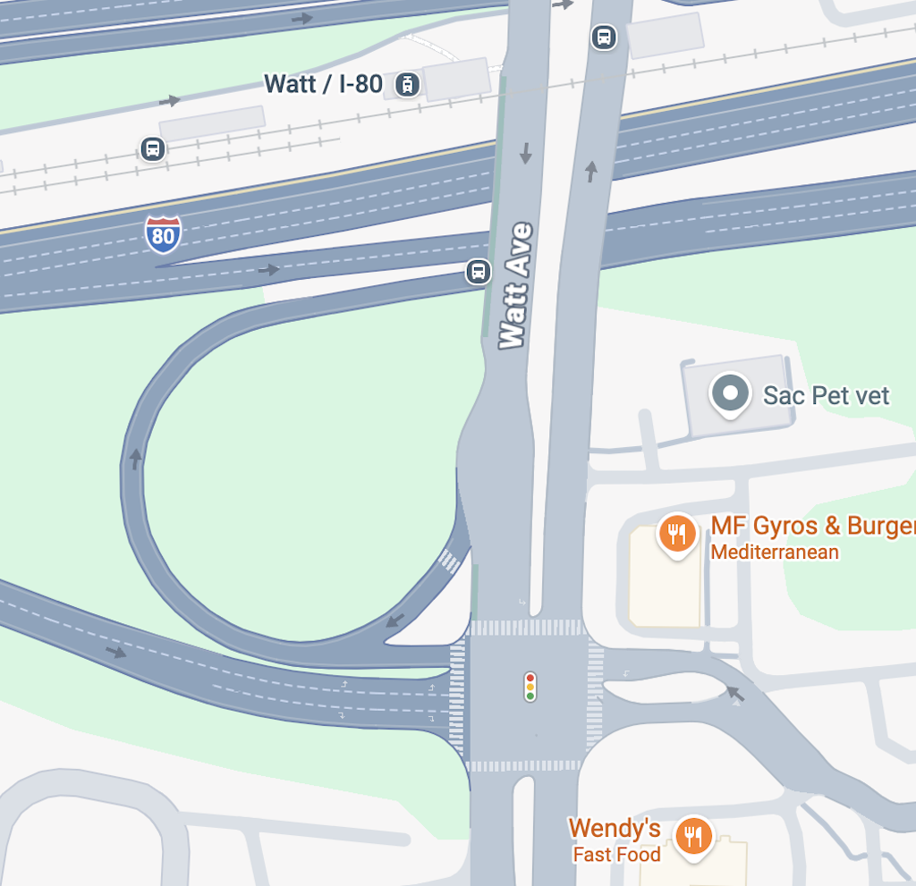
I-80 on-ramp/off-ramp at Watt Ave, south side, eastbound, former

The eastbound I-80 on-ramp/off-ramp from Watt Avenue has also been improved. The sweeping cloverleaf on-ramp has been modified so that the turn is closer to right angle, slowing motor vehicles. The former on-ramp was also a barrier for people with mobility issues, as the sidewalk was extremely steep and awkward. This is a considerable improvement. However, there is no signal or signing control that prevents drivers southbound on Watt from turning across the crosswalk when it is occupied.
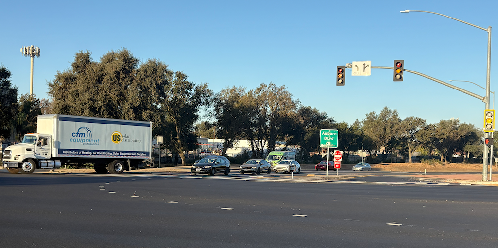
photo of I-80 on-ramp & off-ramp at Watt Ave, eastbound traffic
I-80 on-ramp & off-ramp at Watt Ave, eastbound traffic

The off-ramp has not been improved. There are three lanes. I am sure that Caltrans would not have allowed a change that reduced stacking capacity on the off-ramp.

I will comment that these freeway interchange improvements should not have been funded by SacRT, but by Caltrans. Caltrans designed and constructed on-ramps that it knew to be unsafe for people walking. It is legally and morally obligated to fix them, on their own dime.


The stair on the west side for accessing southbound buses is closed while bus shelters are being installed for the three southbound bus stops. Construction is underway, so it should not be too long before it is opened again. In the meanwhile, riders who want to board southbound buses must still walk to the bus stop adjacent to the Sacramento Inn & Suites, which has a very constrained waiting area with no shelter, and accumulates trash. At least there are now better crosswalks to access that stop. The elevator on the west side is out of service, for an indefinite period of time while a part is being ordered.

The stair on the east side for accessing northbound buses is open. The elevator on the east side is in service, but has the same issues it has always had: strong smell of urine, graffiti inside and outside the elevator, trash in the elevator, and damaged glass. SacRT made the decision to not add publicly accessible restrooms in the station upgrade, though it was a strong request of the public and transit advocates. As long as there is no restroom, urination in the elevators will continue. The other issues are vandalism, which may or may not be reduced by the better station design and aesthetics.

Though the platform at Watt/I-80 light rail was fairly clean, the track area had large quantities of litter, which has clearly been there for some while. The abandoned San Diego light rail train definitely doesn’t add to the aesthetics of the station, though it may serve some purpose in reducing freeway noise at the platform.

Since SacRT has committed itself to the freeway median for this terminus station, the most important improvement that could be made, after publicly accessible restrooms, is sound walls to block the oppressive freeway noise. The first one should be on the north side of the station, where the walkway between the east stair and elevator and the station platform is oppressively and dangerously noisy. The second would be the south side adjacent to the platform, where the noise is oppressive but not dangerous.

On this trip, I also visited the new Dos Rios light rail station, which I’ll write about soon.
the oppressive noise of freeways

I was recently in southern California to assist a seminar. The place I stayed was a ten minute walk from the C Line (Green Line) Hawthorne/Lennox station, which runs every 13 minutes. The place I worked was a twelve minute walk from the K Line, which runs ever 13 minutes. The two lines overlap at the Aviation Blvd and LAX/Metro Transit Center, so transfer between the two lines is easy, and was usually a short wait.

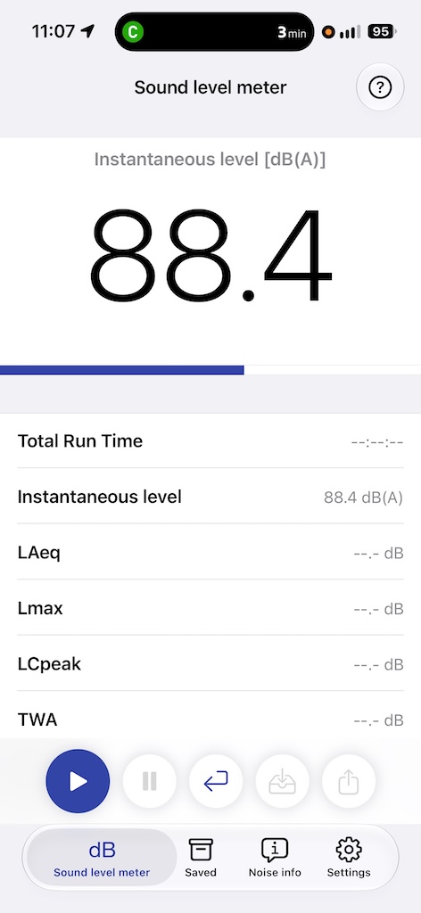
The problem with the C Line is that it was built in the median of a busy freeway, Interstate 105 (‘the 105’), the Century Freeway. It is also parallel to the ‘Imperial Highway’ which is a surface arterial and predates both the freeway and light rail. Almost every light rail station is in that median of a freeway that is 11 lanes wide at the Hawthorne/Lenox station. The freeway noise at this station is oppressive, and I was uptight the entire time I was waiting for the train. I downloaded a decibel app from NIOSH (National Institute for Occupational Safety and Health) called SLM (Sound Level Meter) to see just how bad it is. During non-commute hours, which was the only time I was there, the levels ranged from 80 db to 92 db. Prolonged levels above 85 db are considered hazardous, and levels above 100 of more than 15 minutes risks permanent hearing damage. I would guess that commute hours under free-flowing or nearly free-flowing conditions would be over 100 db. Of course significant congestion would reduce the noise level by reducing tire noise, unless of course drivers are honking their horns.

capture of NIOSH SLM db measurement at Metro Line C Hawthorne/Lennox station
NIOSH SLM db measurement at Metro Line C Hawthorne/Lennox station

Line C (Green Line) was the second light rail line constructed in the LA area, after the Line A (Blue) line from downtown to Long Beach, which has now been extended far to the east of downtown with the same Line A name. It was opened in 1995. The alignment was picked because it was constructed at the same time as the freeway, so there were no right-of-way costs. As a plus, it is completely grade-separated. However, it is a miserable place to be. Parts of the A Line near Pasadena are in freeway median. Parts of BART are in freeway median. Each and every light rail station in a median is an oppressive place to be. These median running rail systems are popular with transit agencies because they cost less. They are extremely unpopular with riders.

I hope that light rail will never again be constructed in freeway medians. I hope that someday the Watt/I-80 station will be moved out of the I-80 freeway median. Note that the Roseville Road and Watt/I-80 West stations are also in the same freeway median, but as the median is wider at these points, the freeway noise is less oppressive. The location of all three stations is located on the right-of-way of an additional freeway that was never built.

Wikipedia: “One of the lessons learned from the line, and the Harbor Transitway built at the same time, was that freeway median stations offer a poor rider experience, requiring customers to descend from bridges or climb stairs from dimly lit underpasses to isolated stations in the middle of a noisy and exhaust-ridden freeway. While stations generally have elevators as a necessary accessibility accommodation, these sometimes fail, and have been known for having sanitation issues; escalators are also often out for maintenance or, with the C Line in particular, only available downward.”

Not to be outdone, Sacramento has a similar problem with the Watt/I-80 Blue Line light rail station. I visited this morning, more or less during commute hours, though not during the peak. At the station platform, the range was 65 to 80 db, helped a great deal by the row of vegetation between the platform and the eastbound I-80 lanes. The walkway from the platform to the east stairway and elevator ranged from 75 to 90 db, harmed a great deal by reflection off the overhead Watt Avenue bridge, and with no sound protection from the westbound I-80 lanes. Up top, where the bus stops are, with primary noise from Watt Avenue traffic and secondary noise from the freeway below, ranged from 65 to 80 db. Watt Avenue is six lanes wide, and carries heavy traffic. I-80 is eight lanes wide, with seven additional lanes of ramps and bypasses, and carries heavy traffic.

When SacRT was considering what to do with Watt/I-80 light rail station, which was an unpleasant and unsafe location, the public asked that the station be moved out of the freeway median and to a more pleasant and safe location. SacRT decided to retain the location and make ‘improvements’. The dark, urine stained, unsafe west stairway has been replaced by a wide, high visibility stairway. The dark, urine stained, unsafe east stairway has been replaced by a better visibility stairwell. The east elevator is in the same condition it always was, with a strong urine smell, graffiti on the walls, and damaged glass. Though the west elevator is closed at the moment for maintenance, I imaging it has the same issues. Wider walkways and trees have been added at a few locations. The station will indeed by nicer than it was, but nice enough to induce riders that have a choice to use it? I doubt that.

SacRT: Watt/I-80 station upgrade

The work on the Watt/I-80 light rail and bus station is almost complete, with final opening due within a month. The west side was open, but is now closed again for final work. The east side is complete and open. The station is a major connecting point between Blue Line light rail and five bus routes (1, 15, 26, 84, 93).

Capital Transit Alliance was offered a tour of the station on Wednesday, August 26, with Principal Engineer Jenny Niello hosting. The project looks great, an immense improvement over the dark, urine-stained, trash filled stairwells of the old station.

The issues not resolved by the project include:

  • There is no public restroom at the station. It is likely that the elevators will continue to be used as bathrooms.
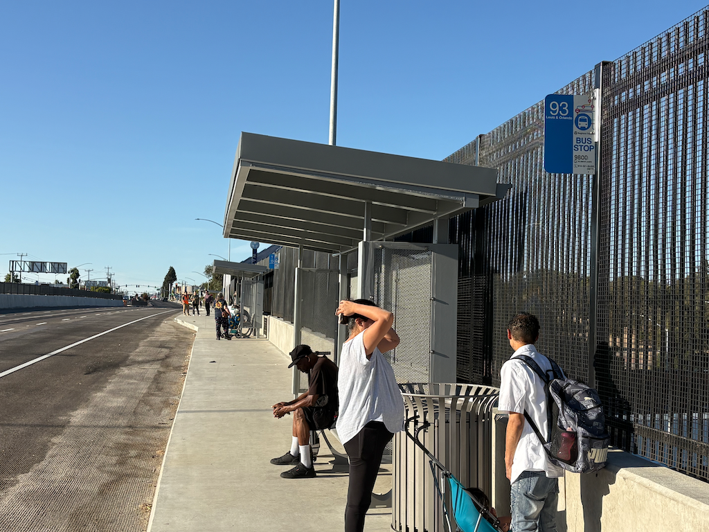
  • Wayfinding signs are not present. This includes wayfinding from the light rail terminus to the east side stair, during construction. For permanent wayfinding at the top of the stairs on the east side, there is nothing. One bus stop is north (26, 84), but the bus stop sign is hardly visible from the top of stairs. Two bus stops are to the south. For the first (1, 15), the sign is partly obscured by the bus shelter. For the second (93), the bus stop sign is not visible at all. There should be wayfinding signs at the top of the stairs that not only indicate which stops are to the right (north) and left (south), but a map showing the destinations of the five bus routes. As always, SacRT seems to be making the assumption that only regular riders, who know the stops and destinations, would be using this station. Nothing for new or inexperienced users.
  • The east side top of stairs and bus stops are very hot in the afternoon summer sun. For the three bus stops at 6:00 PM, there was not shade from the afternoon sun. There must be some additional shade available here. Roof? Canopy?
photo of SacRT Watt/I-80 Route 93 bus stop
SacRT Watt/I-80 Route 93 bus stop