Things That Work: Traffic Posts is the eighth post by Strong SacTown to improve and promote the City of Sacramento update to its Street Design Standards. Other posts at tag: street design standards.
“You don’t often hear news about the crashes that didn’t happen. Today we’d like to highlight something already making real-world safety impacts in Sacramento: traffic posts (aka. delineators) on 15th & 16th Streets in Downtown. These traffic posts reduce the speed of cars (and severity of injuries) as well as channelize traffic – stopping cars from changing lanes at the crosswalk and potentially striking pedestrians who have started crossing.
Note: This post is not about the bicyclist fatality that occurred in this area recently. Not enough is known about that to post, yet. This is Central City Mobility Project update #34.
There is an issue with the 21st Street separated bikeway at W Street. The northbound bikeway transitions from the east side of 21st Street to the west side of 21st Street at W Street. There is a two-stage turn box on the northeast corner, intended for bicyclists who have crossed W Street on the green light to wait to cross 21st Street on the green light, to access the separated bikeway on the west side of 21st Street. The photo below shows the box being used by a walking bicyclist, who waited in the box. The signal has turned green and he has started to cross. A right-turning driver from W Street to 21st Street stopped suddenly to avoid hitting the bicyclist/pedestrian, because the driver did not expect to see someone there. The vegetation somewhat but not completely obscures someone in the box.
21st St at W St NE two stage turn box with bicyclist in box
The city has placed a ‘no turn on red’ sign on W Street, photo below. In about 40 minutes of observation, 60% of the drivers who could turn, meaning they were not blocked by a vehicle in front of them, did turn on red. This is the time when the box would be occupied by a bicyclist.
W St ‘no turn on red’ sign to 21st St
On the green light, drivers are taking the right turn at high speed. If there were a bicyclist or a walker crossing 21st Street, here, it is doubtful that many drivers would notice the person and brake in time. This is a severe injury or fatality waiting to happen. The video below shows drivers cutting across the two-stage turn box.
video of drivers cutting across the two-stage turn box on 21st St
Solution
A temporary solution is to install vertical delineators (flex posts) to block off the right hand lane of W Street approaching the intersection. There is a short section of red curb here, where the ‘no turn on red’ sign is, but the blocked off area should extend 20 feet up to the crosswalk, and be the width of the parking lane. A green K-71 vertical delineator, or two, should be placed at the southwest corner of the two-stage turn box, to force drivers to go around the turn box, and also slow turning movements. The diagram below indicates possible locations of vertical delineators, white dots. Base excerpted from CCMP plans.
A more permanent solution would be to reconfigure the northeast corner to add concrete barrier protection for the turn box. The city, having enticed bicyclists to this location, owes them a much higher level of protection that is currently offered.
It has been a long while since I’ve posted on the Central City Mobility Project. I’ve been traveling, and backpacking, and project implementation has slowed down.
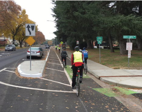
I Street is largely complete, from 21st Street to 12th Street. Part of the route is pretty standard separated bikeway, as below, but of the new bike facilities, it is the most erratic, changing design almost every block. The bikeway, at 16th Street, second below, is not a bike facility at all, but a car facility, designed to not inconvenience drivers turning right from I Street to 16th Street.
I St at 21st St separated bikewayI St at 16th St separated bikeway across motor vehicle turn lane
The concrete turn wedges were being hit by drivers frequently (and some bicyclists), shortly after they were installed. Reflective strips were added, below, and most drivers have gotten accustomed to the turn wedges and are not hitting them, but it continues on a rarer basis. I believe that additional warning signing is going to be installed on the turn wedges, but I haven’t seen this yet.
reflective strips on concrete turn wedges
The concrete turn wedge at Q Street and 21st Street was never installed, so it may have been dropped from the plan.
The paint, not concrete, turn wedges have had K-71 green vertical delineators installed, making them somewhat more visible, and somewhat more respected by drivers. The promised rubber speed bumps have not been installed anywhere, probably a supply chain issue.
The promised bicycle signal at 21st Street and I Street is still not installed.
Though most of the separated bikeways have received green K-71 vertical delineators, a few have not.
Along P Street an added double white line has been installed on some blocks, photo below. I don’t know why, but it must be to solve some issue that was not solved by the original design.
added double white line on P St
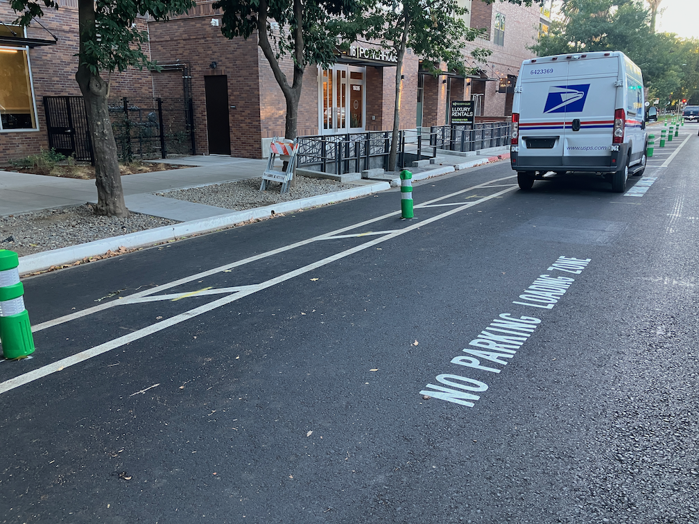
After being mostly neglected, curb designations for loading zones and short term parking have been installed in several places. The photo below shows the white curb with added pavement stencils for a loading zone on P Street approaching 16th Street. This is probably the location that was most being abused by both delivery drivers and private vehicle drivers, so this is good to see. White curb loading zones don’t have a designated time limit, and I have seen this location abused by private vehicle drivers, which should not be here at all since this designation is for commercial loading, but it is far better than before.
curb marking and pavement message for loading zone, P St
Lastly, there seems to be new activity on 5th Street, so that part of the project may be moving forward again. I’ll check it out and post.
I have not visited the south end of 19th Street, nor the south end of 21st Street, so I don’t know if those locations have been improved. Both were a mess. I’ll try to get there and report.
The J Street separated bikeway has problems, as has been highlighted by Streets are Better and many others. Separated bikeways are also called protected bike lanes and cycle-tracks, but in California the official term is separate bikeways.
The City of Sacramento placed a separated bikeway on J Street from 19th Street to 29th Street as part of a repaving and roadway reallocation project called the J Street Safety Project in 2018. This was the second such project in Sacramento, the first being portions of P and Q Street downtown, but it was the first in the heavy retail, parking, and traffic environment of J Street.
The theory of these parking-protected bikeways is that the row of parked cars protects bicyclists from moving cars, and this is true in the length of the block (but not at intersections, which are a separate issue), when there are parked cars. But some times of day there are not parked cars, and throughout the day as cars come and go (particularly on a retail corridor), protection is lacking.
It is true that bikeways don’t need strong protection from PARKed cars, but they do need protection from PARKing cars and delivery vehicles, and bikeway intrusion.
Vertical delineators and pavement markings were used to set off the bikeway, with a sign at the beginning of each block segment showing the new allocation. These vertical delineators are also called bollards and soft-hit posts, with soft-hit meaning that they won’t damage cars when drivers hit them. The first photo below shows the 27th to 28th section. It initially had 14 delineators place, but only three are remaining. The other blocks have fared a little bit better, but overall about half the delineators are gone. The second photo shows the 25th to 26th section sign that has been run over by a driver.
J Street bikeway, 27th to 28th section, missing delineatorsJ Street bikeway, damaged sign
Some of the vertical delineators are being run over by people parking, some by delivery vehicles parking on top of them, and some by drivers going down the bikeway itself. And probably some just for sport. I don’t know which of these causes are most common.
There are several solutions:
One: Put the delineators closer together so as to make it more obvious that vehicles are not supposed to cross them.
Two: Add bollards which either are, or at least look to be, more substantial. The photo below is from a somewhat different setting in Oakland, with more substantial bollards. Reading blogs and Twitter, these seem to be successful in some cities and some settings, but not in others.
bollards in Oakland
Three: More substantial separators such as planter boxes.
planter separated diagram from C40
Four: Partial hard curbs or medians. The photo shows a median at the start of a bikeway section. It reduces the number of signs flattened by drivers and signals to drivers that there is something different about this block.
bikeway with hard median start, FresnoCOG
Five: Continuous hard physical curb or median. It is hard to find good photos of these, probably because in the past they haven’t been seen as necessary. There are a lot of photos of hard medians adjacent to moving traffic, and adjacent to two-way cycle-tracks, and alongside raised bike lanes that are at or close to sidewalk level. But the graphic below gives the general idea.
Of course hard curbs or medians are more expensive, but last 20-30 years whereas delineators or bollards may need to be replaced every year, so I think they are a good investment.
A major issue with all separate bikeways is the presence of driveways. In fact streets with a high density of driveways should not have this design. Below at the blocks of the bikeway, with information about driveways.
19th
3 driveways
partially separated; driveways not changeable
20th
3 driveways
2 changeable driveways
21st
1 driveway
driveway not changeable
22nd
2 driveways
2 changeable driveways
23rd
no driveways
24th
2 driveways
1 maybe changeable
25th
no driveways
26th
no driveways
27th
no driveways
28th
2 driveways
partially separated; 1 driveway changeable
The changeable driveways will be the topic of a separate post, but the basic idea is that parking lots that have access to the alleyway do not need access to the main street, so in this case, parking lots with access to Jazz Alley do not need access to J Street.
My recommendations
Place hard medians at the beginning of each block, to protect the signs, and better signify to drivers this is a different place. For the locations where there are bus stops (19th, 22nd, 25th, 27th, 28th), the median would be moved down the block a bit. Note that this is too high a frequency of bus stops, but that is an issue for another post.
Place more substantial bollards, and at a closer spacing.
Place a continuous hard median on one of the four blocks without driveways, the same width at the painted buffers present now. This would be a pilot to test the installation, determine costs, and document benefits. If the pilot is successful, the other three blocks with no driveways should receive the same treatment.
Start negotiation between the city and the owners of parcels that are used solely as parking lots, to close J Street driveways and use Jazz Alley access. Some of these parcels will be redeveloped into more productive uses anyway, but that may take longer than desired.