H Street Bikeway: a glaring gap

For other posts on the H Street Bikeway project, see category: H Street Bikeway. For the city webpage on the project, see H Street Bikeway to Sacramento Valley Station.

The H Street Bikeway project extends from 5th Street to 10th Street along H Street, and along 10th Street from I Street to H Street. It is intended to improve transit connectivity by double-tracking two blocks of light rail between 5th Street and 7th Street, and to improve bicycle access by providing a two-way separated bikeway (cycle-track) on H Street, which links to bikeways or bike lanes on 9th Street (southbound) and 10th Street (northbound). The project provides a reasonable solution, though it could be improved in a number of details (see H Street Bikeway: overview).

A map in the SacATC presentation shows the bikeway network in the central city, highlighting the gap on 10th Street from I Street to H Street.

map of Preferred Bicycle Network, showing gap on 10th St between I St and H St
Preferred Bicycle Network, showing gap on 10th St between I St and H St (from SacATC presentation)

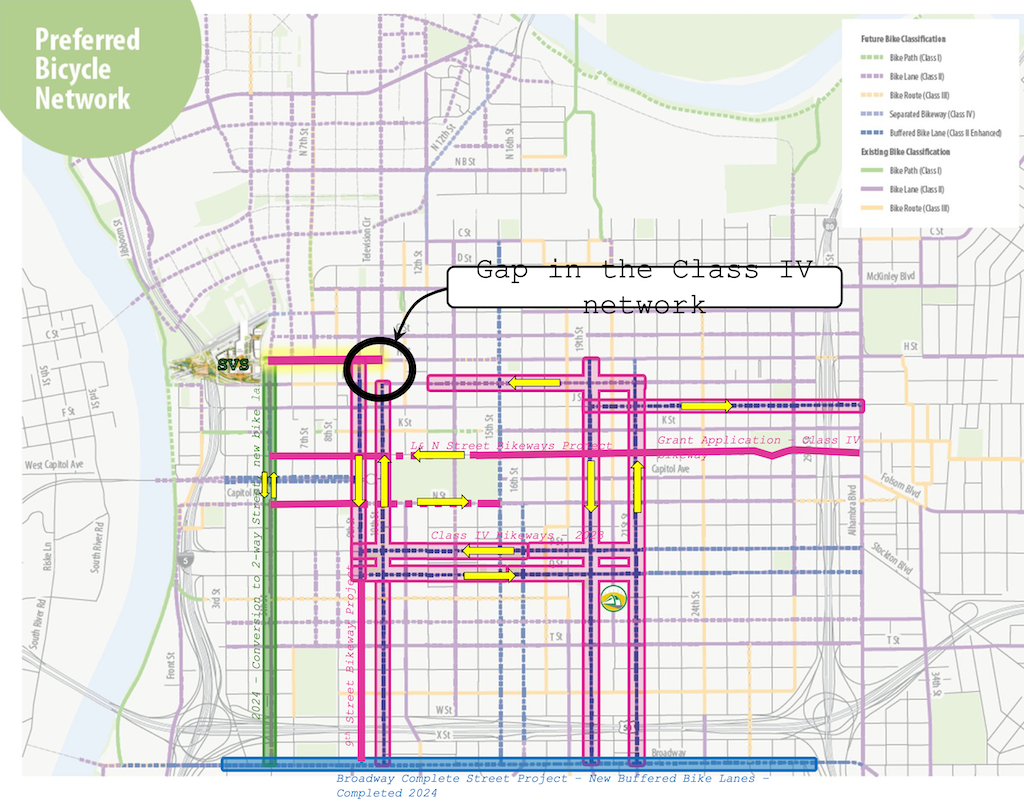
It does not highlight the glaring gap on I Street between 12th Street and 10th Street. The separated, parking-protected bikeway on I Street, that starts at 21st Street, ends at 12th Street (it is just a bike lane in front of the fire department just west of 13th Street, but resumes further west).

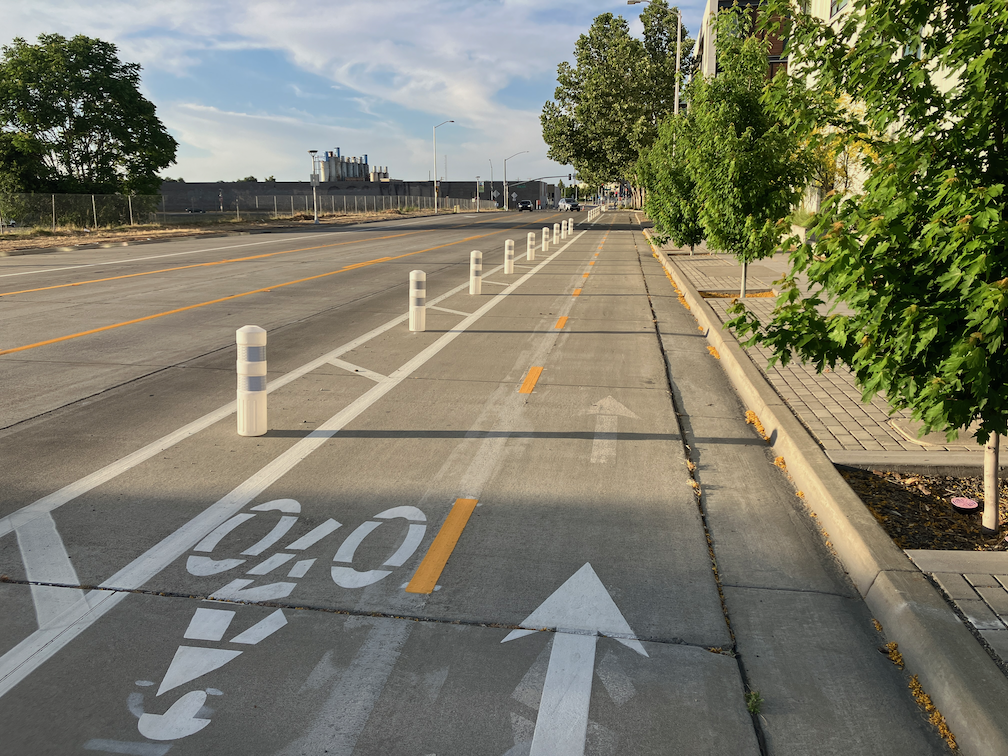
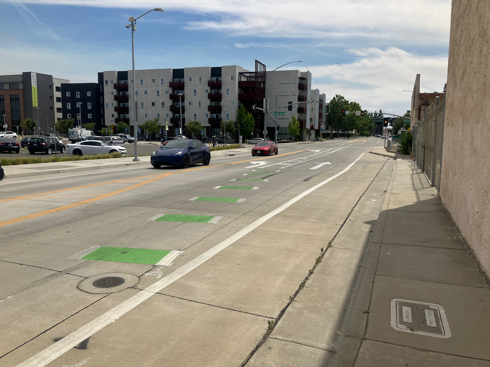
For a bicyclist wanting to access the proposed two-way separated bikeway on H Street, they must use regular Class II (paint only) bike lanes from 12th Street to 10th Street, then proceed north one block in a buffered bike lane to H Street. I Street between 12th Street and 10th Street is three general purpose lanes. As it typical of any three-lane one-way street, motor vehicle speeds are well above the posted speed limit of 25 mph, except when congested. By the way, it is not posted at all in this section, though the change from two lanes to three lanes at 12th Street would make posting logical if not imperative.

There are other gaps, including 9th Street south of Q Street, and L Street and N Street. The map refers to a L & N Street Bikeways Project, but neither the planning or engineering sections of Public Works seem to have a webpage on that project. Strangely, the streets adjacent to Capitol Park are shown as Class II, paint only bike lanes, though these two sections without mid-block driveways are the most logical place for separated bikeways in the entire city.

The map from the H Street Bikeway project presentation at SacATC was adapted from an old Grid 3.0 map (2016), below.

map of central city preferred bicycle network
Grid 3.0 map of central city preferred bicycle network

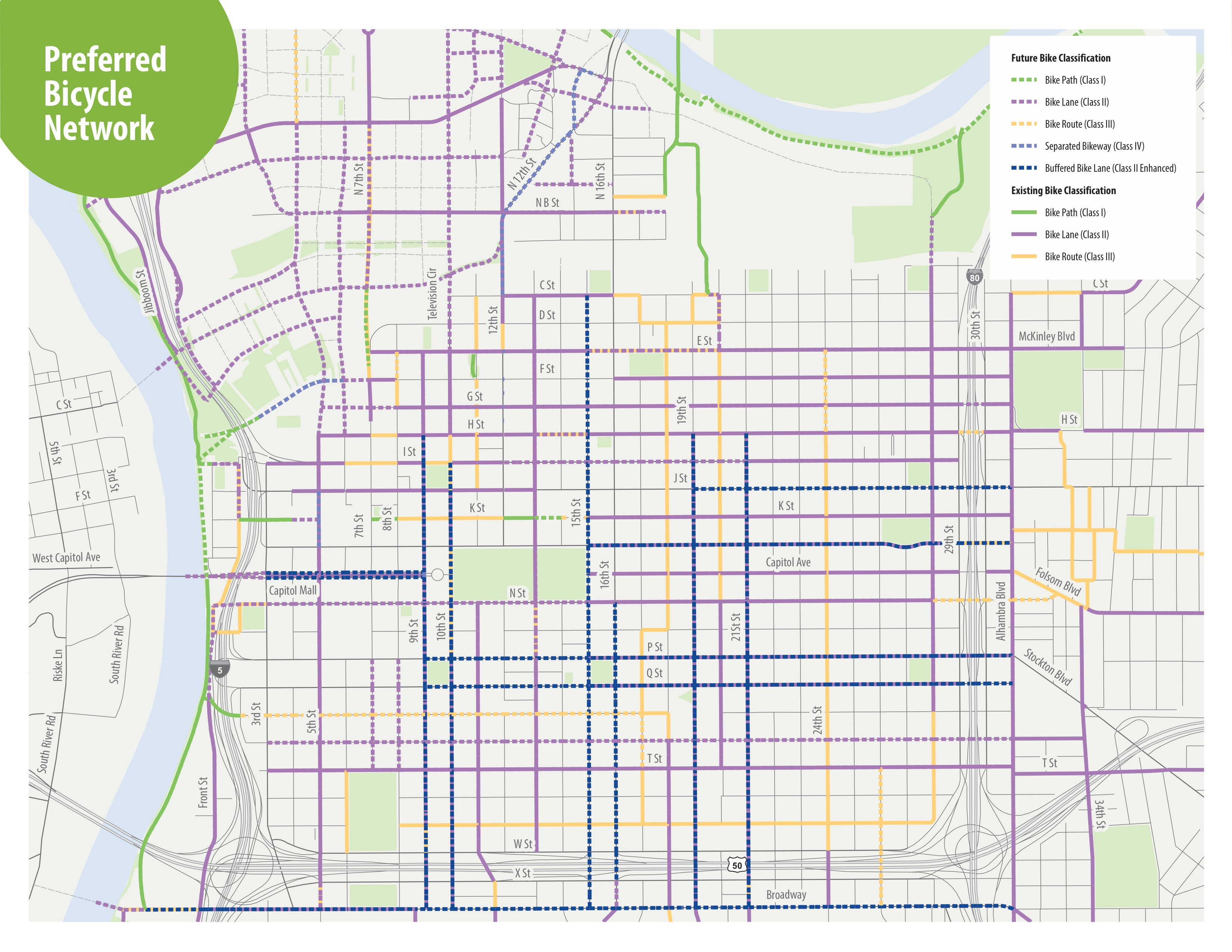
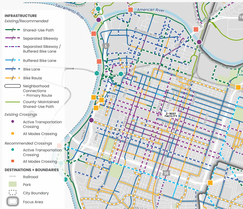
A more up-to-date map, with legend, is in the Streets for People Active Transportation Plan, page 80, ‘Figure 30 – Recommendations for People Biking in Central West Sacramento’, excerpted below. This map shows a separated bikeway (purple) continuing from 21st Street to 9th Street.

cycletrack in West Sacramento Bridge District

Note: I’ve added text and a photo of the approach from the north.

The City of West Sacramento has installed a section of cycletrack (a two-way Class 4 separated bikeway) on South River Road and 5th Street in the Bridge District. Apparently completed late 2023 (shows how long since I’ve ridden that way), it is part of the Riverfront Street Extension and 5th Street Widening Project.

From 15th Street (the connection to Jefferson Blvd) north to almost Mill Street, the bikeway is separated from motor vehicles by a hard curb divider. The on-street bike lane southbound still exists, but this bikeway provides a much safer alternative. The onramp to Hwy 50 east (or Business 80 as it is designated), was an extreme hazard for bicyclists due to drivers turning at high speeds. See two photos below.

South River Rd cycletrack / separated bikeway at 15th St
South River Rd cycletrack / separated bikeway

From Mill Street north to Bridge Street, the cycletrack is separated by a buffer and vertical delineators (K-71). At Bridge Street and north, the roadways returns to traditional Class 2 unprotected bike lanes. Though it would have been great to extend the curb-protected cycletrack all the way north to West Capitol Avenue, at least the truly dangerous section at the freeway onramp was fixed.

To the south of 15th Street, South River Road has more traditional bike lanes, with buffers in a few locations, as it crosses the ship channel and goes through two roundabouts.

The transitions to and from the bikeway seem a little awkward as they swoop through the intersection, but are probably not unsafe. I observed several bicyclists heading westbound to 15th Street who were not following the skip green bicycle markings, but the maneuver was not unsafe. I did not observe any bicyclists at the Bridge Street intersection.

Approaching the cycletrack from the north, the southbound traditional bike lane on the west side of 5th Street transitions to the cycletrack on the east side of 5th Street at Bridge St. Though the transition does not feel safe, I think it actually is, with signals preventing inappropriate motor vehicle movements.

5th St bike lane transitioning to cycletrack approaching Bridge St
signs and signals for bicyclist on 5th St at Bridge St

Elvas Ave and Hornet Tunnel

The section of Elvas Avenue between 62nd Street and Hornet Tunnel which leads to Sac State is very dangerous for bicyclists. Bicyclists have to transition across four lanes of traffic (three travel lanes and a center turn lane), without any protection whatsoever. The pavement quality is low, particularly on the east side where the ‘bike lane’ (not a real bike lane) is. Despite this, it is a high-use bicycle route from Sacramento to Sac State and the American River Parkway trail. M Street, this section of Elvas, and the Hornet Tunnel serve as a bicycle boulevard (though not designated) between the central city, Sac State, and beyond.

Since the day I arrived in Sacramento and rode my bike to work in the eastern suburbs, I have known that this section needs to be fixed. It took me 12 years to get around to writing about it. I hope that it will take the city less to fix it. The solution presented here is not the only solution, so I encourage others to comment, point out flaws, and suggest optimal solutions.

Elvas Avenue is a high-speed, moderately high-volume roadway that acts in many ways as an expressway due primarily to the turns from Elvas Avenue to 65th Street, and from 65th Street to Elvas that encourage high speeds. The roadway is dangerous for motor vehicle drivers and passengers as well as bicyclists. North of 62nd Street, St. Francis High School (about 1100 students) suffers from traffic risk created by Elvas Avenue, so traffic calming to the south will benefit the high school as well as bicyclists. It might be appropriate to extend the separated bikeway north to the signalized crosswalk over Elvas to the school.

Read More »