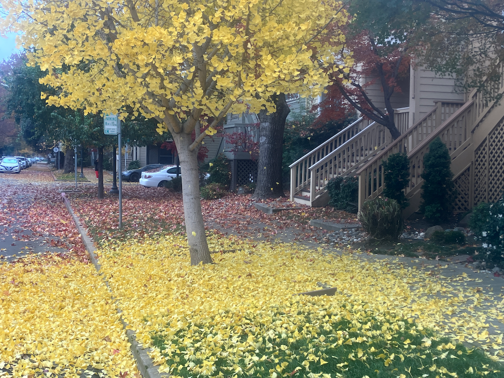
It is fall in Sacramento, trees are turning, leaves are falling. It is my favorite time of year, in part due to the knowledge that it will be over soon, only memories and photos. While out walking the last two days, I have been watching little breezes create leaf-fall, more fascinating to watch than snowfall. The four ginkgo trees back of my apartment are at their peak of brilliant yellow color, and the ground is carpeted in yellow. Blocks with a variety of trees are a kaleidoscope of colors.
This morning landscape workers were out blowing leaves into piles, but they were falling faster than they were moved. As I write, it is raining lightly, which will accelerate the leaf fall.
ginkgo tree and leaves next to bikeway on P St
What is not to like? Well, what happens over the next few days. The wet leaves will start to rot, which is a natural process. But any leaf area where cars are allowed to drive will grind the leaves into fine particles, and those particles with turn into what I call leaf slime. Leaf slime is incredibly slippery, and it is a clear and present danger to bicyclists (and walkers). The Class 4 separated bikeways probably won’t be too bad, since bicycles don’t grind up the leaves, and the city may even get around to sweeping the bikeways. But the regular Class 2 bike lanes will be horrible. Cars will drive over the leaves, and start the process. The city very rarely sweeps bike lanes. They may be partially cleared if residents have illegally piled leaves in the bike lane, and the claw picks up the leaf piles, but the very act of scraping up the piles leaves a thin leaf slime layer.
So, it is time of year to avoid bike lanes, until there is either maintenance or enough rain to wash away the leaf slime. Ride in the general purpose lane. Yes, you will get yelled at by asshole drivers whose car isolates them from the realities of roadways, but at least you won’t be slipping and falling on the leaf slime. Beware the leaves of December.
It has been a long while since I’ve posted on the Central City Mobility Project. I’ve been traveling, and backpacking, and project implementation has slowed down.
I Street is largely complete, from 21st Street to 12th Street. Part of the route is pretty standard separated bikeway, as below, but of the new bike facilities, it is the most erratic, changing design almost every block. The bikeway, at 16th Street, second below, is not a bike facility at all, but a car facility, designed to not inconvenience drivers turning right from I Street to 16th Street.
I St at 21st St separated bikewayI St at 16th St separated bikeway across motor vehicle turn lane
The concrete turn wedges were being hit by drivers frequently (and some bicyclists), shortly after they were installed. Reflective strips were added, below, and most drivers have gotten accustomed to the turn wedges and are not hitting them, but it continues on a rarer basis. I believe that additional warning signing is going to be installed on the turn wedges, but I haven’t seen this yet.
reflective strips on concrete turn wedges
The concrete turn wedge at Q Street and 21st Street was never installed, so it may have been dropped from the plan.
The paint, not concrete, turn wedges have had K-71 green vertical delineators installed, making them somewhat more visible, and somewhat more respected by drivers. The promised rubber speed bumps have not been installed anywhere, probably a supply chain issue.
The promised bicycle signal at 21st Street and I Street is still not installed.
Though most of the separated bikeways have received green K-71 vertical delineators, a few have not.
Along P Street an added double white line has been installed on some blocks, photo below. I don’t know why, but it must be to solve some issue that was not solved by the original design.
added double white line on P St
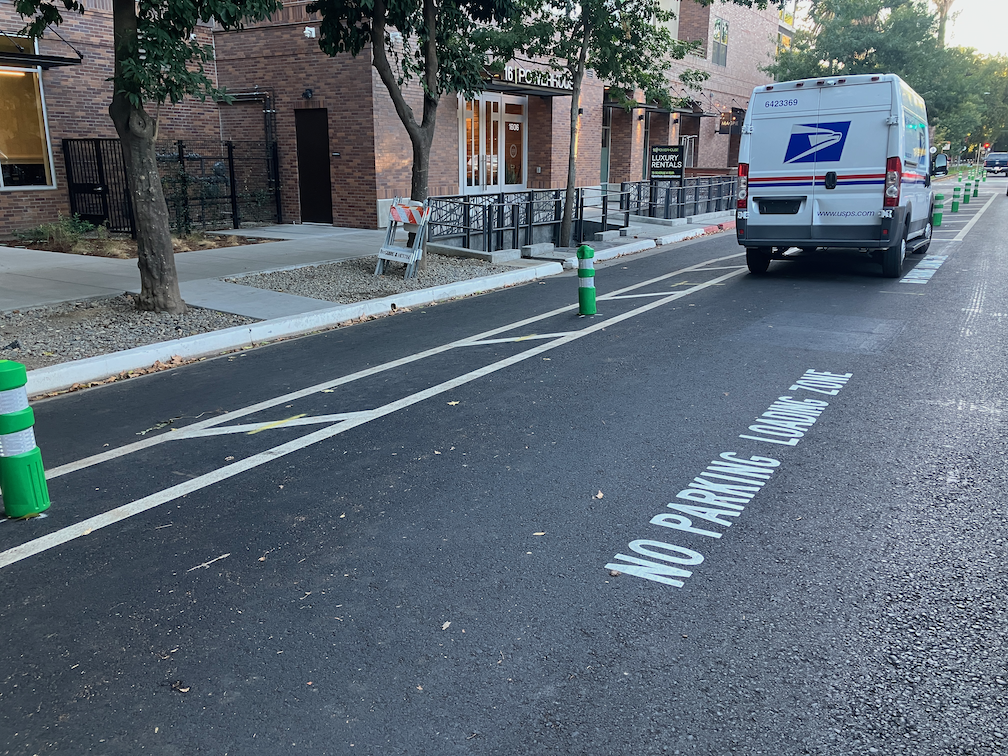
After being mostly neglected, curb designations for loading zones and short term parking have been installed in several places. The photo below shows the white curb with added pavement stencils for a loading zone on P Street approaching 16th Street. This is probably the location that was most being abused by both delivery drivers and private vehicle drivers, so this is good to see. White curb loading zones don’t have a designated time limit, and I have seen this location abused by private vehicle drivers, which should not be here at all since this designation is for commercial loading, but it is far better than before.
curb marking and pavement message for loading zone, P St
Lastly, there seems to be new activity on 5th Street, so that part of the project may be moving forward again. I’ll check it out and post.
I have not visited the south end of 19th Street, nor the south end of 21st Street, so I don’t know if those locations have been improved. Both were a mess. I’ll try to get there and report.
Work is occurring on I Street this week. The street has been marked from 21st Street to 12th Street, and some of the white striping has been completed. No green paint yet. This section is all right side of the street bikeways.
The design is rather erratic:
21st Street to 20th Street, parking protected separated bikeway
20th Street to 19th Street midblock, bike lane
19th Street midblock to 16th Street, buffered bike lane
16th Street to 13th Street, buffered bike lane
13th Street to 12th Street, parking protected separated bikeway
At the intersection of 21st Street and I Street, there are markings for dashed green bike lanes on the west, south, and east legs, adjacent to the crosswalks (not yet painted). No sign of the promised bike signal yet. The markings imply to me that bicyclists continuing north on 21st Street will have to make a two-stage crossing, first across 21st Street, and then across I Street. This is not what was advertised, which was that bicyclists would have an exclusive signal phase during which they could go to any of the three destinations without any moving motor vehicle traffic. To to seen.
21st St & I St intersection bike lane markings
At 20th Street, the street becomes three motor vehicle lanes (general purpose travel lanes) and a curb-side regular bike lane. I’m guessing this is to provide stacking area for motor vehicles when trains are crossing. Makes some sense, but it also makes the bikeway erratic, and will encourage poor behavior as drivers speed into the third lane, and then have to merge back into two lanes.
I St at 20th St, unprotected bike lane and three motor vehicle lanes
At 16th Street, the street design is two motor vehicle lanes and a buffered bike lane. The reason for this is that the Memorial Auditorium loading dock extends into the street, which was an earlier design mistake that the city made to choose auditorium convenience over people walking (Sac permanently closes sidewalk).
I St at 16th St, two vehicle lanes and buffered bike lane
12th Street is the end of the project, and I Street is again a three-lane traffic sewer towards the freeway. At 6th Street it becomes a five-lane traffic sewer.
Since work is actively going on today, I would guess that the white paint will be complete by the end of this week, and green paint added next week. There is still a national shortage of the green K-71 vertical delineators, so I would guess that only a few will be placed in the near future. There are a few places with gaps in the white stripes, which will be a designated color for parking or loading.
For quite some while, the project on 19th Street had stopped at Q Street, but it is now continuing south to W St. White striping is done, there is some green paint but incomplete, curb and line colors for special parking is not started, and there are no vertical delineators. The block from Q Street to the light rail tracks is a buffered bike lane, due to a street dining area at Midtown Spirits. At the tracks, there are some swooping lines, that I think are intended to encourage bicyclists to cross the tracks at a closer to perpendicular angle, but it is not finished so I can’t tell if it being properly marked. The remaining blocks to W Street are parking protection separated bikeway.
19th St at Q St, buffered bike lane
The section from W Street to Broadway has not been worked on. As is true of most of the separated bikeways, it is on the left side. South of Broadway, 19th Street becomes Freeport Blvd and is two way, with the southbound bike lane on the right side. At the moment, there is nothing to indicate how and where a bicyclist would transition from right side to left side. The two blocks are devoted to general purpose (motor vehicle) lanes, and is not a comfortable place for a bicyclist to be.
In the design diagrams, the transition appears to be at W Street, with no particular accommodation for bicyclists. Though the design diagrams do not indicate operations, just striping and signing, it looks as though bicyclists will cross W Street on the east side, with the regular signal, and then 19th Street on the south side, with the regular signal. There is no indication that the bicyclist crossing 19th Street will be protected from left turning motor vehicle traffic by an exclusive phase. Green paint is not sufficient communication for most drivers, hard physical control is required, such as no left turn during the bicyclist movement. I suspect, based on city implementation in other locations, that it was decided that an exclusive bicyclist phase was ‘not practical’ because it would slow motor vehicle drivers a bit.
19th Street from W Street to Broadway
I believe that the city should develop and install signing specifically for bicyclists on the transition points, where a bikeway either ends or transitions to the other side. There is no indication that the city has done or intends to do this. The diagram indicates a R55(CA) (MOD) sign on the southeast corner, which is a mystery, since the standard R55 sign is ‘yield to uphill traffic’. Of course neither the federal MUTCD nor the California CA-MUTCD, which is similar, has much in the way of guidance or signage for bicycle facilities, since in the mind of FHWA and Caltrans, bicyclists are an afterthought. There are several note references around this intersection, several of which I have been unable to locate in the design document, but they must exist somewhere. Be aware that the city has ‘invented’ a number of traffic control signs that are not compliant with CA-MUTCD, so the excuse that there isn’t an official sign is just stonewalling on the part of the city.
I Street
There has been no work on I Street in quite a while, since the resurfacing, but there are new ‘no parking’ signs posted with control starting today, 2023-09-19, so perhaps work is about to start again.
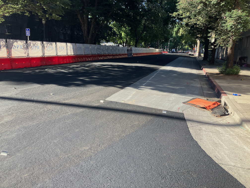
9th Street: 9th Street has a pavement overlay from L Street to Q Street. This is not repaving, removing old pavement and placing new, as has been done on many of the streets in the Central City Mobility Project, but a thin overlay. This was done very recently and there is no marking of any sort on the street. I had guessed that this section of 9th Street would not receive any treatment until the construction projects were complete, but I was wrong. I don’t know what kind of roadway allocation will be done in these five blocks. The left side is constrained by construction from L to Capitol Mall, and the right side from N Street to O Street and from P Street to Q Street. Note that in the photo below, there is a bus stop on the right hand side, which is why the city has designed the separated bikeway design on the left side.
9th St at L St, overlay and no markings
10th Street: 10th Street is largely complete from W Street to Q Street, where a pre-existing separated bikeway continues north, but a few things are left unfinished and not all of the green vertical delineators have been installed. The block from Broadway to X Street has been marked. It does not appear that anything will be done with the block from X Street to W Street, under the freeway.
10th Street from Broadway to X St, new markings for separated bikeway
I Street: Nothing has been done on I Street since the pavement patching. There are lane marker tabs for three general purpose lanes and no bicycle facilities.
19th Street: Work south of Q Street is now underway, with repaving complete and the beginnings or markings for the left side separated bikeway. I have not ridden south on 19th to see what is being done beyond this point.
19th St at Q St, initial markings for separated bikeway
There is no change to the ‘turn wedges of death‘. The bicycle signal at 21st Street and I Street has not been installed. No further work is in evidence on 5th Street.
I have been backpacking and traveling, so not keeping up as much with the Central City Mobility Project. I may do updates on my days back in town, about once a week.
19th St: Paint and vertical delineators are mostly complete from H St to W St. Nothing has happened in the two blocks from W St to Broadway. Though pavement has been patched from Q St to W St, no other work has occurred.
21st St: Paint and vertical delineators are complete from W St to I St. No bicycle signal at I St, so the intersection of 21st St and I St remains extremely hazardous to bicyclists (and walkers).
P St: Paint and vertical delineators are complete from 21st St to 15th St.
Q St: Paint is mostly complete from 14th St to 21st St. Vertical delineators have been installed on some blocks but not others, probably due to materials shortages. Some crosswalks are missing.
10th St: Paint is mostly complete from W St to Q St (Q St to I St was already ‘complete’ before this project). No vertical delineators yet. The block from Broadway to X St has a traditional bike lane on the right, but no changes. The block from X St to W St, under the freeway, has a wide right side shoulder, but it is not a bike lane, nor is it marked as such. The parking-protected separated bikeway on 10th St is on the right side, because 10th St does not have bus service to be accommodated by a left-side bikeway.
9th St: Other than some patching, nothing has happened on 9th St. The new bikeway from L St to Q St will be on the left side. A construction project from L St to Capitol Ave closes the left side bike lane, and there is no accommodation for bicyclists. Though there is a bus area on the right, followed by a parking lane, it is not marked as a bike lane, nor is it safe as a bike lane. There is no signed on 9th St approaching L St to indicate that the bikeway ends, nor how to ride south. See photo below.
9th St at L St, no bicycle accommodation
Another construction project from O St to P St closes the right side of the roadway, but the existing bike lane on the left hand side is still open. As previously noted, it is unlikely that the bikeway on 9th St will be installed until both construction projects are complete.
I St: Other than pavement patches, no other work has taken place. No-parking signs continue to be up even though no active work is occurring. Most blocks from 21st St to 12th St will be reduced from three general purpose travel lanes to two, but from 20th St to 19th St, and part way to 18th St, the three lanes will be retained. It is not clear why.
5th St: No further work has occurred.
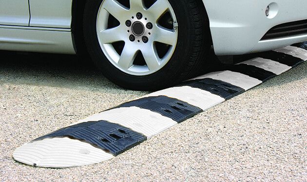
Nothing has changed about the ‘turn wedges of death‘. A closer look at the design diagrams (thanks to the person who provided them) shows that the wedges at intersections of the separated bikeways are intended to have hard curbs, 4 inches with sloped sides (regular curbs are six inches or more) with stamped concrete interiors (style 3), but the other intersections will have ‘rubber speed bumps’, and vertical delineators. The bumps are apparently as shown in the photo below, though the photo shows a bump in the travel lane, and these are in the turn wedges. The bumps are 2.25 inches high, which won’t be even noticed by trucks and SUVs, though might be noticed and respected by passenger car drivers.
I was in Seattle in May, for Northwest Folklife, and am back again at the moment, reminded that I had not posted about transformations happening in Seattle. Seattle is, on the whole, a very traffic-y city with sparse bike facilities, but what is interesting is what they are doing with re-allocating roadway space to better use than motor vehicles. Bus lanes, wider sidewalks, protected bikeways, removal of parking. It is inspirational.
I have not been able to pin down whether it is official policy, but I can say for certain that the city is no longer installing paint-only door-zone bike lanes. Anywhere. All of the bike facilities are separated, some by car parking, some with planters, some with substantial vertical delineators. Almost all the new ones are either at roadway level and protected by hard curbs, or raised to sidewalk level and therefore separated from the roadway by curb and buffer strip.
Nothing has changed on 21st Street since the last post.
On 19th Street, some of the striping has been completed as far south at P Street. This is only white, long-line striping, none of the details have been painted. While riding 19th Street today, I was very nearly hit by a driver at O Street. The long-lines lead drivers to think that they have full width right of way, and to not expect bike riders to be coming out to pass the curb extensions at O Street. As I have said all along, I question putting extensions in locations with separated bikeways. It may be less dangerous once the detailed striping and green paint are installed, but it won’t be as safe as it could be if the city had simply not installed extensions on the east side of the 19th Street and O Street intersection.
A friend pointed out that the separated bikeway on 19th Street southbound is more than half in the gutter pan, and that the gutter pan is deteriorated in many locations. Therefore the effective width of the separated bikeway is not six feet, but about two feet. Smooth sailing for drivers, not for bicyclists!
19th St separated bikeway in the gutter pan
As is true of every street that has been repaved, or patched, so far, the lane tabs have indicated that the general purpose lanes are very wide, and there are no bike lanes. Bike riders are now exposed to higher speed traffic (because of the very wide lanes), with not even the slight protection of paint. Though this might be the fault of the project contractor, I doubt it. If the city had told the contractor to keep temporary bike lanes, they would have. I’m almost certain that the city did not say anything about accommodations for bicyclists to the contractor. The city is endangering bicyclists during this construction project, on purpose and with full knowledge. If someone is hurt or killed here, it will be on the city, and I hope they get sued for millions. The city philosophy, overall, for this project and every other construction project on streets and sidewalks, is that bicyclists and walkers don’t matter.
The city has claimed that they are now, finally, working on a construction accommodation policy. I suspect that it will come out very weak, because Public Works still believes strongly in cars-first. Traffic flow and ease for drivers controls all their decisions.
P Street has been repaved, but does not have any marking yet. Q Street has been patched, though I can’t tell if there is more to be done. A reader pointed out that there is some active work on 10th Street, but I haven’t gotten there yet.
A friend mentioned that traffic was a disaster when the city closed Q Street and 15th Street, with traffic backed up for many blocks. Though I did not observe this, I’ve had reports now from many people that the detour signage for this project does not provide drivers (or bicyclists) with any information about which way to go (the detour signs, I have observed, frequently point two directions, and the signage along the detours is incomplete. This could, possibly, be the fault of the contractor, but if the city was not out inspecting the detours and getting them corrected, the city was also failing. I have talked to a number of people on the street for whom this project has left a bad taste in their mouth. They have seen that the city has done a poor job of communicating with drivers, bicyclists and walkers, and there is a lot of doubt being expressed about whether the separated bikeways will actually be safer.
Lastly, I will note that there was no public outreach on this project. There are no plans available to the public. I am sure if there had been outreach, some of the design details would be different, some of the flaws would have been caught, communication would have been continuous and effective, and construction signing would have been done correctly. This was an internal Public Works project, and it was not done well.
On Wednesday afternoon, the sign below was on 21st Street approaching I Street. The sign was not there on Tuesday morning. If a bicycle signal was intended at this intersection in the design, why was it not signed earlier? Why wasn’t the signal already installed, since there was signal communications infrastructure installed at this intersection several weeks ago? Or was this a design oversight that the city decided to fix after being called out on it? And when is ‘coming soon’?
21st St at I St, sign for future bicycle signal
I observed bicyclist behavior at this location for a while on Tuesday. Every single bicyclist who was headed north on 21st Street crossed against the red light, so as to not be hit by left turning drivers who generally do not yield to anyone in the crosswalk, and then onto the sidewalk on the west side of the street, continuing through the area at Old Soul Weatherstone which is congested with tables and walkers. So the city has trained bicyclist to ride on the sidewalk. Those who have been so trained will be likely to continue sidewalk riding even after installation of the signal. Ouch!
Useless Turn Wedges
I have ridden 21st Street a number of times, to see how the project is progressing and to see how drivers are responding to the new layout. Most drivers are parking correctly in the parking that provides parking-protection for the bikeway, but a few continue to park against the curb. I’ve reported these to 311 for parking enforcement, but of course as always, parking enforcement reports that the vehicle is no longer there, whether it is or not.
Several times in a row drivers have turned across my path at high speed, left from 21st Street to L Street, over the green paint and the white turn wedge paint. At the times of day I was there, there were few to no parked cars, so I was clearly visible to the drivers, not in any way hidden. In both cases I had to slam on my brakes to avoid being hit by the drivers. They did not slow. The turn wedge diagram provided on the Central City Mobility Project page, shown below, clearly shows bumps and posts (vertical delineators) in the wedge. Without more detail, I can’t say whether these will actually affect driver behavior, but in general only hard curbs or real bollards (steel or concrete) actually affect driver behavior. In the meanwhile, drivers are being trained to turn across bicyclists, with impunity, and will not likely change their behavior when and if something is installed in the turn wedges.
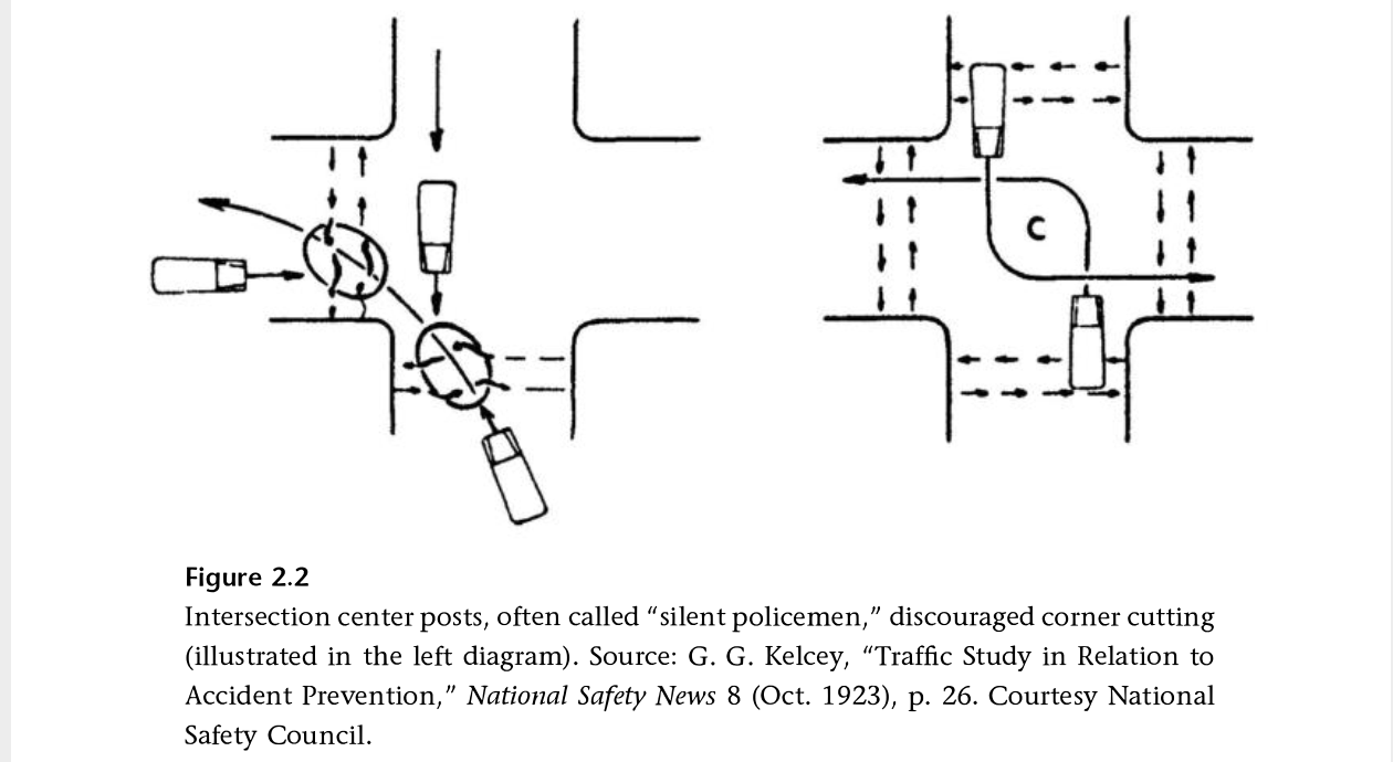
I have been reading Fighting Traffic by Peter Norton, and in Chapter 2 he introduces the concept of the outside left turn, which worked to prevent drivers from cutting the corner on left turns, and was later enforced with ‘silent policemen’, hard structures that provided serious consequences for drivers who insisted on cutting corners. Later, when motor vehicles were given dominance on the roadway, these were removed. It is time to bring these back!
Other
Striping and green paint is very nearly complete on 21st Street. 19th Street has been repaved and preliminary marking installed (the dashed white lines). P Street was just stripped for new pavement (I’m not sure what this process is called, removing 2 to 3 inches of old pavement so that new pavement can be laid), and is being repaved today (Thursday). Q Street has been patched but not stripped. I’m not noticing any active work on I Street, 5th Street, 9th Street, or 10th Street, though I Street has had ‘no parking’ signs up for some while.
The repaving is being done to the full width of the roadway, including the parking lane. This is a waste of materials and money. The parking lane does not need to be repaved, except in a few circumstances where it has been damaged. Nor does it need to be paved to the same standards as the general purpose travel lanes, which receive far more traffic and wear and tear. But the city loves pavement, and loves to add on unnecessary work to projects, ensuring that less is left for actual improvements to the street that would help walkers and bicyclists.
The separated bikeway (protected bike lane) and repaving is mostly complete on 21st Street in Sacramento, part of the Central City Mobility Project. Almost all the white striping and green paint is complete. No vertical delineators (soft hit posts) yet. When I rode the street a few days ago, most vehicles were parked in the correct location in the parking spaces separated from the curb. There are two blocks where the bikeway is adjacent to the travel lane, and parking adjacent to the curb, between T Street and S Street, and between N Street and Capitol Ave. There is no obvious reason for this.
The beginning of the left side separated bikeway at W Street is marked oddly, see photo below. The arrow in the green turn box would imply that one should immediately turn onto 21st Street, when it should indicate to cross 21st Street the the bikeway on the other side. The shadow shows the correct move.
21st Street at W Street, green turn box with incorrect arrow
The ‘turn wedges’ noted in a an update post are is far only white paint, nothing that would prevent a driver from cutting the corner across the bikeway area. In fact, I observed several drivers doing just that.
21st St at T St turn wedge
The big concern is where the separated bikeway approaches I Street. The bikeway is on the left. Travel lanes are in the middle, one left turn only and one combined left turn-through-right turn. I Street becomes one-way westbound at this point, is two-way to the east, and 21st Street is two-way. Before repaving, the left side bike lane had a left turn arrow. The right side bike lane that was there before repaving is not there now, and it isn’t clear that there is intended to be. There is no warning that the separated bikeway ends at I Street, and no bike facility for transitioning to the right side to continue north on 21st St. This would be a good location for a bicycle signal to allow bicyclists to continue through the intersection on a bicyclist-only phase.