SacRT service changes

Sacramento Regional Transit (SacRT) has proposed service changes, primarily elimination of routes, most of which would go into effect January 2017, with a few before that and more after than. The proposal is available (summary chart after the jump), and a more detailed analysis is in the Board of Directors agenda (Item 13) for the May 23 meeting. At the May 23 board meeting, the service changes will be an informational item, not a decision. Five open houses on the service changes were scheduled, two of which have occurred, with three yet to go. I attended the open house at SacRT headquarters on May 17.

I was asked for my thoughts on the service changes. Below is a bullet summary, followed by the nerdy details.

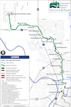
  • SacRT should make the boardings dot map available to the public. It is the best information I’ve seen to indicate which routes are productive, and which not, more understandable to the public than the tables of numbers in the proposal. Additionally, all maps showing routes, including of course the system map, should have an indication of the service frequency, either by color or weight. The “all routes looking the same” maps that SacRT currently uses do not communicate this critical piece of information.
  • A portion of savings from elimination or combination of routes should be reinvested in other routes which could be moved from acceptable productivity to higher productivity with frequency, service hours, or routing improvements.
  • Reductions in frequency are counter-productive, usually making a route with challenges into a failing route, which will then be identified in a future round of service changes for elimination.
  • Routes serving low density residential and semi-rural areas should be cut before routes serving moderate to high density residential areas.
  • Combining routes for more efficient coverage, particularly where routes overlap or are very closely parallel, is a good idea.
  • Saturday service should be retained on all routes. Transit-dependent riders who work the usual weekday work week must have service on at last one weekend day so that they can grocery shop, visit friends and family with less mobility, and seek medical care.
  • Routes should not be eliminated for at least two years after creation or significant revision. Time is needed to see ridership trends once people in a community adjust to the service. Specifically, this means: do not eliminate Route 65 Franklin South.
  • The concept that routes should focus on light rail connections rather than radial routes to downtown, or point-to-point routes, should be considered in all route decisions.
  • SacRT should do a complete system re-visioning within the next four years. A series of cuts, and even transit renewal, has left a system that is inefficient and probably unjust. It should be redesigned from scratch.

Read More »

RideSacRT app

RideSacRTI have been using the RideSacRT app for a bit of time, and have some initial impressions.

When I started, I could not get the app to accept credit cards, which is the only way to pay for tickets. It rejected three different cards (two credit and one debit). I asked about that via Twitter, and SacRT responded that they were aware of problems with some credit cards. After a couple of days, I tried again, and my main card was accepted.

It is fairly easy to purchase tickets. Tap on the the “buy tickets” icon on the lower left, select the length (single or daily pass) and type (basic or discount), and the quantity, and then “add to cart.” Then select select your card, or enter your card if you have not used it before, and then “pay now” and “purchase.” You can then use your ticket immediately, or later by selecting “ticket manager” from the pull-up menu in the lower right corner.

RideSacRT-TicketWalletThe ticket, once selected for use, lasts for 90 minutes and is good on buses and light rail.

William Burg and others have been discussing whether this 90 minute window offered to smart phone users is fair to people who pay cash, and only get one ride. If there were ticket machines available everywhere, it might be reasonable to require that someone pre-purchase a ticket of some sort, but there are not machines everywhere. People paying cash do slow down boarding of buses, often fumbling for the right change and search for money in various places. This is significant because dwell time, the amount of time a bus spends stopped, the largest determinant of how efficient the route is. This is why transit agencies are experimenting with smart phone apps and transit cards like the Connected Card, coming to SacRT some time this century. I’m not sure how I feel about the equity issue.

The app cannot purchase or store passes. The app is a six month pilot, so it is possible that other capabilities will be added during or at the end of the pilot.

The app also offers routing. It opens with a display of a Google Maps centered on the current location, and start/end fields at the top. But the search routine is seriously flawed. It cannot find street intersections. For example, a search for Folsom and 65th St came up with a location far south on 65th St. It cannot find transit stops unless you know and can enter the exact name of the stop. For example, a search for 65th St Station produces nothing, since the actual name of that station University/65th St. If you type a partial match, a list of suggestions is provided, but that list cannot be scrolled, it pops back to the first two on the list and anything further down (which is likely since the matching is so poor) cannot be selected. For example, type “65th” and see what happens. The app is perfectly happy to match partial names to places completely outside the SacRT service area. For example, Berkeley.

So, my first take is that the ticket purchase is worthwhile, but the routing function is worthless.

Note: I’ve not offered a screenshot of an active ticket because I’m not in Sacramento at the moment, and it would waste a ticket to use one.


SacRT issues and solutions

Another list of ideas for improving SacRT. This was developed as part of my work with 350Sac Transportation Committee, but again, the ideas are mine and not the committee’s.

SacRT issues

  • funding
    • SacRT is the most poorly funded transit system of its size in California; the limited amount provided by Sacramento Measure A (through the Sacramento Transportation Authority) is insufficient to operate a transit system
    • dependence on federal funds from most system enhancements and extensions means that the system has not kept up with either population growth or increased demand
  • leadership
    • the board, composed of only elected officials, provides poor oversight and leadership
    • management is weak, unwilling to explore innovative solutions and accepting of current limitations as permanent
  • light rail
    • has a poor reputation among many commuters
    • no evening service to Folsom
    • no service to American River College
    • high-floor rail cars are inaccessible to many people
  • bus network
    • buses are too infrequent to provide effective service, with no routes meeting the definition of high frequency and only four routes meeting the definition of medium frequency
    • routes deviate into neighborhoods in an attempt to maximize coverage, but the result is a loss of functionality and timeliness
  • land use
    • SacRT is ineffective in large part becuase land use decisions have resulted in an urban/suburban/exurban pattern that cannot effectively be served by a transit system
    • SacRT has little to no input into land use decisions
  • fare card system (ConnectCard)
    • the fare card system has been delayed for more than a year
    • there is no evidence that the fare card system will address equity issues such as low-income users without bank accounts and credit cards being able to purchase cards and passes
  • bike parking
    • the lack of secure bike parking at light rail stations and major bus stops reduces transit use and usability
    • SacRT has refused to provide on-demand bike lockers at stations, though Folsom has provided them at stations within the city

SacRT solutions

Read More »

linking the colleges?

I attended the Blue Line extension to Cosumnes River College (CRC) Grand Opening this morning at Meadowview station and then at CRC station. It was a lot of fun. There were more politicians in one place that I think I’ve seen, and they were justifiably proud of their part in supporting this extension, some having worked on it for years. [Photos on Flickr]

A number of speakers talked about linking the colleges, in this case Sacramento City College and Cosumnes River College. An increasing number of students apparently take classes at more than one campus in order to get the ones they need, so this extension is expected to help them, whether they don’t have a car or just choose to get around in a more convenient and more responsible way. Folsom Lake College’s Rancho Cordova Center is very close to the Mather/Mills light rail station. The Cosumnes River College’s Elk Grove Center will be on light rail if the Blue Line is extended to Elk Grove (Blue Line Phase 3). American River College’s Natomas Center will be on light rail if the Green Line is extended to Natomas. All of these connections are great, for students and for the community.

Unfortunately, American River College’s (ARC) main campus in North Highlands was barely mentioned. Brian King, Chancellor of Los Rios Community College District, said that ARC was served by a robust bus system. Unfortunately, that is not true. ARC is served by Route 1 (Greenback) on a 15 minutes frequency, and Route 82 (Howe-65th) on a 30 minute frequency, which is hardly robust service. Route 82 only runs until 9:30PM, missing students with later classes or who are staying to study, and who need to make connections to other buses or light rail to get back home.

Read More »

transit frequency in Houston and Sacramento

Houston has been in the news recently, and will certainly be today, opening day, for their revised transit system which created a network of high frequency (service every 15 minutes or better, 15 hours a day, 7 days a week) transit lines. The map below left shows this new system, only, and clicking goes to the high resolution image on the Houston METRO website. The map below right shows the entire system, with lines that don’t meet the high frequency definition. The system was redesigned with the help of Jarrett Walker, transit consultant and author of Human Transit, which I posted on yesterday and will be posting a lot more in the near future.

Houston METRO Frequent Network

Houston METRO System

So, what’s the story in Sacramento?

Read More »

SacRT light rail extensions

SacRT is considering a number of extensions to the light rail system, beyond the opening of the Blue Line extension from Meadowview station to Cosumnes River College, which will occur August 24.

These are:

  1. lpa_mapGreen Line to the Airport, also known as DNA (Downtown, Natomas, Airport). This project is likely in two phases, first from the current end at Richards Blvd to somewhere in North Natomas, and second the rest of the way to the airport. Information on this project is on the SacRT website. This project is furthest along, and the draft EIS/EIR is now being prepared. The map of the “locally preferred alternative” is at right, and this links to the larger map on the SacRT website.
  2. Blue Line to Elk Grove. This project has been talked about, particularly as the line to CRC has approached completion and generated discussions of whether or not Elk Grove residents will be willing to change from bus to light rail at CRC. So far as I know, there are no publicly available documents on this extension, but it is included in the 2009 Transit Action Plan updated Scenario C (below).
  3. Blue Line Northeast Corridor. This project would extend the line to the northeast, to American River College, Citrus Heights, or Roseville. Though this project was part of the original vision of the light rail line when constructed back in the 1970s, it has not received much notice while I’ve been in Sacramento. So far as I know, there are no publicly available documents on this extension, but it is included in the 2009 Transit Action Plan updated Scenario C (below).

SacRT_TransitActionPlan-ScenarioC

Each of these extensions are worth exploring in detail, but for now I’m posting because I have two ideas I want to share.

Read More »

SacRT issues and posts

A summary of SacRT issues and my blog posts (even more):

And issues on my list to blog about:

  • failure of the streetcar
  • more about light rail extensions
  • much more about bus rapid transit
  • funding (other options)
  • system map and frequency
  • equity
  • serving density
  • more about station amenities (signing, lighting, cleanliness, Watt elevator)
  • delay in ConnectCard implementation
  • need for a SacRT blog
  • transparency in the ad-hoc System Improvement process

Sacramento has stalled

Jim Brown wrote recently in the Sacramento Bee about underfunding for the city’s contractor to develop a new bike plan, and the plateauing of progress on bike mode share in the city. Please read! However, the issues go well beyond bicycling. Sacramento has stalled, period. We are no longer making forward progress towards livability.

There are three additional major issues, as I see them:

  1. Our public transportation system (SacRT) is woefully underfunded, and despite a lot of discussions recently about how to improve the system, not one of our political leaders seems to have the courage to state the obvious, that we cannot have a successful and efficient system unless we devote more tax revenue to it. Putting bandaids on the system will not make a significant difference. Sacramento needs to fund SacRT at a level comparable to other cities of our size, which means tripling our tax base.
  2. Sacramento is not becoming more pedestrian friendly, in fact it seems to me to be becoming less so. There is an almost universal failure among drivers to recognize the rights of pedestrians to cross the roadway (CVC 21950). I find that almost no drivers yield to me when I am walking. Apparently the Sacramento Police Department accepts this situation, because so far as I know they make no effort to enforce the law. I have never seen someone pulled over for failing to yield to a pedestrian, and in fact I’ve had several SacPD officers fail to yield to me. Pedestrians, not bicyclists, are the indicator species for our city, and until we treat people walking as the highest form of transportation, we will never be anything but a sad city. [As an addendum to this, Chris Morfas reminded me that the conversion of one-ways streets to two-way streets has also stalled. The city made a decision to start these conversions years ago, and then lost courage. Nothing has happened on this critical change in years.]
  3. The city is going to focus much of its attention on Natomas, now that the building moratorium has been removed. I think that no effort and no money should be spent there until the city develops a new vision for Natomas. The sprawl suburbs are a dead end, and we should not be spending any money on them until we have a plan for how to make them financial viable and livable. Meanwhile, the two truly needy parts of the city, South Sacramento and North Sacramento/South Natomas, are neglected. These are the areas where the most people are walking, bicycling, and using public transit, but yet the city continues to throw money at the “rich” areas that it hopes will provide sales tax and property tax revenue to save the city from its debt problem. The fact is, however, that it always costs more in infrastructure to support new developments than they ever generate in sales and property taxes. It is the small businesses in South and North Sacramento that actually support this city.

There is also much to celebrate in Sacramento. I live in midtown, and I am so impressed with the new development happening, with the richness of opportunity here, and even impressed with the improvements to bicycle facilities that have happened. But most of this is driven by economics, and will happen with or without the help of the city. What won’t happen without the help of the city is livability in South and North Sacramento. Indeed, to say something controversial, I think the city needs to pay way less attention to downtown/midtown, and much more to the neglected areas north and south. I am not saying that every area of the city can be saved – we will have to prioritize and triage – but to keep acting as though downtown/midtown are the whole of Sacramento indicates a complete lack of leadership on the part of the city council.

SacRT gets grant for light rail car refurbishment

In the recently announced round of grants under the CalSTA Transit and Intercity Rail Capital Program, SacRT received funding to refurbish the remainder of light rail vehicles from San Jose. The money is from the Greenhouse Gas Reduction Fund using proceeds from the state’s cap-and-trade auctions. The statewide total was $224M.

7. Sacramento Regional Transit District (RT) – Refurbishment of Seven Light Rail Vehicles
Award: $6,427,000
Refurbishment of the last 7 of 21 vehicles acquired from Santa Clara Valley Transportation Authority in order to support 15 min peak hour service frequencies throughout the RT light rail system and enable future limited stop service on the RT Gold and Blue Lines during the next 15 years. The project will result in increased ridership, eliminate impacts from the overhaul program needed on the rest of RT’s fleet, and connect residents in disadvantaged communities to jobs. Improved service on the system also increases the attractiveness of connectivity to Amtrak services and future High Speed Rail service at the Sacramento Intermodal Facility.

walking the streetcar route

K Street pedestrian plaza between 11th and 12th

Today I walked the route of the proposed Sacramento Riverfront Streetcar. No, this is not part of the argument about whether pedestrians or streetcars are faster, going around the Internet recently, but I just wanted to see it all from a walking viewpoint, not on my bicycle. There is a map of the probable route on the website above, though oddly it leaves out some streets.

I picked up the route at L and 16th, just two blocks from my home, and headed west between Capitol Park and the brutalist Community Center Theater. The route turns north on 13th Street and apparently goes through the pedestrian plaza over to 12th where is would then use the SacRT light rail tracks (light rail would be routed to the north along H Street). The further west on K Street, the more depressing things are, with most buildings not only empty but abandoned. But, this is part of the reason for the streetcar, to support the economic redevelopment of this area. At 6th it heads north along the existing light rail tracks to H, and then west to Sacramento Valley Station (Amtrak).

Read More »