Streets should be designed from the outside in. They have traditionally and still are designed from the inside out, which means first deciding how much motor vehicle traffic to allow or encourage, and at what speed, then working outward to parking, transit, bike facilities, and sidewalks. This approach has given us the transportation system we have, which is rapidly changing the climate while not meeting the needs of most citizens.
If we plan outside in, we can have a better design, in every way. I don’t mean starting with the sidewalk, I mean starting with the land use. What land use is already there, or do we know will be there in 10-30 years, or most importantly, do we want to be there? What types of livable, economically vibrant places do we want? Then, and only then, what sort of design do we want to accommodate walkers (and rollers) who will access those land uses? What trees do we need to shade and shelter those walkers (and reduce utility bills for the buildings), and what other sidewalk-related amenities do we need for those walkers, and that land use? Benches, bioswales, dining, bike and scooter parking? What sort of bicycle facilities do we need to allow people using bicycles, bike-share, scooter-share, etc. to access that land use? What sort of transit facilities such as bus stops and dedicated transit lanes (bus or rail) do we need to serve those land uses? And lastly, what sort of motor vehicle facilities do we need? Do we need parking? What number and width and direction of general purpose travel lanes do we need? There may be some space left over for motor vehicles, once all the other needs have been met.
You might think I am being facetious, that motor vehicles should be accommodated in left over space. But I am serious. In most cases we don’t need motor vehicles on many streets. We think we do because we have designed streets that way, and encouraged people to think that way, that cars are the main mode of transportation. But there are examples of streets all over the world, and even a few in the US, that don’t allow motor vehicles at all, or if so, under very controlled circumstances. These include car-free or car-light boulevards, all the way down to woornefs, where motor vehicles are guest subservient to all other uses.
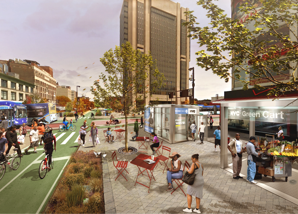
A Google search for ‘photos boulevards without cars’ interestingly produces hundreds of photos of streets with cars, and cars on streets, and mostly, car crashes. But Wikipedia has photos of woonerf, and Google did find one photo of a proposed street redesign for NYC produced by PAU architecture practice.