For other posts on the H Street Bikeway project, see category: H Street Bikeway. For the city webpage on the project, see H Street Bikeway to Sacramento Valley Station.
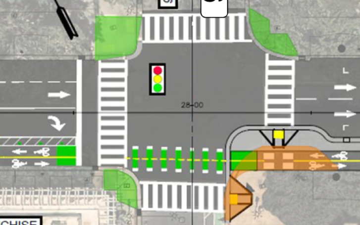
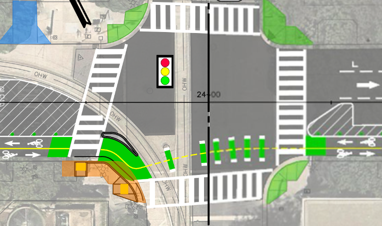
In designing a safe and welcoming two-way bikeway (cycletrack), design of intersections is critical. This post highlights the intersection. Both the staff report and presentation diagrams split the roadway at the intersections, obscuring the intersections themselves. The diagrams below show the intersections, and not the blocks in between the intersections. The diagrams are from the presentation, which offer more details about the intersections than the staff report. The images are rough because I glued together two parts which were not the same pixel resolution, but they provide a good idea of the intersections.
Key points:
- bicycle signal faces are required at every intersection from 5th Street to 9th Street, but are indicated only at 5th Street and 6th Street
- protecting bicyclists is particular critical at 7th Street and 9th Street to guard against right turning drivers heading southbound onto these one-way streets
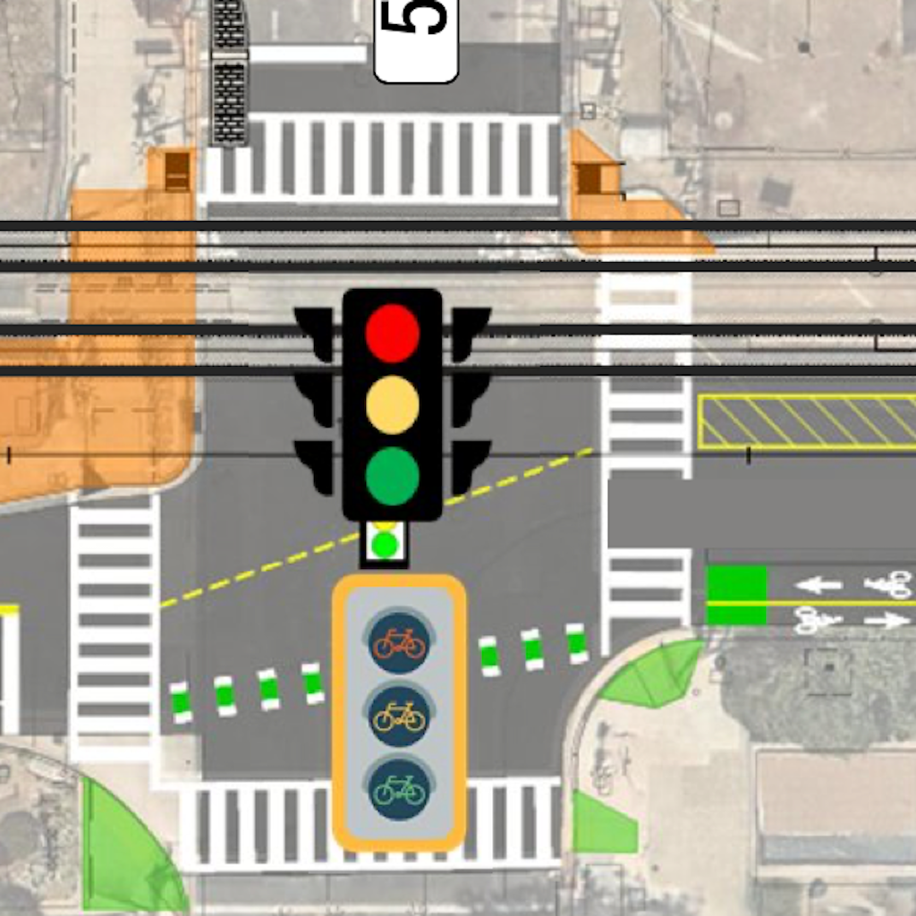
5th Street: This intersection has a bicycle signal face for the two-way bikeway. The transition from the bikeway to Sacramento Valley Station looks awkward, and will be until the station itself is revised, which is also part of the TIRCP grant project.
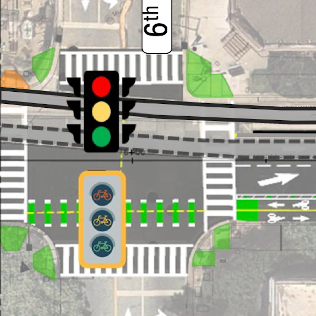
6th Street: This intersection has a bicycle signal face for the two-way bikeway.
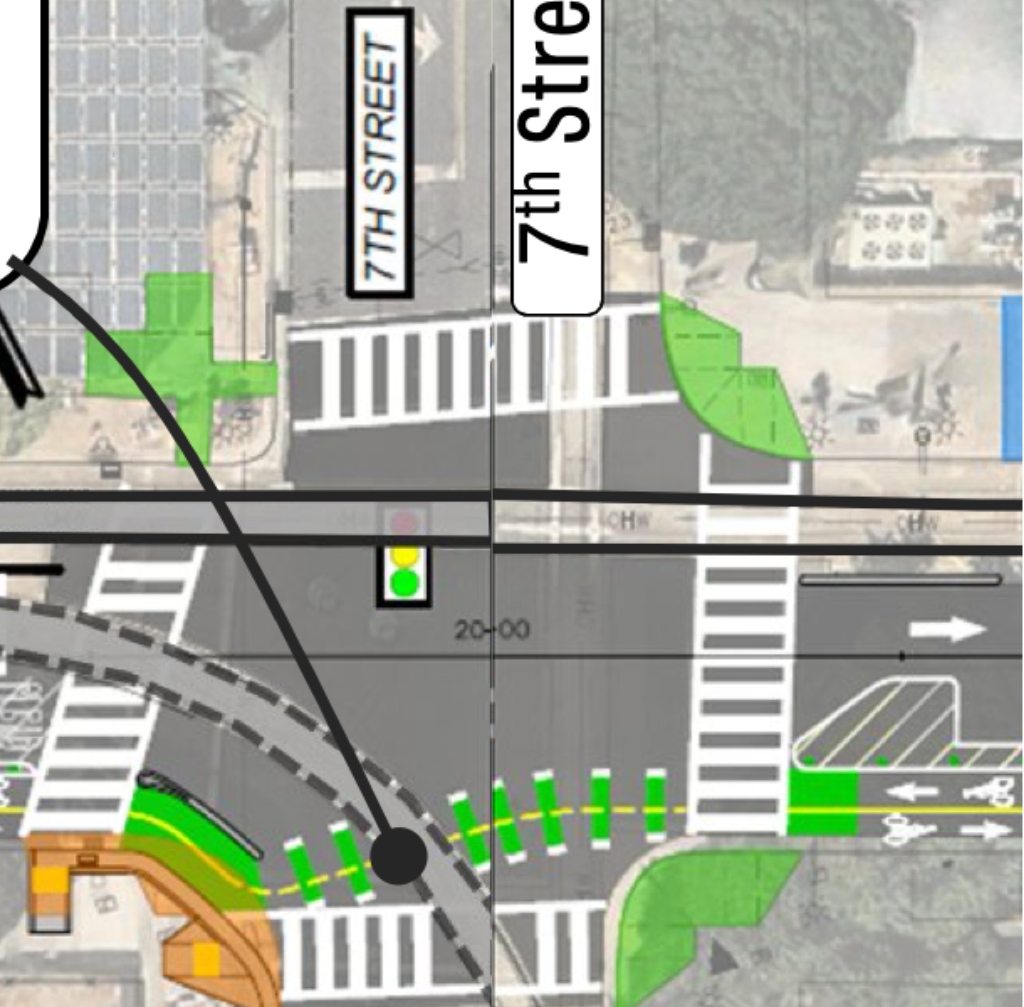
7th Street: This intersection does not have a bicycle signal face. It is particularly required here to protect bicyclist against drivers turning right onto 7th Street. No turn on red signing would not protect bicyclists on the two-way bikeway. 7th Street is one-way southbound south of H Street, and two-way north of H Street.
8th Street: This intersection does not have a bicycle signal face. 8th Street is one-way northbound.
9th Street: This intersection does not have a bicycle signal face. It is particularly required here to protect bicyclist against drivers turning right onto 9th Street. No turn on red signing would not protect bicyclists on the two-way bikeway. 9th Street is one-way southbound to the south of H Street, but two-way to the north of H Street.