I’ve listened to the podcast, and am intrigued. Though I need to read the document (which you can download by registering on the Happy City website) and reflect on it, I’m having the feeling that it may change my ideas about street design. Though I’ve criticized the functional classification system, I may have bought into the concept in my alternative suggestions for street design (tag: street design standards). I have also criticized Complete Streets as neglecting frequent and safe crossings, but maybe the whole complete streets concept is amiss (‘complete streets’ or sidewalks? and (in)complete streets). At least I have fought against the idea that is unfortunately prevalent in bicycle advocacy that every road needs bicycle facilities.
The Franklin Blvd complete streets project is… complete, with a ribbon cutting that occurred on Tuesday morning. This is a project that I have not been paying attention to, but I visited it to see what it is like. It spans Sutterville Road on the north to Fruitridge Road on the south, with the part south of Fruitridge to the county line not constructed. It is about 1.1 miles. Franklin Blvd runs from Broadway 25 miles to well south of Elk Grove, including the crossroads of Franklin, for which it was named. This section of Franklin is largely commercial, with small remnants of residential. The section north of here, to Broadway, is largely residential with some commercial, and is a much slower and calmer street.
The only publicly available document is the initial October 2019 plan. This plan included three similar but not same options. No information is available on what was actually built.
Though this project is complete, an analysis of what worked and what didn’t could help improve future complete streets projects that the city might undertake.
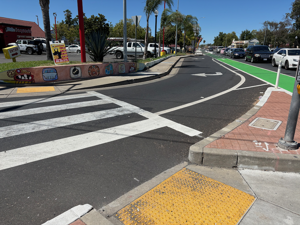
Bikeway: A separated bikeway was created along the corridor. It is protected by concrete curbs or medians for about half of its length, but some paint only sections remain, and the bikeway is interrupted by frequent driveways. Still, it was fairly well done. The initial diagrams show protected intersections with high quality bicycle facilities, but the actual construction at intersections is only slightly protected. OK.
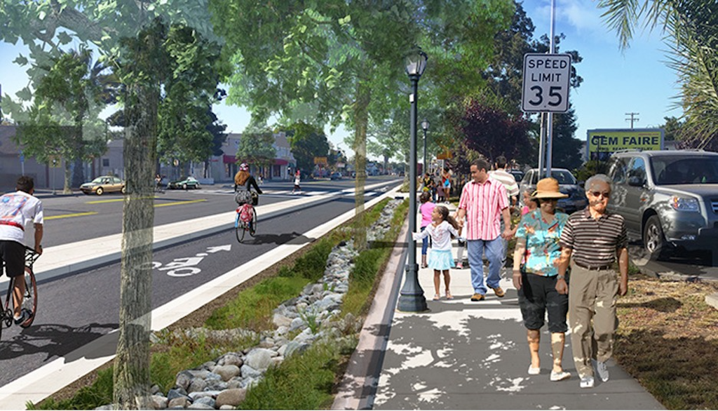
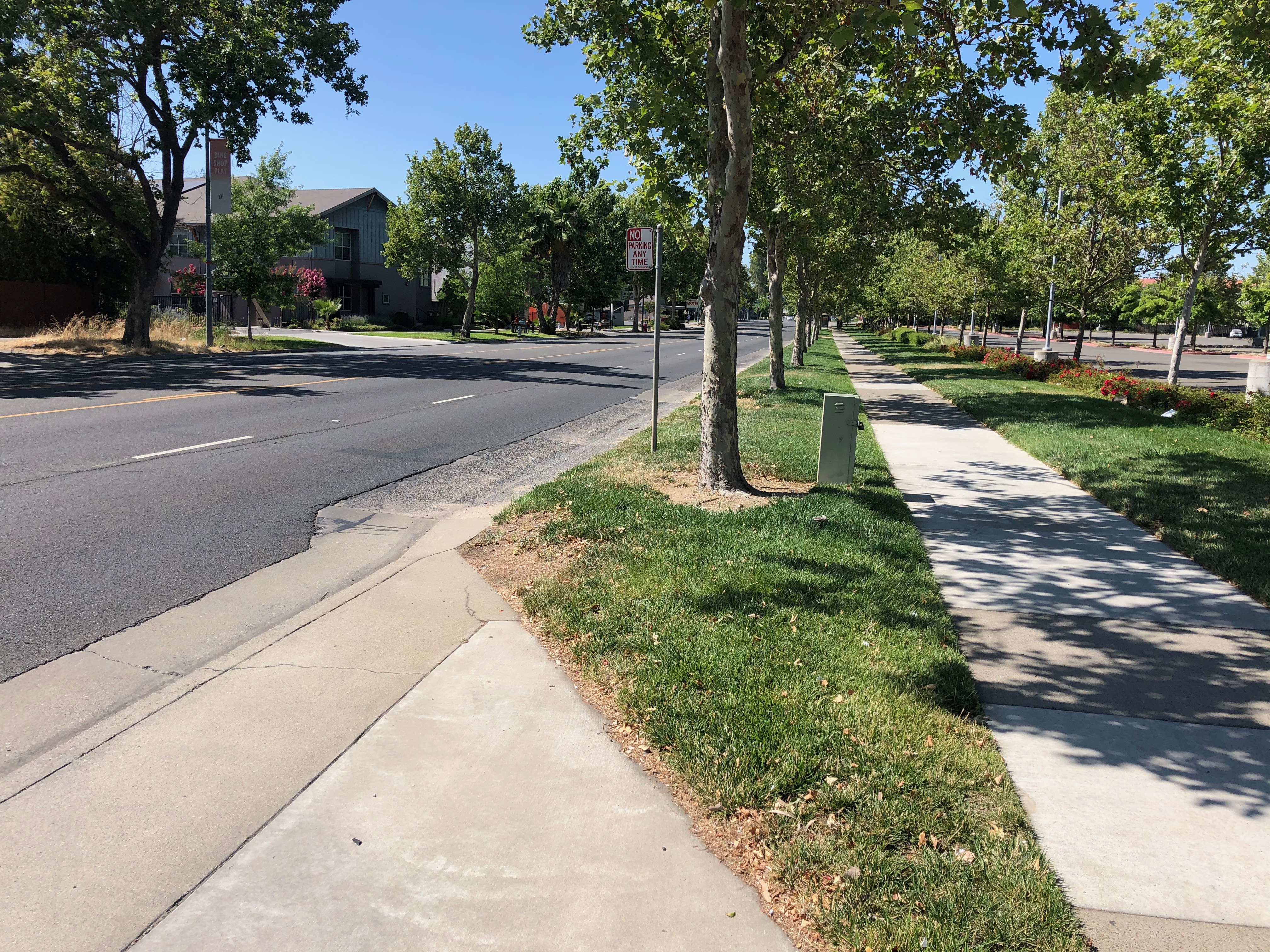
Trees: The initial plan includes this sentence: “Plant trees along street at approximately 30 feet apart, on-center, to provide shade and cooler temperatures.” If implemented, this would result in about 350 trees along the segment. There are 30. Failure. In addition, the trees are mostly in 5.5 foot wide sidewalk buffers (which the city calls planting strips), whereas trees need at least 8 feet to remain healthy and reduce sidewalk heaving. Failure.
The photo below is a mock-up from the initial plan. It is standard practice for city projects to show more trees than they intend to install. Gaslighting the public.
mock-up photo from initial complete streets plan
Other plantings: The initial plan indicated there would be bioswales throughout the project, but I saw only one small one. The plantings in sidewalk buffers are aesthetically pleasing, but not environmentally significant.
Sidewalks: Some sidewalks were upgraded to 6 feet, which is the modern minimum. Ramps were installed at intersections. Driveway crossings are a mix of acceptable and illegal, with cross-slopes in the sidewalk. Other sidewalks were left in their original condition of 4.5 to 5 feet. Falls short.
Sidewalk amenities: There are some trash cans provided by Franklin Blvd Business District. I did not see any other amenities. Weak.
Lighting: Pedestrian-scale lighting, with traditional poles, was installed along the length. The old motor-vehicle scale lighting was left in place. Though I did not visit the street at night, lighting looks to be a great improvement.
Driveways: There are a huge number of driveways in this section, largely due to the traditional development pattern of small business buildings on small parcels, with parking between the street and the building. This is an unfortunate pattern, but not something that can easily be fixed. Most driveways were replaced with a slope in the sidewalk buffer, or more commonly, dip down and back up, which is legal but not ideal. There are several driveways for long abandoned businesses and empty parcels, which should have been closed under the city’s driveway closure policy.
Safe crossings: There are existing signals at Sutterville Road/12th Avenue, 21st Avenue, Atlas Avenue (full pedestrian signal), 26th Avenue (to the west), and Fruitridge Road. At 18th Avenue, there is a new enhanced RRFB (Rectangular Rapid Flashing Beacon). There are RRFBs on a signal mast arm, in addition to at the side, perhaps safer than a standard RRFB, but given driver behavior in Sacramento, not safe. The distance from 26th Avenue to Fruitridge is just over a quarter mile, though there may not be a good location for a crossing in this stretch. The distance from Sutterville/12th Avenue to 18th Avenue is well over a quarter mile, which is an unacceptable distance between safe crossings.
Curb extensions: There was an opportunity to shorten crossing distances and slow drivers by providing curb extensions on the side streets. This was not done.
Bus: SacRT Route 67 runs on Franklin from Broadway to 21st Avenue. There is a pull-out bus stop just south of Sutterville/12th Avenue, which is a timepoint and may be appropriate, though pulling out of traffic, and back in, is poor practice. The other bus stops are in shared bus/bicycle areas, which is probably fine for a low frequency route (30 minutes). It occurs to me that it might be better to run service south on Franklin to Fruitridge Road, to consistently serve the commercial area. The route on Martin Luther King Jr Blvd does serve residential areas, but those are constrained by Hwy 99 to the west and a poor street grid, and the route misses Christian Brothers High School.
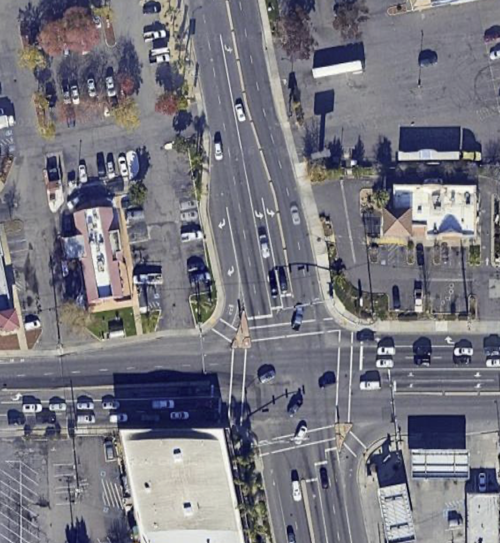
Franklin Blvd & Fruitridge Road intersection: This wide flared intersection is hazardous for all users, and nothing was done to improve it. Southbound, Franklin flares from one travel lane to two dedicated left turn lanes (unnecessary and unsafe), one uncontrolled dedicated right hand turn slip lane (highly dangerous for bicyclists and walkers), and one through lane. Everything that was good about the complete streets project gets tossed out the window at this intersection. I realize that it might have only been possible to fix the north leg of the intersection with this project, but no effort was made to do so. Complete failure.
Franklin Blvd southbound at Fruitridge Rd, uncontrolled slip laneoverhead of Franklin Blvd & Fruitridge Road intersection (only one southbound lane now)
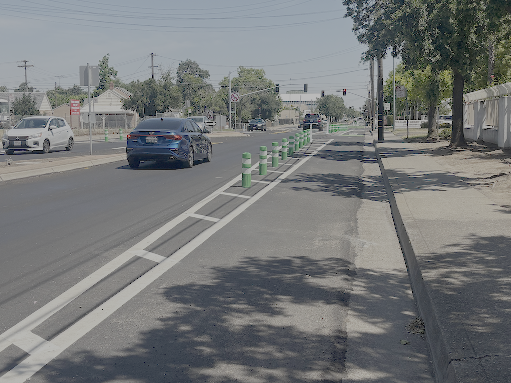
Northbound, the project starts just beyond Los Robles Blvd, and ends at Grand Avenue. Southbound, the project starts just beyond Harris Avenue, and ends just beyond Nogales Street. The focus of the project is narrowing the roadway from four lanes to two lanes with adjacent bike lanes or separated bikeways. Some bicycle facilities are just paint on the ground, while some stretches use vertical delineator (both green K-71 and white ‘wands’ with bases). A typical section is below. The bike lanes at the north and south ends are of poor quality, depending on the gutter pan with a strong linear seam to achieve minimum width. In the middle section, the quality varies but is mostly acceptable.
Marysville Blvd northbound, north of Rosalind St, separated bikeway with K-71 delineators
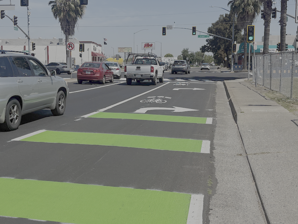
The project uses shared bike lane/turn lane areas at Grand Avenue, below. This is not the worst design, placing bike lanes to the right of right-turning vehicles, but neither will it be comfortable for many bicyclists.
Marysville Blvd northbound at Grand Ave, shared bike lane and right turn lane
Observing motor vehicle traffic on a Saturday, it appears that drivers have adjusted to the change. Though the varying treatment of the right-of-way might be confusing, it seems to be handled OK. The only issue is that a police motorcycle used the bike lane to bypass traffic, and almost hit me. I did not see anyone bicycling along Marysville, though I did see a number of bicyclists crossing Marysville at side streets.
The signal faces at Marysville Blvd and Grand Avenue were replaced. Other signals were not changed, so far as I can determine. One of the signal faces for Marysville northbound at Grand is out, probably due to mis-wiring.
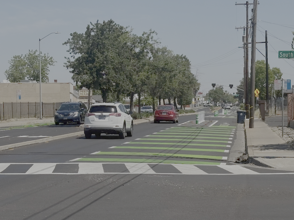
SacRT bus Route 86 runs on this section of Marysville Blvd. Bus stops were marked with dashed (skip) green markings for sharing with bicyclists, below. I suspect the bus area is not long enough for bus use, but since I did not see an buses along the route today, I’m not sure. The bus only runs once per hour on Saturdays. I think the design is safe for bicyclists since it is such a clearly marked area. The only better design would be a bikeway behind (curb-side) from a bus boarding island, though with only one lane for motor vehicles, the city is very reluctant to have buses stop in traffic. I’ve got not problem with it, transit riders have no problem with it, but engineers just can’t stomach giving priority to buses.
Marysville Blvd shared bus and bike area
No improvements to sidewalks were made, not even corner curb ramps at the most critical intersection of Marysville Blvd and Grand Avenue.
This section of Marysville Blvd is characterized by:
moderate to poor sidewalk conditions and width
sidewalk cross-slopes at nearly every driveway, which is a hazard for mobility devices and many walkers
abandoned business building, and abandoned parcels that may have once been occupied by businesses or residences
an excess for driveways, most of are not in use; a number of the parcels have two or more abandoned driveways; even the City of Sacramento Hagginwood Park has an abandoned driveway
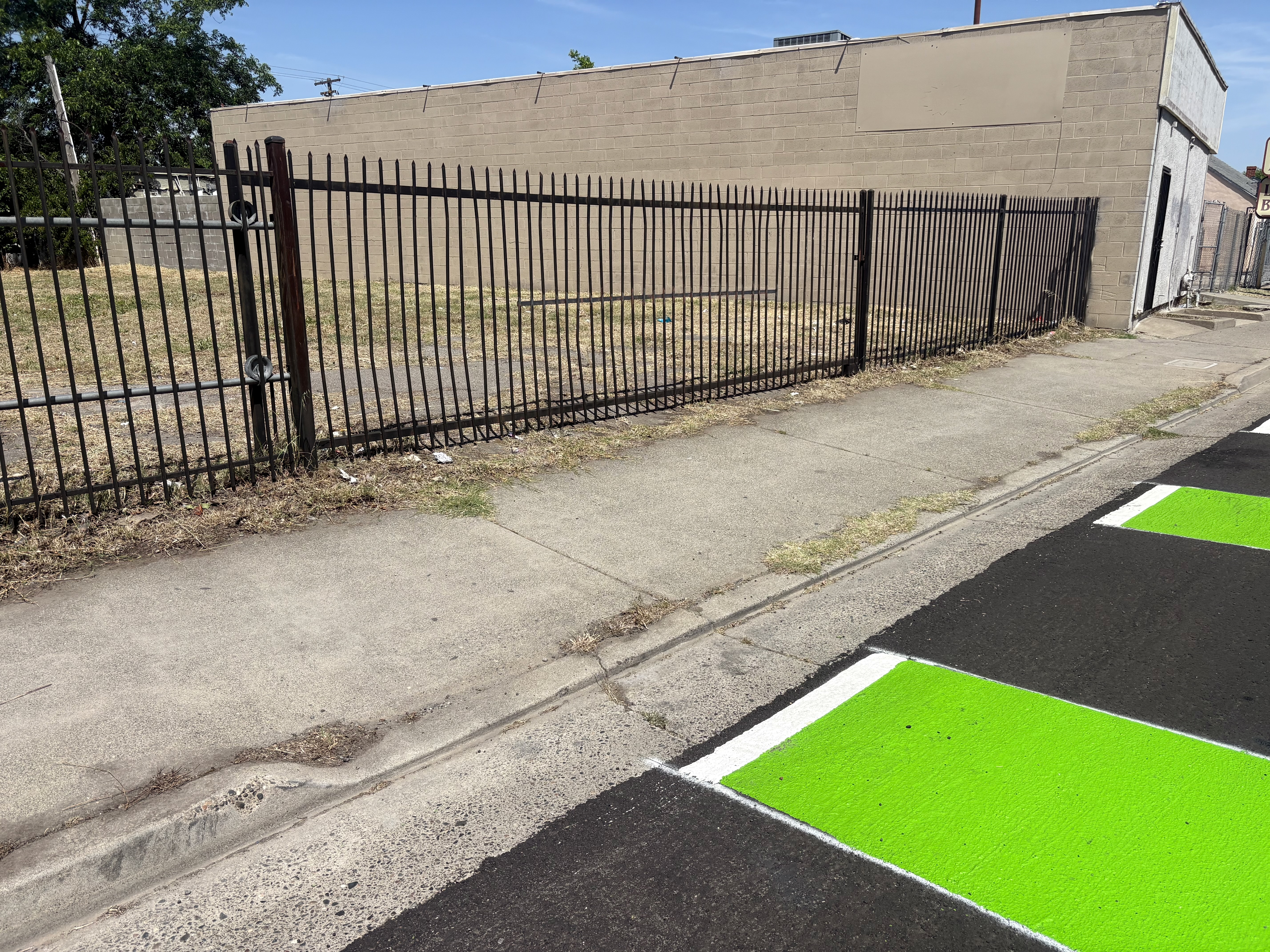
One example of a driveway that slopes across the sidewalk is below. There are dozens of locations just in this section of Marysville, to say nothing of north and south of the project. Some are active driveways for commercial buildings and residences, but probably at least one-third are abandoned, serving no purpose whatsoever except to make the walking/rolling experience less pleasant and more dangerous.
3617 Marysville Blvd, abandoned driveway with cross-sidewalk slope
The project has done nothing to improve the walkability of Marysville Blvd.
The signal which seems to be most confusing to walkers and drivers is the partial signal at Los Robles Blvd on the east and Hagginwood Park on the west. It was not improved in any way. Drivers are unclear about the signal, and so are not sure whether to yield to walkers in the two crosswalks.
I will have at least one more post on Phase 2 of the project, which is not fully funded and has not started.
For previous posts on sidewalks and walkability, see category: sidewalks, and category: walkability.
Almost every complete streets and safety project the City of Sacramento has undertaken has focused on the roadway part of the street, the part where motor vehicles and bicycles travel. They have not focused on the sidewalks.
The ‘complete streets’ concept (note that I’ve placed it in quotes) emphasizes travel along corridors, not local travel and life. Lanes are narrowed or reduced. Bicycle facilities are added. A few safer crossings are added. Sometimes parking is reduced or eliminated. This is all good. But by designing and building this definition of ‘complete streets’, sidewalks are usually neglected. If a sidewalk is present, that is considered good enough. ADA ramps are added at corners, which is good, but the sidewalks in between corners are often untouched. There is a reason for this: repaving a street and then re-striping for different roadway width allocation is cheap (relatively). Replacing and widening sidewalks, and moving curb lines, is expensive. The result of a ‘complete street’ is a street that eases, and perhaps makes safer, travel by bicyclists and motor vehicle drivers, but does little for people walking.
It is bad enough that sidewalks are not improved, but by refusing to move curb lines, and/or to remove private development within the public right-of-way, the common issue of sidewalk buffers (which the city calls planting strips, though they may be used for many purposes in addition to planting) is perforce neglected.
Sidewalk width
Sidewalks should be a minimum of six feet, with widths up to 16 feet where the frequency of people walking justifies it. Many city sidewalks are five feet, and there are relict sidewalks of four feet. And of course there are many streets in the 50’s to 70’s developments that have no sidewalks at all. If a sidewalk is less than six feet, on a roadway that is being reconfigured or reconstructed, the sidewalk should be widened to at least six feet. Wider if justified by walking.
Driveways
In locations with sidewalk buffers, the slope of a driveway in often across the sidewalk, which makes the sidewalk dangerous for anyone in a mobility device, and uncomfortable for all walkers and rollers. Much of south and north Sacramento suffer from this design. Where it is present, it must be corrected. There is a correction available which ramps the sidewalk down and then up again across the driveway, and this is legal in PROWAG, but it is and should be the design of last resort. The better design is to slope the driveway across the buffer. And to remove unnecessary driveway. Strong SacTown and I will write more about this.
Sidewalk buffers
Sidewalk buffers, where they are present, are almost always too narrow to support healthy, mature trees. A healthy tree needs a sidewalk buffer of eight feet or more. If the buffer is six feet, as is common, an assessment should be made about the health and type of trees, to determine whether a wider buffer is needed. If the tree is healthy, and the sidewalk not heaved by roots, probably best to leave it alone. If the buffer is narrower than six feet, it should be widened, with curb line moved if necessary. And if a buffer is absent, it must be installed. Sacramento is the ‘city of trees’. Unfortunately, it is also the city of constrained and unhealthy trees that have heaved sidewalks, because the city and developers did not care to create a safe, healthy place for them to grow. In neighborhoods of north and south Sacramento, where buffers were not created, there are often almost no trees at all. The trees on private property have died and not been replaced, and the city has not provided trees. These are miserable places to live and walk.
Funding constraints
So, given that curbs and sidewalks are more expensive than re-striping a street, what is the solution? The city’s solution is to neglect the sidewalks, and thereby neglect the trees. My solution is that corridors being reconstructed need to be shortened in order to free up money to do the sidewalks, and sidewalk buffers, right. This is a long term investment. Streets usually only last about 40 years before needing significant work. Sidewalks and sidewalk buffers are a long-term investment, that pays off for livability and reduces city liabilities every day, every budget cycle. The sidewalks and 12 foot sidewalk buffers in the Poverty Ridge area of Sacramento (see sidewalk buffer widths) are in good condition after 100 years or more. Sidewalks have required minor repairs in a few places, but most of the work was for utilities. The buffers have been used for a variety of purposes: trees, gardens, seating areas, play equipment, etc. Not just planting.
If a street is being reconstructed, do it right. Make sure there are wide sidewalks and wide sidewalk buffers. If that means that 10 blocks can be completed instead of 40 blocks, so be it. Do it right, and it will last, and will contribute far more to livability and walkability that a roadway reconfiguration.
The photo below shows a section of Stockton Blvd with a sufficiently wide buffer (wider would be better), and healthy trees (at least until they mature). But this is an unusual section of Stockton. Much of Stockton has narrow sidewalks and no sidewalk buffers. The city is planning to spend a lot of money on reconfiguring the roadway on Stockton, but is not fixing the sidewalks nor adding sidewalk buffers except in a few places.
CalBike is supporting SB 960, the Complete Streets bill (Senator Scott Wiener). See their post below. An earlier post here has some information about the Speeding and Fatality Emergency Reduction (SAFER) on California Streets package: Senator Wiener introduces road safety bills.
Note: As is not unusual, I had forgotten that I’d written about N St before: N Street bike route to cycle track, 2015. Seven years have passed, the city has taken no action.
The construction for the Capitol annex project has narrowed N St to two lanes eastbound, from 10th St to 14th St, and parking has been removed from the south side to shift the lanes over. Now is the time for the City of Sacramento to implement its long-delayed (if not deep-sixed) plans for re-allocating space on N St. There have been ongoing utility projects over the last few years that have narrowed N St to two or even just one lane. At no time did that create significant congestion, during the pandemic or before the pandemic. I live two blocks from N St, and both travel along it and cross it frequently. I’ve never seen more than momentary congestion, in 11 years. What that means is that N St, in its three-lane configuration, has grossly excess capacity for motor vehicles.
While the street has been narrowed is the time to redesign the street so that it has no more than two general purpose lanes, and has a curb-protected or parking-protected bikeway. Probably on the left. This is in fact the perfect setting for a separated bikeway, five blocks from 10th St to 15th St with no intersecting streets from the north side, which is Capitol Park.
It is true that the sidewalk on the north side of N St is a designated bikeway, so bicyclists may use the sidewalk to avoid riding in the street. But bicyclists on the sidewalk are often in conflict with people walking on the sidewalk. The sidewalk has pretty continuous use by walkers, particularly during the lunch time – walk time for state workers, but a lot of people also include a circuit of the Capitol Park on their runs and walks. This conflict is easy to solve: create a safe, welcoming, protected (separated) bikeway on the street. And do it now!
On N St eastbound, the leftmost lane is a designated left turn lane at 10th St, which is what makes possible the two-lane configuration beyond 10th St. As a temporary measure, this works well, and forcing turns off three lane streets is a good solution for so many overbuilt arterials roads in Sacramento, but here it is only temporary, and would be obviated by the conversion of all of N St from 3rd St to 15th St. N St becomes a two-lane street at 15th St, and then becomes a two-way street at 21st St. N St from 15th St to 21 St would probably be a good candidate for a separated bikeway as well, but with paint bike lanes existing, would be a lower priority.
Below is a StreetMix sketch of what N St might look like. Note that the width of the street and the elements are estimated, not measured. I don’t believe parking is needed on both sides, but the diagram shows it for people who think it is necessary. Left side is north, Capitol Park in this case, and right side is south, mostly state buildings.
N St Sacramento between 3rd St and 15th St
As a reminder, I feel strongly, and it is backed up by evidence:
Three-lane streets are significantly less safe than two-lane streets, primarily for the muli-lane threat (one vehicle stops for walkers and the others do not). They are also a clear sign of poor land use planning, which puts residents and the things they need to reach (jobs, stores, recreation and entertainment, medical, etc.) far away. Narrowing all such roadways in the city from three to two, or less, would increase safety, increase livability, and encourage people to make different choices about where they live and visit. Maps of collisions (vehicle vs. vehicle, vehicle vs. walker, vehicle vs. bicyclist) align almost perfectly with overbuilt arterials.
One-way streets are significantly less safe than two-way streets, for the same multi-lane threat, and because there isn’t any friction to slow drivers. However, I think that the only valid argument for one-way streets is to accommodate separated bikeways, bus lanes, or rail transit. That may be true of N St.
And, sorry, can’t resist, get rid of the worthless palm trees while they are at it. We need shade trees, not poles.
City of Sacramento staff (Drew Hart) presented to the Sacramento Active Transportation Commission last Thursday on the Freeport Boulevard Emerging Design Concepts. The presentation slides are here. The city’s Freeport webpage has a lot of background material. A link to the virtual open house on April 28 (tomorrow!) is available. This project and the Northgate project are being supported by the same consultant, so you will notice similarities in the process and graphics.
The northern section, between Sutterville Road to the east and Sutterville Road to the west, should look exactly like the traffic-calmed, complete street to the north. This project on Freeport was successful. There is no reason for five lanes in this section. One lane northbound, one lane southbound, and one left turn lane southbound is all it needs. If traffic backs up at the Freeport and Sutterville Road to the east intersection, then shorten the signal cycle.
The emerging design document skips over the issue of whether four general purpose lanes are even needed. A concept should be presented that reduces general purpose lanes to two, and reallocates roadway width to other modes.
Dedicated right hand turn lanes should be removed everywhere. Dedicated left hand turn lanes should be provided only where traffic studies have shown a clear need, and should never reduce the roadway width for other uses.
Green lanes are shown behind protection for separated bikeways. Since the protection does or should prevent vehicle incursion, the paint is not needed.
Dedicated transit lanes should be considered. Though SacRT has not identified this as a high frequency route in the High Capacity Bus Service Study (Route 62 is 30-minute frequency), reconstruction of the roadway must consider the possibility of dedicated transit lanes and transit supporting infrastructure. Appendix A, available on the project webpage, provides a lot of detail about existing transit stops, which are mostly quite poor.
Some businesses along Freeport have multiple driveways, more than are justified by the amount of vehicle traffic access. Closure and narrowing of driveways should be considered. Since almost every business has parking fronting the street, no on-street parking is needed anywhere. This is poor urban design, but it is the nature of the corridor and could not be corrected without wholesale reconstruction of the corridor.
While separated bikeways are often a good solution, the frequency of driveways might make for poor quality infrastructure. Unless driveways can be closed or reconfigured, separated bikeways may not be the best solution.
Posted speed AND design speed should be considered for reduction. Posted speed is 30 mph from Sutterville Rd (to the east) to Arica Way, 35 mph from Arica Way to Fruitridge Rd, and 40 mph from Fruitridge Rd to Blair Ave. The section from Sutterville Rd (to the east) to Fruitridge Rd should be posted and designed for 25 mph, in recognition of the density of businesses and driveways. The section from Fruitridge to Blair Ave should be posted and designed for 30 mph, as it has a lower density of businesses and driveways, and is adjacent to the airport for a significant distance.
Prioritization of the modes for Sutterville (to the east) and Fruitridge Rd should be:
walking
bicycling
transit
motor vehicle
Prioritization of the modes for Fruitridge Rd to Blair Ave should be:
bicycling
transit
walking
motor vehicle
Crash/collision map of the Northgate Blvd corridor for pedestrians (walkers) and bicyclists. Data is from SWITRS for the years 2015-2019. (pdf)
Update: Added a crash/collision map at the bottom. Though prevention of pedestrian and bicyclist killed and severe injury is always a top priority, this is not a high risk corridor as compared to many arterials in the city.
City of Sacramento staff (Leslie Mancebo) presented to the Sacramento Active Transportation Commission last Thursday on the Northgate Boulevard Emerging Design Concepts. The presentation slides are here. The city’s Northgate webpage has a lot of background material. A link to the virtual open house on May 11 is available.
I rode Northgate Blvd yesterday to refresh my memory about the street, as I’d not gone that way in a while. So, some comments:
The section of Northgate from Rio Tierra to I-80 is a standard suburban arterial, with low quality development and a completely uninteresting place to be. Changes to the roadway may make it safer, but won’t make it any more interesting or economically successful. The city should not focus on this area. It is unpleasant, and not particularly safe, but leave it be.
The section of Northgate from Rio Tierra to Garden Hwy has serious issues, but I see it as a place that could be transformed into an interesting, welcoming, and vibrant place. The number of small businesses, each with a driveway, is a challenge, but also an opportunity. At least half of the businesses are locally owned. This is not the home of big box and chain stores like much of the suburbs. It IS a place where people could walk if provided a safe and encouraging environment, and there are multiple destinations used by local residents.
I think that this entire segment should have buffered and wide sidewalks. The bike facilities could provide some buffer, but the sidewalk buffer is critical because it allows street trees. This section desperately needs street trees! Of course to be successful, the buffer/planting strip needs to be at least six feet, and the sidewalk at least six feet, but eight-ten foot buffer and eight foot sidewalk would be better. I think that the walking mode should take precedence over all other modes, even bicycling and transit, so whatever right-of-way the buffer and sidewalk needs, it should get. Don’t compromise this away.
I realize this project is at the gathering community input stage. However, diagrams will be used, and I’d like to see the diagrams include significant improvement to the pedestrian environment, wide sidewalks buffered from other modes, with trees in the buffer.
The presentation resulted in a number of questions from commission members about bicycle facilities. One of the ideas that got support is a two-way separated bikeway (or cycletrack) to provide a connection between the Ninos multiple use trail and the American River Parkway multiple use trail (the ‘special section’ in the presentation). There was less agreement about bicycle facilities north of there. One of the ideas is separated bikeways (protected bike lanes). Though of course separated bikeways are the best solution overall, I’m not sure they make sense for the east side of the street. Separated bikeways work best when there are few or no driveways, but there is a huge numbers of driveways here. The west side of the street has far fewer driveways.
There are some opportunities on the corridor for reducing driveways, and certainly some of the driveways can be narrowed to reduce entry and exit speeds. But short of a wholesale revision of the area, most driveways will remain, so the street design must accommodate this fact.
Transit on the part of the corridor between Arden Way and San Juan Road is provided by SacRT Route 13 Natomas/Arden, with a 45 minute frequency on weekdays. The route has a fairly low ridership, but it is a long route of which the Northgate section is a small part.
Crash/collision map of the Northgate Blvd corridor for pedestrians (walkers) and bicyclists. Data is from SWITRS for the years 2015-2019. (pdf)
Take the information about fault below with a huge grain of salt. It is well known that law enforcement officers assume walkers and bicyclists to be at fault, without any serious investigation, and often on the sole word of the driver involved.
Pedestrian (walker):
Northgate near Rosin Ct: killed, 60 yo male, unknown detail, no fault, no alcohol
Northgate near Ozark Cir: severe injury, 74 yo female, crossing, at fault, alcohol
Northgate at Wisconsin: severe injury, 36 yo female with two children, crossing, driver fault
Northgate at Peralta: severe injury, 48 yo, crossing Peralta, at fault (very unlikely)
Bicyclist:
Northgate near Winter Garden: severe injury, 49 yo male, left turn, at fault
Northgate at Bridgeford: killed, 47 yo male, crossing, at fault, alcohol or drug
Northgate at Harding: killed, 31 yo female, left turn, at fault
Northgate at Garden Hwy: severe injury, 40-44 yo male, broadside, at fault CVC 21453
The intersections of Northgate and San Juan Rd, West El Camino, and Garden Hwy/Jefferson Ave are particularly problematic because they are flared out to accommodate turning lanes, thereby lengthening crossing distances for walkers and creating a walker-hostile environment. Fixing these intersections would probably do more to improve the safety and feeling of this corridor than changes along the corridor.
Note: This is a follow-on to streets – stroads – roads. It will make more sense if you read that one first.
The complete streets concept says that all modes of travel (walking, bicycling, motor vehicles, and transit when appropriate) should be accommodated on streets. The accommodation is accomplished by providing separate spaces for each: sidewalks for people walking, bike lanes for people bicycling, general purpose lanes for people driving.
The concept was and is promoted by the National Complete Street Coalition, now part of Smart Growth America, since 2004. The traffic planning and engineering professions strongly resisted the concept for years, but it now receives at least voice support from most planners and engineers. In California, chances of getting a transportation infrastructure grant are low if it does not at least claim to meet complete streets concepts.
The two biggest weaknesses of the complete streets concept are:
No guidelines for the frequency of safe crossings are built into the complete streets concept. It could be, but it is not. So travel along corridors is better, but crossing that corridor may not be any better than it was before.
Speed limits are rarely reduced on a reconstructed complete streets. Traffic lanes are often narrowed, and sometimes reduced, in an effort to slow traffic. However, a design that actually enforces a lower speed, and therefore allows a lower speed limit is rarely considered.
FHWA (Federal Highway Administration) recent released a Complete Streets Report to Congress and related webpage. I have not had a chance to look at this in detail, so I don’t know if the federal concept overcomes the weaknesses of the previous complete streets concept. The graphic below was the leading one in the new effort, and was justifiably criticised as presenting an unattractive if sort-of compliant complete street, but some people who have read the document say it is better than this. Streetsblog USA: USDOT Tackles Overlooked Barriers to ‘Complete Streets’ — And Sparks Debate.
FHWA complete streets graphic
Caltrans has a recently adopted Complete Streets Policy. The City of Sacramento has a complete streets policy. Citrus Heights, Elk Grove, Folsom, Rancho Cordova, and the county express support for complete streets concepts in their general plans, and have complete streets projects, but apparently do not have specific policies.
There have been a number of complete streets project already in the Sacramento region, and more are on the way. The proposed Measure 2022 transportation sales tax flags complete streets for much of investment, so it is important to understand what a complete street is and is not. Let me say that a complete street is almost always better than what was there before. A lot of our streets were constructed without sidewalks, or with narrow sidewalks interrupted with utility poles and other obstructions, and lacking curb ramps. Complete streets usually have continuous sidewalks of six feet or more, with fewer (but not no) obstructions, and curb ramps at corners. Almost all of our streets were constructed without any place for bicyclists, so a complete street with bike lanes may be an improvement (though many traffic engineers continue to think that painted bike lanes work on higher speed streets).
I was working partly in the City of Citrus Heights when the Auburn Blvd Complete Streets Phase 1 project was designed and implemented. Indeed, travel along the corridor was much improved, and the road was more welcoming to all modes of travel. But there were no more safe crossings of Auburn Blvd than there were before. The crosswalks were still way to far apart for people to conveniently access the businesses, homes, and schools along the corridor. The speed limit was unchanged, though my perception was that actual speeds were a bit slower.
Nearly all streets that have become, or are proposed to become, complete streets are stroads. Think of a major roadway in the county, and you are picturing a stroad. Making a stroad a complete street does not make it not a stroad. Complete streets projects often forget to answer the most basic questions: what is the purpose of this roadway, and how can we construct it so that it fulfills that purpose? A stroad with sidewalks and bike lanes is still a stroad if the primary function is to move people along the corridor, rather than allow them to be in the corridor.
If the purpose of a roadway is to move a high volume of motor vehicles quickly, a road, then sidewalks and bike lanes probably aren’t appropriate, and those modes should be provided for on parallel routes. If the purpose of a roadway is to provide a place for people and building wealth, a street, then sidewalks and SLOW or no motor vehicle traffic is the only appropriate design. This is often expressed as a place where ‘cars are guests’ and bicyclists mix in with other street users rather than needing an exclusive space.
Yes, I am talking about an ideal here. Almost all of our roadways were designed and function inappropriately. We have a long ways to go, but we at least have to get started by stopping what we are doing wrong, and starting to do it right. The proposed Measure 2022 transportation sales tax largely commits to continue doing it wrong, for 40 years. That is the next post.