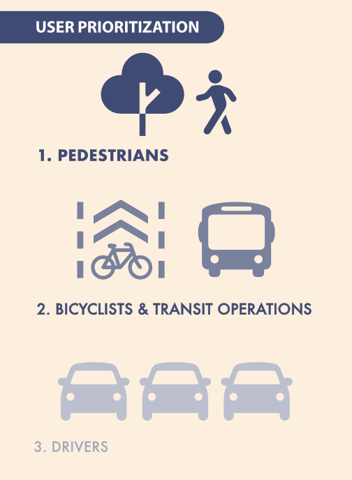
Below is a graphic from the City of Sacramento 2040 General Plan (Chapter 8 Mobility Element, page 8-9). As a transportation advocate, I obviously have a bias, but I think this is the most important graphic, and the most important message in the entire general plan.
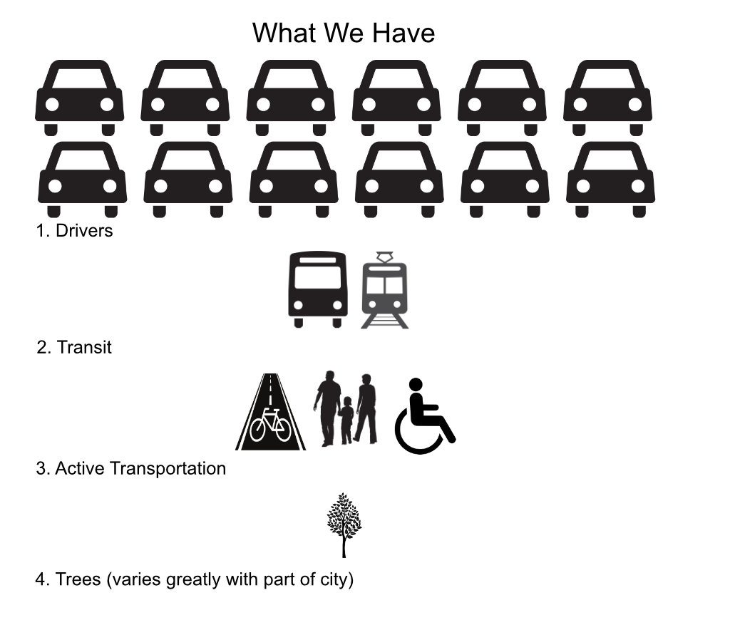
This is in complete contrast to the transportation system we have built. Below is the transportation system we have. One could argue endlessly about how this varies with parts of the city, and whether active transportation should be lumped together, but the graphic communicates the problem.
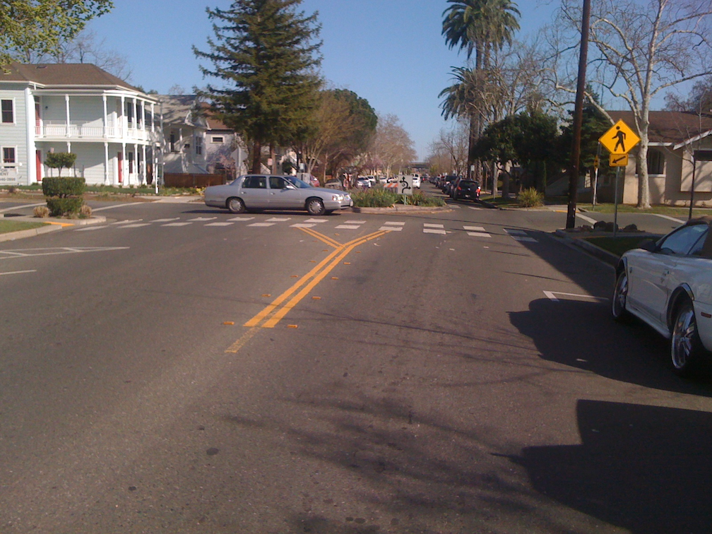
I follow the city’s transportation projects, some in great detail, others only superficially. There are far too many for one person to cover, or even a group of people.
What I see in these projects is a very gradual shift from what we have to what we want. We might reduce general purpose (car) lanes, in number or width, but not always. We might add bicycle facilities. We might, occasionally, improve sidewalks for people walking and rolling (but not if we can get away with making property owners do it). We might make it easier for transit. Though the central city, and some neighborhoods outside the central city, have a reasonable tree canopy, north and south Sacramento are largely lacking a tree canopy, and every transportation project neglects solving this issue. We don’t plan in trees from the beginning, saying we’ll get to them later in the process, but at the end, they are usually missing.
We have invested hundreds of millions of dollars in making things better for drivers and motor vehicles, and very, very little on anything else. It is time to almost completely reverse that, so spend nothing on drivers and motor vehicles, and almost everything on transit, active transportation, and trees.
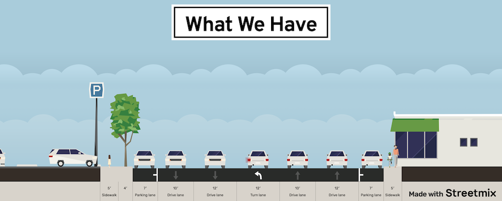
Cross-sections
Another way of exhibiting this is street cross-sections. These are from StreetMix (https://streetmix.net/), for an 80 foot right-of-way. Neither is meant to represent an actual street, but rather illustrative of the way in which we can allocate street space to different uses.
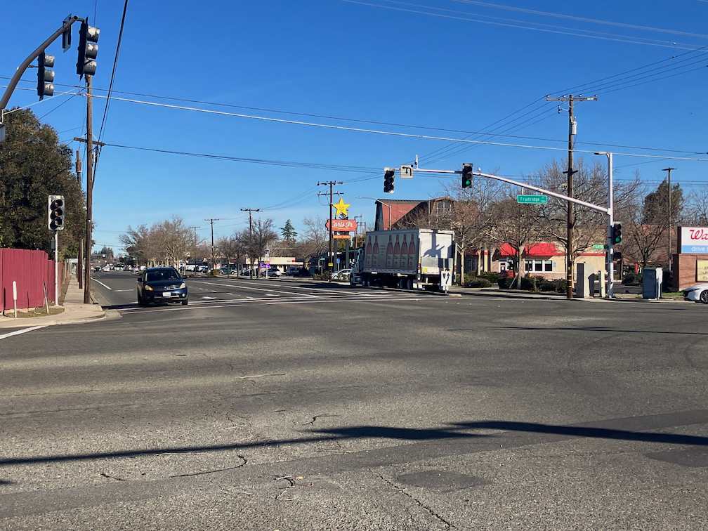
In the ‘what we have’ cross-section, motor vehicles are dominant. Sidewalks are narrow, trees are present but in few numbers, and probably not healthy because they have been squeezed into small spaces, bicycle facilities are not present or are of low quality, ample space is allocated to cars in general purpose lanes, and left turn lanes and right turn lanes. Ample parking is provided, whether needed or not. I have intentionally picked low density and low productivity uses to line this roadway, parking lots and single story buildings, though most often there is a parking lot before you even get to the building. StreetMix only offers a few options for each element, and what is shown is what is available.
In the ‘what we want’ cross-section, private motor vehicles are strictly limited. There is parking, but not ample parking. Transit, where is makes sense to have it, operates in its own right of way. Since the general purpose lane is one-way, a two-way bikeway (cycle track) is provided so that bicyclists have more freedom of movement than drivers. Sidewalks are ample, 8 foot on average. Sidewalk buffers are ample, 8 feet on average, so that trees have space to grow and thrive. The buffers are not just for trees, though, they can host dining and bike racks and street furniture. Reflecting the people-centered nature of this street, there are higher density uses of housing and business, and the buildings come to the sidewalk rather than being set back. The city is not proposing ‘what we want’ anywhere.
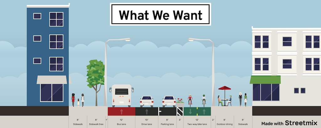
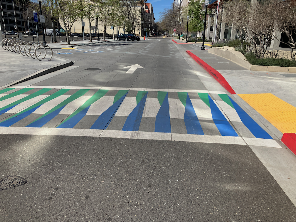
This street is far, far safer than multi-lane streets. By reducing the amount of space devoted to motor vehicle through traffic, space is freed up for people, people walking, people bicycling, people eating and socializing, and people just hanging out. It is quiet. It is friendly. It not only feels safe, but feels welcoming. This reflects my axiom that we should design streets from the outside in, not from the inside out (street design from the outside in). Outside in preferences walkers and trees, inside out preferences drivers and motor vehicles.