This is Central City Mobility Project update #16.
A post today on Streetsblog LA (Santa Monica’s New 17th Street Curb-Protected Bike Lanes are Amazing) is about new bicycle facilities on 17th Street in Santa Monica. I think you will find some of the photos interesting. At first glance, it looks like some of the ones being installed as part of the Central City Mobility Project, but looking more closely, two differences really stand out. Most of the separated bikeways in Santa Monica are curb-protected. Bikeways that are solely parking protected only are protected when cars are parked. Otherwise, they are really just buffered bike lanes. And the turn wedges are hard curbs with additional markers, not paint-only, and definitely superior to the Sacramento’s suggested turn wedges which might have vertical delineators or other markers, but won’t have curbs.

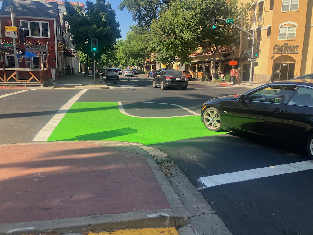
To illustrate the problem these curb turn wedges solve, see the photo below of a motor vehicle making a high speed dangerous turn over a painted parking wedge at P Street and 15th Street.
Other
- P Street markings including green paint are nearly complete. In two blocks, the green paint is nearly the entire block, for unknown reasons. There is nothing unique about these blocks. While green paint is useful to mark conflict areas, excessive use will just lead to maintenance expense over time.
- Q Street has preliminary markings, but the temporary lane tabs still indicate overly wide and dangerous general purpose lanes.
- 19th Street is nearly complete from H Street to Q Street, but there is no marking south of Q Street. South of Q Street, the old bike lanes show in some places, but otherwise have been erased in favor of overly wide and dangerous general purpose lanes. Several blocks of the new bikeway are in the gutter pan, making an unacceptable rough and dangerous surface.
- 21st Street is complete except for a few spots that were missed and have not been picked up. The confusing arrow at 21st Street and W Street has been corrected. There is still accommodation or signal for bicyclists at 21st Street and I Street.
- I Street work has begun, with the last few ADA ramps complete and some repaving.
- 10th Street has the last few ADA ramps complete.
- 9th Street doesn’t have any work in evidence.
- 5th Street has not progresses past installation of signal bases.
- Overall, no vertical delineators have been installed at any locations.
- Delivery vehicles are parking in and blocking the separated bikeway on P Street approaching 16th Street. The city did not mark any of the parking spaces for delivery use. Cones and barricades have been placed in the buffer to reduce this hazardous driver behavior, and have been removed by someone, and replaced by citizens, and removed by someone, and …