beware the leaves of December

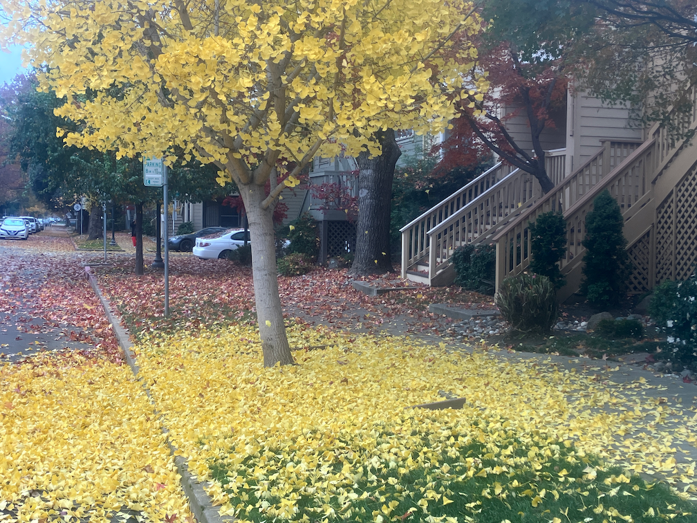
It is fall in Sacramento, trees are turning, leaves are falling. It is my favorite time of year, in part due to the knowledge that it will be over soon, only memories and photos. While out walking the last two days, I have been watching little breezes create leaf-fall, more fascinating to watch than snowfall. The four ginkgo trees back of my apartment are at their peak of brilliant yellow color, and the ground is carpeted in yellow. Blocks with a variety of trees are a kaleidoscope of colors.

This morning landscape workers were out blowing leaves into piles, but they were falling faster than they were moved. As I write, it is raining lightly, which will accelerate the leaf fall.

photo of ginkgo tree and leaves next to bikeway on P St
ginkgo tree and leaves next to bikeway on P St

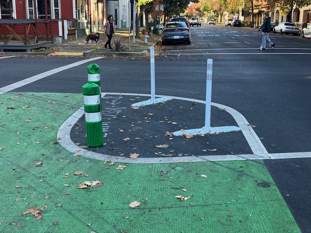
What is not to like? Well, what happens over the next few days. The wet leaves will start to rot, which is a natural process. But any leaf area where cars are allowed to drive will grind the leaves into fine particles, and those particles with turn into what I call leaf slime. Leaf slime is incredibly slippery, and it is a clear and present danger to bicyclists (and walkers). The Class 4 separated bikeways probably won’t be too bad, since bicycles don’t grind up the leaves, and the city may even get around to sweeping the bikeways. But the regular Class 2 bike lanes will be horrible. Cars will drive over the leaves, and start the process. The city very rarely sweeps bike lanes. They may be partially cleared if residents have illegally piled leaves in the bike lane, and the claw picks up the leaf piles, but the very act of scraping up the piles leaves a thin leaf slime layer.

So, it is time of year to avoid bike lanes, until there is either maintenance or enough rain to wash away the leaf slime. Ride in the general purpose lane. Yes, you will get yelled at by asshole drivers whose car isolates them from the realities of roadways, but at least you won’t be slipping and falling on the leaf slime. Beware the leaves of December.

Sac missing middle housing gets better

The Sacramento City Council will hear tonight (Tuesday, November 28, 2023, 5:00PM) on a recommendation to increase the floor area ratio (FAR) from 1 to 2 in areas within a half mile of frequent transit, and other improvements. The Missing Middle Housing program is part of the 2040 General Plan update. In October, staff brought missing middle housing to the council. Housing advocates led by House Sacramento suggested several improvements, and several council members spoke strongly in favor of improvements. See Sac missing middle housing project for background. So at the council meeting tonight, staff will be back with some of the recommended improvements. The documents are here: body of the staff report; table of public comments (the comments account for most of the size of the document, so the body will download much faster).

Public support for improved missing middle housing program policies and areas is critical to ensure that it will end up strong in the general plan. Though people opposed to better housing availability (NIMBYs) have so far not shown up to speak against it, they have been using their political power behind the scenes to ensure that housing remains scarce (which increases their own property values) and that their neighborhood does not change nor include people who have been excluded from housing and opportunity. Of course these Missing Middle Housing program elements will only take effect if they are not weakened when the 2040 General Plan is adopted, perhaps late next year. So housing advocates will need to remain vigilant.

Please see the House Sacramento Take Action page for information about providing public comment on the issue, and suggestions for your comments.

I believe that the public should support these changes. The general plan could be even better, by removing zoning completely, but this represents a huge improvement over both existing conditions and the earlier proposal.

  1. Floor area ratio (FAR) changed from 1 to 2 for all areas within a half mile of frequent transit service (which means if and when areas get better transit service, they can be similarly be allows greater housing density and variety). See map below (pdf). While the area changed is not huge, it represents a huge opportunity for more housing along light rail and SacRT bus route 1 along Stockton.
  2. The cap on dwelling per parcel are removed. Use of FAR will provide the appropriate level of control without reference to number of units. The cap on dwelling is a continuation of the exclusionary housing policies of the past.
  3. Creation of a sliding FAR scale. To be honest, I don’t quite understand this policy, but I trust to House Sacramento that it is useful.
map of areas with FAR increased to 2 within half mile of frequent transit

Four boards meeting

On November 9, 2023, the boards of four agencies met together for the first time: SACOG (Sacramento Area Council of Governments), SacRT (Sacramento Regional Transit District), SMAQMD (Sacramento Metropolitan Air Quality Management District), and SMUD (Sacramento Municipal Utilities District). This is probably the largest gathering of elected officials in one room in Sacramento history. Of course the number was not as great as you might think, because many officials serve on multiple boards. The SMUD board is independently elected, while the other three boards are composed of elected officials appointed to the boards by their own boards or councils.

The agenda for this meeting and the resolution that was passed are available here. The reason for the meeting was to advance collaboration among the boards to further mutual objectives, and to pass a resolution stating that. The staff of these agencies already collaborate to some degree, but also don’t on some important issues.

There was a long discussion period before passing of the resolution. No surprise, many of the smaller cities dominated the discussion, as is the case with SACOG board meetings. Several electeds used the time to promote commercial concerns that they benefit from, which is a really sad statement on the quality of our elected officials. Probably 90% of the discussion was devoted to electric vehicles, and in fact it looks as though seeking grant funding for more electric vehicle infrastructure was the real reason for the meeting. Grant applications with multiple agencies on board are more likely to receive funding. There was also discussion of managing forest lands for carbon sequestration and need to manage forests to reduce severe wildfire carbon release. And a few other topics. Active transportation was not one of them.

The boards tried to cut off public comment, but this caused an uproar and several citizens were allowed to speak (if they had been prevented, it would have invalidated the whole meeting under the Brown Act). Of course I spoke, and made the following points:

  • Where is Sacramento Transportation Authority? SacTA probably has more effect on carbon emissions that any other agency in the region, but was not represented. I later learned they were not invited.
  • The discussion and collaboration is about money, money, money, but should be about policy, policy, policy. What are the policies that the agencies can agree on? Money should follow policy, not control it.
  • The strong focus on motor vehicle electrification is techno-glitter, and results in deemphasizing:
    • safe walking: no mention was made of the needs of walkers for safety from motor vehicles
    • bike share: no mention was made of bike share, or scooter share for that matter
    • electric bikes: no mention was made of electric bikes during the discussion; bikes are the most important solution to the climate crisis, but one that the agencies seem particularly disinterested in
    • reducing VMT: the discussion was mostly about electrification, with very little about reducing VMT (vehicle miles traveled), though all reputable sources indicate that it will be necessary to reduce VMT along with electrification
    • land use: no mention was made of land use; though none of these agencies have direct control over land use, their expenditures affect land use and are affected by land use; the climate crisis cannot be solved without changing our land use patterns, but all of the smaller cities, and the counties, want and hope to ignore this fact

I finished up by talking about my experience with bike parking at the venue, which was the Sacramento State Alumni Center. When I rode up, there was no bike rack on the north side of the building, so I locked up to a parking sign. Exploring around I noticed a wave rack on the south side of the building. Wave racks received a ‘not recommended’ status from the Association for Pedestrian and Bicycling Professionals, which is the national standard, about ten years ago. Yet that is all the university provides. There are acres of car parking north of the building, and acres of parking south of the building. The university does have two dedicated bike parking compounds, but neither are close to the alumni center. The pathway along the south side of College Town Drive is nice, though substandard, but it ends at the intersection with Stadium Drive, where the alumni center is located. This is what we get when we focus on the needs of motor vehicle drivers, and place them above other users of the public space. This is what got us into the climate crisis, and we will not get out of it until we change that focus.

SacCity wasted signals

This is Central City Mobility Project update #29.

I have written before about excess signals in the central city: too many traffic signals?. The fact that these exist is bad enough, but as part of the 5th Street conversion project, one-way to two-way, the city is replacing unnecessary old signals with very expensive and unnecessary new signals.

At 5th Street and S Street, a new signal is being installed. S Street is a low volume street that never needed and never should have had a traffic signal. A four-way stop sign, maybe, or maybe only stop signs for S Street. A fully signalized intersection, no way. There is nothing wrong with the existing signal for northbound traffic. Of course, a new signal is needed for southbound traffic. But the city is replacing northbound. Why?

Why is the city putting in a new signal here? Because there was one here before. If this intersection were studied for whether it needed a signal, the answer would be no. A warrant is a study indicating a need for a signal, as is simply explained at http://www.apsguide.org/chapter3_mutcd.cfm (this is much easier to read than the MUTCD). The 5th Street & S Street intersection does not meet any of these criteria. So, the city is putting in a new signal because they want to, not because it is necessary.

photo of new and unnecessary signal at 5th St & S St
new and unnecessary signal at 5th St & S St

The current cost of a fully signalized intersection is $200K to $500K. Half a mil per. Your tax money. For intersections like 5th Street and P Street, a signal probably is necessary, particularly since the P Street and Q Street traffic sewers encourage high speeds.

It is likely that the signal at T Street is similarly unnecessary, however, T Street is busier than S Street, so might be justified by traffic volume. I’d like to see the city do a new traffic warrant study on this intersection. The city always uses warrants as an excuse for something it does not want to do, but seems to ignore these for things it wants to do. A typical traffic engineering misuse of MUTCD guidance.

Central City Mobility: 5th St signals and rubber speed bumps

This is Central City Mobility Project update #28.

Rubber Speed Bumps

The rubber speed bumps have finally been installed on most of the non-concrete turn wedges. These are marked by vertical delineators, as shown below. it is odd that most of these installations have both green K-71 vertical delineators in addition. These K-71s might have been installed temporarily, while waiting for the rubber speed bumps, and be removed later, or may be permanent. In some of the locations, the white vertical delineators have already been hit and bent by errant drivers. I have not visited all of the locations where the rubber speed bumps have been installed (or not), so don’t have any more information. More info about the rubber speed bumps is available from the vendor TreeTop Products.

photo of turn wedge at 16th St & P St, with green K-71 delineators and rubber speed bumps
turn wedge at 16th St & P St, with green K-71 delineators and rubber speed bumps
Read More »

land value tax and housing

Alex Lee introduced, in the last legislative session, AB 362, ‘Real property taxation: land value taxation study’. “This bill would require the California Department of Tax and Fee Administration to conduct or commission a study on the efficacy of a statewide land value taxation system as an alternative to the current appraisal methods utilized for real property taxation.” It got to the Assembly Committee on Revenue and Taxation, but no further. It is, I believe, a two year bill and can be considered in 2024 session.

So what is land value tax? It is a property tax assessed on the value of the land itself, and not on the improvement to the parcel such as buildings. Current property tax in California is based on both, called split-roll, but strongly weighted towards the value of the improvements, not the land. A pure land value tax would shfit entirely to taxing the land, but blended taxes with a shift towards land value would have some beneficial effects.

Why tax the land? Speculators often leave property undeveloped or vacant in hopes of future high profits at development or sale. There are many such parcels in Sacramento, many of them undeveloped or vacant for decades. Why? The owner pays property taxes, but the value of the property is a small fraction of the value of the improvements, and the improvements are zero, so the property tax paid is a fraction of what it would be if the parcel were in productive use.

The result of improvements-based property taxes is that parcel remain unused. If there were a true land value tax, the owner would want to develop their parcel right now, so that they would receive income from the use to offset their property tax. But with the current mixed property tax, there is almost no incentive whatsoever to develop or redevelop. The result? Far less housing that we would otherwise have.

A shift to valuing the land as a greater percentage of the allocation between land and improvements would help. I have searched for the percentage allocation in Sacramento County (the counties, not cities, administer and collect property taxes, but haven’t been able to find it. It may be one of those black boxes that assessors want to keep from the public.

I am not sure whether a land value tax could be implemented at the county level without changes to state law. It seems that state law tightly controls adjustments to total valuation and tax rates, but so far as I’ve found, does not control the allocation to land value and improvements value. If you can point me to resources for better understanding this, please comment.

NY Times: The ‘Georgists’ Are Out There, and They Want to Tax Your Land, Conor Doughherty

where did the bikes go?

I noticed on the evening of Friday, November 10, that there were no bike-share bikes available on the Lime app, anywhere in the Sacramento region. This is still true on the morning of Thursday, November 16. The red-orange Lime/JUMP bikes had been available throughout the center of Sacramento and West Sacramento. Where have they gone? I don’t know. I’ve received no communication from Lime about the issue, and no one has shared any information with me.

Since there were no Lime/JUMP bikes on the 10th, I looked at the Bird app for their blue bike-share bikes. There were none. As of this morning, there are a few Bird bikes available in the app, but far fewer than there used to be.

I don’t know if the disappearance of bikes from these two vendors was related, or just happenstance.

Bike-share from Lime and Bird are privately owned and operated, under permit from the City of Sacramento and City of West Sacramento. But the permits apparently do not require notification to the cities of major service interruptions or issues. JUMP pulled its bikes from the entire region, without notice to any of the agencies, or the users, at the beginning of the pandemic. Users were left in the lurch, with fewer transportation options that before. The withdrawal, which was not necessitated by the pandemic, was probably a business decision. It killed off the most successful bike-share system in the United States (in terms of rides per bike per day). Sacramento continues to be a second class bike-share market to this day.

I believe that bike-share must be controlled in some way by the transportation or transit agencies. The systems might be contracted out to vendors such as Lime and Bird, but control would be with the agencies. Again, we see the flaws in the privately owned and operated model.

House Sacramento’s book club on homelessness

House Sacramento, the local YIMBY (yes in my backyard, housing for everyone), is starting an Urbanist Book Club in February. The book club is open to everyone, and you can get updates either by the signup below, or by joining House Sacramento’s email list at https://www.housesac.org/sign-up

From their recent email:

Meeting details: Urbanist Book Club: “Our urbanist book club is returning! We plan to convene February 3rd from 2-4pm in person and discuss Homelessness is a Housing Problem by Gregg Colburn and Clayton Page Aldern. We plan to read a couple books a year. We’d love to have you join and discuss this wonderful book! Sign up here if you plan to attend.”

I purchased my copy of the book from Capital Books. It should be available from other local booksellers, and Amazon has it in paperback, Kindle, and Audible Audiobook. A non-Kindle eBook is available from UC Press, the publisher.

The Walkable City book club initiated by Tom Lyons has now concluded. If you know of other book clubs that would be of interest to transportation and housing advocates, please comment with the information.

Sac missing middle housing project

From the City of Sacramento Missing Middle Housing Project page:

“Missing Middle Housing (MMH) is a range of small multi-unit housing types that are similar in scale to a single-family house and are often found in walkable areas. This study focuses on duplexes, triplexes, fourplexes, ADUs, and bungalow courts. MMH types are ‘middle’ in form and scale between that of small single-family houses and larger apartment buildings, enabling them to blend into existing residential neighborhoods. With smaller units, MMH can provide housing at price points attainable to many middle-income households.”

If you would like to see what missing middle housing looks like, head to midtown Sacramento, where missing middle is mostly NOT missing. Midtown has a mix of building uses and housing types. There are corner grocery stores, single family houses, bungalow courts (cottage court, in the MMH documents), multi-unit apartments, and large apartment buildings, with clusters of commercial areas hosted small locally owned businesses.

Midtown was created before the city decided (along with most governments) that uses should be far separated, jobs downtown and housing in the far suburbs. It prohibited most of the kinds of buildings that exist today in midtown. Some of this was through exclusionary zoning, and some through parking mandates that made affordable housing almost impossible. Most, though not all, of midtown escaped the city and state’s urban renewal travesty of the 1960s and 1970s. The city and state replaced missing middle, and lower income, housing, and the people who lived there, with state buildings and parking lots throughout downtown Sacramento (west of 15th Street). But the urban renewal project had just bitten into the edge of midtown, to 17th Street, before urban renewal was stopped, and the housing that had been purchased and not yet torn down was transferred to Capitol Area Development Agency (CADA). And parking mandates were removed from the central city (midtown and downtown).

The Missing Middle Housing Project will become part of the 2020 General Plan update. Four reports will be produced, and the first two are done: MMH Informational Report, and MMH Attainability & Livability Analysis. The analysis was the topic in front of the city council on October 24. All the public comments were in favor of the concept, and requested strengthening the project by removing some of the remnants of the old zoning regime such as tiers matching existing zoning patterns, and unnecessary dwelling unit limits. Floor area ratio (FAR) should be the only built environment limit. The council was also very much in favor of a stronger program, and clearly favored removal of dwelling unit limits. All the attendees were pleased at the support of the council for a strong MMH plan.

My point of concern was recommendation 9, Approval Process – “A discretionary design review process will be required for MMH projects, allowing opportunity for community input.” in the staff presentation. This page is below, and pdf. This type of community review, where NIMBYs are able to kill housing of any density greater than current density, and housing for people of color and lower income, is what got us into this fix to begin with, it is largely the reason missing middle housing is missing. It included in the final proposal, this one item could potentially kill any new housing, by allowing the same exclusionary policies to continue.

City staff tried to clarify that design review would be by city staff, and not public hearings, but that is not what the text says. It says ‘community input’. I’m certainly not opposed to community input, but it should be up front, at the level of policy review, and not review of individual projects. Review of individual projects would force middle housing to continue to be missing.

transportation and May is Bike Month thoughts (guest)

This is a guest post from reader Sonya Hendren. Sonya is a bike advocate and educator in the Sacramento region.

In looking back at this year’s May is Bike Month, two comments during meetings have left an impression, informing my current opinions on the efficacy of our bike advocacy.

During a neighborhood association meeting about walking/biking safety, a panelist emphasized that transportation projects are funded by competitive grants. It’s a fixed-sum game: if Sacramento gets a grant, all the losing cities’ projects are left unfunded. If another city’s project wins, Sacramento’s project doesn’t happen, at least not in this funding cycle, from this source. Of course our first instinct, mine included, is to cheer for Sacramento; we get funding, we do projects.

My revelation is that I don’t want Sacramento to win competitive grants. In the Freeport Blvd Transportation plan, the city never considered a road diet (reduction in lanes), despite it being a prominent request during the community input phase, because their goal is to maintain previous ADT (average daily traffic count.)The city works to maintain current levels of private-car use. The city’s Climate Action and Adaptation Plan, companion document to the General Plan, reduces the MCCC (Mayors’ Commission on Climate Change) goal of 30% Active Transportation, down to 6%. Under these practices and policies, Sacramento would use transportation funding to further cement car-dependency. Grant funding would be better spent in another city that is actually trying to shift transportation mode share away from private-cars, trying to reduce VMT (vehicle miles traveled). The project in another city would do more good to Sacramento by serving as a positive example, than spending the money in Sacramento under Sacramento’s current practices and policies.

Second, during a debrief-and-next-steps meeting on school “bike buses,” I learned that after Safe Routes to Schools programs end, feedback of continued walking/biking is the rare exception, not the norm. The norm is that Safe Routes to Schools programs are funded for one to three years, they get a group of kids walking or biking during those years, and when the funding ends, all the families go back to driving. Current infrastructure and incentives are such that without a paid person there helping, even students/families who have been taught how to walk/bike to school and practiced it for years, do not. That’s so discouraging: if “holding people’s hands,” not just teaching them the routes, but traveling those routes with them regularly, sometimes for years, doesn’t convert people to using the routes, how can any of our encouragement projects have any affect??

Read More »