Strong SacTown, the local affiliate, or local conversation of Strong Towns, has formed a committee to develop ideas for the update of the City of Sacramento Street Design Standards, which is currently underway. These standards, from 2009, are very much in need of an update. They do not include many modern or innovative ideas, and in fact don’t include much. The committee has adopted the city’s own Streets for People moniker for its efforts, as they believe that perspective should inform not just the Active Transportation Plan, but all city documents and efforts in transportation, including the street design standards.
The Street Design Standards will be guided by and consistent with the 2040 General Plan, soon to be adopted.
The group has recently formed, and will be meeting in person about every two weeks. If you have a strong interest in street design, you may want to join. You do not need expertise ahead of time, you do not need to be a planner or engineer, just a person with passion for better and safer streets. But you will develop some expertise as the committee does its work.
The committee is searching out innovative plans from other cities that might be a model for us. We are also looking at progressive design guidance, including but not limited to NACTO’s Urban Street Design Guide and Urban Bikeway Design Guide (which is being updated, with several pieces already published).
If you wish to join in, or just find out more, contact Matt Anderson, the committee lead, matthew.n.anderson@gmail.com.
The City of Sacramento 2024 General Plan, to be adopted February 27, includes in the Mobility element a user prioritization text and diagram, below.
This graphic and text should be added to every city document that has policy or design for roadways in the city, including Street Design Standards (2009-07, being updated), Complete Streets Policy (2019-12), Pedestrian Crossing Guidelines (2021-04), Traffic Calming Guidelines (updated), Vision Zero Action Plan (2018-08, being updated) and related VZ documents, Transportation Priorities Plan (2022-11) and related TPP documents, Creative Crosswalks (2021-05), and any other city document related to transportation.
Thanks, as always, to Matt for pointing this reference out to me, which I had somehow missed in my reading of the draft 2040 General Plan.
M-1.2: User Prioritization. The City shall prioritize mobility, comfort, health, safety, and convenience for those walking, followed by those bicycling and riding transit, ahead of design and operations for those driving.
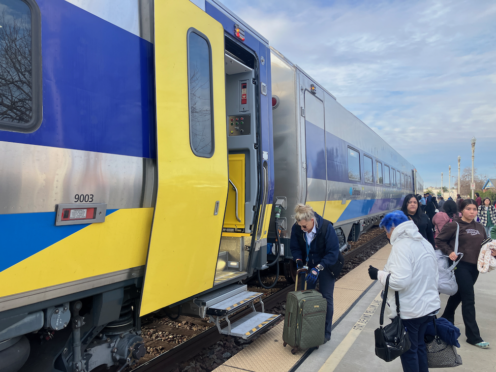
I’m on the San Joaquins train from Sacramento to Bakersfield, and then bus to Los Angeles. I am having a hard time typing because the ride is so rough. The times when I could write in my journal, at least occasionally, are years ago. Every trip I take on the San Joaquins, and my frequent trips on the Capitol Corridor, are rougher than the last. There are many slow zones on both routes where the trains simply cannot go at full speed due to the deteriorated tracks.
Some people have claimed that that problem is not the tracks but the antique California cars (1995) that are now quite old and have not been maintained well by Amtrak (see Wikipedia: California Car). That may be part of the problem, but so are the tracks. Single level cars such as the Siemens Venture should be somewhat smoother than the bi-level California cars.
What I can say for certain is that this level of service, a ride so rough that one can’t type on a laptop, nor safely get up and walk around in some sections, is unacceptable.
Siemens Venture Trainsets
I have not yet had a chance to ride on the new Siemens Venture trainsets so that I can compare the ride quality. I have, however, seen them in stations while waiting for buses. I may have a chance to catch one on my way back north.
Note the use of the term ‘trainsets’, meaning the each consist of cars is linked together, not intended to be separated for longer or shorter trains, during normal operation. The San Joaquins trains will be hauled by Charger locomotives, also from Siemens. A cab car is the operator car on the opposite end of the train from the locomotive, so that the train can operate in either direction without reversing.
San Joaquins Siemens Venture trainset in Hanford
The Trains and Railroads website says this about the new Siemens Venture transets on the San Joaquins route:
“The California Department of Transportation has ordered seven Venture trainsets for the San Joaquins service with seven cars each: four coaches, two coaches with vending machines, and one cab control passenger car. Two cars per trainset will have built-in wheelchair lifts for compatibility with the low platforms used in California. The cab car and two other cars per trainset will have one vestibule per car, while the remaining cars will have two vestibules each. The San Joaquins service does not offer business class seating.”
Streetsblog California had a post on the new trainsets, which it said are running on service 710 (7:36AM from OKJ Oakland Jack London) and 719 (4:12PM from BFD Bakersfield): Review: Amtrak California Passengers are Starving for New Trains. It looks like only two trainsets are in service so far on the San Joaquins. Interestingly, there is no announcement from the San Joaquins on the new trainsets, nor any information about what trainsets are on what schedules.
Correction: There is one trainset, used both directions on 710/719. Rumor is a second trainset will be added soon, for 702/703. The 702/703 is the train that serves Sacramento directly without the bus to Stockton.A rumor from the Cafe Car attendant is that the trainsets will be modified to have a cafe car of some sort, in response to complaints such as from Streetsblog above, about the lack of food service on the new trainsets. It isn’t clear to me whether the San Joaquin JPA or Caltrans Division of Rail is more in charge of train configuration.
The City of Sacramento does not make available to the public an inventory of sidewalks. The city does make available on the Transportation & Infrastructure page: Bike Master Plan, EV Chargers, Off-Street Parking, Signs, Street Lights, Traffic Counts, and Traffic Signals, and other datasets. Sacramento County makes available on the Transportation page: Posted Speed Limits. SACOG makes available on the Transportation page several other transportation datasets. None have sidewalk inventories.
I have heard, unofficially, that the city has a partial dataset of sidewalks, but it is not spatially complete. It may be that it has only more recent installations, or that it focuses on some parts of the city. I have done a PRA for sidewalk inventory, but the city couldn’t figure out what I was asking for, so I will have to determine how to describe the dataset in a way they will understand.
What would a good sidewalk inventory contain?
total width
unobstructed width
sidewalk buffer (planting strip) width
available right-of-way
condition
year of installation, or reconstruction
gaps
intersection corner design
ramps (compliant or not)
The soon to be adopted 2040 General Plan 8-Mobility Element mentions sidewalks a number of times, suggesting widening or improving. Probably the most important are:
M-1.9 Equitable Processes and Outcomes. The City shall ensure that the transportation system is planned and implemented with an equitable process to achieve equitable outcomes and investments so that all neighborhoods one day will have similar levels of transportation infrastructure such as sidewalks, marked low stress crossings, and bikeways.
M-1.14 Walking Facilities. The City shall work to complete the network of tree-shaded sidewalks throughout the city, to the greatest extent feasible, through development project improvements and grant funding to build new sidewalks and crossings, especially within the high-injury network, in disadvantaged communities, near highridership transit stops, and near important destinations, such as schools, parks, and commercial areas. Walking facilities should incorporate shade trees.
However, there is no mention of how locations needing improvement will be identified. Is this guesswork on the part of city staff, or is there a dataset being used but not shared with the public?
My request is that the city make available to the public whatever sidewalk inventory it has, even if it is not spatially complete nor has all the elements a sidewalk inventory should have.
A sidewalk inventory is the first step in meeting the city’s goal of a continuous, high quality sidewalk network. More about that soon.
deteriorated sidewalk on 24th St, near Capitol Ave
And while we are at it, a crosswalk inventory:
marked or unmarked
width
length
design
median island
material: paint or thermoplastic
condition
date of placement or refresh
traffic control (yield, stop, signal, actuated crossing)
crossing prohibition
It should be said that sidewalks and crosswalks in the City of Sacramento are in better condition than many similar sized cities in California, but that does not mean that there isn’t a need for great improvement. Every city and county neglects its sidewalks.
Additional posts on Broadway Complete Streets are available at category ‘Broadway Complete Streets‘.
Many of the corner ADA ramps already installed and to be installed as part of the Broadway Complete Streets project are diagonal ramps. Diagonal ramps were a common solution in the past for corners because they save a little bit of money, and sometimes avoid drain inlets that perpendicular ramp would conflict with. Changing drain inlet locations can be expensive. However, diagonal ramps have never been the optimal solution for corners, and since August 2023, they are not permitted under PROWAG (Public Right of Way Accessibility Guidelines), except under rare circumstances. In those rare circumstances, the ramp must be completely contained within the two crosswalks, which often leads to awkward crosswalks.
There are very few diagonal ramps in the Sacramento central city, so it is surprising that they will be so common at the edge of the central city, Broadway, as part of a complete streets project.
Some transportation agencies have been claiming that they don’t need to follow PROWAG since it has not yet been adopted by USDOJ and USDOT, however, that just means that it is not yet legally enforceable on agencies. But the regulation has been promulgated and published and is now the law.
The project engineer for Broadway Complete Streets has claimed that the diagonal ramps are specified because of “design constraints”. I have looked at every corner where a diagonal ramp was placed, and I see nothing that constitutes a constraint. It may be that what the city means is that it didn’t fit in the budget to install perpendicular ramps, but that is not a valid exception in PROWAG. It is worth remembering that the concrete being installed under this project will be in place for at least 30 years, so that means the city is constructing corners and ramps that are already outmoded, and will be far more so in 30 years.
Of the 15 locations that will have new diagonal ramps, and the 2 that apparently will be unchanged, the northwest corner of Broadway and 18th Street will serve as an example. The other three corners here have perpendicular ramps, but for unknown reasons, the northwest has a diagonal ramp.
Broadway & 18th St diagonal ramp
The diagram below, from NACTO, shows perpendicular ramps. Note also the tight turning radius, which slows turning drivers. Of course the optimal is if these ramps are contained within a curb extension, but even without that, they are a good practice.
NACTO perpendicular ramps
The next diagram snows perpendicular ramps in the context of curb extensions, and illustrates the huge benefit of curb extensions, which is increased visibility between walkers and roadway users. The curb extension also removes the need to paint the curb red or place a sign, one of which is required now under AB 413 (Lee, 2023). Caltrans includes curb extensions in its Pedestrian Safety Countermeasures Toolbox.
The table below shows the plan for each corner along the corridor from 3rd Street to 24th Street, with details about ramps and curb extensions. The plan I have does not include any change from the west side of 19th Street to the east side of 21st Street. This section includes the crossing between 19th and 20th by light rail and railroad tracks. It is unknown why this is.
Cross-street
NW
NE
SW
SE
Notes
3rd S
None
None
Diagonal existing
Diagonal new
No crosswalks
3rd N
Diagonal new
Diagonal existing
None
None
No crosswalks
5th
Perpendicular new
Perpendicular new
Perpendicular new
Perpendicular new
6th
Diagonal new
Perpendicular exist
None
Single
W crosswalk removed
Midblock
New, single with extensions
8th
Diagonal existing
Diagonal new
None
None
No crosswalks
Muir Way
None
None
Diagonal new
Diagonal new
No E crosswalk
9th
Diagonal new
Perpendicular exist
None
None
No crosswalks
10th
Perpendicular new
Perpendicular new
Single, extension
Single, extension
Riverside
Diagonal new
Diagonal new
Diagonal new
Diagonal new, extension
13th
Perpendicular exist
Perpendicular new, extension
Single
Single
14th
Perpendicular new, extension
Perpendicular new, extension
Perpendicular new, extension
Perpendicular new, extension
15th
Perpendicular new
Diagonal new
Single
None
No E crosswalk
16th/Land Park
Perpendicular new
Perpendicular new, extension
Diagonal new
Perpendicular new, extension
W crosswalk unknown
17th
Perpendicular new
Perpendicular new, extension
Diagonal new, extension
Perpendicular new, extension
W crosswalk removed
18th
Perpendicular new, extension
Diagonal new
Perpendicular new, extension
Perpendicular new, extension
19th
Unknown
20th
Unknown
21st
Unknown
22nd
Perpendicular new
Perpendicular new, extension
None
Single, extension
W crosswalk removed
23rd
Perpendicular new, extension
Perpendicular new, extension
Single, extension
None
W crosswalk only
24th
No change
No change
No change
No change
table of Broadway Complete Streets corners and curb extensions
STAR and SABA have already signed on to the campaign, and individuals are encouraged to send letters to their elected representatives. For me, living in Sacramento, the letter goes to Governor Gavin Newsom, State Senator Angelique Ashby, Assemblymember Kevin McCarty, Representative Doris Matsui, Senator Alex Padilla, and Senator Laphonza Butler.
The monthly meeting of the Sacramento Active Transportation Commission (SacATC) will be this Thursday, February 15, 2024, starting at 5:30 PM in the city council chambers. The agenda includes five items. You can comment on these items, or on topics not on the agenda, ahead of time via eComment, or in person at the meeting. I encourage people to attend these commission meetings. There are usually very few members of the public in attendance, which means that your voice is important. Though eComments are valuable, in-person comments carry a lot more weight. The city’s planning staff is usually progressive and innovative, but Public Works in general is not, so it is important the citizens show up to push for progressive and innovative projects and policies. With some new appointments to the commission, and support of the public, the commission itself has been much more progressive than in past years.
Agenda item 3 is a presentation on the Truxel Bridge Concept and Feasibility Study. The Truxel crossing of the American River was originally proposed and approved by SacRT and the county as a transit-walking-bicycling bridge, carrying light rail from downtown to Natomas. The city is now proposing a motor vehicle-transit-walking-bicycling bridge. They are claiming that the bridge would reduce vehicle miles traveled (VMT) through the provision of alternative modes, and a shorter trip between downtown and Natomas, but has not presented data to justify this claim. New roadway capacity induces more motor vehicle trips, a well-established fact, so to claim otherwise requires proof. Walking and bicycling would be unlikely to be the major component of bridge users. Transit availability could reduce motor vehicle trips, but the Green Line to the Airport is probably decades away, and anything short of service to North Natomas would be unlikely to replace many car trips.
The city intends to go full speed ahead (pun intended) with the bridge, based on a 2013 city council approval, seeking public input only on the southern approach to the bridge and the bridge cross-section. Since 2013, the city has declared a climate emergency, the Mayors Commission on Climate Change goal is to achieve Carbon Zero by reducing VMT, the soon-to-be-adopted General Plan 2040 and Climate Action and Adaptation Plan aim for reducing VMT rather than increasing it, and SB 745 required VMT impacts as the primary criteria for judging projects. Most importantly, public awareness of the risk of motor vehicle induced climate change has emerged and strengthened.
This is a follow-up to my serious concerns about Broadway post. There will be additional posts about the Broadway Complete Streets project. The Broadway Complete Streets project is underway, with several locations of corners, midblock crossings, curbs, and sidewalks already reconstructed.
It is clear that throughout the planning and construction of this project, sidewalks were ignored or discounted. The project is all about the roadway, reducing motor vehicle lanes to 2 plus a turn lane (from 4), and adding buffered bikeways. It is common in project planning to assume that sidewalks will not be disturbed, and therefore do not need to be brought up to current ADA/PROWAG requirements. However, sidewalks are being replaced, newly constructed, in several locations along Broadway. That means they do have to meet current requirements, and that requirement is a clear width of 48 inches.
The Broadway Complete Streets Final Recommendations (2016) document identifies ‘Sidewalk obstructions or narrow sidewalks’ as a critical issue. It also says “The proposed road diet allows for a buffered bike lane through the entire corridor, and presents opportunities for pedestrian crossing improvements, new pedestrian crossings, and sidewalk enhancements.” However, other than curb extensions at intersections and mid-block crossings, nothing in the design actually enhances sidewalks. The ‘typical cross section proposed’ is below. Though the diagram shows 8 foot sidewalks, the actual sidewalk width varies greatly along the corridor.
Broadway Complete Streets typical cross-section proposedRead More »