SACOG Transportation Committee 2025-04-03

The SACOG Transportation Committee will meet on Thursday, April 3, 2025, at 10:00 AM, in person at 1415 L Street, Suite 300, Sacramento, CA 95814. The meetings often last about two hours.

The agenda is available on the SACOG Meetings & Agendas page, but I have also provided the overall agenda and the specific agenda items below. The single, large agenda packet contains 10 agenda items, only some of which would be of interest to most readers. I have rotated all the presentations so they are readable in vertical. Usually presentations are attached as separate items, so I’m not sure whether these will be presented during the meeting or are there for information.

The meetings are also streamed, from the Meetings & Agendas page, at the time of the meeting, and can be viewed later on the SACOG YouTube channel.

Comments may be made in person, or by email ahead of time to the Board Clerk, lespinoza@sacog.org. No comments are taken via streaming or by phone.

Though nearly all items that come before the Transportation Committee also go to the Board of Directors, at the next or soon-after meeting, items are often discussed in more detail at the Transportation Committee than the Board, so if an item is of particular interest to you, you may want to follow it now. Proposals are sometimes modified at the Transportation Committee meeting, or as a result of Transportation Committee discussion, before they go to the Board.

I have skimmed the agenda items, and don’t have any strong comments now, but may if I have a chance to look at them more closely.

Agenda

  1. Approve Fiscal Year 2024-2025 Transit Operators Projects for Low Carbon Transit Operations Funds
  2. Senate Bill 125 Transit Program Funding Plan and Updated SACOG Guidelines
  3. Transit Representation on Metropolitan Planning Organizations & Governance Update/MOU
  4. From Plan to Action: Implementing the 2025 Blueprint
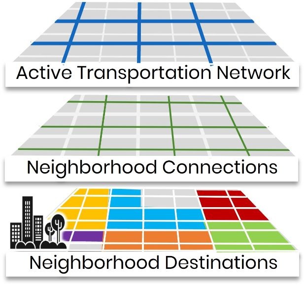
  5. Mobility Zones – Phase 1 Zones
  6. U.S. 50 Comprehensive Multimodal Corridor Plan Policy Framework Input
  7. Transportation Options for Upcoming A’s Games
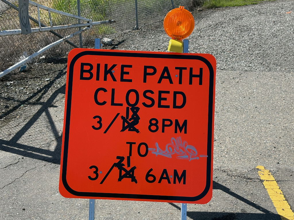
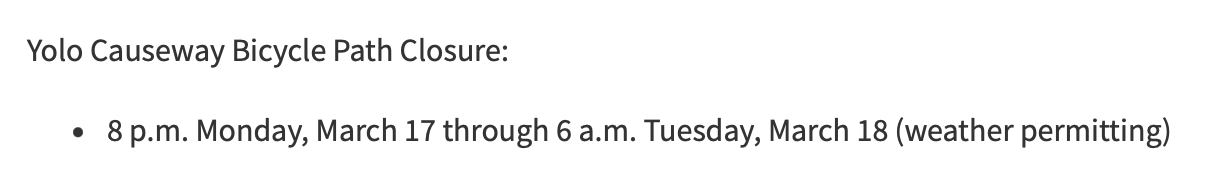
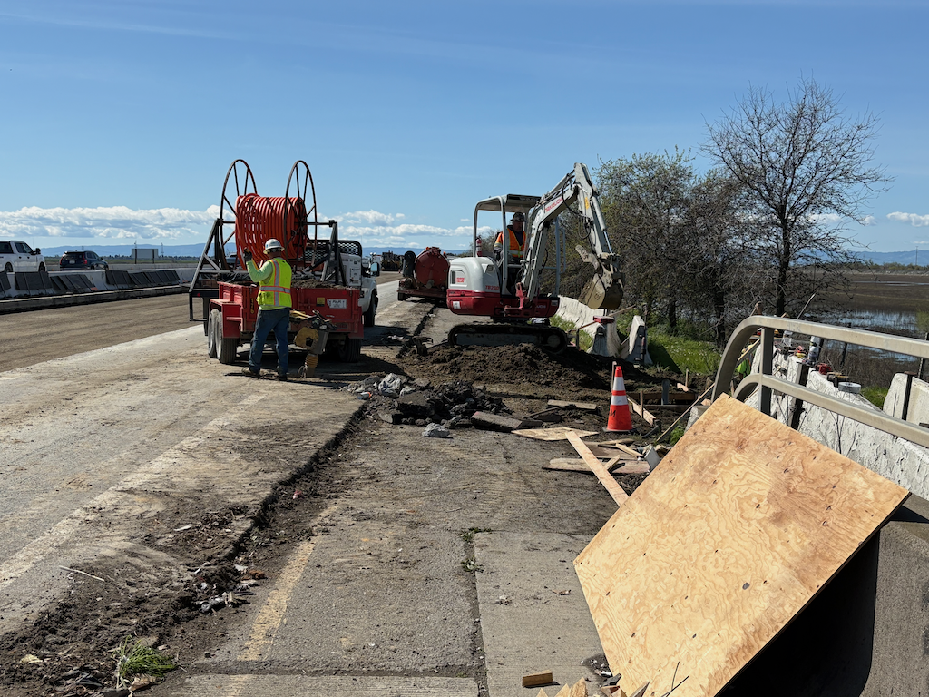
  8. May is Bike Month 2025 Update
  9. Capital Area Regional Tolling Authority Board January-March Recap

SacCity crash dashboard

Corrections: Crash data is from Sacramento Police Department, not SWTRS, but does use the SWITRS selection categories. Demographic data is from the Transportation Priorities Plan.

The City of Sacramento has released a VZ Crash Dashboard with an interactive map and charts. The dashboard apparently uses data from SWITRS for crash data (which means that it will never be up-to-date, as SWITRS is never up-to-date, but patterns don’t depend on up-to-date data), but is selected for the City of Sacramento, and also has demographic data layers for ‘SB 535 disadvantaged communities’, ‘neighborhoods that lack transportation infrastructure’, and ‘communities that have been recipients of racism and bias’. You can turn on and off layers, and can select for crashes on a wide variety of criteria, such as ‘severity’ (fatality, severe injury, etc.) and ‘involved with’ (bicycle, pedestrians, etc.), which are criteria from the SWITRS database.

I have only explored the data in a superficial manner, but noticed some interesting geographic patterns. If you look at crash density, the central city looks bad, but for fatalities only, it looks better than many parts of the city. There are several arterial roadways that were identified as high injury network (HIN) corridors but were not in the Vision Zero Action Plan. However, a visual representation does not necessarily reflect the details of data.

What patterns do you see in the crash dashboard?

VZ crash dashboard map, selected for severity = fatal

quick build at SacCouncil 2025-03-25

The Sacramento City Council meeting on Tuesday, March 25, 2025 (agenda), starting at 5:00 PM (not the 2:00 meeting) will consider a proposed quick build program. Agenda item 21 is ‘Transportation Safety Initiative: Establish Positions, Establish Quick Build Capital Improvement Project, and Suspend Competitive Bidding and Approve an Alternative Procurement Process to Install Signing and Striping and Quick Build Improvements (Two-Thirds Vote Required)‘.

This quick build proposal is worth supporting, whether in person at the council meeting, or ahead of time using the eComment capability on the Upcoming Meeting Materials page. Transportation advocates have been asking for a quick build program (also called tactical urbanism, though they are subtly different) for years. When Councilmember Caity Maple and others proposed an emergency declaration over traffic violence, advocates pushed for quick build to be the top element of that proposal. The city has done a few such projects, such as the closure of a block of 2nd Avenue at Broadway and 34th Street to increase safety for bicyclists and simplify complex intersections. Photo below. But this new program would greatly accelerate the implementation of quick build projects. Some will be at the location of major crashes, while others will be at locations where crashes might be expected and where prior city neglect of lower income neighborhoods has resulted in more unsafe walking and bicycling.

photo of 2nd Ave and Broadway delineators
Sac_2nd-Ave-Broadway_delineators

The program would have a Traffic Safety Team staff of six FTE (full time equivalent), paid with funds from existing budget categories in Public Works. The program would suspend competitive bidding requirements so that projects could be implemented quickly.

The Vision Zero or Safe Systems approach to roadway safety is to immediately change the street design with temporary fixes that slow or channelize traffic, and then to eventually replace these with permanent design changes. The Street Design Standards update (category: Street Design Standards) and Strong SacTown (tag: Street Design Standards), the Active Transportation Plan, Neighborhood Connections and Streets for People Active Transportation Network, and many other efforts align with the quick build program. Most of the traffic calming measures in Neighborhood Connections (SacCity Neighborhood Connections) and and many of the traffic calming measures in Streets for People Active Transportation Network visual gallery – pedestrian and visual gallery – bikeway can also be implemented in quick build, as the photo below shows, a temporary curb extension with vertical delineators.

photo of Land Park Dr & 8th Ave curb extension
Land Park Dr & 8th Ave curb extension

The SacATC 2024 Annual Report is also on the agenda, item 1 on the consent agenda. It is not expected to be controversial, but it would be nice if a couple of people spoke in support, just to remind council that advocates are interested and supportive.

SACOG Board 2025-03-20 (in Rocklin)

The SACOG monthly board meeting will be held in Rocklin this month, Thursday, March 20, at 9:45 AM, at Rocklin Event Center, 2650 Sunset Blvd, Rocklin, CA. It can be viewed on YouTube via the Meetings and Agendas page. Comments may be made in person (in Rocklin), or via email ahead of time to lespinoza@sacog.org. Most board meetings are held at the SACOG Board Room on L Street in Sacramento, but some meetings rotate through the cities and counties in the SACOG region.


Agenda (the official agenda has more detail for each agenda item than below, and the html agenda on the Meetings & Agendas page has staff reports and presentation links; the links below are just a few items of particular interest to me):

Consent:

  1. Approve Minutes of the February 20, 2025, Board Meeting
  2. Approve Revised Local Transportation Fund Allocations for Fiscal Year 2024-2025 for Sacramento County
  3. Approve Local Transportation Fund Findings of Apportionment for Fiscal Year 2025-2026
  4. Approve State of Good Repair Fund Allocation for Fiscal Year 2025-2026
  5. Approve State Transit Assistance Fund Allocation for Fiscal Year 2025-2026; staff report; allocation
  6. Approve Low Carbon Transit Operations Funds Allocations for Fiscal Year 2024- 2025; staff report; allocation
  7. Approve Capital Area Regional Tolling Authority Appointment
  8. Approve Contract Authorization for SB 125 Long-Term Financial Plan and Recovery Strategy and Annual Financial Analysis; staff report
  9. Approve Engage, Empower, Implement Award Correction

Action:

  1. Approve 2025 Regional Active Transportation Program Funding Recommendation (Summer Lopez), recommendations, presentation
  2. Public Hearing: Staff Vacancies (Erik Johnson)
  3. Approve Draft Budget and Overall Work Program for Fiscal Year 2025-2026, Adopt Salary Schedules and Hold Hearing on Vacancies (Loretta Su)

Information:

  1. Capital Area Regional Tolling Authority Loan and Staffing Services (Erik Johnson)

Workshop:

  1. Lessons Learned from Rocklin’s Growth (Lanette Espinoza); staff report; no presentation available yet

Reports:

  1. Chair’s Report, Board Members’ Reports and Executive Director’s Report (Lanette Espinoza)

Receive & File:

  1. Regional Transportation Demand Management Platform “NorCal GO” Launch (Nicole Porter)
  2. 2026 Regional Trail Implementation Strategy Update (Summer Lopez)
  3. U.S. 50 Comprehensive Multimodal Corridor Plan Overview (Dustin Foster)
  4. From Plan to Action: Implementing the 2025 Blueprint (Clint Holtzen)
  5. Advocacy Update (Renee DeVere-Oki)
  6. Fiscal Year 2024-2025 Quarterly Financial Report (Loretta Su)
  7. Green Means Go: Local Efforts to Accelerate Housing (Gregory Chew)
  8. Regional 511 Traveler Information Systems Contract and Service Continuity Considerations (Chase McFadden)

Adjournment:


SacATC 2025-03-20

The Sacramento Active Transportation Commission will meet this Thursday, March 20, 2025, at 5:30 PM. Comments may be made in person during the meeting, or beforehand via the eComment capability on the Upcoming Meetings page. Though the meeting is live-streamed on that same page, comments may not be made in that way.


The core agenda is:

Consent Calendar

  1. Approval of Active Transportation Commission Meeting Minutes
  2. Active Transportation Commission Log

Discussion Calendar

  1. Airport South Industrial Annexation – Amendments to the City Bicycle Master Plan
  2. Streets for People Draft Plan and Phase III Community Engagement Approach (staff report, Streets for People Draft Plan; note: the plan is a large document, and does not include appendices, which can be downloaded from the Streets for People webpage)

In the webinar today, a comment was made that the information in the plan and in the webinar is very complex and hard to get a handle on. I agree. Even as a transportation nerd, it is very hard to digest. I’d suggest the city come up with a simple presention, even simpler than the Executive Summary, that speaks to people who just want better and safer transportation for walking and bicycling, but know little about transportation planning and infrastructure. Some people will want to focus on the streets in their neighborhood where they live, or the routes they travel. Others will want to focus on the policy and approach of the plan. It is probably not possible to look at and understand both.

As I’ve said, I hope to post more detailed information and comments on the plan, but haven’t gotten to that yet.

Caltrans D3 says ‘fuck you’ to Yolo bicyclists

The bike path along I-80 along the Yolo causeway is closed this afternoon (Tuesday, 2:00 PM). The sign at the east entry to the bike paths says:

Bike Path Closed sign on east entry to Yolo causeway bike path

Note that this sign indicates that the path will not be closed until 8 PM on Tuesday, March 18.

This is what the Caltrans website says (UPDATE: Extended 79-hour Closure for Eastbound U.S. Highway 50 in Yolo County Postponed due to Weather Forecast, 2025-03-13, retrieved 2025-03-18 3:00 PM):

screen capture from Caltrans D3 website

Note that this press release says that the path will be open again by 6:00 AM on Tuesday, March 18.

And this is the reality is:

construction on Yolo causeway bike path

Construction is completely blocking the path, at this location and several others. The work to remove the concrete barrier from the freeway is ongoing along the western section of the causeway. Some parts of the freeway are also torn up, awaiting reconstruction.

I talked to the supervisor at this construction location, and he said they are just a subcontractor, not responsible for Caltrans signing, or lack thereof. He called the general contractor, who apparently said it is my problem, not theirs. After exiting at the I-80 off-ramp (the normal entry to the path north to Yolo County 32A is not accessible), I saw a CHP officer, and reported the issue to him. He said he would pass it along. He probably will, but I doubt that either CHP nor Caltrans will do anything about it.

This is an active construction project which was not properly signed for construction. This is a violation of Caltrans procedure, and state law, and federal law.

It is absolutely typical of Caltrans District 3 (which includes Yolo and Sacramento counties) to not care about the travel or safety of bicyclists. What would it take to correct the signing, and to correct the website? Not much, but it is beyond the care and interest of Caltrans D3.

Caltrans has said that as a result of the Yolo 80 project, there would be an improved bike path. I’ve previously written about why that is very likely to be a lie: Yolo causeway bike path. Note that though Caltrans claims the current construction is just bridge rehabilitation and has nothing to do with the Yolo 80 project, that is a lie. It is safe to assume that everything Caltrans D3 says is a lie. Caltrans is a highway department, not a transportation department. They care about motor vehicles. They do not care about walkers or bicyclists or air quality or the state budget. In fact, given the high fatality rate on both under-construction and completed highway projects, they don’t really care about motor vehicle drivers either.

I will also note that the California Transportation Commission (CTC) is complicit in Caltrans D3 malfeasance, as they continue to fund projects no matter what the behavior or violation of the law. And above CTC, California State Transportation Agency, which is intended to oversee both CTC and Caltrans, but does not.

this week 2025-03-17

SacMoves Coalition hosts an event calendar at https://sacmoves.org/events/, which is maintained by STAR (Sacramento Transit Advocates and Riders) and Getting Around Sacramento. ‘This week’ postings are irregular.

Monday 17

  • House Sacramento (SacYIMBY), 6:00 PM, New Helvetia Brewing (the meeting was moved to Urban Roots; future meeting dates and locations yet to be determined)

Tuesday 18

  • SacCity Streets for People Citywide Virtual Workshop #1; 12:00 PM; register
  • Sacramento City Council; 5:00 PM; agenda

Wednesday 19

  • SACOG Transit Coordinating Committee, 9:00 AM, via Zoom; agenda; post
  • SacCity Streets for People Citywide Virtual Workshop #2; 5:00 PM; register

Thursday 20

  • SACOG Board, 9:45 AM; Rocklin (not Sac) or online; agenda
  • SacRT MAC (Mobility Advisory Council), 2:30 PM; agenda; post
  • SacATC (Sacramento Active Transportation Commission), 5:30 PM; agenda; post

Friday 21

Saturday 22

Sunday 23

I missed two important meetings the previous week, because they were not on their usual schedule: CARTA on Monday, 10th, and SacTA, Thursday, 13th.

HSIP grants for SACOG region

Caltrans has released a list of $300M in projects under the HSIP (Highway Safety Improvement Program) program of federal funds. See Streetsblog: State Announces Nearly $300 Million in Grants for Safe Streets for more information. The funds are a mix of federal and state, but the awards are selected by the state. Unlike most projects funded by the federal and state, these projects really do have a focus on safety, though the various signals in these grants may be as much motor vehicle focused as walker and bicyclist focused. The City of Sacramento has installed beg buttons, replacing auto-recall pedestrian signals, in an effort to ease traffic flow and only secondarily make it safer for people walking, so there is a concern about how signals will be implemented.

Twenty-three of the projects are in the SACOG region. A pdf of those is available. Presumably descriptions of each project are available somewhere, but I’ve been unable to locate them. If I do find them, I’ll highlight a few of particular interest.

SacCity Streets for People draft plan

for Matt

Additional posts on the Streets for People Plan will be under category: Streets for People – Active Transportation Network. I encourage you to take a look at Strong SacTown’s series of posts on Street Design Standards. And all of the NACTO Design Guides. And Jeff Speck’s Walkable City and Walkable City Rules. But your own lived experience is just as valuable as the words of the experts, so please join in to support and improve the plan.

The City of Sacramento Streets for People draft plan has been released. The Streets for People / Active Transportation Plan webpage has more detail. The body of the plan is a little difficult to download there, so it is also available here (57MB pdf). The appendices and related documents are easy to download there (I don’t know why Appendix 5 is missing). A comment about terminology: ‘Streets for People’ refers both to the overall Active Transportation Plan, and to this specific section of the overall plan. The Streets for People: Sacramento’s Active Transportation Plan public draft 2025-03 is the section that covers arterial and major collector streets. Local streets are covered in the Neighborhood Connections Plan (2025-01), which has now be adopted by the city and will be incorporated into the overall plan later this year. The diagram below shows the relationship, with the green neighborhood connections, and the blue ‘active transportation network’ which is the topic of the draft plan.

I have only skimmed the plan, so don’t have comments yet, but since it is out there, I hope that many people will take a look and comment. To the city, mainly, but you can also comment on this blog post. Comments are accepted through April 6. Though the map for gathering geographically related comments is closed, it is still available for viewing. You can submit comments through a form, probably best for general comments that apply to the process or the overall document. You can email city staff directly at StreetsForPeople@cityofsacramento.org. The preferred method for comments is to make comments directly on the pdf, available at https://streetsforpeopledraftplan.altago.cloud/#/, probably best for specific comments on text or graphics. You can also sign up to receive email updates.

The Neighborhood Connections Plan is great and provides a solid basis for improving both safety comfort level for people walking and bicycling in their neighborhood. However, local streets are not where the majority of crashes occur, certainly not the fatality and severe injury crashes. These occur on arterial and major collector streets, the ones that were designed for motor vehicle movement and convenience. These roadways are too wide, and too fast. Yet many walking and particularly bicycling trips must cross or travel along these dangerous streets. Until these streets are redesigned to not only accommodate but encourage walking and bicycling, most people won’t leave their immediate neighborhood, and will continue to make most trips, even short trips, but motor vehicle. And that is the subject of this draft plan, and why it is so important.


Table of Contents

  • 1 About This Plan
    • What Is Streets for People?
    • Need for a Focused Approach
    • What’s in the Plan?
    • Plan Goals
    • Recent Achievements
  • 2 Walking, Biking, and Rolling in Sacramento Today
    • Building on the Past
    • What the Data Shows
    • Equity
    • Walking and Rolling
    • Biking
    • Safety
    • Comfort
    • Access
    • Sustainability
  • 3 Community Engagement
    • Leading with Equity
    • Community Planning Team
    • Engagement Events
    • What We Heard
  • 4 Recommendations 52
    • Network Recommendations
    • Intersection Recommendations
    • Recommended Policies and Programs
    • Maintenance Considerations
  • 5 Implementation
    • Costs
    • Funding
    • Monitoring and Review
    • Next Steps
  • A Appendices (which are in separate documents, available on the webpage)

West Sacramento Vision Zero Action Plan

The City of West Sacramento is developing a Vision Zero Action Plan. If you live in, work in, or travel in West Sacramento, I encourage you to take a look at the VZ page. The map showing crash locations, nearly all at intersections, indicate that West Capitol Ave is the epicenter for traffic violence, with Sacramento Ave coming in second. That is my own experience in riding and walking on these arterial streets. West Capitol Ave is the route for Yolobus 42A/42B, and several other routes.

Vision Zero high-injury map for West Sacramento