California OKs a lot of new freeway lanes during climate change-fueled heat wave (SacBee, Ariane Lange, 2026-03-21)
The California Transportation Commission (CaTC; CTC is Commission on Teacher Credentialing) has approved yet more of your tax dollars to serve a small segment of the population, those who commute long distances. Freeways will be expanded all over the state. Why is more highway capacity needed? Because more lanes equals more driving, equals more gas tax, equals more money for highways. It is a circular loop, also known as a growth ponzi scheme.
The CTC has long been in the pocket of the highway lobby, which is composed of the asphalt and concrete providers and construction companies, the fossil fuel companies, and the politicians who love ribbon cuttings over actually doing something to benefit their voters (of course, as we all know, most politicians first consider their campaign contributors, and only if it doesn’t conflict, citizens).
But because CTC continually funds highway expansion, basically giving Caltrans everything that asks for, so long as it is capacity expansion, and refuses to give serious discussion or attention to climate change and the evolved transportation environment, it has really become the highway lobby.
Because nearly all transportation funding (otherwise known as your tax dollars) goes to highway expansion, there is little left at the state level for maintaining highways. And little at the regional (SACOG) level. And almost nothing at the county and city level. Your street is likely falling apart, because the money is going elsewhere.
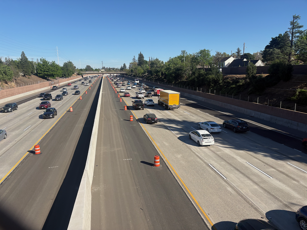
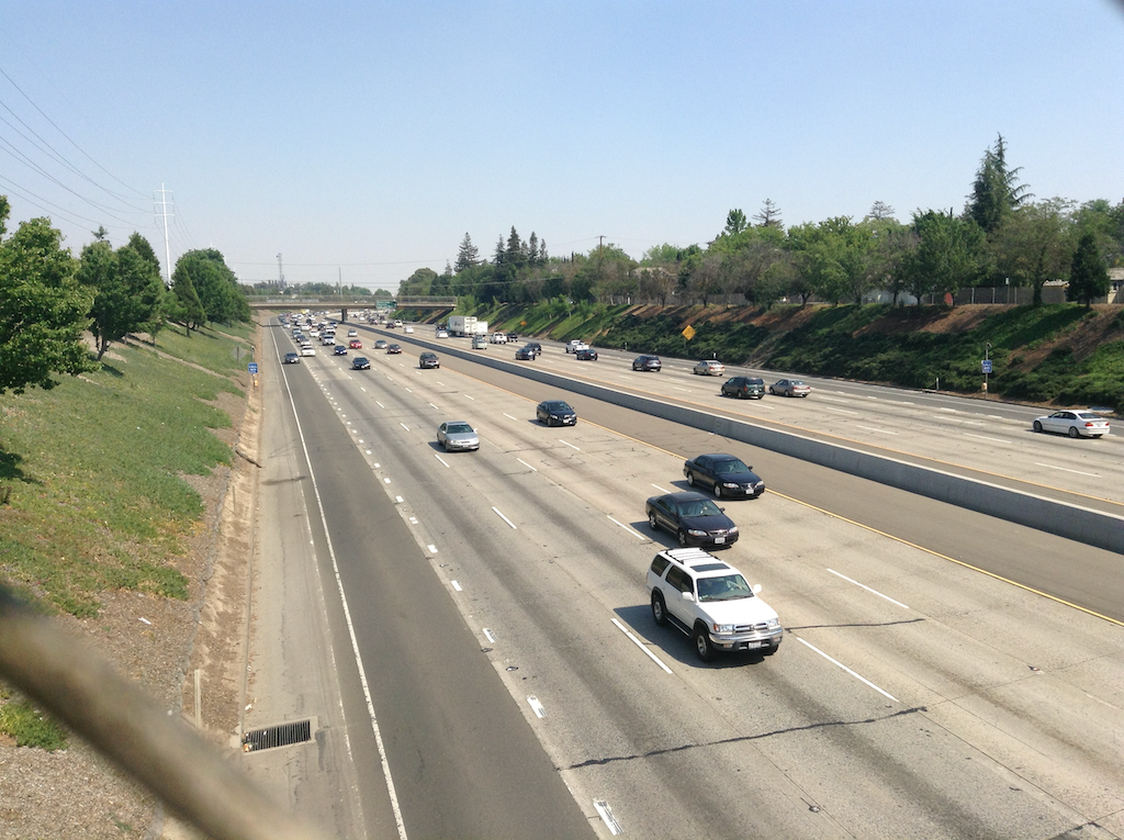
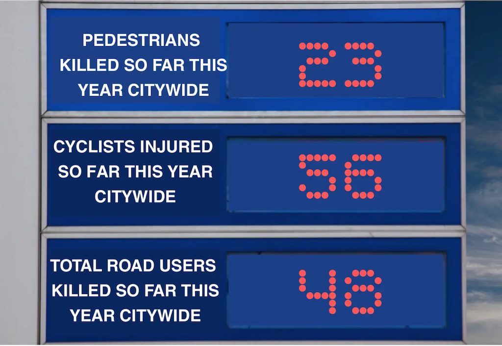
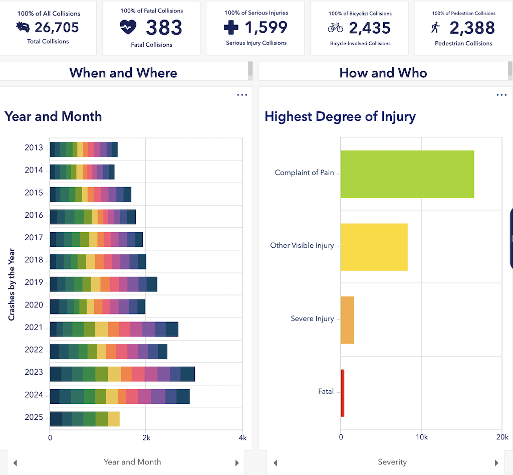
Caltrans has built a transportation system based almost solely on the needs of commuters and freight, though because of congestion induced by commuters, it no longer serves freight very well. Active transportation was not just an afterthought, but was actively planned against. The most dangerous roadway locations in the state are highway onramps and off ramps, which were designed for the highest possible motor vehicle speed, and usually have minimal or no accommodation for people walking and bicycling. As if the ramps were not bad enough, Caltrans retains control of overpasses and underpasses, though they spend none of their money on improving those, forcing local entities to spend their own limited funds to fix Caltrans mistakes. And there are plenty of Caltrans mistakes to be fixed. Billions of dollars worth. Instead of fixing things, Caltrans builds more. More problems to solve, more infrastructure to maintain, but without asking for very much for that maintenance.
Nine of the eleven members of the CTC are appointed by the governor. So our windshield governor owns the misallocation of taxpayer dollars. Of these members, only two could be considered advocates for active transportation, transit, and rail: Adonia Lugo and Darnell Grisby. A few others are not opposed to these, but not very supportive. Some are actively opposed to spending state money on anything but highways.
Strong Towns has addressed this travesty by documenting how the era of Interstate Highway expansion is and should be at an end:
- Mission Accomplished: The Interstate Was Finished. The Program Wasn’t. (with link to Mission Accomplished white paper)
- The Highway Expansion Lightning Lane (2026-03-09)
- What If Federal Transportation Spending Is the Reason Your City Feels Broke? (2026-02-23)
- Transportation After the Age of Expansion (2026-01-25)
- We’ve Been Fighting the Wrong Transportation Fight (2026-02-16)
Of course Caltrans and its enabler CTC is not just expanding the Interstate system, which they are, but the entire state highway system.
CTC is broken. Can it be reformed? It seems to me unlikely. Since CTC largely serves to give Caltrans whatever it wants, maybe it would be better to just give the budget directly to Caltrans. Nothing would improve, but at least active transportation, transit, and rail advocates would only have to monitor one agency instead of Caltrans and CTC.